Kaibab National Forest
Where the camps cluster
The place
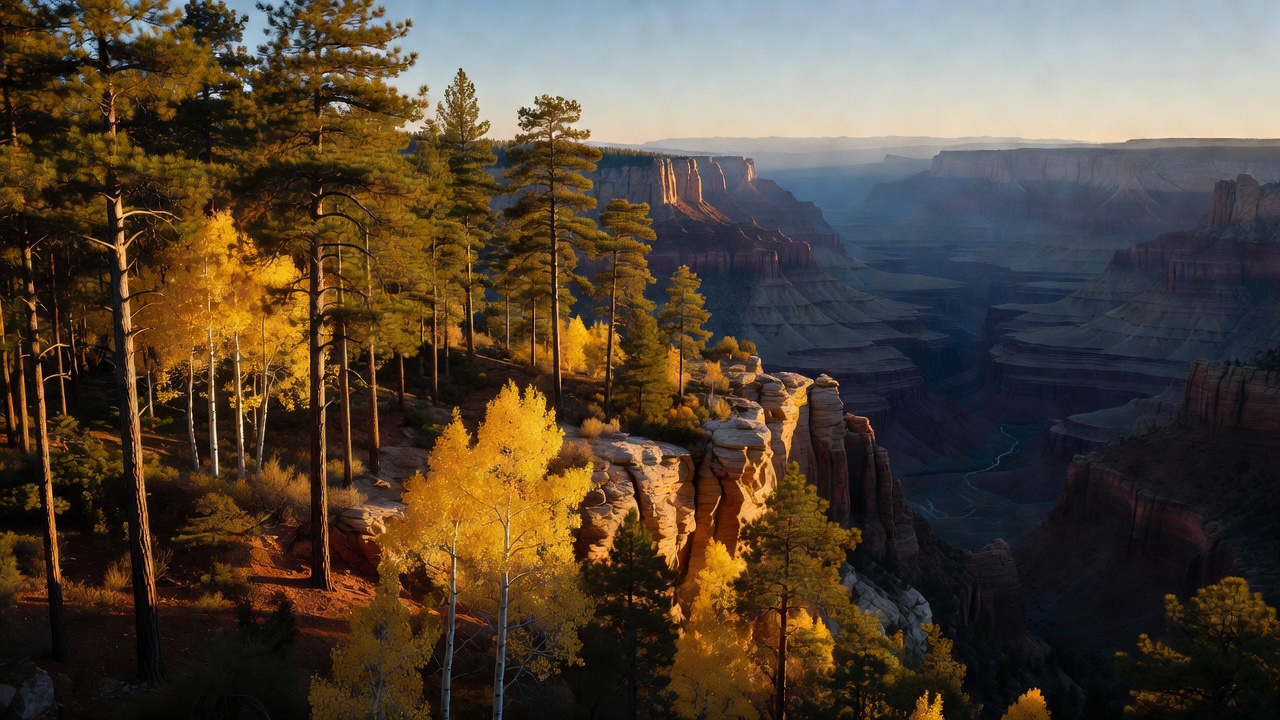
Kaibab National Forest surrounds the northern and southern portions of the Grand Canyon, which is the single fact that explains everything else about it. The Forest Service runs it as three ranger districts -- North Kaibab out of Fredonia, Tusayan out of Grand Canyon, and Williams out of Williams, where the supervisor's office sits -- and the north and south pieces might as well be different states. To get from one to the other you drive around the canyon, roughly 200 miles of pavement to cover a gap you can see across. The name comes from a Southern Paiute word meaning 'mountain lying down,' which is exactly what the Kaibab Plateau looks like from below: a long forested hump rising out of dry country, roughly 1,150 square miles of it standing above 6,000 feet. That elevation is the whole trick. While the surrounding Arizona Strip bakes, the plateau collects snow -- Jacob Lake averages about 105 inches a year and the Bright Angel Ranger Station about 135 -- and grows aspen, Engelmann spruce, blue spruce, and Douglas-fir alongside the ponderosa. Overall the forest runs from about 5,500 feet up to Kendrick Peak at 10,418, and it spans Coconino, Yavapai, and Mohave counties. Come in August and the north side is a green, wet, mosquito-y alpine place; come in January and the only paved road to the North Rim is shut.
History
The land was pulled out of the public domain in 1893 as the Grand Canyon Forest Reserve, renamed Kaibab National Forest in 1908, and formally established as a national forest in 1909; the neighboring Tusayan National Forest was folded into it in 1934, which is how the south-side districts came to share the Kaibab name. But the story this plateau is actually famous for is a wildlife-management disaster that got taught in biology classes for fifty years. On November 28, 1906, Theodore Roosevelt created the Grand Canyon National Game Preserve over this country, with the straightforward goal of protecting and growing the mule deer herd. The plateau had already been chewed hard by sheep, cattle, and horses since the 1880s. Then the government went after the predators: between 1907 and 1939, trappers reportedly killed 816 mountain lions, 20 wolves, 7,388 coyotes, and more than 500 bobcats. The deer herd, put at roughly 4,000 before 1905, was estimated as high as 100,000 by 1924 -- and by the mid-1920s the animals were starving to death on a range they had eaten to the dirt. That is the version in the textbooks, and it is worth saying plainly that the numbers are shaky: the 4,000 figure was never confirmed by any actual count and survives mostly because no better estimate exists, and the 100,000 peak may have been exaggerated by as much as double. The lesson held up better than the arithmetic did. Much more recently, on August 8, 2023, President Biden used the Antiquities Act to create Baaj Nwaavjo I'tah Kukveni -- Ancestral Footprints of the Grand Canyon National Monument, 917,618 acres in all, of which the Forest Service manages 388,376 acres inside the Tusayan Ranger District. The name pairs Havasupai for 'where tribes roam' with Hopi for 'our ancestral footprints,' and it came out of a coalition of ten tribal nations. It made permanent a 20-year moratorium on new uranium mining claims that had been issued in 2012 -- though more than 3,000 pre-existing leases remain developable, so it is a line drawn forward, not backward.
Wildlife & plants
The signature animal is a squirrel. The Kaibab squirrel lives on an area about 20 by 40 miles on the Kaibab Plateau and nowhere else in the world: chestnut back, black or gray belly, a startling white tail, and ear tufts that can stand one to two inches above its head in winter. It is now treated as a subspecies of Abert's squirrel, and the interesting part is how it got stranded -- not because the Grand Canyon walled it off, but because a warming climate pushed the ponderosa pine it depends on up onto the high country and left the low ground between too dry for it. It eats the seeds out of ponderosa cones, so the tree and the squirrel are effectively one system. In 1965, 200,000 acres of its habitat were designated a National Natural Landmark. Beyond that, the forest carries mule deer, Coues white-tailed deer, elk, pronghorn, wild turkey, and coyote, with cougar, bobcat, and black bear around but seen less often; down in the small stuff it is chipmunks, ground squirrels, Abert's squirrels, porcupines, lizards, and rattlesnakes. Birders get Steller's jays, bluebirds, nuthatches, flickers, woodpeckers, ravens, hawks, and hummingbirds. There are also bison here -- a state-owned herd descended from animals brought in during the early 1900s for a ranching venture. Overhead, watch for California condors: the reintroduction released birds at the Vermilion Cliffs starting in 1996, and the flock now ranges across the Grand Canyon country into southern Utah. Lead is what still kills them -- lead poisoning accounted for more than 60% of wild condor deaths with a known cause between 1992 and 2013 -- which is the honest argument for non-lead ammunition if you hunt this country. Plant-wise, the high ground is ponderosa, Douglas-fir, Engelmann and blue spruce, aspen, and oak; drop lower and it turns to pinyon and juniper with bitterbrush, Gambel oak, sagebrush, and cliffrose.
Notable features
Four wilderness areas take big blocks off the motorized map. On the north side, Kanab Creek Wilderness -- 75,300 acres designated in 1984, with 68,600 of it in the North Kaibab district and the rest under the BLM -- protects the largest tributary canyon system on the whole north side of the Grand Canyon, a network of vertical-walled gorges dropping from about 6,000 feet on the rim to 2,000 at the river. Saddle Mountain Wilderness sits nearby. On the Williams district, Kendrick Mountain Wilderness surrounds the forest's high point, and Sycamore Canyon Wilderness -- 56,000 acres designated in 1972 and shared with the Coconino and Prescott forests -- runs south from Williams to where Sycamore Creek meets the Verde River, banded in red sandstone, white limestone, and brown lava. Both of the forest's big summits are dead volcanoes in the San Francisco volcanic field: Kendrick Peak is a lava dome of dacite and rhyolite between 2.7 and 1.4 million years old, with a Forest Service lookout tower that has been staffed since the early 1900s, and Bill Williams Mountain, 9,259 feet, three and a half miles south of town, last erupted around 2.8 million years ago. Both the mountain and the town are named for William Sherley 'Old Bill' Williams, a trapper, trader, and scout who died in 1849. Williams itself was founded in 1881 at 6,916 feet, calls itself the Gateway to the Grand Canyon, is the southern terminus of the Grand Canyon Railway, and has one genuine claim to fame: on October 13, 1984, Interstate 40 opened around it, making Williams the last town on Route 66 to be bypassed. The scenic drive is State Route 67, the Kaibab Plateau-North Rim Parkway, 43.4 miles from Jacob Lake to Bright Angel Point -- a National Forest Scenic Byway in 1989 and a National Scenic Byway in June 1998 -- and it is usually closed to vehicles from December 1 until spring. Jacob Lake, at about 8,000 feet where US 89A meets SR 67, is the practical hinge of the north side, with a Forest Service visitor center and an inn that has been there since 1923. The Arizona National Scenic Trail crosses the plateau, including a 21-mile stretch between the East Rim View and Murray trailheads. On the Tusayan district, Red Butte -- Wii'i Gdwiisa to the Havasupai -- is sacred to the Havasupai, Hualapai, Navajo, Hopi, and Zuni, central to tribal creation stories, and now inside the national monument. Two historic cabins rent to the public: Spring Valley Cabin, a 1917 ranger residence on the Williams district, and Hull Cabin from 1889, the oldest standing cabin near the South Rim and listed on the National Register of Historic Places.
Camps are sourced from public U.S. Forest Service recreation data and have not been personally visited. Roads shown are Forest Service passenger-car routes (maintenance level 3–5) and may be seasonal or gated. Always confirm access, fees and fire rules with the ranger district before you go. Found a fee where we show free? Tell us on the contact page.