Kiowa National Grassland
Where the camps cluster
The place
Kiowa National Grassland is not one block of ground and never was. It comes in two separate pieces of northeastern New Mexico -- a western unit spread across Colfax, Mora and Harding counties, and a smaller eastern unit out in Union County near the Oklahoma and Texas lines -- and neither piece is solid. This is a scattered patchwork of federal parcels laced through private ranch land, which is the single most important thing to understand before you come. The Forest Service says so plainly on its own pages: the land is interspersed government tracts, not a continuous boundary you can wander at will. Nearly all of it is leased to ranchers running cattle, and livestock production is the most visible use of the grassland by a wide margin. Know where the federal ground is before you park on it.
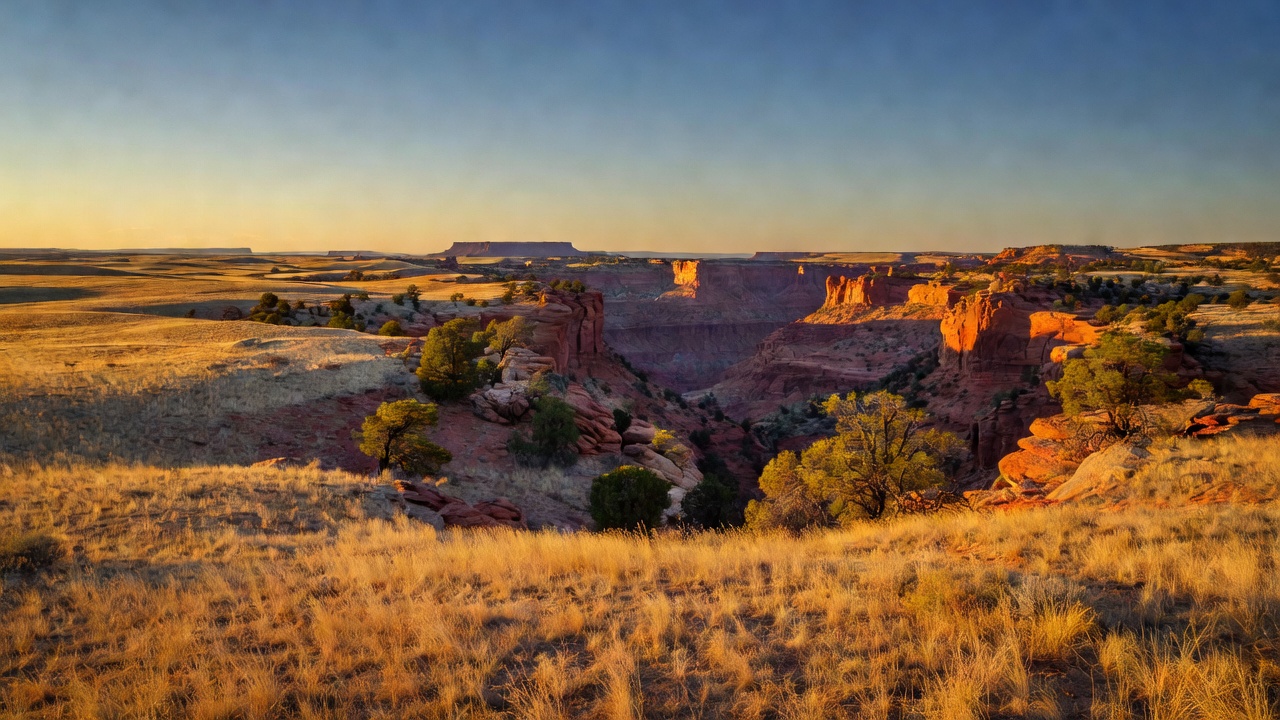
The terrain is high plains -- roughly 4,500 to 6,300 feet -- and the vegetation is honest shortgrass steppe: blue grama, buffalo grass and galleta over rolling country, with sand sage and soapweed yucca where the soil goes sandy. About 79 percent of the grassland is that semi-arid shortgrass prairie. Weather is the real planning constraint. Roughly 15 and a half inches of precipitation falls in an average year at Roy and at Clayton, and it does not fall evenly: there is a bump in April and then the monsoon in July and August, which are the two wettest months. Summers average around 70 degrees, December through February are the cold months, and there is no shade to speak of once you leave the canyon.
Kiowa is administered together with Rita Blanca National Grassland from a district office at 714 Main Street in Clayton, New Mexico, and both fall under the Cibola National Forest and National Grasslands along with Black Kettle and McClellan Creek out in Oklahoma and Texas. Kiowa and Rita Blanca together cover about 230,000 acres across six counties in three states. Practical notes: no fees are collected at Kiowa National Grassland recreation sites, there is no potable water at either developed campground, and the Canadian River is the only permanent stream on the whole grassland. Carry your water in.
History
The grassland is named for the Kiowa, and the Forest Service's own research station is direct about the fact that the Kiowa no longer live here. Their route to this country was long and forced. The Kiowa speak a Kiowa-Tanoan language -- a linguistic isolate more closely related to the languages of the sedentary Pueblo peoples along the Rio Grande than to any other nomadic Plains group -- and the first known reports of them come from the Missouri headwaters. From there they moved to southwestern Montana and then to the Black Hills, where a smallpox epidemic in 1781 devastated them; the Lakota, Arapaho and Cheyenne pushed the weakened tribe south. They came far enough south to run into the Comanche homeland, fought them, and eventually made peace, settling into a southern Plains homeland around the headwaters of the Arkansas, Cimarron, Canadian and Red rivers. The Medicine Lodge Treaty of 1867 confined them to reservations in Oklahoma near Fort Sill, which a nomadic people could not live well under; the last major battles were led by Lone Wolf in 1874 and 1875. The Kiowa Tribe is federally recognized today in southwestern Oklahoma and maintains strong cultural ties to this New Mexico homeland. They were not the only people here -- Kiowa Apache, Comanche, Plains Apache, Mescalero Apache and Jicarilla Apache all have historical ties to northeastern New Mexico.
The Santa Fe Trail crossed this country, and the Kiowa still holds a piece of it. Traders on the Cimarron Route gambled a shorter road against a drier one, and on that route every water source mattered. At McNees Crossing on Corrumpa Creek, just inside present-day New Mexico, a natural rock shelf gave wagons a firm bottom through otherwise loose sandy banks. The crossing is named for a young trader who, with a companion named Monroe, rode ahead of his caravan in 1828 and stopped to rest; both were shot while napping, in sight of the approaching wagons. McNees was buried at the crossing, and Monroe died after being carried thirty miles on to Upper Spring. Three years later, in 1831, Josiah Gregg attended a Fourth of July celebration at the same crossing -- possibly the first Independence Day celebration held in what is now New Mexico -- and the American Legion put up a marble marker there in 1921. The Forest Service maintains a Santa Fe Trail interpretive site on the grassland about 16 miles north of Clayton, where the wagon ruts are still legible in the prairie.
Then came the lawyers and the homesteaders. Most of what is now the Kiowa National Grassland fell inside the Maxwell Land Grant, a 1.7-million-acre claim held by the largest landowner in United States history; the grant was accused of fraudulent claims, litigated for years, upheld by the Supreme Court in 1887 and finally broken up into smaller pieces in the 1890s. One of the attorneys who prosecuted the Maxwell company was Melvin Whiston Mills -- born in Ontario, Canada in 1845, a district attorney for Colfax, Taos, Rio Arriba and Mora counties -- and both the canyon and the nearby town carry his name. In 1880 and 1881 Mills and his family filed homestead claims in the canyon, diverted river water into irrigation ditches, and planted an orchard at the bottom of it: 2,500 peach trees, 500 pear, 1,000 quince, plus prune, mulberry, plum, almond, grape and more. It worked until 1904, when a flood wiped the whole operation out in one go. Mills was ruined and died in 1925. Some of his ditches are still visible, a few of his fruit trees still grow, and the Osage orange he planted in rows as living fence and erosion control is still standing in the canyon.
The grassland itself exists because of a much larger failure. Before the Dust Bowl, American land policy from Virginia west was simply to convert prairie into cash crops, and the Wilson administration pushed farmers to plant more wheat to help win the First World War. Wet years in the late 1920s and new machinery like the one-way disc plow carried that zeal well past the hundredth meridian -- more than 33 million acres of mostly marginal land went under the plow. Then the rain stopped. In 1938, the worst year for wind erosion, an estimated 10 million acres of plowed farmland lost at least five inches of topsoil, and another 13.5 million acres lost at least two and a half inches. The name came from a Denver reporter, Robert Geiger, writing in April 1935 about a five-state area centered on the Oklahoma panhandle and reaching into northeastern New Mexico. The federal response ran in stages: the National Industrial Act of 1933 and the Emergency Relief Appropriations Act of 1935 gave the government authority to buy failed cropland; the Bankhead-Jones Farm Tenant Act of 1937 moved roughly 3.85 million acres of it to the Soil Conservation Service to restore the soil; and in 1954 those lands were transferred to the Forest Service. On June 23, 1960 -- a hundred years after the Homestead Act -- the National Grasslands were formally born, and Congress designated 136,562 acres in Mora, Harding and Union counties as the Kiowa National Grassland. There are 20 national grasslands today, totaling almost four million acres.
Wildlife & plants
This is southern Great Plains wildlife, and the headline animal is the pronghorn -- the open prairie here is good habitat for them and herds are a reasonable expectation rather than a lucky break. The Forest Service's own list of common wildlife for the Kiowa and Rita Blanca runs to black bear, mountain lion, swift fox, black-tailed prairie dog, American pronghorn, thirteen-lined ground squirrel, grasshopper mouse and plains harvest mouse. Reptiles and amphibians: prairie rattlesnake, Texas horned lizard, box turtle and tiger salamander. Watch where you put your hands on the rocks in summer. Mills Canyon also holds a population of Barbary sheep, a North African import turned loose in New Mexico and now living on the canyon cliffs -- they are not native and never were.
Birds are the reason a lot of people come. Hundreds of species live here, winter here or pass through every year, and the Rocky Mountain Bird Observatory has run breeding-season surveys on the Kiowa since 2002. The common list includes ferruginous hawk, scaled quail, mourning dove, great blue heron, long-billed curlew, mountain plover, burrowing owl, sandhill crane, roadrunner, western meadowlark, bald eagle, prairie falcon and common nighthawk. Six species carry special weight in the grassland's management plan -- ferruginous hawk, long-billed curlew, swift fox, burrowing owl, mountain plover and the black-tailed prairie dog -- and that list is a good short summary of what shortgrass steppe is for. Down at the small end, at least 25 species of grasshopper alone have been recorded on the Kiowa, before you start counting crickets, spiders, beetles and ants; on shortgrass prairie the small-mammal diversity is low but the arthropod diversity is not.
The plants are the surprise. A Forest Service survey documented 826 vascular plant species in 81 families on or near the Kiowa and Rita Blanca -- a lot for country that looks like one thing from the road -- and 91 of those taxa, about 11 percent, are exotics. Sunflowers, asters and their relatives account for a fifth of the flora, grasses another 17 percent. Where the species actually concentrate is the tell: riparian ground makes up less than two percent of the study area but holds 26 percent of the plant species, and rocky outcrops are under one percent of the ground with about eight percent of the species. The canyon and ravine habitat, almost all of it in Mills Canyon, carries another 17 percent. In other words, the rare corners do the heavy lifting.
That is why Mills Canyon reads like a different state. Its slopes and ravines grow pinyon pine, ponderosa pine, Rocky Mountain and one-seed juniper, New Mexico olive, apache plume, black cherry, a few mesquite and thickets of hybridizing scrub oak, with ferns and spikemosses tucked in the crevices. The valley bottom runs to cottonwood, willow and box elder -- plus invasive salt cedar. Banana yucca grows in the canyon at one of the northernmost places it is known to occur. Two plants here are Forest Service sensitive species and New Mexico species of special concern: one-flowered milkvetch, the rarest plant on the grassland, found only on knolls of Greenhorn limestone in Colfax, Harding and Mora counties, and Spellenberg's groundsel, documented within three miles of the grassland but not yet on it. Spiny aster is locally common on the east-facing rocky slopes just west of Mills Canyon Campground. For wildflowers, the Forest Service is honest: displays are usually modest, but with the right rainfall the sunflowers in mid to late summer can be spectacular.
Notable features
Mills Canyon is the main visitor attraction of the Kiowa National Grassland, and everything else is a distant second. The Canadian River -- the longest tributary of the Arkansas, rising on the east side of the Sangre de Cristo Mountains -- winds roughly 12 miles through Forest Service ground here, entering the western unit near 5,800 feet and leaving public land around 5,250. Depth depends on which Forest Service page you read: the recreation pages say 700 feet and more than a mile from rim to rim, the agency's wildflower program says almost 1,000 feet, and its research station describes the river cutting 300 to 400 meters into Tertiary and Mesozoic rock. Take the range and be impressed either way. Desert-varnished walls rise several hundred meters above the valley floor in places, and Mills and Mesteno canyons together make up what the Forest Service calls the Mills Canyon Complex.
There are two developed campgrounds and they are very different propositions. Mills Canyon Rim Campground sits up top at 5,760 feet with 6 units, vault toilets, picnic tables and room for RVs and trailers -- this is the one you can reasonably reach. Mills Canyon Campground is down in the canyon at 5,160 feet with 12 units and vault toilets, and getting there means Mills Canyon Road 600: from Roy, drive about 10 miles north and turn west, then about 9 miles in. The Forest Service is blunt that Road 600 is not recommended for cars or for vehicles pulling trailers, and suggests high clearance. Neither campground has potable water. There are no fees at Kiowa recreation sites. Down at the bottom the river supports warmwater fishing, and the Forest Service has been working on a low-water crossing at the Road 600 river ford designed to let aquatic organisms pass while keeping vehicle access.
The Santa Fe Trail site about 16 miles north of Clayton is the other destination, and it is a walking and horseback stop rather than a drive-through -- the wagon ruts of the Cimarron Route are still there in the grass. McNees Crossing itself lies on New Mexico Highway 406, 3.5 miles west of the Oklahoma state line and 1.5 miles south of the small community of Moses. Beyond those two, the recreation here is the grassland itself: hunting, picnicking, hiking, horseback riding and scenery, on a landscape that is geologically more interesting than it looks. This is the Raton section of the Great Plains, shaped by volcanism -- basalt flows capped and protected the softer sedimentary rock underneath, leaving lone peaks, mesas and cones standing above the plain, over caliche sands of the Ogallala Formation laid down 4 to 12 million years ago. Red Triassic Chinle sandstone, Greenhorn limestone, Dakota sandstone and Mancos shale all surface somewhere out here. One more piece of context worth knowing: less than 23 percent of true shortgrass steppe still exists as native vegetation anywhere. This is some of it.
Camps are sourced from public U.S. Forest Service recreation data and have not been personally visited. Roads shown are Forest Service passenger-car routes (maintenance level 3–5) and may be seasonal or gated. Always confirm access, fees and fire rules with the ranger district before you go. Found a fee where we show free? Tell us on the contact page.