Kisatchie National Forest
Where the camps cluster
The place
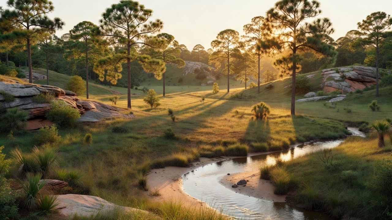
Most people picture Louisiana as swamp, and then they drive into Kisatchie and have to rearrange the whole idea. This is the upland half of the state -- forested piney hills and hardwood bottoms sitting on old Cenozoic uplands, cut by clear, sand-bottomed bayous that look more like east Texas or south Mississippi than anything on a postcard of the bayou country. Over half the forest is longleaf pine and flatwoods vegetation, which is the important thing to know before you get here: longleaf grows park-like and open, with grass and wildflowers underfoot instead of brush, and you can see a long way through it. That look is not an accident and it is not wilderness left alone -- it is fire. The Forest Service keeps this country open with a drip torch, and without regular burning the pine savanna closes up and the rare things in it disappear.
Kisatchie is not one block on the map. It is five ranger districts scattered across central and northern Louisiana, run from a supervisor's office in Pineville: Calcasieu (which is itself split into the Vernon and Evangeline units, out toward Leesville and Alexandria), Caney up in Claiborne and Webster parishes near Homer and Minden, Catahoula in Grant Parish around Bentley, Pollock and Dry Prong, the Kisatchie district in Natchitoches Parish, and Winn out of Winnfield. Seven parishes in all. The districts do not look alike -- Caney in the north is a lake-and-hardwood place, while the Kisatchie district holds the sandstone hills the whole forest is named for -- so pick your district before you pick your camp.
For the camper, this is a forest of water and pine: sand-bottom swimming holes on Kisatchie Bayou, big impounded lakes, a wild and scenic river you can paddle, roughly a hundred miles of trail, dozens of developed recreation sites, and OHV trail systems spread across four parishes. It is also genuinely hot and humid in summer, it is hunted hard in season, and the bugs are real. Come in the cool months if you can.
History
This forest exists because Louisiana ran out of trees. In the late 1800s forest covered about 85 percent of the state, much of it in pure stands of big yellow pine, and the timber industry came for all of it at once. Louisiana led the nation in lumber production in 1914 and ranked second for several years after -- and then it was over. The cutting method was to take everything and move on, and the mills worked through their holdings in roughly 25 years. The Gulf Lumber Company, which the Forest Service calls the largest sawmill west of the Mississippi River, shut down in 1927, two years ahead of the stock market crash; by the end, more than 78 abandoned mills were scattered across 26 pine parishes. What was left was stump land and erosion.
The person who refused to accept that was Caroline Dormon, a Louisiana naturalist and conservationist who led the effort to establish the Kisatchie National Forest at a time when women had almost no foothold in forestry. She is the reason there is a national forest in this state at all. The Secretary of Agriculture proclaimed Kisatchie a national forest in 1930, and the Forest Service assembled it by buying up the cutover land the lumber companies no longer wanted -- which is why the forest is a patchwork of five districts instead of one clean block.
Then came the New Deal. The Civilian Conservation Corps -- the Depression-era work program that ran from 1933 to 1942, hiring unmarried young men aged 18 to 25 out of families on relief -- worked on these lands, part of a national effort that planted over two billion trees and built more than 125,000 miles of roads and trails along with erosion-control works. A good deal of what you drive and camp on here started as that generation's labor. The war came next: Camp Claiborne, on land tied to this forest, trained more than 500,000 troops across six years of World War II. Sawmill towns, CCC camps and military training grounds are all still out there in the woods as foundations, berms and grades, if you know to look. Underneath all of it is the older name -- Kisatchie comes from the Kichai people of the Caddoan Confederacy, who called themselves 'Kitsatchie.'
Wildlife & plants
The signature bird here is the red-cockaded woodpecker, and it is worth understanding because it explains the way the whole forest is managed. It is the woodpecker that will not use a dead tree: it excavates its nest cavity in a LIVING pine, preferring longleaf, which means chiseling through four to six inches of live sapwood while dodging the resin, then hollowing a chamber in the heartwood -- a job that can take years. Once in, the birds keep drilling small resin wells around the entrance so sap runs constantly down the trunk, which appears to be a defense against rat snakes climbing to the nest. They live in cooperative family groups: a breeding pair plus up to six non-breeding adult helpers. Old open pine is the one thing they cannot do without, which is why the drip torch never rests here.
Beyond the woodpecker the list is long and distinctly Louisianian. Biologists have documented 155 species of breeding or overwintering birds, 48 mammals, 56 reptiles and 30 amphibians on the forest. Among the rarities are the Louisiana pine snake -- one of the rarest snakes in North America, a longleaf-country specialist -- the Louisiana black bear, and the Louisiana pearlshell mussel, a freshwater mussel that lives in these clear upland streams and essentially nowhere else. Bald eagles nest around Kincaid Lake.
Do not skip the plants. The wet spots in the longleaf country are carnivorous-plant bogs, where the pale pitcher plant drowns insects in a leaf shaped like a pitcher, and orchids including the rose pogonia come up among them. Rarer still are the calcareous prairies -- pockets of native prairie on alkaline soil, of which fewer than 1,000 acres survive in the entire state, some of them here. These are small, fragile places. Walk the edges, camp somewhere else.
Notable features
KISATCHIE HILLS WILDERNESS is the headline. Designated in 1980 and running about 8,700 acres in the Kisatchie Ranger District, it is terrain that is genuinely rugged by Louisiana standards -- sandstone country in a state that is otherwise famously flat. It is undeveloped and reachable only on foot or horseback. The main route is the Backbone Trail, roughly 7 miles with a couple of short spurs, and walking the whole thing means wading Bayou Cypre, a sand-bottomed stream with no bridge. Treat that as a feature, not a problem, but know it before you plan a loop.
LONGLEAF VISTA is the overlook onto that wilderness and the easiest big view on the forest -- a panorama over the hills for anyone not up for a backpack. It sits along the Longleaf Scenic Byway, a 17-mile drive through the pine hills that is the single best introduction to the place if you have one afternoon.
KISATCHIE BAYOU is the water everyone remembers: clear, sandy-bottomed, with swimming holes and small waterfalls in a state where clear moving water is a rare commodity. SALINE BAYOU is the designated one -- 21 miles of National Wild and Scenic River on the Winn district, cypress-and-tupelo paddling. KINCAID LAKE, on the Calcasieu district, is the developed lake destination, with eagles nesting nearby, and the CANEY LAKES complex serves the far north of the forest.
On foot, the long walk is the WILD AZALEA NATIONAL RECREATION TRAIL -- about 26 miles through the Evangeline unit, and the closest thing to a long-distance backpacking route this state has. For motorized recreation, Kisatchie maintains OHV trail systems spread across four parishes, which is unusual for a southern forest and worth checking before you haul a machine down here. Altogether the forest carries over 100 miles of trail and more than 40 developed recreation sites.
Camps are sourced from public U.S. Forest Service recreation data and have not been personally visited. Roads shown are Forest Service passenger-car routes (maintenance level 3–5) and may be seasonal or gated. Always confirm access, fees and fire rules with the ranger district before you go. Found a fee where we show free? Tell us on the contact page.