Lyndon B. Johnson National Grassland
Where the camps cluster
The place
Most people drive past this one without knowing it is there. The LBJ National Grassland sits northwest of the Dallas-Fort Worth metroplex, in Wise and Montague counties around the town of Decatur, close enough that Fort Worth is an easy morning's drive -- and yet it never reads as one big public place, because it isn't one. The grassland is a scatter of unconnected parcels laid into private ranch country; the Forest Service says roughly 98 percent of the land surrounding these tracts is privately owned, and it numbers the pieces as units (Clear Lake, for instance, sits inside Unit 41). Bring the map. The boundary you are looking for is a fence line, not a gateway.
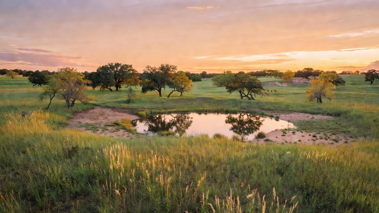
The country itself is the surprise. Nobody should come here expecting the big-sky shortgrass of the Dakotas or the Panhandle. This is a mosaic of oak-dominated woodland and grassland -- post oak and blackjack oak standing in loose stands, opening onto little bluestem, big bluestem, Indiangrass and switchgrass. The original name for this place, Cross Timbers National Grassland, described it better than the one it wears now. The soils are a big part of why: the dominant series here are heavy in clay, and their poor permeability holds the trees back and lets the grass hold ground. The land rolls between roughly 850 and 1,125 feet, with no real relief to speak of -- creek bottoms, low rises, and a handful of small lakes built as flood-prevention reservoirs.
Plan around the weather, because north Texas does not hedge. Summers are hot and humid, winters cool and windy, and the year averages about 63 degrees with roughly 35 inches of rain -- most of it arriving in a burst from mid-April through late June. Spring is the green window and also the muddy one. This is working land as much as recreation land: cattle graze it under permit, oil and gas operations run on it, and the Forest Service manages it for all of that at once. It is run out of a ranger district office in Decatur together with the Caddo National Grassland northeast of the metroplex -- the two of them bracket Dallas-Fort Worth and come to just under 40,000 acres between them -- and both answer to the National Forests and Grasslands in Texas supervisor's office clear across the state in Lufkin.
History
This grassland exists because the farming here failed. Settlers moved into this country in the 1800s and broke it out for agriculture, and it did not hold. Drought through the 1920s and 1930s met farming practices that had stripped the ground of its cover, and the topsoil went with the wind -- the same catastrophe that gave the era its name. The land was badly eroded by the time the federal government stepped in during the 1930s and bought the failed homesteads outright, under the authority of the Bankhead-Jones Farm Tenant Act, with the explicit purpose of returning the ground to something like its natural state.
What followed is the pattern behind every national grassland in the country. The Soil Conservation Service held the purchased land first and was charged with rehabilitating it -- replanting, terracing, stopping the gullies. That work ran for the better part of two decades before the Forest Service took the lands over from the Soil Conservation Service in 1954, and it was not until 1960 that they were formally designated as National Grasslands. There are 20 of them today, just under four million acres nationwide, and this is one of the smaller ones. Some of the water you will fish here belongs to that same soil-conservation chapter: Cottonwood Lake was built as a flood-prevention reservoir by what is now the Natural Resources Conservation Service, and Clear Lake was built for the same job.
The name came late and was not the first one. This was the Cross Timbers National Grassland until 1974, when it was renamed for Lyndon B. Johnson -- a Texas president, and one whose home country lies a long way south of here in the Hill Country. The human history runs far deeper than either name. The Forest Service describes this ground as the ancestral homelands of the Caddo Nation of Oklahoma, the Choctaw Nation of Oklahoma, the Jena Band of Choctaw Indians, the Muscogee (Creek) Nation, the Absentee-Shawnee Tribe, the Comanche Nation, and the Wichita and Affiliated Tribes, and it has worked with tribal partners in recent years on practical things -- allowing cattail collection, setting cedars aside for tribal use.
Wildlife & plants
The plant list is the honest headline here, because it explains everything else. Two oaks dominate the woody side -- post oak and blackjack oak -- and where the canopy opens you get the tallgrass four: little bluestem, big bluestem, Indiangrass and switchgrass. That mix is not an accident of neglect. The Forest Service works this ground with prescribed fire specifically to encourage the natural plant communities, alongside limited timber harvesting and permitted cattle grazing. Fire is the tool that keeps the grass in the mosaic instead of letting the oaks close it in.
For animals, this is classic edge habitat, and it hunts like it. White-tailed deer are the headline, with coyotes, bobcats, red foxes and rabbits sharing the cover. The bird list is what draws most people: bobwhite quail, wild turkey, waterfowl on the little lakes, and songbirds through the oak stands. Quail and dove country in particular is why so much of the fall traffic here is hunters -- and why one of the strangest amenities on the grassland, a dedicated bird dog training area, exists at all. Duck hunting is specifically called out at Cottonwood Lake.
The fishing is small-water fishing and should be judged as such. The lakes hold largemouth bass, blue catfish, channel catfish and sunfish. Nobody is coming here for a trophy; they are coming to sit on a bank an hour from a metroplex of eight million people and watch a bobber. That proximity is the whole point of this place, and it is also why the Forest Service leans on partnerships with neighboring landowners to keep the trails and habitat working.
Notable features
The trail system is the reason most people make the drive. The LBJ Multiuse Trail System runs nearly 75 miles and is open to hikers, mountain bikers and horseback riders alike, and its headquarters is TADRA Point, a trailhead south of Cottonwood Lake on Forest Service Road 900 where five loops of the system come together. TADRA Point was constructed through the volunteer efforts of local equestrian groups, which is worth knowing before you use it -- this is a horse-built facility, and it shows in the details: 20 parking spurs with stock tethers and pull-throughs, a horse ramp, stock water, vault toilets, non-potable water, and picnic tables. Overnight camping there runs $10 a night, trailer or tent, with no hookups, and the site hosts non-commercial group events including equestrian endurance rides.
The water is all small and all worth a look. Black Creek Lake is a 35-acre lake north of Decatur with a picnic area, a boat launch, vault toilets and 14 walk-in campsites at $10 a night -- day-use parking is $2 a vehicle or $30 for the year, and there is no potable water on site, so haul your own. Cottonwood Lake is a 40-acre flood-prevention reservoir on Forest Service Road 900, undeveloped, good for fishing and duck hunting, open around the clock and with no facilities at all. Clear Lake is an 18-acre flood-prevention lake inside Unit 41 with a fully accessible 50-foot T-shaped fishing pier -- a genuinely thoughtful piece of construction on an otherwise plain little lake.
Then there is Valley View, which is unlike anything on most national forest land. The Valley View group-use facility sits inside a 1,500-acre Designated Bird Dog Training Area on the LBJ grassland -- 15 camp units, a 20-by-40-foot pavilion with a Texas-sized charcoal grill, and a barrier-free double restroom, available to groups first come, first served. Dog trials run from October 1 through March 31, with the schedule posted on the bulletin board, so if you want the place quiet, that is the half of the year to avoid. Know the rules before you settle in anywhere out here. The occupancy order for the National Forests and Grasslands in Texas caps a stay at 14 days in any 30-day period, prohibits camping within 300 feet of any developed parking area or boat ramp, and holds an individual campsite to 8 people, 2 tents and 2 vehicles. During firearm hunting seasons you are required to wear at least 400 square inches of fluorescent orange -- 144 each on chest and back -- plus an orange head covering. In a place this heavily hunted and this tangled up with private land, that last one is not a formality.
Camps are sourced from public U.S. Forest Service recreation data and have not been personally visited. Roads shown are Forest Service passenger-car routes (maintenance level 3–5) and may be seasonal or gated. Always confirm access, fees and fire rules with the ranger district before you go. Found a fee where we show free? Tell us on the contact page.