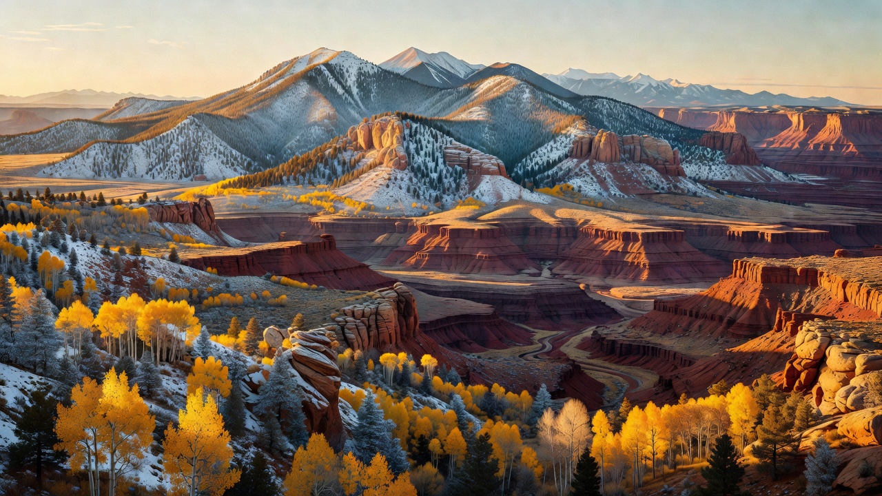
Manti-La Sal National Forest
Where the camps cluster
The place
Manti-La Sal National Forest does not sit in one place. Its roughly 1.4 million acres come in three disconnected pieces spread across central and southeastern Utah, with a bit spilling into western Colorado, and the Forest Service runs them out of four ranger districts -- Sanpete and Ferron/Price on the northern Manti Division, and Moab and Monticello down south -- from a headquarters in Price. The Manti side is the Wasatch Plateau: a high, rolling tableland on the edge of the Colorado Plateau, timbered in aspen and conifer, cut by canyons that drop west to Sanpete Valley and east to Castle Valley, and topped by South Tent Mountain at 11,263 feet. The southern pieces are stranger. The La Sal Mountains southeast of Moab and the Abajo (Blue) Mountains west of Monticello are not folded-up ranges at all -- they are igneous intrusions, magma that shouldered its way into the flat sedimentary layers of the Colorado Plateau 22 to 29 million years ago and was then uncovered as the softer rock around it eroded away. The result is a pair of true sky islands: Mount Peale in the La Sals tops out at 12,721 feet, the highest point in Utah outside the Uinta Mountains, and Abajo Peak reaches 11,368 feet, both of them rising straight out of desert. The Forest Service puts the total spread at about 10,000 feet of elevation across the forest, from roughly 3,000-foot desert country to the high summits. For anyone traveling the Moab-Monticello corridor, that spread is the whole point: the forest is the cold, wooded ceiling above canyon country, and it is snowed shut for a good part of the year while the desert below is wide open.
History
People have been on this ground a very long time. The Forest Service's own history of the area runs from Paleo-Indians (12,000 to 7,500 years ago) through the Desert Archaic (7,500 to 2,500 years ago) to the Fremont and Ancestral Puebloans (2,500 to 800 years ago), with Utes, Paiutes, Shoshones, Goshutes and Navajos in the country from roughly 900 years ago. Spanish parties came through in 1776 -- the Sierra La Sal, the 'Salt Mountains,' was a landmark on the Old Spanish Trail between Santa Fe and Los Angeles, and 'Abajo' is Spanish for 'low' -- followed by fur trappers, then Mormon settlement beginning in 1847, then cattle and sheep outfits, homesteads, and mining for gold, silver, radium and uranium. The federal forest came in pieces: the Manti Forest Reserve was set aside on May 29, 1903 at 584,640 acres, the Nebo National Forest was added July 1, 1915, the La Sal National Forest was folded in on November 11, 1949, and the combined Manti-La Sal name was adopted August 28, 1950. The hyphen is doing a lot of work -- it joins two forests that never touched. The most consequential history here, though, is scientific. By the early 1900s heavy grazing on the Wasatch Plateau plus hard summer thunderstorms was sending floods and debris slides down onto the Sanpete Valley towns below. In 1911 Ephraim Canyon was picked as the site of a Forest Service range and watershed research station, established in 1912 as the Utah Experiment Station -- known today as the Great Basin Experimental Range. Its first director, Arthur Sampson, built log exclosure fences around study plots to test whether the floods and the overgrazing were the same problem. They were, and the work he started on this plateau is generally credited as the beginning of rangeland ecology as a discipline.
Wildlife & plants
The forest's habitat list is stacked vertically, and the Forest Service simply says it supports hundreds of plant and animal species. In the high country you are in aspen, spruce-fir and ponderosa pine with mule deer, elk and the occasional black bear; the canyons of the Dark Canyon Wilderness hold mule deer, black bear, bighorn sheep and some mountain lions, and the life zones there run all the way from ponderosa and aspen on the rim down to desert vegetation on the canyon floor. The Wasatch Plateau's own signature vegetation is the tall forb community -- the dense, waist-high wildflower meadows that were exactly what Sampson's grazing studies were about. The oddest thing living here is much smaller. The forest is well known for its lichens: alpine lichen research on the La Sal Mountains and in the Mount Peale Research Natural Area, started by Dr. Steve Leavitt in 2018 with funding from the Canyonlands Natural History Association and Brigham Young University, has produced a string of scientific papers and several species new to science. One of them, Lecidella ayazii, was described from La Sal collections and has since turned up from the Antarctic Peninsula to far northern Canada -- named off a mountain range in the Utah desert, and it turns out to live nearly pole to pole.
Notable features
Skyline Drive is the classic run: a gravel road along the crest of the Wasatch Plateau, whose northern segment -- the North Skyline Drive State Scenic Backway -- climbs from US-6 and undulates 27 miles south to SR-31, looking into the Lake Fork and Fish Creek drainages. It is high, it is exposed, and it is closed in winter, when it becomes a groomed snowmobile trail; the Forest Service calls it passable by passenger cars but also lists high-clearance vehicles, which is about right for a road that can hold snow into June. The forest's other named backways cover the southern ranges: the Abajo Loop, which climbs from desert floor and red-rock canyon to mountains over 11,000 feet; Elk Ridge, with views taking in Monument Valley, Bears Ears, Canyonlands and, the agency claims, nearly 200 miles of country; the Ferron to Mayfield backway, which goes well over 10,000 feet through aspen and conifer; Harts Draw Highway across the Abajos; and the La Sal Mountain Loop above Moab. The forest's only designated wilderness is Dark Canyon, 47,116 acres established September 18, 1984 under the Utah Wilderness Act, a horseshoe of upper Dark Canyon plus Woodenshoe and Peavine canyons -- sandstone walls standing 3,000 feet above the floor, narrow enough in the lower section to hold shade through the middle of the day, with Ancestral Puebloan cliff dwellings tucked into it. The Monticello district is also monument country: of the 1,351,849 acres President Obama proclaimed as Bears Ears National Monument on December 28, 2016, roughly 289,000 acres are Forest Service land on this forest. That designation was cut to 201,397 acres on December 4, 2017 and restored on October 8, 2021, so any map or guidebook printed in between is wrong -- check current boundaries before you plan a trip. On the Manti side, Joes Valley Reservoir sits ringed by the forest at about 6,995 feet behind a 192-foot Bureau of Reclamation earthfill dam finished in 1965, and is a fishing, boating and camping hub. Forest-wide the agency lists 43 camping facilities including 28 campgrounds, six group campgrounds and seven lookouts and cabins -- and fire restrictions are a real seasonal fact of life here, with Stage 2 restrictions in force forest-wide as of July 17, 2026.
Camps are sourced from public U.S. Forest Service recreation data and have not been personally visited. Roads shown are Forest Service passenger-car routes (maintenance level 3–5) and may be seasonal or gated. Always confirm access, fees and fire rules with the ranger district before you go. Found a fee where we show free? Tell us on the contact page.