McClellan Creek National Grassland
Where the camps cluster
The place
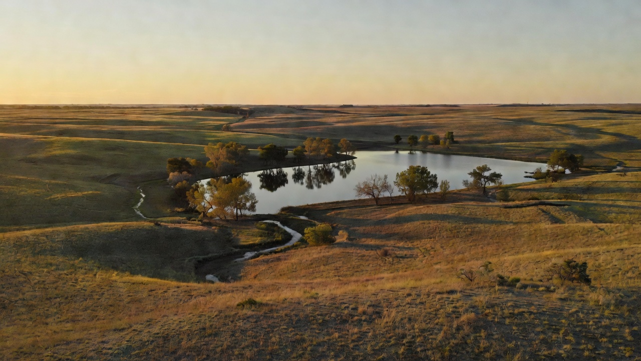
This is Gray County, Texas, out where Interstate 40 runs between McLean and Alanreed, and the whole unit is organized around one piece of water. Texas Parks and Wildlife puts it about 60 miles east of Amarillo and 3 miles north of I-40 at exit 128, on FM 2477. Do not come expecting a sea of shortgrass. TPWD's description of the ground is the most useful sentence written about this place: the site is predominantly bottomland surrounded by rough rangeland terrain, with brushy draws running down out of the upland range into bottoms holding cottonwood, hackberry and elm. So it reads as a sheltered green seam in open, broken country -- which is exactly why the deer and turkeys are here, and why a unit this small is worth a stop at all. The Forest Service calls it open year-round and variously locates it 'near Pampa' on its website and 'near McLean' in its own printed guide to the unit; either way, this is a small, self-contained destination rather than a landscape you disappear into.
The water is called Lake McClellan on the Forest Service's signs and McClellan Reservoir on Texas Parks and Wildlife's books, and it sits on McClellan Creek, a tributary of the North Fork of the Red River. TPWD puts it at 339.2 surface acres with a maximum depth of 21 feet and a mean depth of just 4 feet -- which is the single most important number on this page. A four-foot average means a shallow, turbid, weather-dependent lake, and both agencies say so plainly: TPWD records moderate-to-severe annual fluctuation of 4 to 10 feet and 1-to-2-foot visibility, notes the reservoir 'has gone dry three times since 2000,' and warns that the ramps can be unusable; the Forest Service's own recreation page says the lake dries up seasonally and to call ahead. The number to call is the Black Kettle Ranger District at (580) 497-2143.
Which brings up the other quirk of this place: nobody administers it from Texas. On paper McClellan Creek belongs to the Cibola National Forest and National Grasslands, headquartered in Albuquerque, New Mexico, which spans about 1.9 million acres and administers four national grasslands out on the plains -- Black Kettle, McClellan Creek, Kiowa and Rita Blanca, roughly 263,000 acres between them. Day to day it is run by the Black Kettle Ranger District in Cheyenne, Oklahoma, whose office shares a building with the National Park Service's Washita Battlefield National Historic Site visitor center, completed in 2007. So the ranger station for this Texas grassland is in another state, and the phone number for lake conditions has an Oklahoma area code.
History
The land here was home to the Cheyenne, Arapaho, Sioux, Apache, Comanche and Pawnee, among others. The Forest Service's account of this grassland and its sibling is unsentimental about what came next: after 'much conflict and the eventual relocation of the tribes,' settlers were pulled onto the plains by the promise of free land during the land-run era, and the farmsteads they broke out changed the landscape fast.
The creek itself carries a name from an earlier passage through. In 1852 Captain Randolph B. Marcy led the expedition credited with first reaching the headwaters of both forks of the Red River, assisted by a young army officer named George B. McClellan -- later Marcy's son-in-law, and later still a Union general in the Civil War. The Forest Service states flatly that McClellan Creek was named for 'explorer and army officer G.B. McClellan, by his commander R.B. Marcy.' The grassland is named for the creek, so the smallest unit in the national grassland system is named at two removes for a man who rode through the drainage once.
Then the dirt left. In the 1930s this region took extreme drought and hard wind that, by the Forest Service's reckoning, swept away as much as four inches of soil; farms were wrecked and often simply abandoned, and the Great Depression was running at the same time. Congress answered with the National Industrial Recovery Act of 1933 and the Emergency Relief Appropriations Act of 1935, which let the federal government relocate ruined farmers and buy the drought-stricken land, and then with the Bankhead-Jones Farm Tenant Act of 1937 -- which, in the Forest Service's own telling, required the Department of Agriculture to build a program of land conservation and utilization that did not involve row cropping. That was the start of what the agency calls 'grassland agriculture' -- the deliberate decision to stop plowing this country and put grass back on it. The dam that made Lake McClellan went up in 1938, right in the middle of that work, and the reservoir was renovated and dredged in 1995.
Once the ground was partly stabilized, the tracts moved from the Soil Conservation Service to the U.S. Forest Service in 1954, and in 1960 they were formally established as national grasslands. Because every acre came from a willing seller rather than a condemnation, the grasslands have what the Forest Service calls a 'checkerboard' look and feel -- federal parcels interleaved with private ground, which matters more than it sounds like it should when you are deciding where you can legally park for the night.
Two recent chapters are worth knowing. March 2006 was a catastrophic fire month across the eastern Panhandle; the National Weather Service office in Amarillo documented wildfires burning in Gray County among others, under strong dry westerly winds. By some accounts the whole of McClellan Creek burned over and lost the majority of its trees -- which, on ground whose appeal is the cottonwood and hackberry down in the bottoms, is not a small thing. Expect a young, recovering tree canopy rather than a mature one. And on the paperwork side, this grassland is not run under the Cibola's forest plan. The Kiowa, Rita Blanca, Black Kettle and McClellan Creek national grasslands have had their own Land and Resource Management Plan since 2012, separate from the 2022 plan covering the Cibola's mountain districts in New Mexico -- so the prairie out here is governed by its own document, written for prairie.
Wildlife & plants
The Forest Service's list of what you can commonly expect to see across these grasslands is short and practical: white-tailed deer, Rio Grande turkey, coyote, beaver, bobcat, rabbits and squirrels. The grasslands act as a winter haven for a wide variety of ducks and geese, and the bird list otherwise runs to hawks and owls, quail, dove, songbirds and the seasonal Mississippi kite -- a slim, gray, extraordinarily graceful raptor that summers on the southern plains and eats dragonflies on the wing. The agency also makes a point of the insects: these prairies produce thousands of pollinators, butterflies, bees, wasps and moths among them.
There is one animal here nobody wants. Feral hogs (Sus scrofa) are established on both Black Kettle and McClellan Creek, and the district has an active project to manage and remove them specifically to improve wildlife habitat and prairie health. Expect rooted-up ground and, on a quiet evening, the possibility of seeing them.
In the water, TPWD lists largemouth bass, channel and blue catfish, saugeye, white crappie and sunfish. Saugeye -- a walleye-sauger hybrid that agencies stock because it tolerates turbid, warm, up-and-down reservoirs exactly like this one -- carries an 18-inch minimum length limit and a 3-fish daily bag here; everything else is under statewide regulations. Be realistic about the fishing. TPWD's own outlook rates most species poor to fair while the population rebuilds after the dry-outs: channel catfish were documented in 2018 but none were caught in the 2021 survey, and largemouth bass relative abundance in 2021 was 2.0 per hour. Cover is thin -- large beds of pondweed in the upper reservoir and scattered stands of cattail and bulrush, over a bottom of mostly sandy clay with some gravel.
Hunting here works differently than it does on most national grassland, and it is worth getting right. The Forest Service's guide to this district says hunting is permitted on most of the Oklahoma portion of Black Kettle -- one of the most enjoyed hunting areas in that state -- and prohibited on the two Texas pieces, the Lake Marvin unit and this one. So there is no general walk-on hunting at McClellan Creek. What there is instead is a drawn hunt: Texas Parks and Wildlife runs Lake McClellan Recreation Area as a Special Permit public deer hunt area, and its current brochure spells out the terms -- permitted hunters report to area headquarters by noon on the first day, take an orientation, and are escorted to assigned blinds by Forest Service and TPWD staff; centerfire rifles only; 400 square inches of blaze orange plus orange headwear; no dogs; no hunting from a vehicle and no ATV or ORV use, with exceptions for hunters with mobility disabilities; and non-permitted visitors and family members are not allowed on the area during hunts. Camping on the area is open to permitted hunters at the normal overnight fee.
The part that matters even if you never hunt: the portion of the area being hunted is CLOSED to the general public during hunt periods. If you are planning a fall or winter trip out here for the lake or the trails, check the hunt schedule first, or you may drive four hours to a locked gate.
Notable features
The riding is the headline. The Lake McClellan UTV/ATV area sits just outside the campground and runs roughly 10 miles of multiple-use trail -- open to hikers and bikes as well as machines -- and the Forest Service calls the designated ATV and motorcycle trails at McClellan Creek a popular spot of the Texas Panhandle. On a unit this small, ten miles of legal motorized trail is a remarkable share of the whole place, and it is the main reason people make the turn off I-40.
Camping is developed rather than dispersed. The Forest Service lists three campgrounds -- Lake McClellan Campground, East Bluff #1 and McDowell -- plus a large group shelter, picnic sites and a boating site; it counts 60 camping units at the Lake McClellan campground, and TPWD's access listing describes 60 campsites including full hookups along with 25 picnic sites and restrooms. Note that this is not free-and-first-come the way its sibling grassland is: the recreation area is operated under a Forest Service concession, reachable at (806) 779-2092, and there is a boat ramp fee. There are two one-lane ramps, one entered on the south side of the road and one just south of the dam, each with parking for about five rigs. Everything is open all year.
There is lodging in Pampa, Groom and Clarendon if the lake is down and you would rather not sleep next to a dry basin. Beyond that, the activity list is what a small prairie lake supports: fishing, swimming, picnicking, day hiking, motorized boating, mountain biking and road cycling. The grassland is also a working landscape and does not hide it -- the Forest Service issues livestock grazing permits here, and the grasslands produce oil and natural gas, with royalties going to area schools, county roads and the federal treasury. Windmills and the odd abandoned structure still stand on the prairie. If you want the deeper interpretive experience the district offers, it is 60-odd miles northeast at the Black Kettle Interpretive Trail by the ranger office in Cheyenne, Oklahoma, where there is a working windmill, a replica dugout home and prescribed-fire study plots.
Camps are sourced from public U.S. Forest Service recreation data and have not been personally visited. Roads shown are Forest Service passenger-car routes (maintenance level 3–5) and may be seasonal or gated. Always confirm access, fees and fire rules with the ranger district before you go. Found a fee where we show free? Tell us on the contact page.