Ottawa National Forest
Where the camps cluster
The place
Ottawa National Forest fills the western end of Michigan's Upper Peninsula, extending from the south shore of Lake Superior down to the Wisconsin border. It covers most of Gogebic and Ontonagon counties plus slices of Iron, Houghton, Baraga and Marquette, with the supervisor's office in Ironwood and the visitor center out at Watersmeet. The relief is modest on paper -- the Forest Service puts the range at about 600 feet along the Lake Superior shoreline to more than 1,800 feet in the Sylvania Wilderness -- but that number badly undersells the terrain. This is Superior Upland country, ancient volcanic and sedimentary rock that the ice ages scraped down to bare stone and sand, and the rivers have been cutting into it ever since. What you get is short, sharp topography: basalt ridges with open rock balds, a gorge 300 feet deep, and streams that hit a conglomerate ledge and simply fall off it.
Water is the organizing principle. The Forest Service counts over 2,000 miles of streams here, over 500 lakes, and more than 130,000 acres of wetlands. Add roughly 196 miles of hiking and backpacking trail, three wildernesses totaling over 50,000 acres, and 23 developed campgrounds, and you have a forest that rewards a slow route and a willingness to walk the last half mile. Then there is winter, which is the other half of this place: sections of the forest take more than 200 inches of snow in a season off Lake Superior, and over 485 miles of groomed snowmobile trail exist because of it. Plan around the snow, not against it -- forest roads that are trivial in August are a different proposition in November.
History
The Ojibwa lived in this country long before it was a forest, harvesting beaver pelts across the western Upper Peninsula; most of what is now the Ottawa passed out of Ojibwe hands in the 1854 Treaty of La Pointe, which ceded Lake Superior Ojibwe land, established reservations including L'Anse and Lac Vieux Desert, and retained hunting, fishing and gathering rights in the ceded territory. The Lac Vieux Desert Band descends from tribal members who bought land here. Industrial logging arrived with the railroad: after the Duluth, South Shore and Atlantic Railway went through in 1892-94, the white pine came out fast, and the cutting in places like the Sturgeon River Gorge had largely run its course before 1910. What was left was cutover land -- which is exactly the kind of land the federal government started buying back.
The Ottawa National Forest was established in 1931 and grew through purchases in 1933 and 1935, reaching a maximum of 1,026,329 acres. Pockets of old-growth white and red pine survived the boom and are still standing. Two of the forest's three wilderness areas came from private hands rather than federal ones. The McCormick family of Chicago assembled their roughly 17,000-acre tract between 1904 and 1920 and willed it to the government in 1967. Sylvania has an even better story: Wisconsin lumberman A.D. Johnston bought 80 acres there in 1895 intending to cut it, was moved enough by the place to leave it standing, and it became the exclusive Sylvania Club -- a private resort for wealthy guests that ran until the Forest Service acquired the property in 1967, removed the buildings, and managed it as a special recreation area. Congress made McCormick, Sylvania and Sturgeon River Gorge designated wilderness in 1987 under the Michigan Wilderness Act. Five years later, on March 3, 1992, the Michigan Scenic Rivers Act (Public Law 102-249) put six of the forest's rivers into the National Wild and Scenic Rivers System. The visitor center at Watersmeet opened in 1971 and still runs interpretive programs; admission is free.
Wildlife & plants
The Forest Service's own list for the Ottawa runs to deer, fox, snowshoe hare, bald eagles, loons and songbirds, plus bears, coyotes, fisher and wolves. The wolves are the headline. Gray wolves recolonized the Upper Peninsula on their own after federal Endangered Species Act protection in 1978, and Michigan removed them from its state threatened list in 2009 once recovery targets were met -- the Forest Service specifically names the eastern timber wolf among the rare species using the Trap Hills. Moose are here too, and they are here on purpose: the Michigan DNR trucked moose in from Ontario's Algonquin Provincial Park in the mid-1980s and released them in Marquette County, and the herd that grew from that release ranges the highlands around the McCormick Wilderness. Seeing one is luck, not planning.
Birds are the other reason to keep your head up. Peregrine falcons were released from a hack site on the Trap Hills ledges -- the Hacking Site Trail is named for it -- and bald eagles work the Black River and the Lake Superior shoreline. Underfoot, the botany is genuinely rare in spots: the Forest Service flags fairy bells and Braun's holly fern among endangered plants in the Trap Hills. The forest cover is classic northern hardwood and boreal mix -- sugar maple, eastern hemlock and yellow birch dominate Sylvania, alongside white, red and jack pine, white spruce, balsam fir and paper birch, with basswood and aspen filling in the cutover ground. In spring the Black River Harbor woods put on a wildflower show: bloodroot, hepatica, nodding and great white trilliums, violets, starflower, blue-bead lily, Jack-in-the-pulpit, and big aromatic patches of wild leeks in the wet spots. The fishing skews cold and clean -- and note that Sylvania runs special regulations, including catch-and-release on all bass, which is a large part of why those lakes still fish the way they do.
Notable features
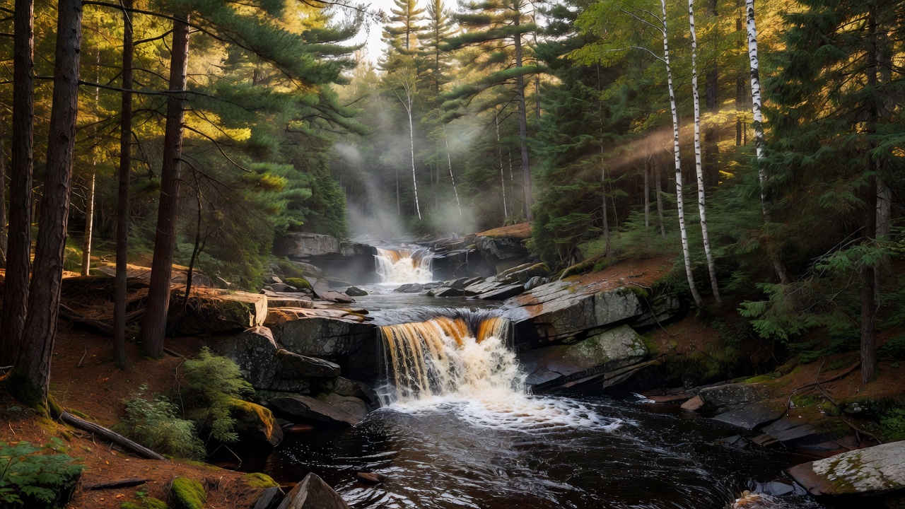
The Black River National Scenic Byway is the single best-known drive here: County Road 513 runs north from Bessemer about 15 miles to Black River Harbor on Lake Superior, paved the whole way, with five waterfalls strung along the last stretch of river. Conglomerate Falls is farthest upstream, then Potawatomi, Gorge, Sandstone and Rainbow spread over roughly two miles, each on its own short trail through hemlock and northern hardwood, all of them cut into conglomerate and sandstone bedrock. The North Country Trail runs the same corridor. The Presque Isle River carries another set of falls, though some of those sit outside the forest boundary in the adjoining Porcupine Mountains state park.
Inland, the Trap Hills are the sleeper. The Forest Service calls the range one of the best choices for backpacking in the upper Midwest -- rugged volcanic slopes and ridges, open rock balds, waterfalls, large tracts of undisturbed forest, and the North Country Trail running east-west straight through it. It is non-motorized except for collector roads reaching the trailheads, and it carries no wilderness label, which means dispersed camping is on the table. Silver Mountain is a different kind of landmark: an isolated basalt dome that is the interior of an extinct volcanic vent, 1,312 feet high, with a steep staircase trail to a summit that still holds the remnants of an old fire tower and a view over the Prickett Lake backwaters and most of the Sturgeon River Gorge Wilderness. That gorge -- 14,729 acres, wilderness since 1987 -- runs as much as 300 feet deep, with Sturgeon Falls dropping about 15 feet inside it. Sylvania (18,327 acres) is the paddler's wilderness: 34 lakes, about 25 miles of trail and portage, and roughly 15,000 acres of old-growth northern hardwood, among the most extensive left in North America. McCormick, around 17,000 acres, is the trailless one, holding the headwaters of the Huron, Dead, Peshekee and Yellow Dog rivers.
Camps are sourced from public U.S. Forest Service recreation data and have not been personally visited. Roads shown are Forest Service passenger-car routes (maintenance level 3–5) and may be seasonal or gated. Always confirm access, fees and fire rules with the ranger district before you go. Found a fee where we show free? Tell us on the contact page.