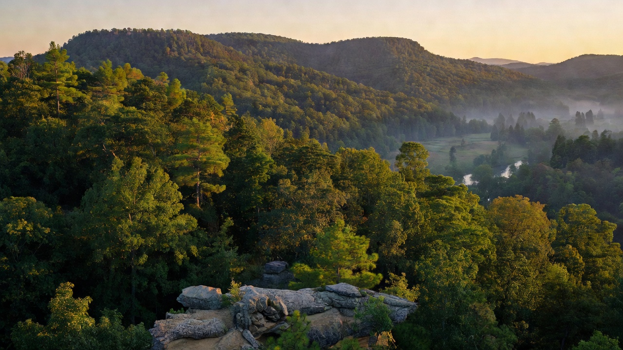
Ozark-St. Francis National Forest
Where the camps cluster
The place
The Ozark National Forest fills the high, broken country of northern Arkansas -- the Boston Mountains and the Ozark plateau country, which look less like classic mountains than like a plateau that water has been carving apart for a very long time. What you actually drive through is a maze of narrow hollows, sandstone bluff lines, seasonal waterfalls, and oak-hickory ridges that go blaze-orange in fall. Mount Magazine, at 2,753 feet, is the highest point in Arkansas and, oddly, a flat-topped mesa belonging to the Ouachita Mountains region even though it sits inside the Ozark National Forest. The Mulberry River runs west through the forest for most of its length and is the state's best-known whitewater float.
Then there is the other half. The St. Francis National Forest is one of the smallest national forests in the country, about 22,600 acres in Lee and Phillips counties on the far eastern edge of Arkansas -- a different world, a long drive away. It rides Crowley's Ridge, a strange 150-mile spine of windblown loess standing 250 to 550 feet above the flat Mississippi Delta, and drops off into the bottomlands along the St. Francis and Mississippi rivers. The Forest Service says it is the only place in the National Forest System where the public can reach the Mississippi River from the shoreline. If you came for mountains, go west; if you came for lake fishing and big-river bottom hardwood, this is it.
History
The Ozark National Forest was proclaimed on March 6, 1908 by President Theodore Roosevelt, putting it among the earliest national forests in the eastern half of the country -- cutover, burned-over Ozark hill land brought back under federal management. The St. Francis National Forest came half a century later, established November 8, 1960 by President Dwight D. Eisenhower, and the two have been administered together ever since.
The best story here is the bears. Arkansas was once nicknamed "The Bear State," then hunted its black bears essentially out of existence in the 1800s. Between 1958 and 1968 the Arkansas Game and Fish Commission trapped 254 black bears in Minnesota and Manitoba and released them into the Ozark and Ouachita national forests. It worked -- spectacularly. Researchers now routinely describe it as one of the most successful large-carnivore reintroductions ever attempted, and thousands of bears live in Arkansas today.
The forest's other landmark project went underground. Locals knew the cave above Blanchard Springs as "Half-Mile Cave" by the 1930s; systematic exploration began in the 1950s, and after ten years of trail and lighting work the Forest Service opened Blanchard Springs Caverns to the public in 1973.
Wildlife & plants
Black bears are the marquee animal and the reason many people come -- hang your food and store it smart. You will share the woods with white-tailed deer, wild turkey, bobcat, coyote, raccoon, and armadillo, and the streams hold smallmouth bass; the Mulberry and the Ozark creeks are good smallmouth water. The rare stuff is mostly in the dark: the forest's limestone caves shelter federally endangered bats, including the Ozark big-eared bat (listed endangered in 1979, with a total population estimated under 2,000 animals), the gray bat (listed in 1976), and the Indiana bat. Those bats are cave obligates -- they use caves year-round for every stage of life -- and human disturbance is the biggest threat to them, which is why some caves and gates on this forest are closed and should stay that way.
Above ground the forest is a hardwood forest first and a pine forest second: shortleaf pine mixed into oaks -- post, blackjack, black, white, and northern red -- with over 500 species of trees and woody plants across the unit. Mount Magazine is a butterfly hotspot, with 94 of Arkansas's 134 butterfly species recorded there, the Diana fritillary being the prize. Out east on Crowley's Ridge the plant list changes character entirely -- tulip tree, American beech, and other species that read more like the Kentucky and Tennessee hills than the Ozarks 200 miles behind you.
Notable features
Blanchard Springs Caverns is the headliner and a genuine oddity: the only tourist cave owned and operated by the U.S. Forest Service, and the only federally run show cave outside the National Park System. It is a three-level limestone cave with roughly 8 miles of surveyed passage, and its Giant Flowstone -- about 164 feet long and 30 feet thick -- is one of the largest in the United States. Tours run from the easy half-mile Dripstone Trail to the 1.2-mile Discovery Trail (366 feet of descent) to a crawling, muddy Wild Cave tour.
The Ozark Highlands Trail is the long walk: about 165 miles across the Ozark National Forest, built and maintained largely by volunteers, and the anchor section of a longer route running from Lake Fort Smith State Park toward the Buffalo National River. It passes White Rock Mountain, Hare Mountain, and the Hurricane Creek Wilderness. Five wilderness areas sit on the forest: Upper Buffalo, which holds the headwaters of the Buffalo National River; Hurricane Creek; Richland Creek (11,801 acres, designated by the 1984 Arkansas Wilderness Act); East Fork; and Leatherwood.
For shorter days there is a strong bench of rock scenery -- the stone arch at Alum Cove Natural Bridge, the weather-carved pedestals of the Pedestal Rock Scenic Area and its adjoining Kings Bluff trail, and Sam's Throne near Mt. Judea, a well-known Arkansas rock-climbing area overlooking the Big Creek valley. The Mulberry River -- its uppermost 56 miles added to the National Wild and Scenic Rivers System in 1992 -- runs Class I to III and floats best from about mid-October through mid-June. On the St. Francis side, Bear Creek Lake and Storm Creek Lake are the draw, with largemouth bass, crappie, warmouth, and channel catfish.
Camps are sourced from public U.S. Forest Service recreation data and have not been personally visited. Roads shown are Forest Service passenger-car routes (maintenance level 3–5) and may be seasonal or gated. Always confirm access, fees and fire rules with the ranger district before you go. Found a fee where we show free? Tell us on the contact page.