Rita Blanca National Grassland
The place
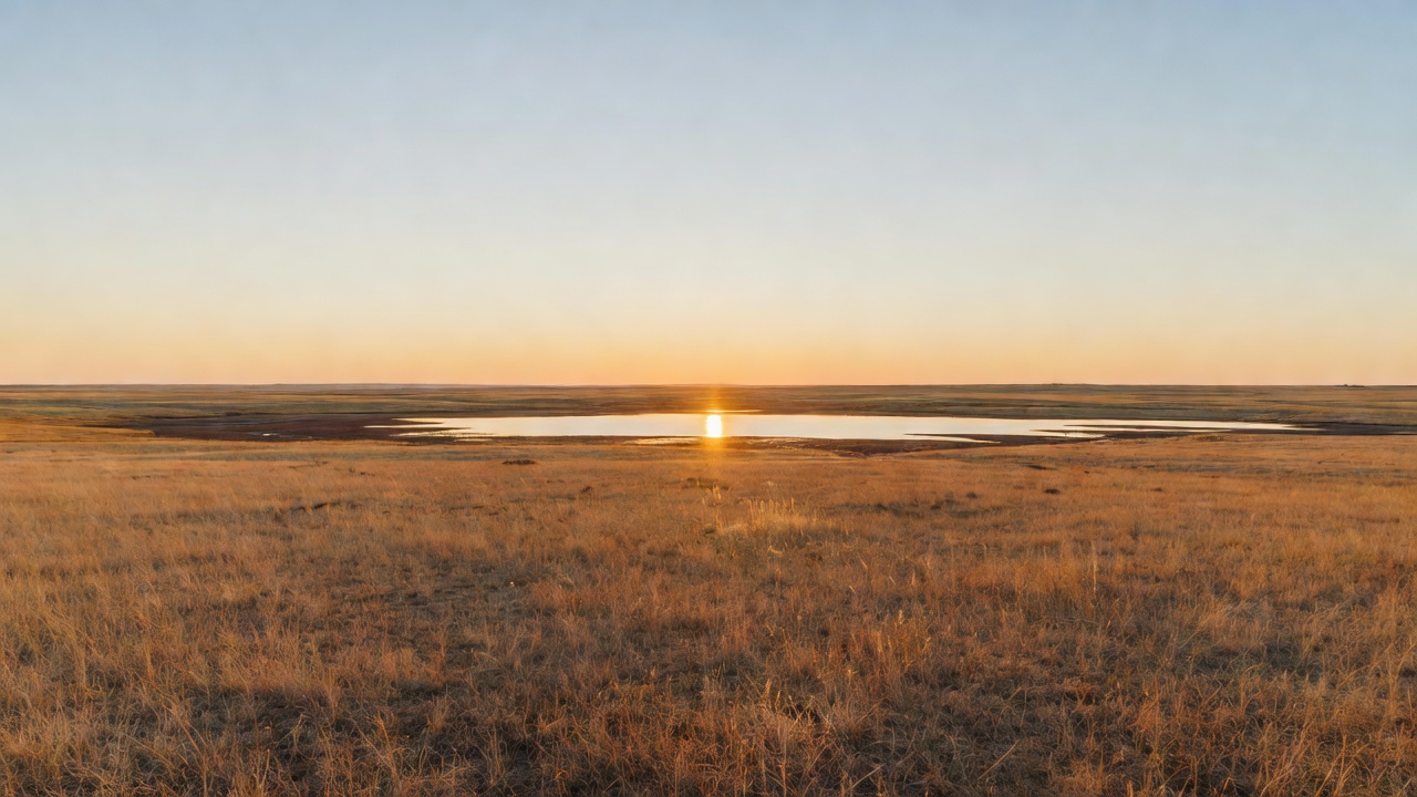
Rita Blanca National Grassland sits in the northwest corner of the Texas Panhandle, in Dallam County, and reaches north across the state line into Cimarron County in the Oklahoma Panhandle -- roughly five-sixths of it on the Texas side. Dalhart is the nearest town of any size; Texline and Boise City are the other names on the map. The Forest Service describes the country as the shortgrass prairie of the southern Great Plains and calls this unit a refuge for visitors to slow down and enjoy the nature that surrounds them, which is a polite way of saying there is nothing here to do but look, and that looking turns out to be enough.
The land tilts gently across the whole unit: about 4,700 feet up in northwestern Cimarron County down to about 3,700 feet in southeastern Dallam County, a 1,000-foot drop you will never feel as a hill. Underneath is the Ogallala Formation -- red-to-brown caliche sands laid down four to twelve million years ago -- and on top of it Mollisols, the deep dark-brown grassland soil built by generations of rotting roots. That soil is the whole story of this place, both why people plowed it and why losing it hurt so much. The Forest Service's own survey of this grassland calls it dominated by shortgrass steppe, with sandy soils common, and notes that every habitat type the researchers mapped in the district shows up here except one: the rocky canyon-and-ravine country -- the cliffs, the scrub oak, the shaded ledges -- is missing entirely. That is the single most useful sentence anyone can tell you before you come. There is no canyon to drop into, no timber to shelter in, no north-facing slope. It is open, and it stays open.
Weather is the other thing to plan around. Annual precipitation across this district runs roughly 15 to 18 inches, with the Rita Blanca end getting about two inches more than the Kiowa end -- Boise City, just north, has averaged 17.70 inches. That is enough for grass and not much else. Summer afternoons are hot on ground with no shade, spring wind is relentless, and the same wind that took the topsoil in the 1930s is still working. Neither picnic site has potable water. Carry every drop you intend to drink, plus more.
The practical catch is ownership. This grassland is not one shape on the map -- it is several small blocks of Forest Service prairie interspersed with privately owned property, and out here nothing on the ground announces where one ends and the other begins. Livestock production is the most visible use of these lands, so expect cattle, expect gates, and leave them how you found them. Get the grassland map and the Motor Vehicle Use Map before you wander, and when in doubt stay on the county road. There are no fees collected at the recreation sites here. Camping on Cibola grassland is capped at 14 days, consecutive or not, within any 45-day period under a standing occupancy order, and there is no developed campground on this unit; fire restrictions come and go with the season, so check before you plan on a flame of any kind. The office that knows the answers is the Kiowa and Rita Blanca ranger district at 714 Main Street in Clayton, New Mexico -- a third state, an hour and a half away, which tells you something about how this district is shaped. Call 575-374-9652, weekdays 8:00 to 4:30.
History
Before there was a line on any map, this was no man's land. Through the late 1800s the panhandle country of Oklahoma and Texas belonged to no state's jurisdiction -- a status Texas made permanent in 1850 when it relinquished all claims to the strip -- and with no courts and no sheriffs it became a refuge for outlaws, desperados and horse thieves. Residents tried to police themselves. In 1887 there was a serious effort to name the place Cimarron Territory. It took the Organic Act of 1890 to attach no man's land to Indian Territory and open it to homestead settlement, one year after the Oklahoma land rush had already claimed the better ground to the south. The grassland's own name comes from an earlier layer still: Rita Blanca, 'Little White River,' was what the Spanish sheep herders working the High Plains of the Texas Panhandle called a stream out here in the late 1800s. The name stuck to a lake, to the aquifer underneath, and to the cattle outfit that came next.
That outfit was the XIT, and the deal behind it is one of the strangest in American land history. In 1882 the Texas Legislature, needing a new State Capitol in Austin and short of cash, struck a bargain with the Farwell brothers of Chicago: a syndicate backed largely by British investors would build the capitol and take three million acres of Panhandle land as payment. The resulting ranch ran 200 miles along the New Mexico border, 20 to 30 miles wide, through ten Texas counties -- Dallam among them. It regularly handled 150,000 head of cattle behind 781 miles of fence by 1886 and 1,500 miles by the late 1890s, watered by 335 windmills and a hundred earthen dams. It sold its last cattle by November 1912 and broke itself up into farms. Contrary to a century of campfire talk, the XIT brand did not stand for 'Ten In Texas' -- a trail driver named Ab Blocker designed it because it was hard for a rustler to alter.
The farms that replaced the XIT are the reason this grassland exists. Encouraged during the First World War to plant more wheat, and helped along by the one-way disc plow and a run of wet years in the late 1920s, farmers broke better than 33 million acres of native sod across the plains, much of it land that had no business being plowed. Cimarron County put 305,000 acres into wheat in 1931 and got more than 21 bushels an acre. Then the rain quit. Boise City's annual total fell to nine inches in 1933 and again in 1934, and the Forest Service's own history of these grasslands puts the county's average wheat yield across the whole decade of the 1930s at 0.9 bushels an acre -- not, as that report points out, even enough seed to plant the next year's crop. In April 1935 a Denver reporter named Robert Geiger wrote that three little words achingly familiar to the western farmer's tongue rule life in the dust bowl of the continent: if it rains. He was writing about this exact country, with the Oklahoma panhandle at the center of it. The phrase outlived the drought. In 1938, the worst year for wind erosion, some 10 million acres of plowed farmland had lost at least five inches of topsoil and another 13.5 million had lost two and a half. Around Felt, Oklahoma, the blowing was so bad that after August 1934 the Farm Credit Union simply stopped making grants or refinancing loans to anyone in the area.
The repair took twenty-five years and three federal agencies. Depression-era authorities -- the National Industrial Act and the Emergency Relief Appropriations Act, passed in 1933 and 1935 -- gave the government power to buy failed cropland outright. The Bankhead-Jones Farm Tenant Act of 1937 moved roughly 3.85 million acres of ruined Dust Bowl ground to the Soil Conservation Service, whose job was to hold the soil down and put the grass back. The last administrative handoff came in 1954, when the lands went to the Forest Service, and in 1960 Congress finally gave them a name and a status: 77,183 acres in Dallam County, Texas and 15,639 acres in Cimarron County, Oklahoma became the Rita Blanca National Grassland. When you walk it now, you are walking on a public admission that the plow was the wrong tool for this ground.
Wildlife & plants
The animal that runs this landscape is the black-tailed prairie dog, and everything interesting about the shortgrass ecosystem tends to happen where the towns are. The Forest Service's management plans for these grasslands single out six species for special attention, and five of them are tied to the sixth: ferruginous hawk, long-billed curlew, swift fox, burrowing owl, mountain plover, and the prairie dog itself. Burrowing owls nest down inside the old holes. Mountain plovers want the clipped, half-bare ground a colony creates and will not use tall grass. Swift fox -- a coyote-shaped animal about the size of a house cat, and a genuinely rare thing to see -- hunt the same country. Find a prairie dog town on public ground, park a respectful distance off, and just watch it for an hour. That is the best wildlife viewing this grassland offers.
Pronghorn are the big animal here, doing what pronghorn do on flat ground, which is see you long before you see them and then leave at a speed that seems unfair. The Forest Service's list of common wildlife for the Kiowa and Rita Blanca grasslands together runs to thirteen-lined ground squirrels, grasshopper mice and plains harvest mice among the small mammals, with black bear and mountain lion on the district's rougher canyon country over in New Mexico rather than out on this flat. Rabbits and coyotes are the ones you will actually count. On the reptile side, expect prairie rattlesnake -- watch where you put hands and feet around rock and burrow -- along with Texas horned lizard, box turtle, and, after a wet spell fills the playas, tiger salamanders.
Birding here is a shortgrass specialist's game and a big-sky spectacle by turns. Scaled quail bust out of the grass at your feet; western meadowlarks supply the soundtrack; roadrunners and common nighthawks work the roadsides; mourning doves are everywhere. Overhead the list gets better: ferruginous hawk, prairie falcon, bald eagle, and, in season, sandhill cranes crossing high and loud. Where there is water -- a stock tank, a rain-filled playa -- great blue herons turn up looking wildly out of place. There is no shortage of insect life either; researchers recorded at least 25 species of grasshopper on the Kiowa side alone, and on a shortgrass prairie the bugs are the base of everything above them.
The plants deserve a paragraph, because a Forest Service research team spent years cataloging them and found 826 species of vascular plants in 81 families on or near the Kiowa and Rita Blanca grasslands -- an inventory that would embarrass anyone who calls this country empty. The floor is blue grama, buffalo grass and galleta, the shortgrass trio that survives being grazed and being droughted. Sandy ground grows sand sage and soapweed yucca. A clump-forming variety of sideoats grama is locally common on this unit specifically. Three plants in that whole 826-species inventory were found only on the Rita Blanca: a dwarf dalea, a round-leaf snakeweed of the sandy soils, and Nuttall's variety of cat-claw mimosa. And where you see purple three-awn taking over, you are looking at a scar -- that grass moves in on ground that was once plowed or hard grazed. The same report notes that less than 23 percent of true shortgrass steppe still exists as native vegetation. This is a piece of the remainder.
Notable features
Thompson Grove Picnic Site is the developed stop on the Texas side, and by the standards of this grassland it is a metropolis: ten picnic units at 4,200 feet, tables, a vault toilet, no potable water, no fee. It sits at roughly 36.4146 N, -102.8058 W, south of the state line in Dallam County. 'Grove' is doing real work in that name -- on a prairie the Forest Service's own habitat survey records as having no canyon-and-ravine country at all, a stand of trees you can park under is a landmark, and it is why travelers on the panhandle highways have known this spot.
Felt Picnic Site is the other one, up across the line in Oklahoma near the community of Felt, at roughly 36.5595 N, -102.7932 W and 4,500 feet -- the higher and smaller of the two, five picnic units, tables, a vault toilet, again no water and no fee. Between them, that is the entire developed recreation inventory of the Rita Blanca National Grassland. Two tables-and-toilets sites is not an oversight; it is the honest measure of a place whose job is to hold soil down and grow grass, and it is exactly why people who like empty country like it here.
Everything else is the land itself, and using it well means knowing where it is. Because the grassland is a scatter of blocks laced through private ranches, the single best investment before a visit is the district map plus the Motor Vehicle Use Map, and a phone call to Clayton if you have a specific two-track in mind. Sunrise and sunset are the events. So are the storms, which you can watch build for an hour before they arrive -- there is nothing between you and the horizon to hide them, and nothing to hide behind either, which is worth remembering when the lightning starts.
Just off the grassland, the neighborhood is better than it looks. Dalhart -- founded in 1901 and named by mashing together Dallam and Hartley counties -- calls itself the XIT City, and every August it throws the XIT Rodeo and Reunion, whose free barbecue is billed as the world's largest. Rita Blanca Lake sits south of town in a park with trails and facilities -- city water and city ground, not Forest Service ground, and not to be confused with the grassland that shares the name. North, Cimarron County is the only county in the United States that touches four states -- Colorado, Kansas, New Mexico and Texas -- and holds Black Mesa, the high point of Oklahoma at 4,973 feet, which is likewise not part of this grassland. And Boise City, the county seat, has the strangest historical marker in the panhandle: the town was bombed by the United States Army Air Forces.
Camps are sourced from public U.S. Forest Service recreation data and have not been personally visited. Roads shown are Forest Service passenger-car routes (maintenance level 3–5) and may be seasonal or gated. Always confirm access, fees and fire rules with the ranger district before you go. Found a fee where we show free? Tell us on the contact page.