Salmon-Challis National Forest
Where the camps cluster
The place
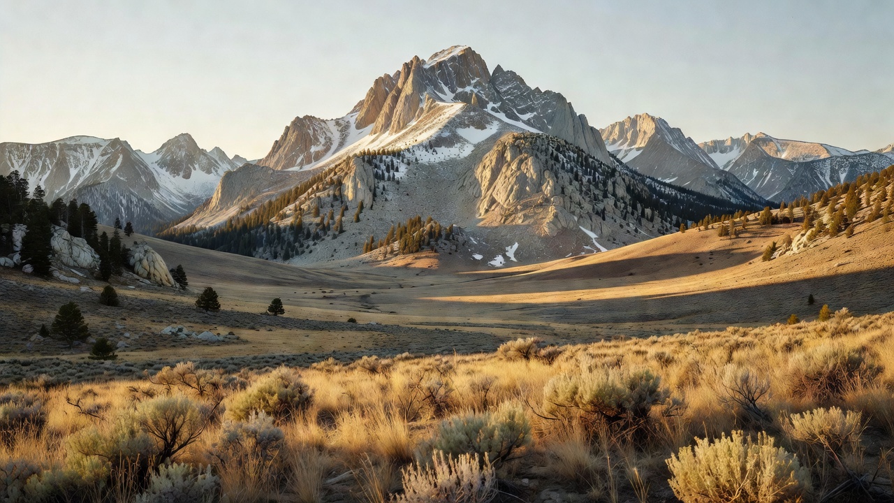
Salmon-Challis National Forest covers roughly 4.3 million acres of east-central Idaho -- big, rugged, lonesome country that ranks among the largest national forests in the lower 48. It climbs from the sagebrush flats of the Big Lost River up into a stack of high, dry mountain ranges -- the Lost River, Lemhi, and Beaverhead -- that hold some of Idaho's tallest peaks, then drops off the far side into the wild canyons of the Salmon River, the famous 'River of No Return.' A great deal of the forest is roadless backcountry, and a large share of it lies inside the Frank Church-River of No Return Wilderness, widely called the largest unbroken wilderness in the lower 48. The towns of Salmon and Challis anchor the two ends of the forest -- and gave it its name.
History
The forest carries the names of two Idaho towns -- Salmon and Challis -- and for most of the 1900s it was actually two separate national forests, the Salmon and the Challis, that were combined into a single administrative unit in the late 1980s. Long before that, this was the homeland of the Lemhi Shoshone, and it holds one of the most storied spots in the whole Lewis and Clark story: at Lemhi Pass, on the Continental Divide along the forest's eastern edge, the expedition crossed the divide in August 1805 and made contact with the Shoshone -- the band of Sacagawea, who by most accounts was born in this country near the Salmon River. The mountains later drew miners: the Yankee Fork gold district northwest of Challis boomed in the late 1800s, leaving behind the ghost towns of Custer and Bonanza and the enormous Yankee Fork Gold Dredge, a floating machine that chewed up the river gravels for gold well into the 20th century.
Wildlife & plants
This is prime Idaho big-game country -- Rocky Mountain elk and mule deer, black bears, and mountain lions you'll almost never see -- and the high, rugged ranges hold bighorn sheep and mountain goats on the steep ground. Gray wolves range back through the backcountry after their reintroduction to central Idaho in the 1990s, and the remote high country is considered some of the best remaining habitat in the lower 48 for wolverine. The signature animals, though, are the fish: wild chinook salmon and steelhead climb hundreds of miles up the Columbia, Snake, and Salmon rivers to spawn in these cold headwaters -- among the longest and highest-climbing fish migrations left in the country -- though those runs are now protected and struggling under the Endangered Species Act, along with native bull trout and cutthroat. The forest itself runs from sagebrush and Douglas-fir on the dry lower slopes up through lodgepole and subalpine fir toward timberline.
Notable features
The crown of the forest -- and of the whole state -- is Borah Peak, Idaho's highest summit at 12,662 feet, standing at the head of the Lost River Range. The Main Salmon River, the 'River of No Return,' cuts west through the heart of the forest and is one of the great multi-day wilderness whitewater trips in the country. A very large share of the Frank Church-River of No Return Wilderness lies within the forest -- at roughly 2.3 million acres it's widely cited as the largest contiguous wilderness in the lower 48, managed jointly with several neighboring forests. Three long, high ranges define the country: the Lost River, Lemhi, and Beaverhead mountains, the last of which forms the Continental Divide and the Montana line. And along that divide sits Lemhi Pass, the historic crossing point on the Lewis and Clark trail.
Camps are sourced from public U.S. Forest Service recreation data and have not been personally visited. Roads shown are Forest Service passenger-car routes (maintenance level 3–5) and may be seasonal or gated. Always confirm access, fees and fire rules with the ranger district before you go. Found a fee where we show free? Tell us on the contact page.