San Juan National Forest
Where the camps cluster
The place
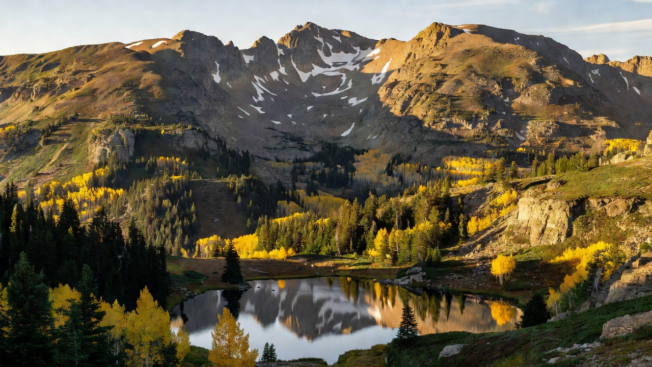
The San Juan takes in most of the southern San Juan Mountains west of the Continental Divide, spread across ten counties in the southwestern corner of Colorado -- Archuleta, Conejos, Dolores, Hinsdale, La Plata, Mineral, Montezuma, Rio Grande, San Miguel and San Juan. The Forest Service sums the range up in one line: "From high-desert mesas to alpine peaks." That is the honest shape of the place. Its scenery, in the agency's words, "ranges from high desert mesas and canyons to high alpine peaks and meadows," and you can drive between those two worlds in an afternoon.
The supervisor's office is in Durango, with district offices in Bayfield, Dolores and Pagosa Springs running the Columbine, Dolores and Pagosa ranger districts. The forest borders the Uncompahgre National Forest to the north and the Rio Grande National Forest across the Divide to the east, and it shares three of its four wilderness areas with those neighbors. The name comes from the San Juan River, originally the Rio San Juan, for Saint John the Baptist.
Water organizes everything here. The high country feeds the Animas, the Dolores, the Piedra, the Los Pinos, the San Juan and the Blanco, and the big flatwater -- McPhee and Vallecito reservoirs, Taylor Lake, the Beaver Lakes -- sits below. The Forest Service lists hiking, mountain biking, hunting, fishing, OHV riding, alpine and nordic skiing, horseback riding and camping as the standard uses. Two long trails run through: the Colorado Trail, whose southern terminus is Durango, and the Continental Divide Trail along the eastern boundary. The 236-mile San Juan Skyway loops the whole forest, and the Hermosa Creek Special Management Area and The Glade -- roughly 165,000 acres -- add protected country outside the designated wilderness.
History
This was Ute country long before it was a national forest. The Weeminuche band ranged the San Juan Mountains, the valley of the San Juan River and its northern tributaries, and the Abajo Mountains west into Utah -- and the largest wilderness on the forest still carries their name. Silver turned up in the San Juans in 1872, the government wanted the ground, and on September 13, 1873 leaders of the seven bands of the Ute Nation signed the Brunot Agreement, relinquishing the mountain land the miners were after. The Weeminuche later became the Ute Mountain Ute Tribe, moving to the western end of the Southern Ute Reservation in 1897 under Chief Ignacio; their reservation is near Towaoc in the Four Corners today, and the Southern Ute Indian Tribe is seated at Ignacio.
Older still is the record on the mesa above the Piedra. Chimney Rock housed roughly 2,000 Ancestral Puebloan people between AD 925 and 1125 -- an outlier of the Chaco culture, and the highest and northernmost of the Chacoan great houses. Its people burned the buildings and walked away in 1125.
The mining rush that followed the Brunot Agreement built the towns that still ring the forest -- Silverton, Telluride, Ouray, Creede -- and it built the railroad. The Denver and Rio Grande, under General William J. Palmer, reached Durango in July 1881 and pushed the last 45 miles to Silverton in nine months and five days, opening the route in 1882. Crews blasted the cliffs of the Animas canyon to leave a narrow shelf for the rails. Large-scale mining is long over: the Idarado on Red Mountain Pass closed in the 1970s, and the Sunnyside near Silverton hung on until late in the twentieth century.
President Theodore Roosevelt created the San Juan National Forest on June 3, 1905. Modern history here is written in fire and in law. The Hermosa Creek Protection Act of 2014 turned a long local campaign into a wilderness area and a surrounding special management area. Then on June 1, 2018 embers from one of the railroad's coal-burning steam locomotives started the 416 Fire ten miles north of Durango; it burned for two months, forced more than 1,300 homes and businesses to evacuate, closed the entire forest, and ended in a $20 million federal settlement in March 2022.
Wildlife & plants
The elevation spread is the whole story. Ponderosa pine holds the lower, drier slopes; Douglas fir, Engelmann spruce, subalpine fir and aspen stack up above it; and the top of the range is open alpine tundra. That banding is what gives the forest such a wide animal list in a short vertical distance.
Elk, mule deer, bighorn sheep, moose, black bear and mountain lion all range the Weminuche, along with a non-native mountain goat population. The rare one is the lynx. Canada lynx were reintroduced to Colorado starting in 1999, and the first animals went out right here in the San Juan Mountains; by 2010 the eleven-year effort had established self-sustaining populations through the south-central Colorado Rockies as far north as Summit County.
In the water, the native Colorado River cutthroat trout is the fish that matters -- non-native brook and rainbow trout share the streams, and the Forest Service's work in the Hermosa Creek watershed is aimed squarely at restoring the natives.
Not everything survived. The last known grizzly bear in Colorado was killed in the South San Juan Wilderness in 1979; people still report sightings, but there is no sufficient evidence to confirm them. And the forest itself is under pressure: spruce beetle infestation has hit more than 120,000 acres of the Weminuche alone, so expect standing dead timber and take the deadfall warnings seriously when you pick a spot to park.
Notable features
The Weminuche Wilderness is the centerpiece and the largest wilderness area in Colorado at 499,771 acres, designated in 1975 and expanded by the Colorado Wilderness Acts of 1980 and 1993. It is split down the Continental Divide with the Rio Grande National Forest, and it climbs from 7,700 feet on the Animas River to 14,093 feet on the summit of Windom Peak. Three fourteeners stand in it -- Windom, Sunlight Peak and Mount Eolus -- all cut from Eolus granite in the Proterozoic rock of the Needle Mountains, while the eastern side sits in the San Juan volcanic field under deposits more than 6,000 feet thick. Nearly 500 miles of trail run through it, including 83 miles of the Continental Divide Trail.
The other three wildernesses each have their own character. The South San Juan, 158,790 acres designated in 1980 east of Pagosa Springs and shared with the Rio Grande, carries many peaks above 13,000 feet, topped by Summit Peak at 13,307, plus 32 lakes, another 42 miles of the Continental Divide Trail, and the headwaters of the Conejos, San Juan and Blanco rivers. Lizard Head, established January 1, 1980 and managed jointly with the Uncompahgre, sits ten miles southwest of Telluride and holds three more fourteeners -- Mount Wilson at 14,246 feet, El Diente Peak at 14,159 and Wilson Peak at 14,017 -- plus the 13,113-foot spire that names it, a crumbling volcanic tower that only experienced mountaineers should be on. Hermosa Creek is the newest and quietest: 37,236 acres twelve miles north of Durango, created by the Hermosa Creek Protection Act of 2014, running from 7,500 feet along the creek to 12,338 feet on Indian Trail Ridge, foot and horseback only, with just two trails in it -- Salt Creek at 5.6 miles and Clear Creek at 7.2.
Chimney Rock National Monument covers 4,726 acres in Archuleta County between Durango and Pagosa Springs. Its Great House Pueblo -- 36 rooms and two kivas -- was first built in AD 1076 and finished in AD 1093, and the site has been on the National Register of Historic Places since 1970; President Barack Obama proclaimed it a national monument on September 21, 2012.
For drivers, the San Juan Skyway is the loop: 236 miles on US 160, CO 145, CO 62 and US 550 through Durango, Mancos, Cortez, Dolores, Rico, Telluride, Ridgway, Ouray, Silverton and Hermosa. It was named a National Forest Scenic Byway in September 1988, a Colorado Scenic and Historic Byway in 1989, and an All-American Road in September 1996. It tops out at Red Mountain Pass, 11,018 feet, and crosses Molas Pass at 10,910, Coal Bank Pass at 10,640 and Lizard Head Pass at 10,222 -- the stretch from Ouray south is the Million Dollar Highway. Paralleling part of it, the Durango and Silverton Narrow Gauge Railroad still runs 45.2 miles of three-foot gauge through the Animas canyon.
Camps are sourced from public U.S. Forest Service recreation data and have not been personally visited. Roads shown are Forest Service passenger-car routes (maintenance level 3–5) and may be seasonal or gated. Always confirm access, fees and fire rules with the ranger district before you go. Found a fee where we show free? Tell us on the contact page.