Shawnee National Forest
Where the camps cluster
The place
Tucked into the far southern tip of Illinois between the Ohio and Mississippi rivers, Shawnee National Forest is the largest publicly owned body of land in the state -- and it looks almost nothing like the Illinois most people picture. Instead of corn and section-line roads, you get oak-hickory forest, flourishing wetlands, grassy open lands, lush canyons, sheer bluffs and genuinely strange geology. The Forest Service spreads across nine southern Illinois counties, with the supervisor's office in Harrisburg and district offices in Jonesboro and Vienna. What makes the place punch above its weight is location: four of Illinois' natural divisions meet here -- the Missouri Ozark Hills, the Mississippi River Bottomlands, the Shawnee Hills and the Coastal Plain -- so habitats that normally sit hundreds of miles apart are stacked within a short drive of one another. That is the whole pitch for camping here. You can sleep under a sandstone overhang one night and walk a bald cypress swamp the next.
History
People have been using these bluffs for a very long time. At Millstone Bluff in Pope County, Mississippian people built semi-subterranean houses between roughly 1350 and 1550 CE and carved petroglyphs into the sandstone -- thunderbirds, pipes, axes, turkey tracks, a spider-like figure and the cross-and-circle motif -- and the site also holds a stone box cemetery and a Late Woodland stone fort. The Forest Service now maintains an interpretive trail there. Later history is harder. The Trail of Tears National Historic Trail runs through this country south of Jonesboro. In the 1800s the hills were industrial: the Illinois Iron Furnace near Rosiclare, built between 1837 and 1839 by Chalon Guard and Leonard White, made iron by the charcoal blast method and stands today, reconstructed, as the only remaining iron furnace structure in Illinois. The forest itself came out of the Depression. President Franklin D. Roosevelt declared the Illini and Shawnee Purchase Units to be the Shawnee National Forest in September 1939, and most of the land added in that first decade was exhausted farmland -- worn out, eroding, and for sale. Through the 1930s and 1940s the Civilian Conservation Corps planted pine across those bare hillsides to hold the soil in place and let it rebuild. Much of the deep green you camp in today is land that was given up on and grew back.
Wildlife & plants
The four-natural-divisions collision is the reason the species list here reads strangely for Illinois. The forest is home and host to more than 200 species of breeding and migrating birds, helped along by sitting in the Mississippi Flyway -- spring and fall migration is the show. On the ground you share the woods with white-tailed deer, wild turkey, bobcat and fox. Down in the Coastal Plain division at the southern edge, bald cypress-tupelo swamps bring genuinely southern animals this far north, including the bird-voiced tree frog and the cottonmouth. The Ozark division on the western side adds hill prairies and its own oddities -- plains scorpion, spring cavefish, eastern narrow-mouthed toad, coachwhip and northern flat-headed snake all live in Illinois only in that corner. The single best illustration is the LaRue-Pine Hills/Otter Pond Research Natural Area, where about 66 percent of the amphibians and 59 percent of the reptiles known to occur in Illinois are found. Practical note for campers: this is snake country in the real sense -- copperheads and rattlesnakes are present along the River to River Trail, along with an enthusiastic tick population. Watch where you put your hands on the bluffs.
Notable features
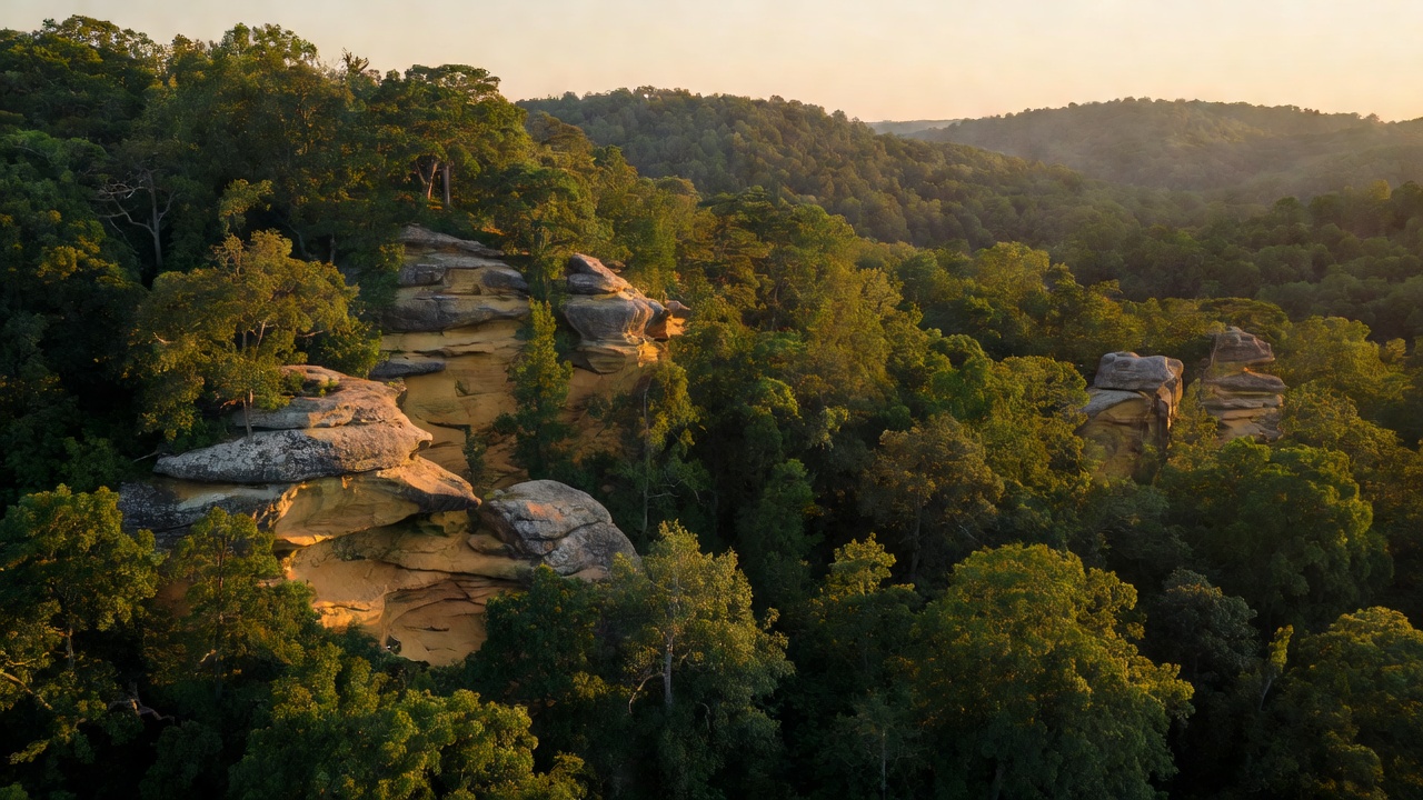
Garden of the Gods is the postcard -- a 3,318-acre wilderness of hoodoos and weathered formations with names like Camel Rock, Anvil Rock and Table Rock, cut from a thick bed of gray sandstone laid down around 300 million years ago and never scraped flat by the glaciers that flattened the rest of the state. It is the most-visited wilderness area in Illinois, with paved access to Buzzards Point, and it is spectacular in fall color. Bell Smith Springs near Eddyville was designated a National Natural Landmark in 1980 and holds the largest natural stone arch in the forest, a 125-foot span, plus sandstone cliffs, four creeks with swimming pools and about 8 miles of marked trails. Little Grand Canyon is a creek-carved gorge more than 200 feet deep that shelters relict Arctic plants left over from the ice ages. Jackson Falls is the region's rock-climbing destination. Seven congressionally designated wilderness areas are scattered across the forest -- Bald Knob, Bay Creek, Burden Falls, Clear Springs, Garden of the Gods, Lusk Creek and Panther Den -- and the 160-mile River to River Trail crosses the whole thing, running from Grand Tower on the Mississippi to Elizabethtown on the Ohio, with sections doing double duty as part of the American Discovery Trail. Other names worth knowing: Lake Glendale, Kinkaid Lake, Cedar Lake, High Knob and Trigg Tower.
Camps are sourced from public U.S. Forest Service recreation data and have not been personally visited. Roads shown are Forest Service passenger-car routes (maintenance level 3–5) and may be seasonal or gated. Always confirm access, fees and fire rules with the ranger district before you go. Found a fee where we show free? Tell us on the contact page.