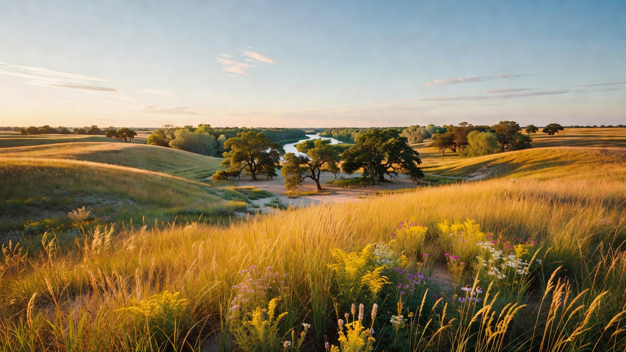
Sheyenne National Grassland
The place
Sheyenne National Grassland sits in southeastern North Dakota, in eastern Ransom and western Richland counties, roughly 12 miles east of Lisbon. It is the only national grassland in the tallgrass prairie region of the country -- every other one is out in the shortgrass and mixed-grass country of the western plains -- and that single fact is why it matters far out of proportion to its size. The Forest Service puts less than 4 percent of the original tallgrass prairie as still standing anywhere. This is a piece of it.
The ground itself is sand. The Forest Service describes the soils here as originally deposited as the delta of an ancient river as it emptied into glacial Lake Agassiz, with wind and rain since then shaping the topography into everything from flat deltaic plains to choppy sand dunes. The North Dakota Geological Survey puts the dunes near Wyndmere and McLeod, in northeastern Richland and eastern Ransom counties, exactly where the Sheyenne River ran into the lake. Most North Dakota dunes probably formed between about 8,500 and 5,500 years ago during the Altithermal Interval, the warmest and driest stretch since the ice went away, when plant cover got too sparse to hold the sand down. They come in two shapes -- long ridges running northwest-southeast, parallel to the wind that built them, and a smaller number of crescent-shaped dunes with the convex side facing upwind to the northwest. The Survey says many of North Dakota's dunes stand 50 to 80 feet high with a few nearly 100, and that the crescents are the smaller of the two.
On top of that sand is a landform the Forest Service calls hummock and swale: an undulating surface where small knolls carry mixed-grass prairie species, the vegetation shifts to tallgrass species as you walk down the slope, and the swales at the bottom hold wet meadow. That gradient is the whole ecology of the place compressed into a hundred feet of walking. The deltaic plains are where the Forest Service says you will find the best remnant tallgrass. The northern part of the grassland is oak savanna -- rolling prairie dotted with groves of bur oak -- and along the Sheyenne River there are hardwood stands of basswood, American elm and green ash.
The planning problem here is ownership and livestock, and you should sort it out before you arrive. Alongside the public acres the Forest Service counts 64,769 acres of privately owned land interspersed through the grassland, and roughly 83 cattle ranchers graze the public part under Forest Service permit. So expect cattle, expect gates, and expect the boundary to be complicated. The agency's own trail rules are blunt about it: be aware that livestock may be grazing, water availability at livestock water sources varies through the season, and close all gates after opening them. All feed and straw brought onto the grassland must be certified weed seed-free. Motor vehicle use is restricted to designated roads, so pull the current Motor Vehicle Use Map before you drive anything off the county gravel. The Dakota Prairie Grasslands supervisor's office is in Bismarck; the people who actually run this place are the Sheyenne Ranger District at 1601 Main Street in Lisbon. That same district also administers the Denbigh Experimental Forest -- 640 acres 13 miles west of Towner on Highway 2, plus a 115-acre Souris Unit -- but Denbigh is a separate tract clear across the state, not part of this grassland.
History
The story of this grassland is the story of all twenty of them, and it starts with the Homestead Act of 1862, which handed out 160-acre parcels of federal land to anyone who would live on and cultivate them for five years. By 1904 nearly 100 million acres of the West had been homesteaded into some 500,000 farms, and the Forest Service's own legal history of the national grasslands says plainly that many of those farms were on submarginal land -- ground low in productivity or otherwise ill-suited for crops, land that falls below the margin of profitable private cultivation. On a wind-built sand delta, that description needs no elaboration.
Then came the Depression and the Dust Bowl together. More people moved out to rural land just as foreclosures multiplied, tax delinquencies climbed and farm income collapsed, and drought, flood, insects and erosion did the rest. The federal answer was a large-scale land utilization program begun in the 1930s, which culminated in the Bankhead-Jones Farm Tenant Act of 1937. Title III of that act authorized the Secretary of Agriculture 'to develop a program of land conservation and land utilization, including the retirement of lands which are submarginal or not primarily suitable for cultivation in order thereby to correct maladjustments in land use.' In plain terms: buy the failed farms back and repair them. Congress authorized $50 million for land acquisition and appropriated $20 million of it. Between 1938 and 1946 the government picked up 2.6 million more acres, bringing the program to 11.3 million acres at an average acquisition cost of $4.40 an acre. Then it went to work on them -- roads, fences, buildings, erosion and flood control, planted grass and trees, water storage, cleaned stream channels -- which roughly tripled the per-acre cost to $13.50 and created more than 50,000 jobs while the country was climbing out of the Depression.
The Soil Conservation Service ran the program from 1938 to 1954, when the Secretary of Agriculture handed administration to the Forest Service. And then, in 1960, the Secretary designated roughly 3.8 million acres of that land -- most of it in the Great Plains -- as national grasslands, in an order published at 25 Federal Register 5845 on June 24 of that year. That is the birth of the whole system, and of this place. By the Forest Service's 1997 tally there were twenty national grasslands totaling 3,842,278 acres, with Sheyenne listed at 70,268 of them.
The cattle never left, and that was the design. Forest Service regulation allows grazing associations organized under state law to hold a grazing agreement -- a permit of ten years or less that lets the association issue and administer grazing permits to its own members under rules of management approved by the agency. That is why a national grassland does not look or feel like a national park. It was bought as broken farmland, rebuilt as range, and it is still being ranched.
Wildlife & plants
The plant worth planning a July trip around is the western prairie fringed orchid, a federally threatened wildflower with creamy white blossoms whose three-part lower lip is split into a delicate, feathery fringe. It lives in moist tallgrass prairie and sedge meadows -- here, the damp swales and marshy low spots between the dunes -- and it is pollinated at night, when its fragrant flowers draw in large sphinx moths that carry pollen from plant to plant. The Forest Service says one of the largest populations anywhere is on the Sheyenne, and that you can see it from ND Highway 27 in early July. Do not pick them; they are federally protected. The counting here is real and ongoing: over two days in early July 2026, fourteen volunteers -- Dakota Prairie Grasslands staff and their families, North Dakota State University research assistants, The Nature Conservancy, and one person who drove up from Blair, Nebraska -- walked six macro plots covering 960 acres and tallied 638 orchids. The agency surveys the full macro plots every five years and smaller plots annually. As range program manager Stacy Swenson put it, orchid populations can vary from year to year depending on many factors such as precipitation, and The Nature Conservancy's Eric Hoff noted the water levels are well down from the wetter monitoring cycle of 2010 to 2012.
The bird is the greater prairie chicken. The Forest Service's own wildflower page calls the Sheyenne 'North Dakota's only stronghold' for the species; North Dakota Game and Fish is slightly more generous and puts the state's remaining populations in two places, Grand Forks County and this grassland. Either way you are standing in one of the last two. It is a mid- to tallgrass prairie bird, 16 to 19 inches long and about two pounds, and in spring the males collect on booming grounds -- leks -- where they display twice daily at dawn and dusk to hold territory and advertise the lek to females. Hens nest within about a mile of the display ground in residual vegetation, laying 10 to 14 eggs. Do not plan on hunting them: North Dakota has kept the pinnated grouse season closed, including in 2026, because the state no longer holds enough intact tallgrass prairie to support a huntable population. That closure is, in one line, the case for this grassland's existence.
Two prairie butterflies fly here as well. The Dakota skipper -- a small, roughly one-inch-wingspan butterfly whose caterpillars feed mainly on little bluestem -- was listed as threatened in 2014, and critical habitat has since been designated; the Fish and Wildlife Service is direct that its prairie types are unlikely to be re-established on any site that has been plowed, which is why remnant ground like this is irreplaceable. The regal fritillary is the other. Wildflowers run from spring into early fall and include prairie smoke, western wallflower, spiderwort, penstemon and hoary puccoon. For mammals and the rest, this is white-tailed deer and coyote country, with spring migration filling the wet swales. And one management detail you may actually witness: the Forest Service grazes sheep here to knock back leafy spurge, an invasive that cattle will not touch.
Notable features
The North Country National Scenic Trail is the headline. About 30 miles of it cross the grassland east to west -- the Forest Service's own pages give the segment as 30 miles in one place and 31 in another -- and it is non-motorized year-round, open to hiking, horseback riding and mountain biking. Motor vehicles are prohibited on it at all times. The etiquette is posted and worth knowing before you go: horse riders have the first right of way, hikers yield to horse riders, and cyclists yield to both. There are West, Middle and East trailheads plus mile-marker posts, and the Ekre Trailhead spur is foot traffic only. Connecting to it near Jorgen's Hollow is the Oak Leaf Trail, a marked, graveled 4-mile loop through tallgrass prairie and gently rolling oak savanna -- the best short introduction to the place, and the one where you are likeliest to walk up on grazing cattle. There is no water on it.
Two campgrounds anchor the grassland, both first-come, first-served with no reservations, both open year-round with limited services after Labor Day and before Memorial Day. Jorgen's Hollow Campground has 14 semi-primitive sites in three loops, with sites 4 and 7 through 11 designated for equestrian use and the rest non-equestrian, two vault toilets, one potable-water hand pump, and a picnic table and fire ring at each site; it sits in oak savanna and puts both the Oak Leaf loop and the North Country Trail out your door. Hankinson Hills Campground is northwest of Hankinson in Richland County, off I-29 exit 8 and west on ND 11 -- the Forest Service page says three miles northwest in its description and seven in its driving directions, so follow the signs rather than the odometer. It has 15 shaded sites -- six equestrian, nine not -- three vault toilets, a hand pump running spring through fall, a large picnic shelter, and the 8-mile Hankinson Hills Trail leaving from camp. Hankinson Hills is $10 a night, half that with a Senior or Access Pass.
For dispersed camping, the rule here is unusually generous and unusually specific: camping is allowed anywhere on the Sheyenne National Grassland EXCEPT at day use areas -- and all trailheads are day use areas, closed to overnight camping. So park at a trailhead to walk, not to sleep. Shooting is prohibited in or within 150 yards of any campground, trailhead or occupied area. Bring your own water; the Forest Service notes hand-pump wells and seasonal spigots are shut off in winter and tells you to carry extra, and livestock water sources are not a plan. Weather turns fast out here, fire bans are common in dry spells, and the agency's short list of things to watch for on the Dakota Prairie Grasslands includes rattlesnakes and ticks.
The last piece is the river. The Sheyenne River Water Trail is a 199-mile paddling route running from Lake Ashtabula down through Griggs, Barnes, Ransom and Richland counties to the national grassland, which holds the southeastern end and several access points -- Ylvisaker Bridge east of Lisbon, the semi-primitive Brome Field launch, Mirror Pool Wildlife Management Area and East River. It is a slow, beginner-friendly float in the right water, generally May through September, and the Forest Service publishes streamflow guidance worth checking: under 100 cubic feet per second is a scrape, 300 to 1,000 is the sweet spot, over 1,000 calls for caution, and over 2,000 is flagged outright as dangerous for fast current and debris.
Camps are sourced from public U.S. Forest Service recreation data and have not been personally visited. Roads shown are Forest Service passenger-car routes (maintenance level 3–5) and may be seasonal or gated. Always confirm access, fees and fire rules with the ranger district before you go. Found a fee where we show free? Tell us on the contact page.