Siuslaw National Forest
Where the camps cluster
The place
Siuslaw National Forest is Oregon's coastal forest: about 630,000 acres of federal land strung 135 miles along the central and north coast between Tillamook and Coos Bay, in places reaching east over the crest of the Oregon Coast Range almost to the Willamette Valley. It is one of just two national forests in the contiguous United States with oceanfront property, and the vertical range is the whole story -- sea level to 4,097 feet at Marys Peak, the highest point in the Coast Range. Two forest types split it: Sitka spruce in the fog belt near the water, western hemlock and Douglas fir inland, with red cedar, red alder and bigleaf maple mixed through. Four rivers drain it to the Pacific -- the Nestucca, Alsea, Siuslaw and Umpqua -- across roughly 1,200 miles of streams, plus some 30 lakes. The climate is Pacific maritime: up to 100 inches of rain a year, mild winters in the 30s and 40s, summer days in the 60s on the coast with a lot of fog, and September and October as the driest, warmest stretch of the year -- which is why locals plan the good trips for fall. The Forest Service runs it from a supervisor's office in Corvallis with two ranger districts: Hebo in the north (roughly 151,000 acres) and the Central Coast (roughly 479,000 acres), based in Waldport.
History
The forest is named for the Siuslaw people, whose homeland is the Siuslaw River country and who still had 34 named villages recorded in the 1880s. They called themselves sha'yuushtl'a and spoke a Coast Oregon Penutian language, closely related to that of the Lower Umpqua (Kuitsh); the language is now extinct, but the people are not -- Siuslaw descendants are enrolled today in the Confederated Tribes of Coos, Lower Umpqua and Siuslaw Indians and in the Confederated Tribes of Siletz Indians. Their legal history is its own hard story: the 1855 Empire Treaty was signed but never ratified by the United States, and a century later the Western Oregon Indian Termination Act -- Public Law 588, signed August 13, 1954 -- ended federal recognition and services for 61 western Oregon tribes, the Coos, Lower Umpqua and Siuslaw among them. Getting it back took thirty years: the Confederated Tribes of Coos, Lower Umpqua and Siuslaw Indians were restored by Act of Congress on October 17, 1984. The first European name on this coast came earlier still: Captain James Cook, working north in search of the Pacific end of a Northwest Passage, named Cape Perpetua on March 7, 1778, for St. Perpetua's day. The national forest itself was established July 1, 1908, in the reshuffle that turned Oregon's forest reserves into national forests -- part of the short-lived Tillamook National Forest, set aside in 1907, was folded into the new unit. The Civilian Conservation Corps left its mark in the 1930s, including the stone observation shelter built near the top of Cape Perpetua in 1933, which the military later used as a coastal watch station during World War II. Congress kept adding protections through the modern era: Cascade Head Scenic Research Area in 1974, the Oregon Dunes National Recreation Area in 1972, the Drift Creek, Cummins Creek and Rock Creek wildernesses in 1984, and -- most recently -- the Devil's Staircase Wilderness in March 2019.
Wildlife & plants
The Forest Service counts 235 bird species, 69 mammals, 26 amphibians and reptiles and more than 200 fish species on this forest, which is a lot of life for a strip of coast. The big mammals are Roosevelt elk, black-tailed deer, black bear and cougar -- hang or box your food. The rain forest interior is classic northern spotted owl and marbled murrelet country, both dependent on the old growth, along with bald eagles; the ground crew is banana slugs, salamanders and woodpeckers. The water is where this forest earns its reputation. In fall, chinook and coho salmon push up creeks like Drift Creek along with steelhead and coastal cutthroat trout, and the Forest Service describes the Nestucca River watershed as some of the most promising salmon and steelhead recovery country in the contiguous U.S., providing critical habitat for the threatened Oregon Coast coho. On the sand, the headline species is the western snowy plover, a small beach-nesting shorebird whose coastal population was listed as threatened in 1993. Recovery has actually worked: the Forest Service says Oregon's population has climbed from 30 adults at listing to more than 600, and it reckons the Siuslaw and the Oregon Dunes together hold about half of the central coast population. That is the reason for the closure you will actually run into -- dry sand beach areas inside the plover management areas are closed to entry from March 15 to September 15 for nesting, and the birds read people, dogs, kites and drones as predators, so it is worth honoring. Up at the other end of the elevation range, Marys Peak's meadows and rock gardens hold specialties like Cascade desertparsley and Olympic onion, and in 2015 scientists described an ice crawler found there as a species new to science.
Notable features
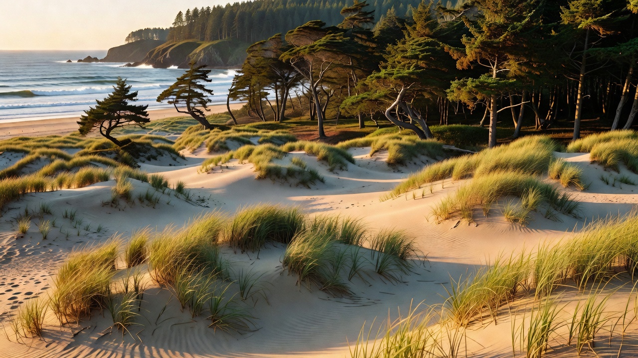
The Oregon Dunes National Recreation Area is the forest's signature: 31,500 acres designated by Congress in 1972, running 40 miles between Florence and Coos Bay, and one of the largest expanses of temperate coastal sand dunes in the world. The sand came off the Coast Range, carried down by the rivers and pushed back ashore; the present shoreline settled about 6,000 years ago. The dunes come in named forms -- oblique dunes, the giants, up to 180 feet high and more than a mile long, angled to catch both the summer and winter winds and, according to the Forest Service, found nowhere else on earth; transverse dunes rippling 5 to 20 feet high under the summer northwesterlies; U-shaped parabola dunes; marshy deflation plains; and 'tree islands,' isolated scraps of older coastal forest that the advancing sand has nearly buried. Riding is real here but bounded: OHV use covered 91 percent of the area until 1979 and about 31 percent after the 1994 plan, split into the North, Middle and South riding areas. North of the dunes, the Cape Perpetua Scenic Area stacks 2,700 acres of old growth above a violent basalt shoreline -- Thor's Well, the Devil's Churn and the Spouting Horn at Cook's Chasm all put on a show at the right tide -- with 26 miles of connected trail and a 600-year-old Sitka spruce called the Silent Sentinel of the Siuslaw standing over 185 feet tall. Cascade Head Scenic Research Area, 9,670 acres set aside in 1974 and part of a UNESCO biosphere region designated in 1976, protects native coastal prairie on the headlands, home to the threatened Oregon silverspot butterfly whose caterpillars eat nothing but early blue violet; the Salmon River estuary below it has been under estuary-restoration study since the first dike was breached in 1979. For deep woods, Drift Creek Wilderness -- 5,798 acres seven miles north of Waldport, with the Coast Range's largest rain forest stand of old growth, spruce and hemlock up to seven feet in diameter, 120 inches of rain a year and about 8.5 miles of trail on the Horse Creek and Harris Ranch routes -- is the accessible one. Devil's Staircase Wilderness, east of Reedsport between the Umpqua and Smith rivers, is the opposite: no trails at all, sheer sandstone, unstable soil and dense brush, with the Forest Service warning outright that cell and GPS coverage is unreliable and search and rescue can take days. And Marys Peak, reached by a road that stays open year-round (chains or four-wheel drive in winter), gives you the Willamette Valley, the Cascade volcanoes and the Pacific from one summit meadow.
Camps are sourced from public U.S. Forest Service recreation data and have not been personally visited. Roads shown are Forest Service passenger-car routes (maintenance level 3–5) and may be seasonal or gated. Always confirm access, fees and fire rules with the ranger district before you go. Found a fee where we show free? Tell us on the contact page.