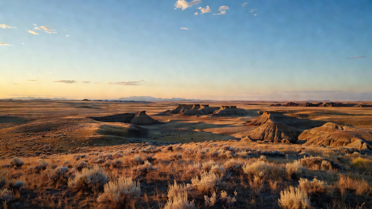
Thunder Basin National Grassland
Where the camps cluster
The place
Thunder Basin National Grassland lies in northeastern Wyoming's Powder River Basin, in the open country between the Big Horn Mountains and the Black Hills. Elevations run from 3,600 to 5,200 feet and the climate is semi-arid, which is the short version of why this is grassland and not forest. Ecologically it is a transition zone rather than one habitat: sagebrush communities and grassland communities interleaved across rolling ground, broken by low clay hills and draws. In descending order of land area it touches Weston, Converse, Campbell, Niobrara and Crook counties. The Forest Service runs it from the Douglas Ranger District, whose office is in Douglas, Wyoming, under the Medicine Bow-Routt National Forests umbrella headquartered in Laramie.
The single most important planning fact here is the ownership pattern. The Forest Service's own history page describes the grassland as sitting inside a 1.8-million-acre mosaic of public and private land -- federal, state and private parcels interleaved rather than a solid block -- and it warns that not all private land is fenced and that you need landowner permission to use private roads. In other words, an unmarked two-track crossing open prairie is not automatically yours to drive, and there is frequently nothing on the ground to tell you where the line is. Carry a map that shows land status and know where you are before you commit.
What people actually come here to do, per the Forest Service's own list: hunting, dispersed camping, OHV riding, recreational shooting, scenic driving and nature viewing, plus some warm-water fishing in the reservoirs and stock ponds. Note what is missing from that list -- there are no developed campgrounds on the grassland, though camping is allowed. This is dispersed country by default, which is either the appeal or the deal-breaker depending on your rig. Bring your own water and plan on shade being scarce and weather being fast; the semi-arid high plains do not negotiate. Fire restrictions are common here in summer and seasonal restrictions apply to prairie dog shooting, so check current forest orders and alerts with the Douglas district before you go.
History
This is ancestral ground for American Indian Tribes who stewarded it for thousands of years, a fact the Forest Service states plainly on its own history pages for the unit. The federal grassland that exists today, though, is a much more recent and much less flattering story: it is here because farming here failed.
In the 1930s, drought and the Dust Bowl collapse hit the plains homesteads across this part of Wyoming. The federal response was to buy the land. Under Franklin Roosevelt's submarginal-land program the government purchased worn-out and abandoned holdings across eleven states -- 11.3 million acres in all, at an average of about $4.40 an acre -- through the Resettlement Administration and its successors, with the Bankhead-Jones Farm Tenant Act of 1937 providing the durable legal framework. Thunder Basin's own chapter started in 1934, when this country was organized as the Northeastern Wyoming Land Utilization Project under the Agricultural Adjustment Administration. Over the following two decades it passed through the hands of the Farm Security Administration, the Bureau of Agriculture and the Soil Conservation Service before being transferred to the Forest Service in 1954.
The permanent identity came in 1960, when the land was given National Forest System status and formally designated Thunder Basin National Grassland -- part of the same nationwide action that turned roughly 3.8 million acres of those purchased lands into the national grasslands. Administration shifted again in 1987, when the grassland was combined with the Laramie Peak area into the Douglas Ranger District, where it sits today.
One thread runs unbroken through all of it: livestock. The grassland is subdivided into three units for grazing administration, each with its own grazing association, and those associations date to the mid 1930s -- older than the national grassland designation itself. That is a real difference from a national forest. The ranchers were not added to this landscape after the fact; the arrangement with them is roughly as old as the federal ownership, and it still shapes nearly every management decision made here.
Wildlife & plants
The keystone of this whole system is a rodent. Black-tailed prairie dogs build the habitat that a long list of other species depends on, directly or indirectly, and the Forest Service is explicit that no other animal here duplicates what they do. Their colonies are why you find burrowing owls, mountain plovers, ferruginous hawks and golden eagles working this ground -- that is the Forest Service's own list of at-risk species tied to prairie dog colonies here. It is also why prairie dog shooting carries seasonal limits: the grassland's plan amendment, whose Record of Decision was released December 2, 2020, is published by the Forest Service under the heading 'Permanent Seasonal Restrictions -- Thunder Basin National Grassland, Prairie Dog Hunting,' with the closed months timed to when those birds are on the ground. Prairie dog management here is contested rather than settled -- the same agency also contracts for prairie dog control where colonies press against private land -- so check the current forest orders rather than assuming.
Around them is a genuinely deep species list. Thunder Basin supports over 100 species of birds. Large herbivores are pronghorn and mule deer. Smaller mammals include white-tailed jackrabbits, cottontails, kangaroo rats, thirteen-lined ground squirrels and bats, and the predators include swift fox, badgers, coyote and red fox. Because the grassland straddles a sagebrush/shortgrass boundary, it carries both suites of specialists at once: greater sage-grouse, sagebrush sparrow, Brewer's sparrow and sage thrasher on the sagebrush side, black-tailed prairie dog, burrowing owl, mountain plover and ferruginous hawk on the shortgrass side. Those eight species are the exact list targeted by the Thunder Basin Grassland Prairie Ecosystem Association, a landowner-and-agency collaborative working across Campbell, Converse, Crook, Niobrara and Weston counties, for which the U.S. Fish and Wildlife Service in November 2016 proposed a programmatic Candidate Conservation Agreement with Assurances -- an arrangement offering participating landowners 30 years of regulatory certainty in exchange for proactively conserving habitat before any of those species get listed.
The honest part of this story is how fragile it turned out to be. In 2017 an outbreak of sylvatic plague -- a non-native, flea-borne disease that prairie dogs have essentially no resistance to -- tore through the colonies. An area holding nearly 25,000 acres of prairie dog colonies was reduced to about 125 acres. That is not a decline, it is a collapse, and it took the animals that depend on those colonies down with it. The Forest Service now runs a plague management plan for the unit, including dusting colonies with insecticide to knock back the fleas that carry it.
Which brings up the ghost. The black-footed ferret is a prairie dog obligate -- it lives in their burrows and eats almost nothing else -- and it was extirpated from Thunder Basin in the 1970s. The grassland's plan has long carried a management area -- MA 3.63 -- set aside as black-footed ferret reintroduction habitat, with direction to build and hold large prairie dog complexes specifically so that one of the rarest mammals in North America could someday come back to this ground. The 2020 plan amendment revised that management area's boundaries and direction, and the current status of ferret reintroduction habitat here is a live management question rather than a settled one. But it explains the whole prairie dog fight on this grassland -- plague dusting, control contracts, shooting seasons, buffers along private land all run through that argument.
Notable features
The developed recreation on Thunder Basin is deliberately thin, and the standout small site is Turner Reservoir: a four-acre fishing pond in the northeast corner of the grassland, roughly 17 miles northwest of Newcastle, with the final access off Forest Road 914. It has a loading ramp, a fishing pier, a picnic table and a vault toilet, there is no fee, and it is sunrise-to-sunset day use only -- no overnight stays at the site itself. Dispersed camping is available nearby, and unusually for this country there are large stands of ponderosa pine there for shade. It fishes in winter too, through the ice.
The other landmark here is not a landmark anyone built for recreation. Thunder Basin sits on top of the Powder River Basin coalfield, and the USGS states outright that the Black Thunder Mine and the North Antelope Rochelle Complex -- two of the largest open-pit mines in the basin -- lie within Thunder Basin National Grassland. Read that precisely, because the ownership pattern matters: the grassland's boundary encloses a checkerboard of federal, state and private surface and minerals, and 'within the grassland' means inside that boundary -- not that the pits are dug in Forest Service front country. The mineral estate underneath is split between the Forest Service and the BLM depending on the tract. What it does mean is that this is a working landscape at industrial scale, and it is visible from space: USGS tracks the mines' expansion across decades of Landsat imagery. Powder River Basin coal is sub-bituminous and low in sulfur, and in 2019 the basin produced 43 percent of the nation's coal -- a figure worth reading as a snapshot of scale in that year rather than a current statistic. Whatever you think about all that, come here expecting to share the horizon with haul roads, unit trains and energy infrastructure. It is part of the honest picture of the place.
Beyond that, what Thunder Basin offers is space and access rather than attractions. Scenic driving over the county and forest road network, OHV riding, big-country hunting, recreational shooting and wide-open wildlife viewing are the draw, and the Douglas Ranger District office on East Richards Street in Douglas, Wyoming is the place to sort out current conditions, closures and -- important here -- what is actually federal and what is not.
Camps are sourced from public U.S. Forest Service recreation data and have not been personally visited. Roads shown are Forest Service passenger-car routes (maintenance level 3–5) and may be seasonal or gated. Always confirm access, fees and fire rules with the ranger district before you go. Found a fee where we show free? Tell us on the contact page.