Umatilla National Forest
Where the camps cluster
The place
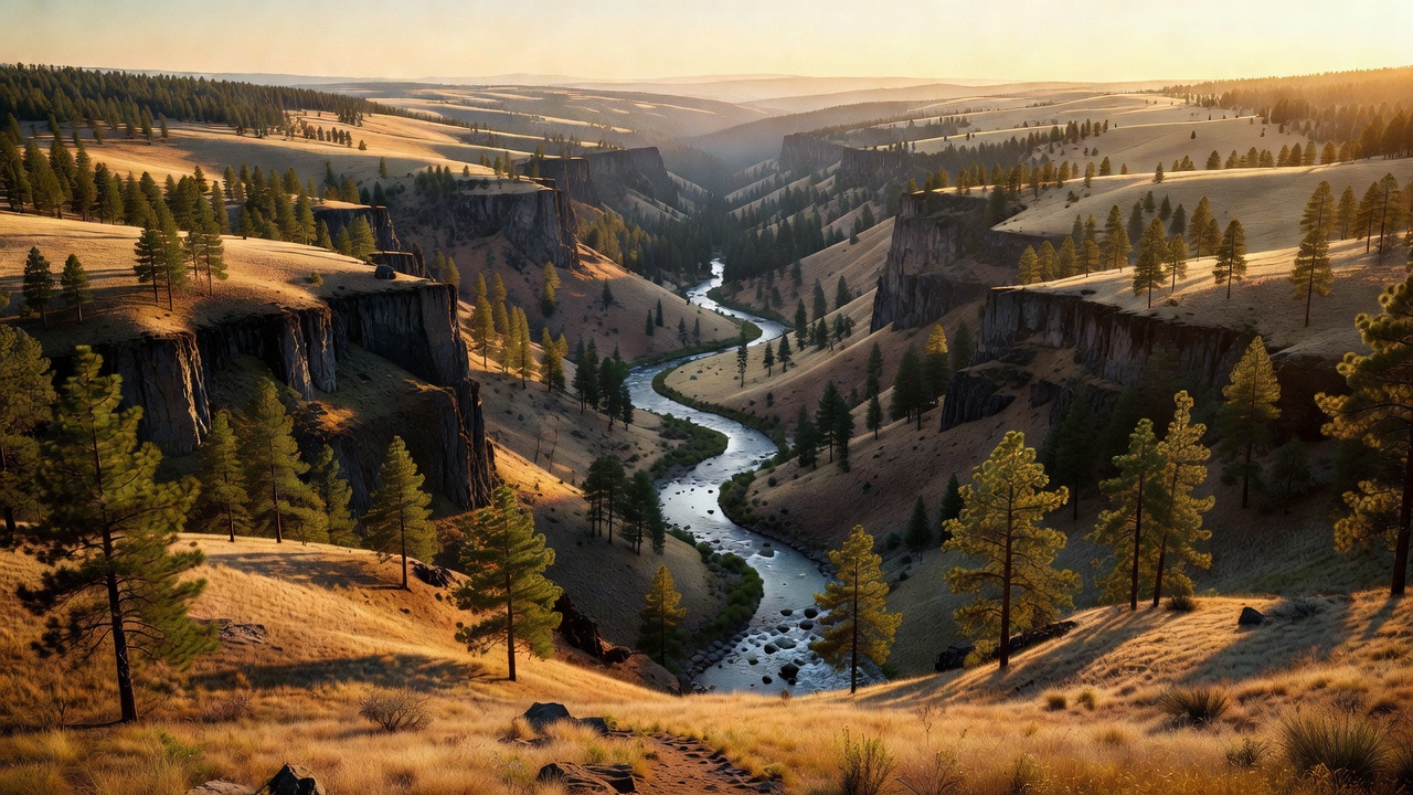
Umatilla National Forest lies in the Blue Mountains of northeastern Oregon and southeastern Washington, with more than three-quarters of its land on the Oregon side. It reaches into ten counties -- Umatilla, Grant, Columbia, Morrow, Wallowa, Union, Garfield, Asotin, Wheeler and Walla Walla -- and its name comes from an Umatilla word generally translated as 'water rippling over sand.'
This is rugged, folded country rather than a single mountain wall: heavily timbered slopes drop into V-shaped valleys separated by narrow ridges and open plateaus, with bold basalt outcroppings and grassland benches breaking up the forest. Elevations run from around 1,600 feet in the low canyons up to roughly 8,000 feet on the high plateaus. The forest is drained by rivers with big Northwest names -- the North Fork John Day, the Grande Ronde, the Tucannon, the Wenaha and the Walla Walla -- most of them feeding the Snake and Columbia systems.
History
Umatilla National Forest was established on July 1, 1908. Its name is drawn from the Umatilla people and their language, an Umatilla word usually translated as 'water rippling over sand.' Like the other Blue Mountains forests, its high country carries the marks of the 19th-century gold rush: the North Fork John Day country, in particular, boomed with placer and lode mining in the mid-1800s, and old mining structures, building foundations and dredged ditches are still scattered through what is now wilderness, left to weather away naturally under wilderness rules.
Wildlife & plants
The Umatilla is famous first for its elk -- the Blue Mountains hold some of the largest Rocky Mountain elk herds in the region, and the North Fork John Day country alone is a stronghold for them, sharing the range with big mule deer and white-tailed deer herds. Bighorn sheep, mountain goats, moose, black bears, cougars, gray wolves, coyotes, badgers, wild turkeys and several kinds of grouse round out the wildlife list. The cold rivers and streams are prized for their fish, including runs of chinook and coho salmon and steelhead that push far up into the mountains to spawn, plus rainbow, brook and lake trout. Forests here grade from ponderosa pine on the warm lower slopes up through lodgepole pine, western larch, fir and spruce, topping out in subalpine fir, native bunchgrasses and forbs on the high ground. A 1993 Forest Service study estimated the forest still held about 190,741 acres of old growth.
Notable features
More than a fifth of the Umatilla is protected wilderness, spread across three areas. The largest, the Wenaha-Tucannon Wilderness, covers about 177,400 acres of rugged basalt ridges and deep canyons along the Oregon-Washington border, ranging from around 2,000 feet on the Wild and Scenic Wenaha River up to 6,401-foot Oregon Butte, with roughly 200 miles of trail. The North Fork John Day Wilderness (about 121,000 acres, shared with the neighboring Wallowa-Whitman National Forest) protects a Wild and Scenic stretch of the North Fork John Day River and reaches into the Greenhorn Mountains. The smaller North Fork Umatilla Wilderness adds another 20,000-plus acres. Away from the wilderness, the forest offers more than 20 campgrounds, over 2,000 miles of forest roads, and popular spots like Jubilee Lake, along with the kind of open, uncrowded high country where you can spend a fall day picking huckleberries or wild mushrooms.
Camps are sourced from public U.S. Forest Service recreation data and have not been personally visited. Roads shown are Forest Service passenger-car routes (maintenance level 3–5) and may be seasonal or gated. Always confirm access, fees and fire rules with the ranger district before you go. Found a fee where we show free? Tell us on the contact page.