Wayne National Forest
Where the camps cluster
The place
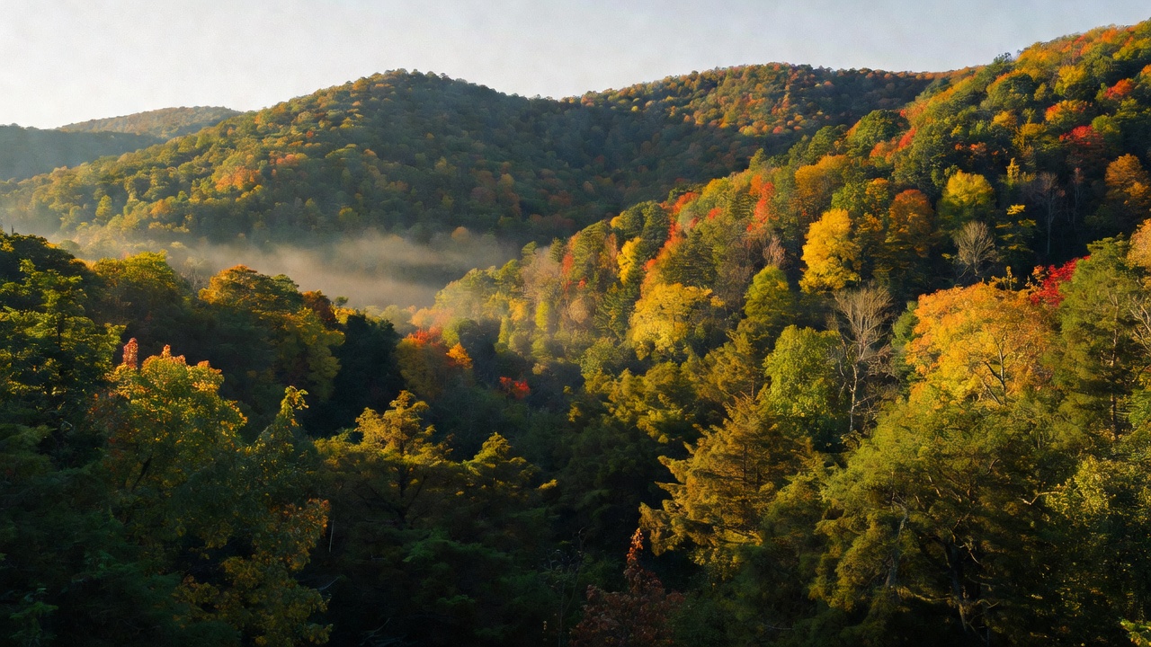
Wayne National Forest sits in the unglaciated Appalachian foothills of southeastern Ohio, and the first thing to understand about it is that it is not one place. The Wayne is three geographically separate units -- Athens (72,485 acres), Marietta (64,667 acres) and Ironton (107,113 acres) -- each named for the nearest sizable town, spread across 12 counties and run out of two ranger districts. Athens and Marietta together make up the Athens Ranger District, headquartered in Nelsonville off US 33 with a field office in Marietta; the Ironton Unit is its own district, run from an office in Pedro. The tour the Forest Service built of its own high points covers 33 sites spread over 100 miles of southeast Ohio, which tells you what kind of trip this is.
Inside each unit the land is fragmented too -- private and state parcels interleaved with federal ones, the federal tracts running from thousands of acres down to under 50. The terrain is steep-sided hills, deep hollows and winding streams rather than mountains, wrapped in a humid temperate climate that keeps the forest usable all twelve months; winters are chilly but not brutal. That combination is the whole planning problem here. Not all Wayne boundaries are marked on the ground, cell service is limited to nonexistent across much of it, and the Forest Service's own advice is blunt: download the free Avenza app and the Wayne's geoPDF maps before you go, so you know in real time whether you are standing on public land or someone's back forty. Most roads crossing the forest are state, county or township roads of wildly varying condition, and mapping services will cheerfully route you down tracks that stopped existing decades ago. One more piece of timing: multi-use trails close to off-highway vehicles, mountain bikes and horses from December 15 to April 15 each year. Foot travel stays open year-round.
History
People have lived in Ohio for at least 13,000 years, and the Forest Service is direct about the fact that the 'untouched wilderness' Euro-Americans thought they found here was nothing of the kind -- the Tribes who considered this their homeland farmed it, managed it and traded across it for millennia, and they shaped what later arrivals mistook for nature. Most Tribal sites on the Wayne are protected and their locations deliberately not published. American control of this ground was formalized after the 1795 Treaty of Greenville, and what followed was a century of extraction.
Two industries did the damage. In the Hanging Rock region around present-day Ironton, roughly 46 stone furnaces were built between about 1818 and 1873 to smelt locally mined iron, and at its height this corner of Ohio was among the foremost iron producers in the world -- the Forest Service notes the region was one of only three in the country capable of producing the iron the Civil War demanded. Those furnaces ran on charcoal, which meant cutting forest. Then came coal. Hundreds of mining towns went up across southeast Ohio -- the 'little cities of black diamonds' -- and feeding them stripped the rest: nearly all the forest cut for timber and charcoal, ridgetops and bottomlands plowed into row crops, hillsides grazed by sheep and cattle. By 1910 only 10 percent of Ohio was forested. Barren hillsides gullied out with every storm and washed their soil into the streams. When the coal went bust the towns went with it. New Floodwood, in the Athens Unit, peaked in the late 1800s with nearly 600 wooden houses, a large store and two iron furnaces; today it is a hollow full of trees, and the federal government did not acquire the ground until the 1980s. Not every vanished community here was a company town: Poke Patch, in what is now the Ironton Unit, was a predominantly Black community in the 1800s and was heavily involved in the Underground Railroad, helping self-emancipated people moving north. Vesuvius Furnace was itself a station on that network -- ironmasters in this region often acted as abolitionists.
The national forest exists because of that wreckage, not in spite of it. Congress had laid out purchase areas in the eastern states so the government could buy up deforested land and put it back; Ohio's legislature cleared the way in 1934, and the Forest Service began buying the first parcels that year. The sellers were willing ones -- mining companies dumping ground whose coal was gone, farmers whose land no longer produced or whose taxes had gone delinquent. Mining tracts tended to be large and farm tracts small, and that is precisely why the Wayne came out as a patchwork of big and little pieces rather than a block. Then came the replanting. Foresters reached for fast-growing eastern white pine to hold the soil, and crews -- mostly young men of the Civilian Conservation Corps -- planted hundreds of white pine plantations across barren hills; CCC-era buildings still stand at Lake Vesuvius. Administratively the forest took a detour, folded in under the Hoosier National Forest in 1949 with headquarters in Indiana, and was not re-established as a distinct national forest until December 1992.
The name is unsettled business. The forest honors General Anthony Wayne, and on August 21, 2023 the Forest Service formally proposed renaming it Buckeye National Forest, in response to requests from American Indian Tribes and local community members -- the agency's own release states that Wayne's 'complicated legacy includes leading a violent campaign against the Indigenous peoples of Ohio that resulted in their removal from their homelands,' and that the current name is offensive because of that history. Ohio National Forest and Koteewa National Forest were the other candidates. Authority to make the change rests with the Secretary of Agriculture. It has not happened yet: the Forest Service still publishes this place as the Wayne.
Wildlife & plants
This is oak country, and the Forest Service treats that as the organizing fact of the whole ecosystem. Oaks make up somewhere between 34 and 73 percent of the canopy depending on the site, and they have dominated southeast Ohio for thousands of years. The food web built on them is enormous -- over 500 species of butterflies and moths eat oak leaves, migrating songbirds key on oaks because of the caterpillars in them, acorns are among the most important winter foods for white-tailed deer, and oak leaves decay slowly enough to feed the invertebrates that feed the salamanders and shrews. Ridgetops and south-to-west slopes hold dry oak communities; north-to-east slopes hold dry-mesic mixed oak; hollows and floodplains run to mixed bottomland hardwoods.
The honest headline is that this is changing. Oaks are failing to replace themselves: shade-tolerant, moisture-loving species -- red maple above all -- are winning the understory, a process called mesophication. Walk almost anywhere on the Wayne and you can see it yourself, old oaks in the canopy and nothing but young maples beneath them. The Forest Service fights it with prescribed burning and timber harvest, and says plainly that whether that can work at scale across such a fragmented landscape is still an open question. Two other habitats are in trouble. Open oak woodlands, once common here, have mostly closed into dense forest, taking red-headed woodpeckers and prairie warblers with them; rare oak barrens on thin ridgeline soils are burned every two to five years at Bluegrass Ridge to keep them from growing shut. And young, shrubby forest under 20 years old fell 93 percent on the Wayne between 2006 and 2016, which is bad news for prairie warblers, yellow-breasted chats and ruffed grouse.
Then there is the strangest habitat here: old strip mines. Reclamation often left soil too thin for trees, so those sites came back as grassland instead of forest -- and they turned out to be a stronghold for grassland birds in steep decline across the East, including Henslow's sparrows, northern bobwhites and eastern meadowlarks. The National Audubon Society has identified these reclaimed mines as Important Bird Areas, and the Forest Service now manages places like Anderson Meadows to keep them open. In the water, the Little Muskingum in the Marietta Unit carries an exceptional warmwater habitat designation and is home to river otter and the state-endangered Ohio lamprey; the forest holds over 130 ponds and lakes. Spring is the show for plants -- Wildcat Hollow alone is a documented display of Virginia bluebells, Dutchman's breeches, bloodroot, twinleaf, trout lily, mayapple and both large-flowered trillium (Ohio's state wildflower) and nodding trillium. Two ugly legacies persist. Acid mine drainage still runs out of abandoned mines and can turn streams shocking orange or blue, acidic enough that nothing lives in them, though partnerships with the Ohio Department of Natural Resources and groups like Rural Action have brought some back. And non-native invasives are everywhere, particularly bush honeysuckle and autumn olive planted deliberately on reclaimed minelands because little else would grow, plus emerald ash borer killing ash outright.
Notable features
Lake Vesuvius is the most popular destination on the forest and the best single introduction to it. The 143-acre reservoir in the Ironton Unit has a beach, a boat ramp and campgrounds, more than 25 miles of hiking trail including a 16-mile backpacking loop, a horse-trail system of roughly 46 miles that draws riders from hundreds of miles away, and CCC-era buildings still in place. It is named for the Vesuvius Iron Furnace, whose stone stack stands right there by the dam -- one of the 46 furnaces of the Hanging Rock region, and a documented Underground Railroad station. You can park at the dam and walk to both.
In the Marietta Unit, the Covered Bridge Scenic Byway runs 35 miles along Ohio State Route 26 from Marietta to Woodsfield with the Little Muskingum River alongside for most of it. It historically passed four covered bridges; the Knowlton bridge collapsed in 2019 and has been under reconstruction since, so confirm what is standing before you plan around it. None of the bridges belong to the Forest Service, but the campgrounds and interpretive stops along the way do, and four campgrounds sit on the route. The best hiking on the forest is out here too: the Archer's Fork Loop is a rugged 14 miles taking in the Irish Run Natural Bridge, a rockshelter and serious rock outcrops, and the North Country National Scenic Trail -- the longest trail in the National Trails System, administered by the National Park Service, running from North Dakota to Vermont -- passes through both the Marietta and Athens units, sharing its path in Ohio with the 1,444-mile Buckeye Trail. The 5-mile Covered Bridge Trail at Hune Bridge Campground links up to it. Leith Run Recreation Area puts a campground directly on the bank of the Ohio River, though the Forest Service is candid that its floodplain location is a growing liability -- 2018 floods closed it for a summer, then closed it again five days after it reopened. Nearby, the Walter Ring House at Ring Mill Campground is a stone house built in the 1840s by a family of millers, now on the National Register of Historic Places, and Lamping Homestead is a former 1800s farmstead with the family cemetery still on its knob.
In the Athens Unit, the Wildcat Hollow Trail is the signature walk -- a 17.2-mile loop with a 5-mile short option, through pine plantations, meadows, stream bottoms and rock outcrops, and it runs through the forest's Future Old Forest Management Area, established in 2006 to let some parcels age into something like old forest over the coming decades. Dispersed camping is allowed at the trailhead; there is a vault toilet and no potable water, and the Forest Service asks you to keep vehicles on the gravel. The Wayne is also the biggest off-highway vehicle destination in Ohio, with roughly 145 miles of motorized trail across systems including Monday Creek north of Nelsonville, plus Hanging Rock, Pine Creek and Superior in the Ironton Unit. A Wayne permit is required to ride, the width limit is 50 inches, and the machines are only allowed April 15 to December 15. Hanging Rock, a 1960s-70s strip mine turned recreation area, offers 26 miles of trail, 51 fishable ponds and popular dispersed car camping. And the Baileys Trail System near Chauncey is the newest thing here -- purpose-built, mountain-bike-optimized singletrack funded through conservation financing, with 26 miles on the ground and open and 88 miles planned, deliberately routed to pull visitors into former coal towns.
Camps are sourced from public U.S. Forest Service recreation data and have not been personally visited. Roads shown are Forest Service passenger-car routes (maintenance level 3–5) and may be seasonal or gated. Always confirm access, fees and fire rules with the ranger district before you go. Found a fee where we show free? Tell us on the contact page.