Bunker Hill
The nearest road on the Forest Service MVUM is FR 2612901 (Bunker Hill Cg), 20 ft from the pin. The MVUM lists it as native material surface and maintenance level 3 – suitable for passenger cars.
From the Forest Service's own Motor Vehicle Use Map roads layer (EDW, Clearinghouse refresh Aug 30, 2026), straight-line from the pin to the nearest mapped segment. The nearest segment is not necessarily the way in, a maintenance level is the agency's class and not a report on today, and a road's season is the road's — it is not a campground order. What the levels mean → What an MVUM is →
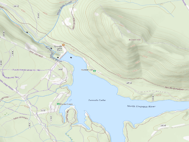
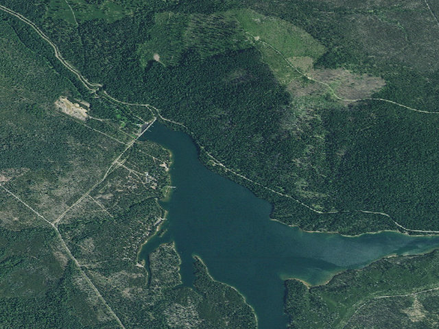
Everything you need — measured from Bunker Hill · Umpqua National Forest · OR
- LLaundry0 mi
- WWater7 mi
- FFuel10 mi
- @Mail10 mi
- EVEV fast charger10 mi
- ShShower11 mi
- GGrocery13 mi
- OOutfitter17 mi
- MMechanic26 mi
- DDump31 mi
- HHardware33 mi
- RxPharmacy33 mi
- +Urgent care33 mi
- PPropane54 mi
- AAir-up54 mi
The read: water's a short hop out, fuel & food sit about 10 mi out.
One dot per need — the nearest of each kind, straight-line from camp. Places from OpenStreetMap (© OpenStreetMap contributors); the EV fast charger from the US DOE station locator. Open in Google Maps ↗
The site — Bunker Hill
Nearby & resupply — around Bunker Hill · Umpqua National Forest · OR (OpenStreetMap)
- Water featureLemolo Lake · ~0.1 mi · USGS: perennial lake or pond
- Nearest townCrescent Lake · ~18.3 mi
- Rail & highwaynone mapped within 10 mi
- Drinking waterWater · ~7.3 mi
- FuelFuel · ~9.8 mi
- Propane / LPGnone within 31 mi
- GroceriesSouth Store · ~12.6 mi
EV charging — from Bunker Hill · Umpqua National Forest · OR — nearest public DC fast & Level 2 (US DOE station data)
- Nearest public DC fast charger10.1 mi straight-line S — Pacific Power Diamond Lake (Diamond Lake, OR) · Electrify America · CCS · 4 fast ports listed · listed open, last confirmed by AFDC 2026-09-16 · hours: 24 hours daily · directions
- Public DC fast stations within reach3 within 25 mi · 5 within 50 · 99 within 100 · 232 within 150
- Nearest listing NACS (Tesla)24.6 mi — Chemult, OR - Tesla Supercharger, Chemult
- Nearest listing CHAdeMO44.8 mi — 52530 US-97, La Pine
- Nearest public Level 2 (J1772)21.1 mi — Umpqua's Last Resort, Idleyld Park, OR · FLO · J1772 · 4 Level 2 ports listed · listed open, last confirmed by AFDC 2026-09-16 · hours: 24 hours daily
- Pricing at the fast chargernot listed
- Power (kW)not listed by AFDC — “DC fast” spans roughly 24 to 350 kW, so ask the network.
- Read this honestlyStraight-line miles, like every distance on this site. Roads run longer than this, and you have to get back. We know where a charger is listed. We don’t know if it works today, how fast it is, or the road miles. Check the network before you commit.
Snapshot 2026-09-16 · AFDC record 466504 · US DOE Alternative Fuels Data Center
Nearby restrooms — around Bunker Hill · Umpqua National Forest · OR — pit toilets, restrooms & rest areas (government data)
- Vault / pit toiletBunker Hill · at this camp · USFS
- Vault / pit toiletPoole Creek · ~0.6 mi SW · USFS
- Vault / pit toiletEast Lemolo Campground And Boat Ramp · ~1.4 mi SE · USFS
- Vault / pit toiletInlet · ~1.7 mi E · USFS
Coming out here — Bunker Hill · Umpqua National Forest · OR
- Surface water mapped nearby: USGS maps Lemolo Lake as a perennial lake or pond, ~0.1 mi from the pin (National Hydrography Dataset, data refreshed October 2022). Mapped as perennial is not the same as flowing today. Nobody has checked it for you. Filter or boil anything you drink.
- Ground slope around the pin: about 15.1% — steep. Measured on USGS's 3DEP elevation model (10 m data here), sampled every 10 metres around the point. That is the hillside, not the ground under your wheels — a graded pullout or a bench a few metres across is too small to show up at that spacing, and nobody has checked this one for you.
- No rail line and no interstate or US route is mapped within 10 mi of the pin. Checked against the FRA/BTS North American Rail Network (data updated Jul 21, 2026) and the Census's TIGER/Line primary roads (TIGER/Line 2025, released Oct 2025). Both are national files and both are maps of what is built, not counts of what moves on it.
- Power: Dave carries his own — batteries or solar. A generator will run your rig and it is also the thing everybody camped near you can hear.
- Getting online: Dave recommends Starlink. He has had it since SpaceX introduced it, used it for four years living on the road, and it delivers as promised — several hundred nights out, and he can count on one hand the places he could not connect. The cable on his unit runs 150 feet, which is usually all it takes to find enough sky. Starlink → Referral link — Starlink pays Dave $100 in cash if you sign up through it, and that money funds this site and the next trip. It costs you nothing and does not change the recommendation.
Open Bunker Hill elsewhere
Other camps near Bunker Hill
If this one is full, gated or washed out.
- Poole Creek~0.6 mi · fee
- East Lemolo Campground And Boat Ramp~1.4 mi · fee
- Inlet~1.7 mi · fee
- Crystal Springs~2.5 mi
The unit that manages Bunker Hill
Stay limits, road closures and fire restrictions at Bunker Hill are set by Umpqua National Forest, not by the campsite — check there before you go.
How we know this — Bunker Hill
What we don’t know about Bunker Hill
A land record can put you within a few meters of a spot. It cannot tell you any of this — so check it yourself, and treat anything below as the open question it is.
- Whether that MVUM road is the way in, and the last stretch beyond it
- Whether the site itself closes on its own schedule — only the road's season is on record
- How many rigs actually fit
- Cell coverage by carrier
- Current fire restrictions
- Whether any water here is drinkable
- Shade & wind exposure
- Noise and who else shows up
- Whether a listed EV charger works today, or the road miles to it