Agency-listedSCDNRFree

Eastatoe Creek Heritage Preserve Eastatoe Gorge Campsite

Hike-in · public land · SC · 35.03440, -82.81942
Ask an AI about this campsiteOpens Grok already loaded with this site. It reads the same records this page is built from, and links whatever it tells you.
Ask about this camp →
The land manager lists this site. Someone from the agency inventoried it, so it is a real camp — not a spot we guessed at. What changes is conditions — roads, gates, closures, fire rules. Check those with the unit before you commit to the drive.

The Eastatoe Gorge campsite is a steep hike-in below the rim -- this is not a drive-up. SCDNR's own data contradicts itself on whether this property is open to camping: the campsite record says yes, the property flag says no. Verify with SCDNR before publishing. No water claimed.
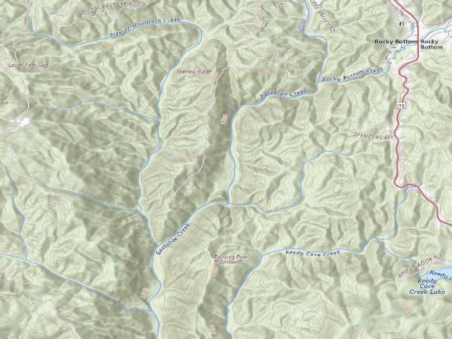
USGS topo — contours & terrain
USGS topographic map of Eastatoe Creek Heritage Preserve Eastatoe Gorge Campsite
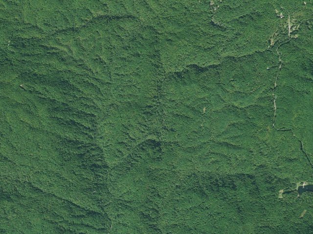
Aerial — USGS / NAIP
Aerial image of Eastatoe Creek Heritage Preserve Eastatoe Gorge Campsite
XFacebookReddit
Weather outlook — at Eastatoe Creek Heritage Preserve Eastatoe Gorge Campsite
Loading the latest forecast…
Live NWS area forecast (~2.5 km grid, not elevation-corrected). Camp sits at 1,367 ft.
Fire & smoke — around Eastatoe Creek Heritage Preserve Eastatoe Gorge CampsiteNIFC · AirNow
Checking active fires & air quality…
Active wildfires from NIFC (within ~50 mi); air quality from AirNow. Always confirm current fire restrictions with the managing office before you go.

Everything you need — measured from Eastatoe Creek Heritage Preserve Eastatoe Gorge Campsite · public land · SC

15 MI30 MI60 MIYOUR CAMPN ↑Water · 8 miWDump · 9 miDFuel · 5 miFHolly Springs Country Store · Grocery · 5 miGWalgreens · Pharmacy · 12 miRxOur Country Store · Hardware · 8 miHPetit's Paint & Body Shop · Mechanic · 9 miMK & A Laundromat · Laundry · 8 miLShower · 26 miShAir-up · 26 miAToxaway Health Center · Urgent care · 9 mi+Southern Appalachian Outdoors · Outfitter · 12 miOMail · 4 mi@Benson Ford · EV fast charger · 21 miEV
Straight-line miles · bearings approx · roads run longer
Nearest of each
  • @Mail4 mi
  • FFuel5 mi
  • GGrocery5 mi
  • LLaundry8 mi
  • WWater8 mi
  • HHardware8 mi
  • +Urgent care9 mi
  • MMechanic9 mi
  • DDump9 mi
  • OOutfitter12 mi
  • RxPharmacy12 mi
  • EVEV fast charger21 mi
  • ShShower26 mi
  • AAir-up26 mi
≤30 mi30–4545+water

The read: water's a short hop out, fuel & food sit about 5 mi out.

Not within 60 mi: Propane. Plan those before you head up.

One dot per need — the nearest of each kind, straight-line from camp. Places from OpenStreetMap (© OpenStreetMap contributors); the EV fast charger from the US DOE station locator. Open in Google Maps ↗

The site — Eastatoe Creek Heritage Preserve Eastatoe Gorge Campsite

Access
Hike-in
Land
public land
Elevation
1,367 ft
State
SC
Coordinates
35.03440, -82.81942
Cost
Free

Nearby & resupply — around Eastatoe Creek Heritage Preserve Eastatoe Gorge Campsite · public land · SC (OpenStreetMap)

  • Water featureEastatoe Creek (stream) · nearby
  • Nearest townRocky Bottom · ~1.3 mi
  • Drinking waterDrinking water · ~8.0 mi
  • FuelJarrett's · ~7.5 mi
  • Propane / LPGFreeman Gas · ~17.2 mi
  • Dump station~9.3 mi
  • GroceriesJarrett Brothers IGA · ~7.5 mi
  • PharmacyGordon Family Pharmacy Inc · ~14.1 mi
  • Hospital / clinicToxaway Health Center · ~8.8 mi
  • HardwareOur Country Store · ~8.5 mi

EV charging — from Eastatoe Creek Heritage Preserve Eastatoe Gorge Campsite · public land · SC — nearest public DC fast & Level 2 (US DOE station data)

Nearby restrooms — around Eastatoe Creek Heritage Preserve Eastatoe Gorge Campsite · public land · SC — pit toilets, restrooms & rest areas (government data)

Open Eastatoe Creek Heritage Preserve Eastatoe Gorge Campsite elsewhere

Other camps near Eastatoe Creek Heritage Preserve Eastatoe Gorge Campsite

If this one is full, gated or washed out.

How we know this — Eastatoe Creek Heritage Preserve Eastatoe Gorge Campsite

Area rules
Camping is not permitted on WMA lands except in designated camp sites.
Source
public land records
Confidence
Thin — A single weak source put this here. Treat the location itself as unconfirmed, not just the details.
How it was placed
Coordinate: SCDNR "SCDNR Public Lands Viewer" ArcGIS feature service, layer 0 "Property Asset Points", AssetType=CampPrim, AssetID=POI00791, PropertyID=035, queried 2026-08-15 -- https://services.arcgis.com/acgZYxoN5Oj8pDLa/arcgis/rest/services/DEV_-_SCDNR_Public_Lands_Viewer/FeatureServer/0 (this is the agency layer behind https://public-lands-scdnr.hub.arcgis.com/). It is SCDNR's own mapped campsite record, NOT a field visit. Land owner of record in that layer: South Carolina Department of Natural Resources. County: Pickens. || SCDNR asset record for this exact point, AssetName "Eastatoe Gorge Campsite": "Camping only allowed at designated campsite." PublicAccess = "Open". SCDNR Managed Lands Regulations 8.1: "Camping is not permitted on WMA lands except in designated camp sites." (https://www.dnr.sc.gov/mlands/wmaregulations.html, read 2026-08-15). This point IS one of the agency's designated camp sites -- that is the legal basis for camping here. CONTRADICTION: the SCDNR properties layer flags this property Camping = "No" while the asset point on it says camping is allowed at the designated campsite. The SCDNR Jocassee Gorges brochure (https://www.dnr.sc.gov/assets/maps/LowResJocasseeMap.pdf) separately says "Permits are not required for primitive camping any time of year along the Foothills Trail or Palmetto Trail or on limited areas of Eastatoee Creek Heritage Preserve," which supports the asset record. Eastatoe Creek Heritage Preserve is not listed in the Heritage Preserve special regulations at all. Resolve before publishing. || SCDNR asset description: "Camping only allowed at designated campsite." || Nearest incorporated place/CDP: Pickens, 12.0 mi (US Census Bureau TIGERweb Places_CouSub_ConCity_SubMCD, state FIPS 45, queried 2026-08-15; straight-line distance to the place centroid, not road miles). == NIGHTSHIFT RE-VERIFIED 2026-08-20 (fire 1180, leftover backlog pass 6: TX/TN/MO/SC/VT) == HOLDS UP - THE CONTRADICTION IS NOW RESOLVED IN FAVOUR OF CAMPING. Re-queried SCDNR's own service https://services.arcgis.com/acgZYxoN5Oj8pDLa/arcgis/rest/services/DEV_-_SCDNR_Public_Lands_Viewer/FeatureServer on 2026-08-20 (layer 0 Property Asset Points where AssetType='CampPrim', 39 points statewide; layer 5 Property Entrance; layer 3 SCDNR Public Properties View). The asset point is unchanged: AssetID POI00791, AssetName "Eastatoe Gorge Campsite", AssetType CampPrim, PropertyID 035, AssetDescription "Camping only allowed at designated campsite.", Accessible "No", PublicAccess "Open", at exactly 35.034404, -82.819418. SCDNR Managed Lands Regulations 8.1 re-read at https://www.dnr.sc.gov/mlands/wmaregulations.html (2026-08-20) still says verbatim "Camping is not permitted on WMA lands except in designated camp sites." - and this point is one of the agency's designated camp sites. THE TIE-BREAKER, read this fire: I downloaded and extracted the text of SCDNR's own Jocassee Gorges brochure https://www.dnr.sc.gov/assets/maps/LowResJocasseeMap.pdf (5.2 MB, 2026-08-20). It states, verbatim: "Permits are not required for primitive camping any time of year along the Foothills Trail or Palmetto Trail or on limited areas of Eastatoee Creek Heritage Preserve." It also confirms the Eastatoee Creek Heritage Preserve Spur is a constructed trail and that camping on Jocassee is "permitted (first come, first served) at designated campsites". So THREE SCDNR sources - the named asset point, regulation 8.1, and the printed brochure - all support camping at this designated site. The only dissent is a single boolean on the properties layer (PropertyID 035 Eastatoe Creek HP and WMA, Camping = "No"), which is still "No" as of this fire. I am weighting three affirmative agency statements, one of them naming this exact campsite, over one unexplained flag. DECISION: approved, hike-in. The Camping="No" flag stays on the record so nobody thinks it went away.
EV chargers
US DOE Alternative Fuels Data Center station locator, snapshot 2026-09-16. Straight-line miles to the nearest public, open, unrestricted station; restricted and planned units are shown but never counted.
Field check
On the agency's books. The land manager inventoried this site, so its existence is not in question — current conditions are. Nobody from here has camped it recently.

What we don’t know about Eastatoe Creek Heritage Preserve Eastatoe Gorge Campsite

A land record can put you within a few meters of a spot. It cannot tell you any of this — so check it yourself, and treat anything below as the open question it is.

Before you go — Eastatoe Creek Heritage Preserve Eastatoe Gorge Campsite

Been here? Tell us what changed. This page is built from public records, so the fastest way it gets better is somebody who has actually pulled in. Road washed out, site gone, gate locked, or it is exactly as described — all of it useful. Send a report →