Forebay Recreation Area (Boundary Dam)
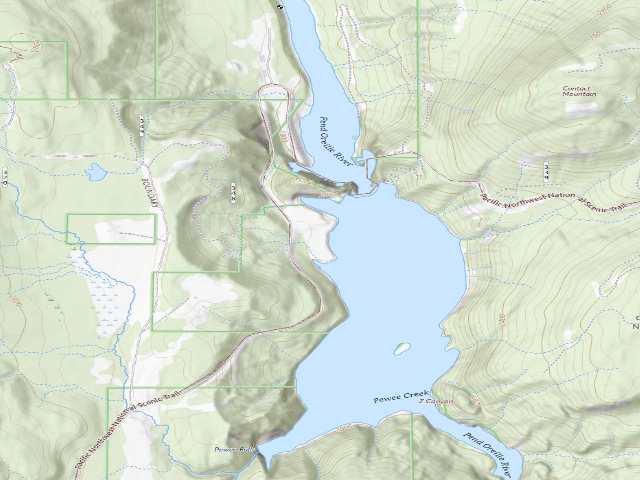
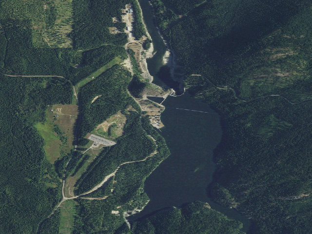
A free, developed, year-round campground run by an electric utility a mile from the Canadian border -- and it is genuinely free, in Seattle City Light's own words: 'Free. First-come, first-served. No reservations.' The Forebay Recreation Area sits above Boundary Dam on the Pend Oreille River, and City Light lists 22 campsites, 12 of them RV sites that will take a Class C, all with fire rings and picnic tables, plus flush toilets and potable water. There are no hookups, no dump station and no showers, so come self-contained. Stays are capped at six consecutive nights. Know the drive before you commit: from Metaline on WA-31 it is about eleven miles up Boundary Dam Road (County Road 2975) to the dam -- this is not a park in town, it is a long run up a county road into the Selkirks, and the nearest groceries and fuel are back in Metaline Falls or Ione. The campground is open year-round on paper, but City Light warns that 'in winter, water may not be available, and roads may not be plowed' -- treat anything past October as a call-ahead. No Discover Pass is needed; this is utility land, not a state park, which is exactly why it is free. The reason a place this good costs nothing is the dam: public recreation is a condition of the federal licence City Light operates it under. There is a visitor gallery and dam tours in season if you want to see what you are camped above. Confirm the current rules with Seattle City Light (509-446-3083) before you go, buy your supplies in the valley towns on the way through, and leave it better than you found it.
Everything you need — measured from Forebay Recreation Area (Boundary Dam) · public land · WA
- GGrocery8 mi
- @Mail8 mi
- FFuel9 mi
- HHardware20 mi
- EVEV fast charger21 mi
- DDump35 mi
- LLaundry38 mi
- MMechanic39 mi
- +Urgent care39 mi
- OOutfitter40 mi
- ShShower40 mi
- WWater47 mi
- RxPharmacy57 mi
The read: water is a real 47-mi drive, fuel & food sit about 8 mi out.
Not within 60 mi: Propane. Plan those before you head up.
One dot per need — the nearest of each kind, straight-line from camp. Places from OpenStreetMap (© OpenStreetMap contributors); the EV fast charger from the US DOE station locator. Open in Google Maps ↗
The site — Forebay Recreation Area (Boundary Dam)
Nearby & resupply — around Forebay Recreation Area (Boundary Dam) · public land · WA (OpenStreetMap)
- Water featurePend Oreille River (river) · nearby
- Nearest townNelway · ~2.6 mi
- Drinking waternone within 10 mi
- FuelFuel · ~9.4 mi
- Propane / LPGnone within 31 mi
- GroceriesThe Falls Market · ~8.5 mi
- PharmacyWalmart Pharmacy · ~14.0 mi
- Hospital / clinicKootenay Boundary Regional Hospital · ~17.9 mi
- HardwareNorthport Hardware · ~19.9 mi
EV charging — from Forebay Recreation Area (Boundary Dam) · public land · WA — nearest public DC fast & Level 2 (US DOE station data)
- Nearest public DC fast charger20.8 mi straight-line S — Tiger Historical Museum, Cusick, WA (at a public site) · RED_E · CHAdeMO, J1772, CCS · 4 fast ports listed · listed open, last confirmed by AFDC 2026-09-16 · hours: not listed · directions
- Public DC fast stations within reach1 within 25 mi · 5 within 50 · 47 within 100 · 71 within 150
- Nearest listing NACS (Tesla)91.2 mi — Liberty Lake, WA - Tesla Supercharger, Liberty Lake
- Nearest public Level 2 (J1772)8.5 mi — Metaline Falls Visitor Center · Blink Network · J1772 · 2 Level 2 ports listed · listed open, last confirmed by AFDC 2026-09-16 · hours: 24 hours daily
- Pricing at the fast chargernot listed
- Power (kW)not listed by AFDC — “DC fast” spans roughly 24 to 350 kW, so ask the network.
- Read this honestlyStraight-line miles, like every distance on this site. Roads run longer than this, and you have to get back. We know where a charger is listed. We don’t know if it works today, how fast it is, or the road miles. Check the network before you commit.
Snapshot 2026-09-16 · AFDC record 456457 · US DOE Alternative Fuels Data Center
Nearby restrooms — around Forebay Recreation Area (Boundary Dam) · public land · WA — pit toilets, restrooms & rest areas (government data)
- Vault / pit toiletCrescent Lake · ~1.7 mi E · USFS
- Vault / pit toiletPit Toilet Structure - Everett Slough · ~2.3 mi S · BLM
- Vault / pit toiletPit Toilet Structure - Ledbetter Cove · ~4.2 mi S · BLM
- Vault / pit toiletPit Toilet Structure - Grandview · ~7.0 mi S · BLM
Open Forebay Recreation Area (Boundary Dam) elsewhere
Other camps near Forebay Recreation Area (Boundary Dam)
If this one is full, gated or washed out.
- Crescent Lake Campground~1.7 mi
- Boundary Reservoir Recreation Area~2.2 mi
- Moon Flats~9.0 mi
- Silver Creek Campground~9.3 mi
How we know this — Forebay Recreation Area (Boundary Dam)
What we don’t know about Forebay Recreation Area (Boundary Dam)
A land record can put you within a few meters of a spot. It cannot tell you any of this — so check it yourself, and treat anything below as the open question it is.
- Road surface & last-mile access
- How many rigs actually fit
- Cell coverage by carrier
- Current fire restrictions
- Whether any water here is drinkable
- Shade & wind exposure
- Noise and who else shows up
- Whether a listed EV charger works today, or the road miles to it