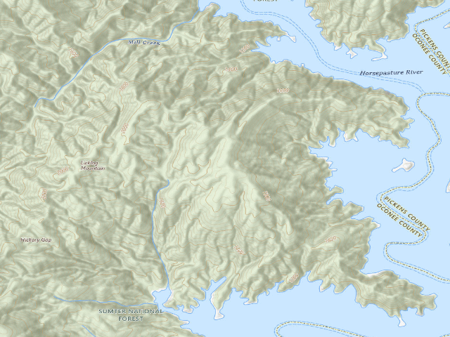
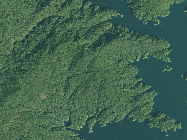
Dispersed · public land · SC · 35.02330, -82.93524
Ask an AI about this campsiteOpens Grok already loaded with this site. It reads the same records this page is built from, and links whatever it tells you.
The land manager lists this site. Someone from the agency inventoried it, so it is a real camp — not a spot we guessed at. What changes is conditions — roads, gates, closures, fire rules. Check those with the unit before you commit to the drive.
Two SCDNR sources disagree on whether a permit is needed at the designated roadside sites -- assume you need one and apply through SCDNR before you go. No fires are allowed anywhere in the Jocassee backcountry, so bring a stove. Most access roads are gated shut in late winter and again in summer; check the gate schedule before driving in. No water is claimed at this site -- SCDNR publishes none. Camp no closer than 25 feet to any stream or lake.
Can I go now? — Jocassee Gorges primitive campsite · public land · SC
Season: check firstSeason stated, but not plainly enough to read as a date.
public land record: “Most of the roads are closed for public use in late winter to avoid detrimental impacts associated with winter weather, and they are also closed in the summer to allow for wildlife use of the unique habitats along the roadsides.” Read against the calendar on 2026-09-17; with JavaScript your browser re-checks it against today.
Nearby & resupply — around Jocassee Gorges primitive campsite · public land · SC(OpenStreetMap)
Nearest townSalem · ~9.6 mi
Drinking waterWater · ~4.8 mi
FuelFuel · ~6.3 mi
Propane / LPGnone within 31 mi
Dump station~4.8 mi
GroceriesSapphire Country Store · ~6.3 mi
PharmacyWalgreens · ~16.2 mi
Hospital / clinicToxaway Health Center · ~6.1 mi
HardwareZoller Hardware · ~11.4 mi
EV charging — from Jocassee Gorges primitive campsite · public land · SC— nearest public DC fast & Level 2 (US DOE station data)
Nearest public DC fast charger19.4 mi straight-line SW — OPTIMUS CPO BTC WALHALLA 2 · ChargePoint Network · CCS · 1 fast port listed · listed open, last confirmed by AFDC 2026-09-16 · hours: 24 hours daily · directions
Public DC fast stations within reach2 within 25 mi · 87 within 50 · 235 within 100 · 673 within 150
Nearest public Level 2 (J1772)5.0 mi — Devils Fork State Park, Salem, SC (at a public site) · RIVIAN_WAYPOINTS · J1772 · 2 Level 2 ports listed · listed open, last confirmed by AFDC 2026-09-16 · hours: 24 hours daily
Also listed, not counted aboveLevel 2, restricted access — Lodge and Falls Cottages, Highlands, 14.9 mi · J1772 · hours: 24 hours daily; for guest use only · AFDC lists it “Free”
Pricing at the fast chargernot listed
Power (kW)not listed by AFDC — “DC fast” spans roughly 24 to 350 kW, so ask the network.
Read this honestlyStraight-line miles, like every distance on this site. Roads run longer than this, and you have to get back. We know where a charger is listed. We don’t know if it works today, how fast it is, or the road miles. Check the network before you commit. Snapshot 2026-09-16 · AFDC record 458250 · US DOE Alternative Fuels Data Center
Nearby restrooms — around Jocassee Gorges primitive campsite · public land · SC— pit toilets, restrooms & rest areas (government data)
How we know this — Jocassee Gorges primitive campsite
Seasonal closure
Most of the roads are closed for public use in late winter to avoid detrimental impacts associated with winter weather, and they are also closed in the summer to allow for wildlife use of the unique habitats along the roadsides.
Source
public land records
Confidence
Likely — The record is good enough to put a pin on, but thin in places. Treat the details as a starting point, not gospel.
How it was placed
Coordinate: SCDNR "SCDNR Public Lands Viewer" ArcGIS feature service, layer 0 "Property Asset Points", AssetType=CampPrim, AssetID=POI00955, PropertyID=003, queried 2026-08-15 -- https://services.arcgis.com/acgZYxoN5Oj8pDLa/arcgis/rest/services/DEV_-_SCDNR_Public_Lands_Viewer/FeatureServer/0 (this is the agency layer behind https://public-lands-scdnr.hub.arcgis.com/). It is SCDNR's own mapped campsite record, NOT a field visit. Land owner of record in that layer: DukeEnergyCarolinas. County: Oconee. || TWO SCDNR SOURCES DISAGREE AND BOTH ARE QUOTED HERE. (1) SCDNR Jocassee Gorges map/brochure (https://www.dnr.sc.gov/assets/maps/LowResJocasseeMap.pdf, read 2026-08-15): "Camping is permitted (first come, first served) at designated campsites along the main roads in Jocassee Gorges. Designated sites are noted on the Jocassee Gorges map and on kiosks at each entrance. Many of these sites are places that were traditionally used as hunt camps in the past. When the main roads and gates are closed in late winter and summer, primitive camping is permitted anywhere on Jocassee; however, a written permit must be obtained well in advance. Permits are not required for primitive camping any time of year along the Foothills Trail or Palmetto Trail or on limited areas of Eastatoee Creek Heritage Preserve. Camping is not permitted along the shore of Lake Jocassee, except for the Double Springs Primitive Campground operated by Devils Fork State Park." (2) SCDNR Public Lands Regulations 123-204, Jim Timmerman Natural Resources Area at Jocassee Gorges (https://www.dnr.sc.gov/mlands/specregs.html, read 2026-08-15): "Backcountry camping by permit will be allowed at any time during the year that the main roads allowing access to the Jocassee Gorges are not opened in connection with big game hunting. Backcountry camping is allowed by permit only at any location within the Jocassee Gorges, except for any area closed for camping by the Department. Backcountry camping is defined as minimal impact camping. No fires are allowed and each permitted camper is responsible for camping in a manner that results in no trace of the camping activity being left after breaking camp. Backcountry campers must apply for camping permits over the Department internet site. No camping is permitted within twenty-five (25) feet of a stream, lake, or as posted by the Department." THE CONFLICT: the brochure says designated roadside sites are first-come first-served; the regulation says camping anywhere in Jocassee is "by permit only". A reviewer must resolve this with SCDNR before we tell anyone they can just show up. SEASONAL CLOSURE (brochure): "Most of the roads are closed for public use in late winter to avoid detrimental impacts associated with winter weather, and they are also closed in the summer to allow for wildlife use of the unique habitats along the roadsides." Roads with red gates are closed to vehicles year-round; green gates are seasonal. FIRE: the regulation says "No fires are allowed" for backcountry camping on Jocassee. NO FEE is stated by SCDNR on either source. || Nearest incorporated place/CDP: Salem, 9.6 mi (US Census Bureau TIGERweb Places_CouSub_ConCity_SubMCD, state FIPS 45, queried 2026-08-15; straight-line distance to the place centroid, not road miles). | auto:agency-trust 2026-08-18: state agency GIS record with a source URL and coordinates, confidence not low. Fee value is the agency's own, not field-checked. Not field-verified -- confirm access, road conditions and fire rules before you go.
Season
Read from the agency's own season / closure text in this record (data/conditions.py) and checked against the calendar. The words we read are printed under the verdict at the top of the page.
EV chargers
US DOE Alternative Fuels Data Center station locator, snapshot 2026-09-16. Straight-line miles to the nearest public, open, unrestricted station; restricted and planned units are shown but never counted.
Field check
On the agency's books. The land manager inventoried this site, so its existence is not in question — current conditions are. Nobody from here has camped it recently.
What we don’t know about Jocassee Gorges primitive campsite
A land record can put you within a few meters of a spot. It cannot tell you any of this — so check it yourself, and treat anything below as the open question it is.
Road surface & last-mile access
How many rigs actually fit
Cell coverage by carrier
Current fire restrictions
Whether any water here is drinkable
Shade & wind exposure
Noise and who else shows up
Whether a listed EV charger works today, or the road miles to it
Before you go — Jocassee Gorges primitive campsite
Been here? Tell us what changed. This page is built from public records, so the fastest way it gets better is somebody who has actually pulled in. Road washed out, site gone, gate locked, or it is exactly as described — all of it useful. Send a report →