Agency-listedTWRA · dispersedFreeOpen today

North Cumberland WMA - Dispersed Camping (Royal Blue Unit access)

Drive-up · public land · TN · 36.38391, -84.25569
Ask an AI about this campsiteOpens Grok already loaded with this site. It reads the same records this page is built from, and links whatever it tells you.
Ask about this camp →
The land manager lists this site. Someone from the agency inventoried it, so it is a real camp — not a spot we guessed at. What changes is conditions — roads, gates, closures, fire rules. Check those with the unit before you commit to the drive.

Nearest town: Caryville. Camping on a Tennessee Wildlife Resources Agency wildlife management area. TWRA publishes no camping fee. TWRA's per-area pages say "License fees may apply" and require a hunting/fishing licence or a High Impact Habitat Conservation Permit for horses, bicycles and OHVs - which implies arriving on foot or by car to camp needs neither, but TWRA does not say that in so many words and we have not confirmed it. Camping is legal ONLY in the designated area.
Can I go now? — North Cumberland WMA - Dispersed Camping (Royal Blue Unit access) · public land · TN
Open today Year-round per the agency record.
public land record: “Year-round” Read against the calendar on 2026-09-17; with JavaScript your browser re-checks it against today.
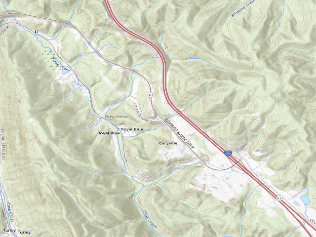
USGS topo — contours & terrain
USGS topographic map of North Cumberland WMA - Dispersed Camping (Royal Blue Unit access)
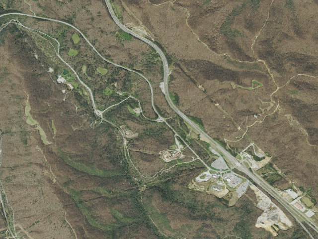
Aerial — USGS / NAIP
Aerial image of North Cumberland WMA - Dispersed Camping (Royal Blue Unit access)
XFacebookReddit
Weather outlook — at North Cumberland WMA - Dispersed Camping (Royal Blue Unit access)
Loading the latest forecast…
Live NWS area forecast (~2.5 km grid, not elevation-corrected). Camp sits at 1,704 ft.
Fire & smoke — around North Cumberland WMA - Dispersed Camping (Royal Blue Unit access)NIFC · AirNow
Checking active fires & air quality…
Active wildfires from NIFC (within ~50 mi); air quality from AirNow. Always confirm current fire restrictions with the managing office before you go.

Everything you need — measured from North Cumberland WMA - Dispersed Camping (Royal Blue Unit access) · public land · TN

15 MI30 MI60 MIYOUR CAMPN ↑Water · 14 miWDump · 16 miDLove's · Propane · 36 miPFuel · 1 miFGrocery · 1 miGTerry's Pharmacy · Pharmacy · 6 miRxLowe's · Hardware · 6 miHMechanic · 1 miMMaytag Coin Laundry · Laundry · 6 miLShower · 32 miShAir-up · 12 miAVA Clinic · Urgent care · 6 mi+Rocky Top Outdoors · Outfitter · 12 miOPioneer Post Office · Mail · 3 mi@Walmart 1048 (Williamsburg, KY) · EV fast charger · 24 miEV
Straight-line miles · bearings approx · roads run longer
Nearest of each
  • FFuel1 mi
  • GGrocery1 mi
  • MMechanic1 mi
  • @Mail3 mi
  • HHardware6 mi
  • RxPharmacy6 mi
  • +Urgent care6 mi
  • LLaundry6 mi
  • AAir-up12 mi
  • OOutfitter12 mi
  • WWater14 mi
  • DDump16 mi
  • EVEV fast charger24 mi
  • ShShower32 mi
  • PPropane36 mi
≤30 mi30–4545+water

The read: water's a short hop out, fuel & food sit about 1 mi out.

One dot per need — the nearest of each kind, straight-line from camp. Places from OpenStreetMap (© OpenStreetMap contributors); the EV fast charger from the US DOE station locator. Open in Google Maps ↗

The site — North Cumberland WMA - Dispersed Camping (Royal Blue Unit access)

Access
Drive-up
Land
public land · dispersed
Elevation
1,704 ft
State
TN
Coordinates
36.38391, -84.25569
Cost
Free

Nearby & resupply — around North Cumberland WMA - Dispersed Camping (Royal Blue Unit access) · public land · TN (OpenStreetMap)

  • Nearest townJacksboro · ~4.9 mi
  • Drinking waternone within 10 mi
  • FuelFuel · ~0.6 mi
  • Propane / LPGnone within 31 mi
  • Dump station~15.6 mi
  • GroceriesGrocery · ~0.7 mi
  • PharmacyRiggs Drug Store · ~5.6 mi
  • Hospital / clinicVA Clinic · ~5.8 mi
  • HardwareLowe's · ~5.5 mi

EV charging — from North Cumberland WMA - Dispersed Camping (Royal Blue Unit access) · public land · TN — nearest public DC fast & Level 2 (US DOE station data)

Nearby restrooms — around North Cumberland WMA - Dispersed Camping (Royal Blue Unit access) · public land · TN — pit toilets, restrooms & rest areas (government data)

Open North Cumberland WMA - Dispersed Camping (Royal Blue Unit access) elsewhere

Other camps near North Cumberland WMA - Dispersed Camping (Royal Blue Unit access)

If this one is full, gated or washed out.

How we know this — North Cumberland WMA - Dispersed Camping (Royal Blue Unit access)

Open season
Year-round
Source
public land records
Confidence
Thin — A single weak source put this here. Treat the location itself as unconfirmed, not just the details.
How it was placed
THE SINGLE BIGGEST PIECE OF GENUINELY PUBLIC FREE CAMPING IN TENNESSEE, and it was entirely missing from our map. North Cumberland is the largest actively managed WMA in the state - approximately 205,000 acres across Morgan, Scott, Anderson, Campbell and Claiborne counties in the Cumberland Mountains, in six units (New River, Royal Blue, Sundquist, Ed Carter, Highcliff, Otey Mills Refuge). TWRA states, verbatim and without a hunter restriction: "Camping is permitted on the entire area." and "The WMA is open year-round with an area that is open 24 hours a day, including camping." and lists camping among the WMA's recreational activities alongside hunting, fishing, OHV trails and hiking. Unlike almost every other Tennessee WMA, the camping permission here is area-wide, not confined to a designated campground. THIS COORDINATE IS AN ACCESS POINT, NOT A CAMPSITE - hence dispersed=1 and confidence=low. TWRA maps no campsites on North Cumberland, so there is nothing to pin. The value used is TWRA's own published Royal Blue Unit access: "Titus Hollow Road and Hwy 63 - Lat 36.38391, Long:-84.25569". Other TWRA-published access points on the same WMA, for a reviewer who wants to place additional pins: Sundquist Unit at Hatfield Knob 36.44899, -84.1227 (elk viewing tower). A reviewer should treat this as an AREA, not a site. HAZARD, in TWRA's own words: "All users should be aware that hazards associated with mining (deep and strip) exist in this area." BLAZE ORANGE: "During daylight hours all users (except waterfowl hunters) outside of an enclosed vehicle or outside of camp must wear 500 square inches of fluorescent orange/pink during the deer and elk gun and muzzleloader seasons." Alcohol possession on the WMA is prohibited. OHV use needs a North Cumberland OHV riding permit; horses and bicycles need a High Impact Habitat Conservation Permit. Sources: https://www.tn.gov/twra/wildlife-management-areas/east-tennessee-r4/north-cumberland-wma.html (read 2026-08-16). FEE BASIS: TWRA's own licence price list (https://www.tn.gov/twra/license-sales.html, read 2026-08-16) lists no camping fee for any Tennessee WMA or state forest. The only camping line on the whole price list sits under the heading "Land Between the Lakes" - "Annual Hunt/Camp Permit (Age 18 and over) ... $50.00" - which is the federal LBL permit, not a state charge. Rule 1660-01-14-.13 sets WMA camping rules and prescribes no fee. This is an absence-of-fee finding, not a published "free" statement. STATEWIDE WMA RULE, Tenn. Comp. R. & Regs. 1660-01-14-.13 (https://publications.tnsosfiles.com/rules/1660/1660-01/1660-01-14.20240415.pdf, read 2026-08-16), verbatim: "Overnight camping may be permitted on designated areas by permission from the Area Manager"; "Camping shall not exceed 3 weeks in length from the beginning to the end of the camping stay"; "Owner's contact information (name, phone number, address) or TWRA ID number and date of arrival must be displayed on camper, tent, vehicle, etc."; "No warming, camping or any type fire shall be allowed except at designated camping areas." == NIGHTSHIFT RE-VERIFIED 2026-08-20 (fire 1180, leftover backlog pass 6: TX/TN/MO/SC/VT) == HOLDS UP, AND THE PAGE IS EVEN CLEARER THAN WE RECORDED. I re-read https://www.tn.gov/twra/wildlife-management-areas/east-tennessee-r4/north-cumberland-wma.html on 2026-08-20. TWRA still says, verbatim and with no hunter restriction: "The WMA is open year-round with an area that is open 24 hours a day, including camping."; "Camping is permitted on the entire area."; "Camping - Allowed area-wide. Do not block roads, trails, or gates."; and "Public use is permitted during all hunts." The access coordinate on this row is still printed verbatim on the page: "Titus Hollow Road and Hwy 63 - Lat 36.38391, Long:-84.25569" - an exact match to this row, to five decimals. Acreage and counties confirmed: "approximately 205,000 acres of mountainous terrain expanding across five East Tennessee counties: Morgan, Scott, Anderson, Campbell, and Claiborne", six units (New River, Royal Blue, Sundquist, Ed Carter, Highcliff, Otey Mills Refuge). NEW CAVEAT FOUND THIS FIRE, NOT PREVIOUSLY RECORDED - THE AREA-WIDE PERMISSION HAS ONE HOLE: the Otey Mills Refuge unit is, verbatim, "Closed to all forms of use and trespass except as noted during big game and small game seasons" with "Prohibited Activities: OHV riding, horseback riding, mountain bike riding, hiking, camping, and ginseng hunting." So camping is NOT allowed in the Otey Mills Refuge unit. The Royal Blue access this row pins is a different unit and is unaffected. Hazards and rules re-confirmed verbatim: "All users should be aware that hazards associated with mining (deep and strip) exist in this area."; 500 square inches of blaze orange/pink outside a vehicle or camp during deer and elk gun and muzzleloader seasons; "Use or possession of alcohol on the WMA is prohibited."; a North Cumberland OHV Riding Permit is required for OHV trail use (and from 1 July 2026 Sportsman/Lifetime Sportsman holders must buy a supplemental NCWMA OHV riding permit); horses and bicycles need a High Impact Habitat Conservation Permit. DECISION: approved. This remains an AREA pin at a published access point, not a campsite.
Season
Read from the agency's own season / closure text in this record (data/conditions.py) and checked against the calendar. The words we read are printed under the verdict at the top of the page.
EV chargers
US DOE Alternative Fuels Data Center station locator, snapshot 2026-09-16. Straight-line miles to the nearest public, open, unrestricted station; restricted and planned units are shown but never counted.
Field check
On the agency's books. The land manager inventoried this site, so its existence is not in question — current conditions are. Nobody from here has camped it recently.

What we don’t know about North Cumberland WMA - Dispersed Camping (Royal Blue Unit access)

A land record can put you within a few meters of a spot. It cannot tell you any of this — so check it yourself, and treat anything below as the open question it is.

Before you go — North Cumberland WMA - Dispersed Camping (Royal Blue Unit access)

Been here? Tell us what changed. This page is built from public records, so the fastest way it gets better is somebody who has actually pulled in. Road washed out, site gone, gate locked, or it is exactly as described — all of it useful. Send a report →