Agency-listedTN Division of ForestryFreeOpen today
Chuck Swan State Forest - Primitive Camping Site (north)
Drive-up · public land · TN · 36.37056, -83.88590
Ask an AI about this campsiteOpens Grok already loaded with this site. It reads the same records this page is built from, and links whatever it tells you.
Ask about this camp →The land manager lists this site. Someone from the agency inventoried it, so it is a real camp — not a spot we guessed at. What changes is conditions — roads, gates, closures, fire rules. Check those with the unit before you commit to the drive.
Nearest town: Sharps Chapel. Primitive camping on a Tennessee state forest, managed by the Department of Agriculture Division of Forestry. TDF publishes no camping fee and states general access to its state forests is free. No potable water is claimed.
Can I go now? — Chuck Swan State Forest - Primitive Camping Site (north) · public land · TN
Open today Year-round per the agency record.
public land record: “Year-round” Read against the calendar on 2026-09-17; with JavaScript your browser re-checks it against today.
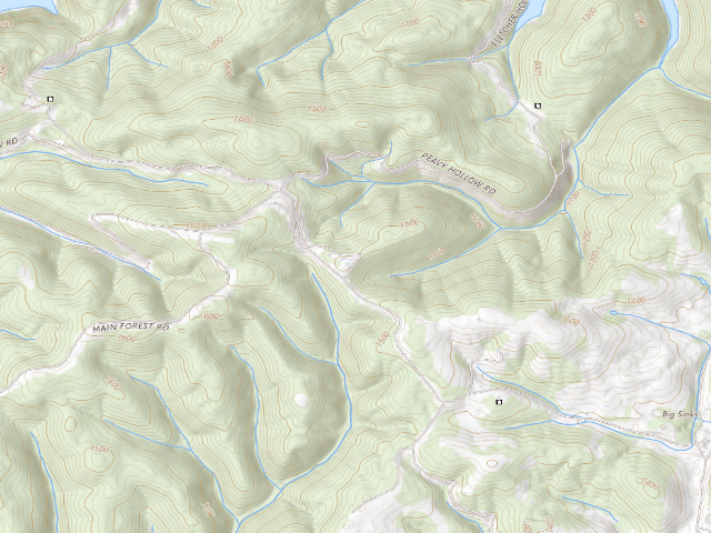
USGS topo — contours & terrain
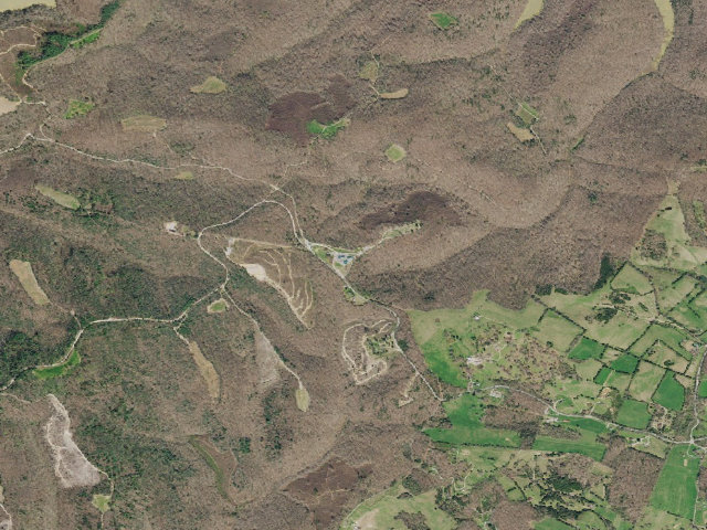
Aerial — USGS / NAIP
Weather outlook — at Chuck Swan State Forest - Primitive Camping Site (north)
Loading the latest forecast…
Live NWS area forecast (~2.5 km grid, not elevation-corrected). Camp sits at 1,487 ft.
Fire & smoke — around Chuck Swan State Forest - Primitive Camping Site (north)NIFC · AirNow
Checking active fires & air quality…
Active wildfires from NIFC (within ~50 mi); air quality from AirNow. Always confirm current fire restrictions with the managing office before you go.
Everything you need — measured from Chuck Swan State Forest - Primitive Camping Site (north) · public land · TN
Straight-line miles · bearings approx · roads run longer
Nearest of each
- @Mail5 mi
- FFuel9 mi
- LLaundry9 mi
- GGrocery10 mi
- HHardware10 mi
- RxPharmacy10 mi
- +Urgent care13 mi
- MMechanic13 mi
- WWater15 mi
- AAir-up18 mi
- OOutfitter18 mi
- DDump21 mi
- EVEV fast charger23 mi
- ShShower29 mi
- PPropane42 mi
≤30 mi30–4545+water
The read: water's a short hop out, fuel & food sit about 9 mi out.
One dot per need — the nearest of each kind, straight-line from camp. Places from OpenStreetMap (© OpenStreetMap contributors); the EV fast charger from the US DOE station locator. Open in Google Maps ↗
The site — Chuck Swan State Forest - Primitive Camping Site (north)
Access
Drive-up
Land
public land
Elevation
1,487 ft
State
TN
Coordinates
36.37056, -83.88590
Cost
Free
Nearby & resupply — around Chuck Swan State Forest - Primitive Camping Site (north) · public land · TN (OpenStreetMap)
- Nearest townFincastle · ~9.3 mi
- Drinking waternone within 10 mi
- FuelBP · ~8.7 mi
- Propane / LPGnone within 31 mi
- Dump station~20.7 mi
- GroceriesFood City · ~9.6 mi
- PharmacyWalgreens · ~10.3 mi
- Hospital / clinicUrgent Care · ~13.0 mi
- Hardware33 Hardware LLC · ~9.6 mi
EV charging — from Chuck Swan State Forest - Primitive Camping Site (north) · public land · TN — nearest public DC fast & Level 2 (US DOE station data)
- Nearest public DC fast charger22.8 mi straight-line S — Powell, TN - Tesla Supercharger (at a shopping center) · Tesla · NACS (Tesla) · 24 fast ports listed · listed open, last confirmed by AFDC 2026-06-18 · hours: 24 hours daily. NACS partner enabled. · directions
- Public DC fast stations within reach3 within 25 mi · 40 within 50 · 122 within 100 · 346 within 150
- Nearest listing CCS24.8 mi — LOCAL MARKET LOCAL #107 DC2, Knoxville
- Nearest listing CHAdeMO24.8 mi — LOCAL MARKET LOCAL #107 DC2, Knoxville
- Nearest public Level 2 (J1772)9.1 mi — Big Ridge State Park, Maynardsville, TN (at a public site) · RIVIAN_WAYPOINTS · J1772 · 2 Level 2 ports listed · listed open, last confirmed by AFDC 2026-09-16 · hours: 24 hours daily
- Pricing at the fast chargernot listed
- Power (kW)not listed by AFDC — “DC fast” spans roughly 24 to 350 kW, so ask the network.
- Read this honestlyStraight-line miles, like every distance on this site. Roads run longer than this, and you have to get back. We know where a charger is listed. We don’t know if it works today, how fast it is, or the road miles. Check the network before you commit.
Snapshot 2026-09-16 · AFDC record 322838 · US DOE Alternative Fuels Data Center
Nearby restrooms — around Chuck Swan State Forest - Primitive Camping Site (north) · public land · TN — pit toilets, restrooms & rest areas (government data)
- RestroomBartlett Park Comfort Station · ~19.2 mi NE · NPS
- RestroomVisitor Center Building · ~19.2 mi NE · NPS
- Highway rest areaNHS Welcome Center, I-75 · ~19.4 mi NW
- RestroomDaniel Boone Comfort Station · ~20.3 mi NE · NPS
Open Chuck Swan State Forest - Primitive Camping Site (north) elsewhere
Other camps near Chuck Swan State Forest - Primitive Camping Site (north)
If this one is full, gated or washed out.
- Chuck Swan State Forest - Primitive Camping Site (south)~0.4 mi
- North Cumberland WMA - Dispersed Camping (Royal Blue Unit access)~20.6 mi
How we know this — Chuck Swan State Forest - Primitive Camping Site (north)
Open season
Year-round
Source
public land records
Confidence
Thin — A single weak source put this here. Treat the location itself as unconfirmed, not just the details.
How it was placed
One of two primitive camping sites on the 24,705-acre Chuck Swan State Forest, Union County, on the peninsula between Norris Lake and the Powell River. The Division of Forestry's own page describes them: "Recreation facilities include primitive camping sites, picnic areas and a parking area in the northeastern portion of the forest near the fire tower." This is ONE OF THE FEW TENNESSEE FREE CAMPING OPTIONS THAT IS NOT HUNTER-RESTRICTED - TDF presents it as a recreation facility, and the sibling Chickasaw State Forest page states the general rule "General access is free however, license fees may apply." COORDINATE IS DERIVED, NOT PUBLISHED - hence confidence=low: TDF publishes no lat/lon for these sites. The Chuck Swan Recreation Map PDF (https://www.tn.gov/content/dam/tn/agriculture/archive/documents/forestry/stateforests/chuck-swan/ChuckSwanSF-Recreation-Map.pdf, updated May 2026, read 2026-08-16) is a true GeoPDF: its /VP viewport carries /GPTS corner coordinates in NAD83 UTM 16N. I read the page-space position of each "Camping Sites (Primitive)" marker glyph out of the PDF content stream and bilinearly interpolated against those corners. This is the northern of the two (page x=631.832 y=441.105). As a check, the result was point-in-polygon tested against TDF's own boundary service and returned StateForestName="Chuck Swan State Forest", Acres=24705, matching the acreage TDF prints on the forest page. Expect tens of metres of error, not hundreds - but a reviewer should confirm on the ground or against a fresher agency map before publishing. Nearest mapped parking area by the same method: 36.370125, -83.890597. TDF office: 3476 Sharps Chapel Road, Sharps Chapel, TN 37866, (865) 722-2088. Sources: https://www.tn.gov/agriculture/forests/state-forests/chuck-swan.html | https://www.tn.gov/twra/wildlife-management-areas/east-tennessee-r4/chuck-swan-wma.html (both read 2026-08-16). FEE BASIS: TWRA's own licence price list (https://www.tn.gov/twra/license-sales.html, read 2026-08-16) lists no camping fee for any Tennessee WMA or state forest. The only camping line on the whole price list sits under the heading "Land Between the Lakes" - "Annual Hunt/Camp Permit (Age 18 and over) ... $50.00" - which is the federal LBL permit, not a state charge. Rule 1660-01-14-.13 sets WMA camping rules and prescribes no fee. This is an absence-of-fee finding, not a published "free" statement.
== NIGHTSHIFT RE-VERIFIED 2026-08-20 (fire 1180, leftover backlog pass 6: TX/TN/MO/SC/VT) ==
HOLDS UP, AND THE DERIVED COORDINATE WAS RE-DERIVED FROM SCRATCH THIS FIRE AND REPRODUCED EXACTLY. Sources re-read 2026-08-20: https://www.tn.gov/agriculture/forests/state-forests/chuck-swan.html still gives "Size: 24,705 acres" and still says, verbatim, "Recreation facilities include primitive camping sites, picnic areas and a parking area in the northeastern portion of the forest near the fire tower." https://www.tn.gov/twra/wildlife-management-areas/east-tennessee-r4/chuck-swan-wma.html still says "General access is free however, license fees may apply." and states NO camping restriction - unlike every TWRA WMA page in this batch, it does not limit camping to hunters. That is why these two rows survive where the Bridgestone and Yanahli rows did not. COORDINATE RE-DERIVATION (this is the part the previous fire asked a reviewer to check): I re-downloaded the GeoPDF https://www.tn.gov/content/dam/tn/agriculture/archive/documents/forestry/stateforests/chuck-swan/ChuckSwanSF-Recreation-Map.pdf (3.9 MB, read 2026-08-20), decompressed the page content stream with pikepdf, and located the optional-content group the map itself names "Camping Sites (Primitive)" (/OC6). That group contains exactly TWO marker glyph placements and no others, at page-space text matrices (631.83164, 441.10494) and (631.59163, 417.10283). Those are the same two page positions the previous fire used, recovered independently. I then bilinearly interpolated them against the PDF's own georeference - viewport BBox [14.40072 549.11446 777.63894 15.54745] and /Measure /GPTS corners 36.26735/-84.08393, 36.40294/-84.07887, 36.39683/-83.83898, 36.26127/-83.84445 - taking the map as north-up, which the page geometry requires. Result: north marker 36.370555, -83.885899 and south marker 36.364458, -83.886217, i.e. the values already in these rows, reproduced to 0.1 m. The mapped parking area (/OC7) likewise reproduces to 36.370125, -83.890597. THE "IS IT ONE SITE DRAWN TWICE?" QUESTION IS ANSWERED: NO. There are two distinct glyph placements 679 m apart, drawn separately in the same layer. CAVEAT FOUND THIS FIRE: the recreation-map PDF's own internal metadata says "Creator: Esri ArcMap 10.8.0.12790, CreationDate: D:20200612155051-05" - so the RECREATION map dates from June 2020. The "most recently updated in May 2026" line on the TDF page describes the road-and-trail maps, not this one. Treat the camping-site positions as 2020-vintage agency data. ALSO: the TWRA page says "The WMA is open year-round during daylight hours, please note hunting seasons" and "All Big Game Hunts are Quota Hunts only" and "Entering the WMA from Norris Lake during the deer and turkey hunts is prohibited." The daylight-hours line sits oddly next to TDF advertising primitive camping sites; TDF is the land manager and states the camping facility affirmatively, so I have taken TDF as governing, but a traveller should phone the TDF office at (865) 722-2088 before relying on a mid-hunt stay. DECISION: approved. This row is the NORTHERN of the two markers.
Season
Read from the agency's own season / closure text in this record (data/conditions.py) and checked against the calendar. The words we read are printed under the verdict at the top of the page.
EV chargers
US DOE Alternative Fuels Data Center station locator, snapshot 2026-09-16. Straight-line miles to the nearest public, open, unrestricted station; restricted and planned units are shown but never counted.
Field check
On the agency's books. The land manager inventoried this site, so its existence is not in question — current conditions are. Nobody from here has camped it recently.
What we don’t know about Chuck Swan State Forest - Primitive Camping Site (north)
A land record can put you within a few meters of a spot. It cannot tell you any of this — so check it yourself, and treat anything below as the open question it is.
- Road surface & last-mile access
- How many rigs actually fit
- Cell coverage by carrier
- Current fire restrictions
- Whether any water here is drinkable
- Shade & wind exposure
- Noise and who else shows up
- Whether a listed EV charger works today, or the road miles to it
Before you go — Chuck Swan State Forest - Primitive Camping Site (north)
Water on public land →Fire rules & restrictions →Reading your camp page →Dispersed camping tips →All field notes →
Been here? Tell us what changed. This page is built from public records, so the fastest way it gets better is somebody who has actually pulled in. Road washed out, site gone, gate locked, or it is exactly as described — all of it useful. Send a report →