North Platte River-Foote PAA Campground
ACCESS DATES: Open year round Confirm with Game and Fish before you go -- these areas commonly close seasonally for wintering wildlife. This is a designated campground on the North Platte River-Foote Public Access Area in Carbon County, land acquired or administered by the Wyoming Game and Fish Commission. The area runs about 1 acres. Note what a Public Access Area is: Game and Fish describes PAAs as "permanent or long-term easements, or Wyoming Game and Fish Commission-owned land managed by the Wyoming Game and Fish Department for allowing public access for recreational purposes." So the ground under you may belong to a private landowner or to another agency -- several PAAs sit on federal land -- while Game and Fish holds the public-access right and its rules are the ones that govern your stay. Do not be surprised by another owner's signage, and respect any posted boundary. Camping here is genuinely free and first come, first served -- and unlike neighbouring states, Wyoming does NOT make you buy a license or a habitat/entrance pass simply to be on the land or to camp. (If you intend to hunt or fish while you are there, that is a different matter: you need the appropriate Wyoming license and a conservation stamp for that activity.) STAY LIMIT IS 5 DAYS HERE, NOT 14. Wyoming's statewide cap is 14 consecutive days, but Game and Fish posts a shorter 5-day camping limit for this specific area, and the posted limit is the one that binds. You also cannot leave a camp unattended more than 48 hours, and once you hit the limit you must be off that same Game and Fish land for at least 72 hours before returning. WATCH THIS ONE CAREFULLY -- Game and Fish carves out a spot on this area where camping is NOT allowed: 'No overnight camping at upper river access'. Camping is permitted on the area, but not there. Note in particular that Wyoming STATE TRUST LAND parcels are often mixed in with wildlife areas, and camping on state trust land is prohibited statewide by the Board of Land Commissioners -- so a boundary you cannot see on the ground can matter. Read the sign and the map at the entrance. Area-specific regulations from Game and Fish: Limited to 50 foot easement area marked with signs 5 Day Camping Limit at down river access only, No Open Fires, Access road and parking not plowed during winter. Exceptions noted for this area: No overnight camping at upper river access. Amenities listed by Game and Fish for the area: Handicap Accessible Comfort Station, Primitive Boat Ramps These are working wildlife areas first and campgrounds second -- they exist for habitat, so expect gravel, expect stock, and leave it cleaner than you found it. We have not visited; confirm current conditions and closures with the Wyoming Game and Fish Laramie regional office before you go.
Everything you need — measured from North Platte River-Foote PAA Campground · Wyoming Game & Fish · WY
- OOutfitter4 mi
- @Mail4 mi
- MMechanic4 mi
- FFuel4 mi
- GGrocery4 mi
- WWater21 mi
- EVEV fast charger27 mi
- DDump49 mi
- LLaundry49 mi
- ShShower49 mi
The read: water is a real 21-mi drive, fuel & food sit about 4 mi out.
Not within 60 mi: Propane. Plan those before you head up.
One dot per need — the nearest of each kind, straight-line from camp. Places from OpenStreetMap (© OpenStreetMap contributors); the EV fast charger from the US DOE station locator. Open in Google Maps ↗
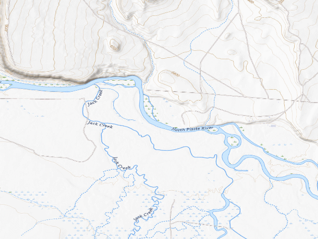
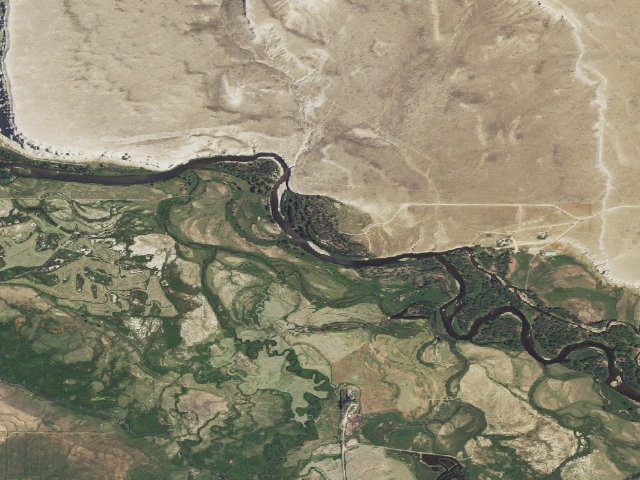
The site — North Platte River-Foote PAA Campground
Nearby & resupply — around North Platte River-Foote PAA Campground · Wyoming Game & Fish · WY (OpenStreetMap)
- Water featureJack Creek (stream) · nearby
- Nearest townOld Haymaker Place · ~2.7 mi
- Drinking waternone within 10 mi
- FuelConoco · ~4.2 mi
- Propane / LPGnone within 31 mi
- GroceriesConoco/Country Store · ~4.2 mi
- Hospital / clinicMemorial Hospital of Carbon County · ~29.0 mi
EV charging — from North Platte River-Foote PAA Campground · Wyoming Game & Fish · WY — nearest public DC fast & Level 2 (US DOE station data)
- Nearest public DC fast charger27.3 mi straight-line NW — Rawlins, WY - Tesla Supercharger (at a hotel) · Tesla · NACS (Tesla) · 8 fast ports listed · listed open, last confirmed by AFDC 2026-06-18 · hours: 24 hours daily. Open to Teslas only. · directions
- Public DC fast stations within reachnone within 25 mi · 3 within 50 · 18 within 100 · 207 within 150
- Nearest listing CCS27.7 mi — Kroger-City Market 412 (Rawlins, WY), Rawlins
- Nearest listing CHAdeMO71.9 mi — MAVERIK SB SPRINGS PL1, Steamboat Springs
- Nearest public Level 2 (J1772)27.9 mi — Fremont Motor Rawlins (at a car dealership) · Non-Networked · J1772 · 1 Level 2 port listed · listed open, last confirmed by AFDC 2025-10-13 · hours: 8am-6pm M-Sat
- Also listed, not counted aboveLevel 2, restricted access — Copperline Lodge, Saratoga, 3.8 mi · J1772 · hours: 24 hours daily; for guests only · AFDC lists it “Free; donations accepted”
- Pricing at the fast chargernot listed
- Power (kW)not listed by AFDC — “DC fast” spans roughly 24 to 350 kW, so ask the network.
- Read this honestlyStraight-line miles, like every distance on this site. Roads run longer than this, and you have to get back. We know where a charger is listed. We don’t know if it works today, how fast it is, or the road miles. Check the network before you commit.
Snapshot 2026-09-16 · AFDC record 102518 · US DOE Alternative Fuels Data Center
Nearby restrooms — around North Platte River-Foote PAA Campground · Wyoming Game & Fish · WY — pit toilets, restrooms & rest areas (government data)
- Highway rest areaFt. Steele Rest Area · ~17.9 mi N
- Vault / pit toiletLincoln Park · ~19.4 mi SE · USFS
- RestroomBennett Peak Toilet · ~20.9 mi SE · BLM
- Vault / pit toiletSouth Brush Creek · ~21.2 mi SE · USFS
Open North Platte River-Foote PAA Campground elsewhere
Other camps near North Platte River-Foote PAA Campground
If this one is full, gated or washed out.
- North Platte River-Pick Bridge PAA Campground~3.0 mi
- North Platte River-Sanger PAA Campground #2~5.4 mi
- North Platte River-Sanger PAA Campground~5.6 mi
- North Platte River-Sanger PAA Campground #4~6.3 mi
How we know this — North Platte River-Foote PAA Campground
What we don’t know about North Platte River-Foote PAA Campground
A land record can put you within a few meters of a spot. It cannot tell you any of this — so check it yourself, and treat anything below as the open question it is.
- Road surface & last-mile access
- How many rigs actually fit
- Cell coverage by carrier
- Current fire restrictions
- Whether any water here is drinkable
- Shade & wind exposure
- Noise and who else shows up
- Whether a listed EV charger works today, or the road miles to it