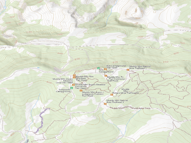
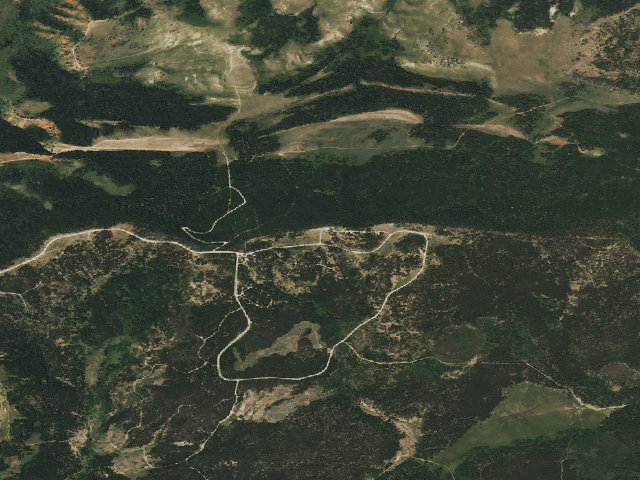
Drive-up · Bureau of Land Management · WY · 42.68086, -106.25858
Ask an AI about this campsiteOpens Grok already loaded with this site. It reads the same records this page is built from, and links whatever it tells you.
Bureau of Land Management lists this as a developed campground. Expect marked sites, a fee station or a reservation, and the usual campground rules. The dispersed-camping freedom of the surrounding forest does not apply inside it. What changes is conditions — roads, gates, closures, fire rules. Check those with the unit before you commit to the drive.
Nearby & resupply — around Rim Campground (Muddy Mountain) · Bureau of Land Management · WY(OpenStreetMap)
Nearest townCasper Mountain · ~4.9 mi
Drinking waternone within 10 mi
FuelLoaf 'N Jug · ~10.6 mi
Propane / LPGnone within 31 mi
Dump station~12.2 mi
GroceriesLoaf 'N Jug · ~10.6 mi
PharmacyWalmart Pharmacy · ~11.1 mi
Hospital / clinicImmediate Care · ~10.7 mi
HardwareMenards · ~11.5 mi
EV charging — from Rim Campground (Muddy Mountain) · Bureau of Land Management · WY— nearest public DC fast & Level 2 (US DOE station data)
Nearest public DC fast charger11.5 mi straight-line N — Target T0164 (Casper, WY) · Electrify America · CCS · 4 fast ports listed · listed open, last confirmed by AFDC 2026-09-16 · hours: 24 hours daily · directions
Public DC fast stations within reach3 within 25 mi · 3 within 50 · 9 within 100 · 30 within 150
Nearest public Level 2 (J1772)79.0 mi — Fremont Motor Rawlins (at a car dealership) · Non-Networked · J1772 · 1 Level 2 port listed · listed open, last confirmed by AFDC 2025-10-13 · hours: 8am-6pm M-Sat
Also listed, not counted aboveNACS-only Level 2 — Hampton Inn & Suites Douglas - Tesla Destination, Douglas, 43.5 mi · NACS (Tesla) · hours: 24 hours daily. Open to Teslas only. · AFDC lists it “Free”
Pricing at the fast chargernot listed
Power (kW)not listed by AFDC — “DC fast” spans roughly 24 to 350 kW, so ask the network.
Read this honestlyStraight-line miles, like every distance on this site. Roads run longer than this, and you have to get back. We know where a charger is listed. We don’t know if it works today, how fast it is, or the road miles. Check the network before you commit. Snapshot 2026-09-16 · AFDC record 234511 · US DOE Alternative Fuels Data Center
Nearby restrooms — around Rim Campground (Muddy Mountain) · Bureau of Land Management · WY— pit toilets, restrooms & rest areas (government data)
The nearest automatic snow station is Casper Mtn. at 7,940 ft, about 5 miles away. It sits about 345 ft lower than this camp, so treat it as a guide rather than a reading for this spot. We do not repeat a depth here, because any number we stored would be stale by the time you read it — the station publishes today's.
How we know this — Rim Campground (Muddy Mountain)
Stay limit
14 nights (STAY LIMIT: BLM's own field, "14 days")
Source
Bureau of Land Management recreation data
Confidence
Likely — The record is good enough to put a pin on, but thin in places. Treat the details as a starting point, not gospel.
How it was placed
BLM fee campground in the Muddy Mountain Environmental Education Area above Casper -- the cheapest developed site in this batch. FEE, BLM's own words: "$7.00/night and $3.00/night for 2nd vehicle. Access Pass and Senior Pass Holders receive half off camping rates. Cash or check is accepted." CASH OR CHECK -- no card. STAY LIMIT: BLM's own field, "14 days". SITES: "Rim Campground provides 8 camping sites that include level tent pads and fire rings, with a few pull-through sites for large trailers/RVs. One double-vaulted toilet is provided." WATER: "Potable water is not available at this campground, but is available at the nearby Lodgepole Campground." ACCESS: from Casper, WY 251 to the top of Casper Mountain, then County Road 505 about 3 miles to the end of the pavement, 2 more miles to Circle Drive, then 4.5 miles of BLM gravel. NOTE FOR THE REVIEWER: we already carry one generic "Muddy Mountain Environmental Education Area" row ~434 m away. Muddy Mountain actually has TWO campgrounds -- Rim (this row) and Lodgepole (which is what our existing pin is closest to, 281 m). Consider whether to keep the generic area row at all once both campgrounds are pinned. Coordinate is BLM's own published facility point from gis.blm.gov/arcgis/rest/services/recreation/BLM_Natl_Recreation_Sites_Facilities (read 2026-08-17), cross-checked against the Geographic Coordinates printed on the site's own blm.gov page. It is a facility pin, not a surveyed campsite. SOURCE: https://www.blm.gov/visit/search-details/274354/1
--- NIGHT-SHIFT REVIEW 2026-08-19 (nightshift-verified) -- APPROVED.
Re-fetched https://www.blm.gov/visit/search-details/274354/1 this fire. The page is live and still titled "Rim Campground | Wyoming". The Fees section still reads "$7.00/night and $3.00/night for 2nd vehicle. Access Pass and Senior Pass Holders receive half off camping rates. Cash or check is accepted.", the Stay Limit field still reads "14 days", and the July 2025 accessibility text is still there, including "Potable water is not available at this campground, but is available at the nearby Lodgepole Campground." BLM's printed Geographic Coordinates are still 42.680857, -106.25858, matching this row to the digit. Cross-checked the same day against gis.blm.gov/arcgis/rest/services/recreation/BLM_Natl_Recreation_Sites_Facilities (layer 8, BLM Natl RIDB Facilities Camping). CHECKED AND KEPT despite sitting only 434 m from the published "Muddy Mountain Environmental Education Area" (blm/1102). They are not the same record: blm/1102 is the EEA area pin, and BLM's own directions for this campground say "Upon entering the EEA, continue straight and travel .25 miles to the campground" -- 0.25 mi is 402 m, almost exactly the offset we measure. Two different things, correctly 400 m apart. WORTH SOMEONE ELSE'S ATTENTION, OUT OF SCOPE FOR THIS FIRE: blm/1102 is published with the blanket note "USFS/BLM authoritative: free & dispersed", but the EEA it points at contains two BLM fee campgrounds -- this one at $7 and Lodgepole at $7 (BLM GIS layer 8, read 2026-08-19). That published row may be overstating "free". Nothing this row claims has changed since it was written.
EV chargers
US DOE Alternative Fuels Data Center station locator, snapshot 2026-09-16. Straight-line miles to the nearest public, open, unrestricted station; restricted and planned units are shown but never counted.
Field check
On the agency's books. The land manager inventoried this site, so its existence is not in question — current conditions are. Nobody from here has camped it recently.
What we don’t know about Rim Campground (Muddy Mountain)
A land record can put you within a few meters of a spot. It cannot tell you any of this — so check it yourself, and treat anything below as the open question it is.
Road surface & last-mile access
How many rigs actually fit
Cell coverage by carrier
Seasonal & winter access
Current fire restrictions
Whether any water here is drinkable
Shade & wind exposure
Noise and who else shows up
Whether a listed EV charger works today, or the road miles to it
Been here? Tell us what changed. This page is built from public records, so the fastest way it gets better is somebody who has actually pulled in. Road washed out, site gone, gate locked, or it is exactly as described — all of it useful. Send a report →