Swan Falls River Access
Fifteen free campsites on the Snake River below Swan Falls Dam, and 'free' is Idaho Power's own word for it: the utility's page lists the fee as 'Free. No usage fees.' and the site as 'Day use and overnight camping'. This is the reason a place like this exists -- Idaho Power holds a federal licence to run the dam, and public recreation is part of the deal, so the campground is provided rather than sold. You get 15 RV/tent sites with fire rings, a vault toilet and a boarding platform for boats. There are no water or electric hookups, so arrive self-contained and haul your own drinking water -- we are not claiming a water source here, because the utility does not. The stay limit is 14 days, one camping unit and no more than eight people per site. Idaho Power also asks that you not burn pallets anywhere around Swan Falls. Know which Swan Falls you are driving to: the utility runs three separate facilities at this dam, and SWAN FALLS PARK, the one with the picnic shelters, is DAY-USE ONLY -- no overnight camping there at all. This one is the river access downriver of the dam. The road in drops off the Snake River Plain into the canyon on a long gravel grade through the Morley Nelson Birds of Prey country south of Kuna, which is spectacular and slow; there are no services down there, so fuel and shop before you drop in. Confirm current conditions with Idaho Power (1-800-488-6151) before a shoulder-season trip, pack out everything, and leave it better than you found it.
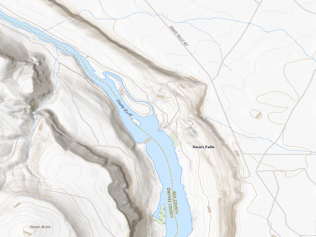
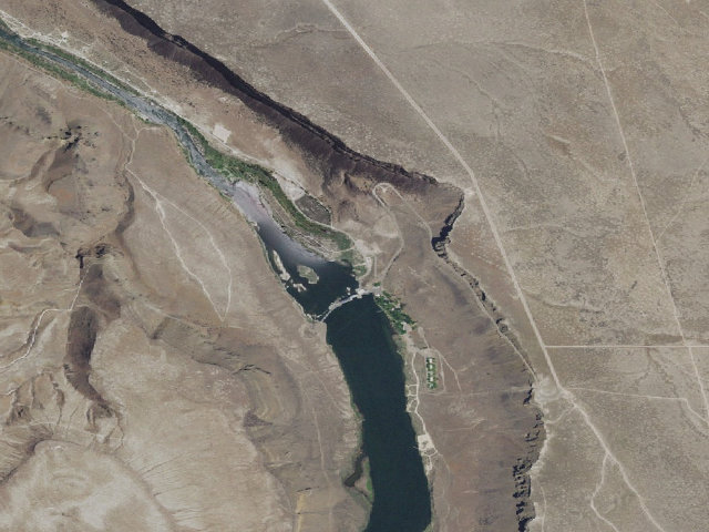
Everything you need — measured from Swan Falls River Access · public land · ID
- GGrocery9 mi
- @Mail9 mi
- +Urgent care12 mi
- LLaundry12 mi
- FFuel12 mi
- RxPharmacy17 mi
- MMechanic17 mi
- HHardware18 mi
- WWater20 mi
- EVEV fast charger24 mi
- OOutfitter24 mi
- AAir-up31 mi
- DDump32 mi
- ShShower51 mi
The read: water is a real 20-mi drive, fuel & food sit about 9 mi out.
Not within 60 mi: Propane. Plan those before you head up.
One dot per need — the nearest of each kind, straight-line from camp. Places from OpenStreetMap (© OpenStreetMap contributors); the EV fast charger from the US DOE station locator. Open in Google Maps ↗
The site — Swan Falls River Access
Nearby & resupply — around Swan Falls River Access · public land · ID (OpenStreetMap)
- Water featureSnake River (river) · nearby
- Nearest townMurphy · ~8.9 mi
- Drinking waternone within 10 mi
- FuelDan's Ferry Services · ~13.0 mi
- Propane / LPGBlue Rhino · ~17.7 mi
- GroceriesAlbertsons · ~16.9 mi
- PharmacyAlbertsons Pharmacy · ~16.9 mi
- Hospital / clinicFamily Medicine Health Center · ~16.8 mi
- HardwareAce Hardware · ~17.7 mi
EV charging — from Swan Falls River Access · public land · ID — nearest public DC fast & Level 2 (US DOE station data)
- Nearest public DC fast charger23.9 mi straight-line N — Kendall Meridian Ford · Blink Network · J1772, CCS · 6 fast ports listed · listed open, last confirmed by AFDC 2026-09-16 · hours: 24 hours daily · directions
- Public DC fast stations within reach4 within 25 mi · 25 within 50 · 31 within 100 · 53 within 150
- Nearest listing NACS (Tesla)24.2 mi — WinCo Foods - Tesla Supercharger, Meridian
- Nearest listing CHAdeMO24.4 mi — Walmart 2508 (Boise, ID) (Boise, ID), Boise
- Nearest public Level 2 (J1772)17.7 mi — Ridley’s Family Markets - Tesla Destination, Kuna, ID · Tesla Destination · J1772, NACS (Tesla) · 4 Level 2 ports listed · listed open, last confirmed by AFDC 2026-08-27 · hours: 24 hours daily. Open to all vehicles.
- Also listed, not counted aboveLevel 2, restricted access — Candlewood Suites Boise Meridian, Meridian, 23.7 mi · J1772 · hours: 24 hours daily; for guest use only · AFDC lists it “$0.40 per kWh”
- Pricing at the fast chargernot listed
- Power (kW)not listed by AFDC — “DC fast” spans roughly 24 to 350 kW, so ask the network.
- Read this honestlyStraight-line miles, like every distance on this site. Roads run longer than this, and you have to get back. We know where a charger is listed. We don’t know if it works today, how fast it is, or the road miles. Check the network before you commit.
Snapshot 2026-09-16 · AFDC record 316568 · US DOE Alternative Fuels Data Center
Nearby restrooms — around Swan Falls River Access · public land · ID — pit toilets, restrooms & rest areas (government data)
- RestroomDedication Point Toilet 1 · ~2.3 mi N · BLM
- RestroomDedication Point Toilet 2 · ~2.3 mi N · BLM
- RestroomSwan Falls Fisherman'S Point Toilet · ~2.6 mi NW · BLM
- RestroomSwan Falls River Canyon Trailhead Toilet · ~3.9 mi NW · BLM
Open Swan Falls River Access elsewhere
Other camps near Swan Falls River Access
If this one is full, gated or washed out.
- Rabbit Creek Ohv Trail~9.2 mi
- Morley Nelson Snake River Birds Of Prey National Conservation Area~10.9 mi
How we know this — Swan Falls River Access
What we don’t know about Swan Falls River Access
A land record can put you within a few meters of a spot. It cannot tell you any of this — so check it yourself, and treat anything below as the open question it is.
- Road surface & last-mile access
- How many rigs actually fit
- Cell coverage by carrier
- Seasonal & winter access
- Current fire restrictions
- Whether any water here is drinkable
- Shade & wind exposure
- Noise and who else shows up
- Whether a listed EV charger works today, or the road miles to it