Agency-listedUSFS · dispersedUnpriced · confirm
Thunderbird Lake
Dispersed · U.S. Forest Service · MN · 47.59481, -91.09172
Ask an AI about this campsiteOpens Grok already loaded with this site. It reads the same records this page is built from, and links whatever it tells you.
Ask about this camp →U.S. Forest Service lists this site. On most of their ground you can camp away from developed sites pretty much anywhere — so treat this as a known-good spot, not the only one allowed. The unit sets stay limits and how far off road and water you must be. What changes is conditions — roads, gates, closures, fire rules. Check those with the unit before you commit to the drive.
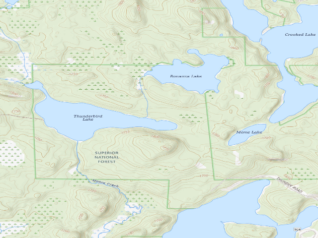
USGS topo — contours & terrain
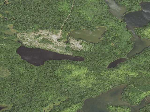
Aerial — USGS / NAIP
Weather outlook — at Thunderbird Lake
Loading the latest forecast…
Live NWS area forecast (~2.5 km grid, not elevation-corrected). Camp sits at 1,710 ft.
Fire & smoke — around Thunderbird LakeNIFC · AirNow
Checking active fires & air quality…
Active wildfires from NIFC (within ~50 mi); air quality from AirNow. Always confirm current fire restrictions with the managing office before you go.
Everything you need — measured from Thunderbird Lake · Superior National Forest · MN
▲ your camp. Rings are 15, 30 and 60 straight-line miles; bearings are approximate and roads run longer.
Nearest of each
- @Mail10 mi
- WWater10 mi
- ShShower11 mi
- LLaundry11 mi
- FFuel12 mi
- GGrocery12 mi
- OOutfitter12 mi
- MMechanic15 mi
- HHardware22 mi
- +Urgent care22 mi
- DDump36 mi
- RxPharmacy37 mi
≤30 mi30–4545+water
The read: water's a short hop out, fuel & food sit about 12 mi out.
Not within 60 mi: Propane. Plan those before you head up.
One dot per need — the nearest of each kind, straight-line from camp. Places from OpenStreetMap (© OpenStreetMap contributors); the EV fast charger from the US DOE station locator. Open in Google Maps ↗
The site — Thunderbird Lake
Access
Dispersed
Land
U.S. Forest Service · dispersed
Elevation
1,710 ft
State
MN
Coordinates
47.59481, -91.09172
Cost
Unpriced — no source gives a price; assume it may cost something and confirm before you go
Nearby & resupply — around Thunderbird Lake · Superior National Forest · MN (OpenStreetMap)
- Nearest townFinland · ~13.6 mi
- Drinking waternone within 10 mi
- FuelCircle K · ~11.8 mi
- Propane / LPGnone within 31 mi
- GroceriesCircle K · ~11.8 mi
- Hospital / clinicBay Area Medical Clinic · ~22.1 mi
- HardwareIsak Hansen Lumber & Home Center · ~21.6 mi
Nearby restrooms — around Thunderbird Lake · Superior National Forest · MN — pit toilets, restrooms & rest areas (government data)
- Vault / pit toiletNinemile Lake Boat Access · ~1.4 mi SE · USFS
- Vault / pit toiletNinemile Lake Campground · ~1.4 mi SE · USFS
- Vault / pit toiletHogback Lake Carry Down · ~4.0 mi NW · USFS
- Vault / pit toiletHogback Lake Fishing Pier · ~4.0 mi NW · USFS
Coming out here — Thunderbird Lake · Superior National Forest · MN
- No surface water within about a mile and a half in our records — which is not proof there is none, only that we found none. Plan to carry washing water as well as drinking water.
- Assume no services at all. Most dispersed camping in a national forest has none: no tap, no power, no dump, often no toilet. Everything you need, you bring.
- Power: Dave carries his own — batteries or solar. A generator will run your rig and it is also the thing everybody camped near you can hear.
- Getting online: Dave recommends Starlink. He has had it since SpaceX introduced it, used it for four years living on the road, and it delivers as promised — several hundred nights out, and he can count on one hand the places he could not connect. The cable on his unit runs 150 feet, which is usually all it takes to find enough sky. Starlink → Referral link — Starlink pays Dave $100 in cash if you sign up through it, and that money funds this site and the next trip. It costs you nothing and does not change the recommendation.
Open Thunderbird Lake elsewhere
Other camps near Thunderbird Lake
If this one is full, gated or washed out.
- Ninemile Lake Campground~1.4 mi · fee
- Dam Five Lake Site 1~3.1 mi
- Steer Lake Site #1~3.4 mi
- Scarp Lake Site #2~3.5 mi
The unit that manages Thunderbird Lake
Stay limits, road closures and fire restrictions at Thunderbird Lake are set by Superior National Forest, not by the campsite — check there before you go.
How we know this — Thunderbird Lake
Source
public land records
Confidence
Likely — The record is good enough to put a pin on, but thin in places. Treat the details as a starting point, not gospel.
How it was placed
USFS Recreation Area Activities, activity 'Dispersed Camping', pulled 2026-09-19: https://www.fs.usda.gov/recarea/superior/recarea/?recid=36953 | agency openstatus: none || REVIEW 2026-09-24 (nightshift-verified): VERIFIED 2026-09-24: live page https://www.fs.usda.gov/r09/superior/recreation/thunderbird-lake says 'Site Open' and 'Access to the 2 sites on this lake is a carry down portage on the Eastern tip of the lake. Each has a fire grate and a latrine.' Page prints no coordinate. USGS NHD: our pin is 24 m from 'Thunderbird Lake' (0.39 km2). Wildfire closure Exhibit A lists Tofte district 'None'. Not a duplicate: no pin of any status on this water body or within 2 mi except other pending leads. Water: page says 'Potable water is not available at this site' -- treat/boil lake water. Fee: the page states none either way; fee/fee_verdict left NULL for fee_verdict.py (renders 'price unconfirmed'). camp_type set to 'backcountry' so the map does not default it to 'Drive-up' (build_map.py falls back to 'drive' on NULL); the pin marks the lake, not a surveyed tent pad. Superior NF 'Watch for Wildfire Hazards While Recreating' alert (2026-07-30) applies forest-wide.
Field check
On the agency's books. The land manager inventoried this site, so its existence is not in question — current conditions are. Nobody from here has camped it recently.
What we don’t know about Thunderbird Lake
A land record can put you within a few meters of a spot. It cannot tell you any of this — so check it yourself, and treat anything below as the open question it is.
- Road surface & last-mile access
- How many rigs actually fit
- Cell coverage by carrier
- Seasonal & winter access
- Current fire restrictions
- Whether any water here is drinkable
- Shade & wind exposure
- Noise and who else shows up
- Whether a listed EV charger works today, or the road miles to it
Before you go — Thunderbird Lake
Camping near a reservoir →Water on public land →What “dispersed” means here →Getting unstuck →All field notes →