Twin Bridges Bike Camp (Jessen Park)
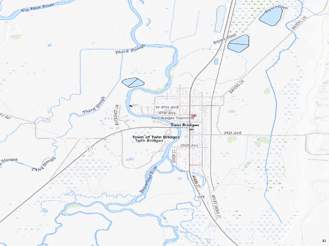
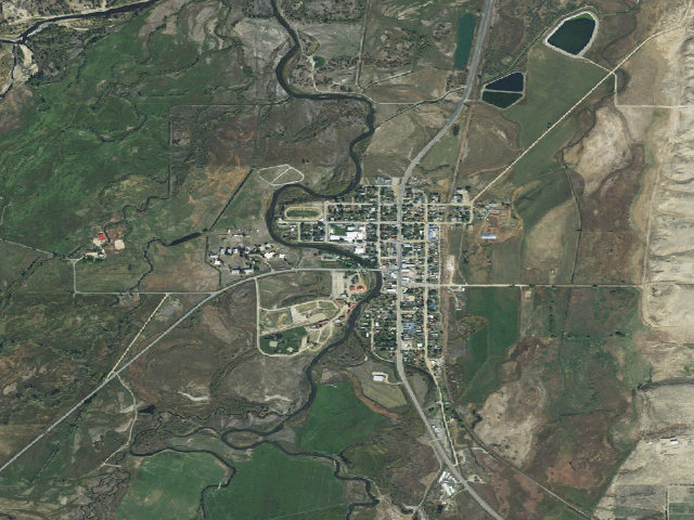
READ THIS FIRST: this one is built for BICYCLE travelers, and the town describes it that way. The Town of Twin Bridges' own page says the bike camp "allows bicyclists to stop for a quick break, spend the night, take a hot shower, or refuel their stomaches." It never says whether drivers or RVs may stay, and there is no posted night limit or season. If you are not on a bike, call the town office first at (406) 684-5243 rather than assuming. For cyclists on the MT-41 / Adventure Cycling corridor this is a gem: a purpose-built camp shelter at Jessen Park on the Beaverhead River, put up by the town in 2009, with level tent ground, an indoor seating and kitchen area, bike repair stands, a toilet, and a hot shower. No fee is charged, but donations are asked for: "Donations are requested for the maintenance of the bike camp. There is a drop box and envelopes inside the bike camp building for your convenience." A town of 400 people built and maintains this for travelers -- use the drop box. Watch for lawn sprinklers on the camping grass (the mappers who surveyed it flag that specifically). Confirm current rules with the town office before you go. We have not visited this site.
Everything you need — measured from Twin Bridges Bike Camp (Jessen Park) · public land · MT
- @Mail0 mi
- OOutfitter9 mi
- GGrocery9 mi
- FFuel9 mi
- MMechanic25 mi
- DDump26 mi
- LLaundry27 mi
- ShShower30 mi
- +Urgent care31 mi
- RxPharmacy31 mi
- EVEV fast charger31 mi
- WWater32 mi
- HHardware32 mi
- AAir-up32 mi
The read: water is a real 32-mi drive, fuel & food sit about 9 mi out, the nearest EV fast charger is a 31-mi run (and back).
Not within 60 mi: Propane. Plan those before you head up.
One dot per need — the nearest of each kind, straight-line from camp. Places from OpenStreetMap (© OpenStreetMap contributors); the EV fast charger from the US DOE station locator. Open in Google Maps ↗
The site — Twin Bridges Bike Camp (Jessen Park)
Nearby & resupply — around Twin Bridges Bike Camp (Jessen Park) · public land · MT (OpenStreetMap)
- Water featureBeaverhead River (river) · nearby
- Nearest townTwin Bridges · ~0.1 mi
- Drinking waternone within 10 mi
- FuelMelrose Bar and Station · ~17.9 mi
- Propane / LPGnone within 31 mi
- Dump station~26.1 mi
- GroceriesIGA · ~9.0 mi
- Hospital / clinicRuby Valley Hospital · ~9.4 mi
EV charging — from Twin Bridges Bike Camp (Jessen Park) · public land · MT — nearest public DC fast & Level 2 (US DOE station data)
- Nearest public DC fast charger31.3 mi straight-line N — Butte, MT - Tesla Supercharger (at a hotel) · Tesla · NACS (Tesla) · 6 fast ports listed · listed open, last confirmed by AFDC 2026-06-18 · hours: 24 hours daily. Open to Teslas only. · directions
- Public DC fast stations within reachnone within 25 mi · 3 within 50 · 23 within 100 · 43 within 150
- Nearest listing CCS34.7 mi — Flying J Town Pump (Butte, MT), Butte
- Nearest listing CHAdeMO65.1 mi — Audi of Bozeman, Bozeman
- Nearest public Level 2 (J1772)25.6 mi — Virginia City Central Parking Lot (at a parking lot) · Non-Networked · J1772 · 2 Level 2 ports listed · listed open, last confirmed by AFDC 2026-05-12 · hours: 24 hours daily
- Pricing at the fast chargernot listed
- Power (kW)not listed by AFDC — “DC fast” spans roughly 24 to 350 kW, so ask the network.
- Read this honestlyStraight-line miles, like every distance on this site. Roads run longer than this, and you have to get back. We know where a charger is listed. We don’t know if it works today, how fast it is, or the road miles. Check the network before you commit.
Snapshot 2026-09-16 · AFDC record 102263 · US DOE Alternative Fuels Data Center
Nearby restrooms — around Twin Bridges Bike Camp (Jessen Park) · public land · MT — pit toilets, restrooms & rest areas (government data)
- Highway rest areaTwin Bridges · at this camp
- Vault / pit toiletHells Canyon Cabin · ~11.1 mi NW · USFS
- Vault / pit toiletMill Creek Campground · ~13.6 mi E · USFS
- Vault / pit toiletBranham Lakes Campground · ~16.8 mi E · USFS
Open Twin Bridges Bike Camp (Jessen Park) elsewhere
Other camps near Twin Bridges Bike Camp (Jessen Park)
If this one is full, gated or washed out.
- USFS dispersed camp — MT #108~9.3 mi
- USFS dispersed camp — MT #754~9.7 mi
- Forest Rd 8306~10.1 mi
- Forest Rd 8306~10.5 mi
How we know this — Twin Bridges Bike Camp (Jessen Park)
What we don’t know about Twin Bridges Bike Camp (Jessen Park)
A land record can put you within a few meters of a spot. It cannot tell you any of this — so check it yourself, and treat anything below as the open question it is.
- Road surface & last-mile access
- How many rigs actually fit
- Cell coverage by carrier
- Seasonal & winter access
- Current fire restrictions
- Whether any water here is drinkable
- Shade & wind exposure
- Noise and who else shows up
- Whether a listed EV charger works today, or the road miles to it