Caribou-Targhee National Forest
Where the camps cluster
The place
The Forest Service describes Caribou-Targhee as over 3 million acres across southeastern Idaho, western Wyoming and a slice of Utah, run out of a supervisor's office in Idaho Falls and split into seven ranger districts: Ashton/Island Park, Dubois, Montpelier, Palisades, Soda Springs, Teton Basin and Westside. The official slogan -- 'From Sawtell Peak to Minnetonka Caves' -- is a fair description of how far apart the ends of this place are. It is really two forests wearing one name. The Targhee half, about 1.64 million acres, is the northern piece: eastern Idaho and northwestern Wyoming, the Henrys Fork country, and the timbered back side of the Teton Range. The Caribou half, about 987,000 acres, is the southern piece, scattered in ranges across southeastern Idaho toward Bear Lake, with pieces reaching into Wyoming and northern Utah. The forest also administers the 47,000-acre Curlew National Grassland.
It borders Yellowstone National Park, Grand Teton National Park and the Bridger-Teton National Forest, and it is one of six national forests inside the roughly 22-million-acre Greater Yellowstone Ecosystem -- described as one of the last remaining large, nearly intact ecosystems in the northern temperate zone. That neighborhood is the whole story here. Caribou-Targhee is the working-country side of Yellowstone: the ground people drive through on the way to the parks, and the ground the parks' animals actually walk out onto. There are roughly 1,600 miles of trail, a lot of it empty on days when the park entrance stations have a line. Underneath it all is the Yellowstone hotspot -- the Island Park and Henrys Fork calderas, rhyolite and welded ash, and the Snake River Plain running off to the southwest like the track it left behind.
History
People have been here roughly 11,000 years, arriving at the tail end of the last Ice Age when small hunting bands were still tracking mammoths and bison. As the climate changed they shifted to plant gathering and seasonal rounds, wintering in villages along the upper Snake River and moving up into the mountains for the summer. The Shoshone-Bannock Tribes, whose treaty rights still connect them to this ground, are among the descendants of those early stewards. One half of the forest carries a Bannock warrior's name: Targhee.
Between about 1810 and 1840 this was fur country, and the Teton Basin -- Pierre's Hole to the trappers -- hosted two of the great Rocky Mountain rendezvous. The 1832 gathering was one of the largest ever held: roughly 400 mountain men, 108 Nez Perce lodges, 80 Flathead lodges and more than 3,000 horses, with William and Milton Sublette, Jim Bridger, Joe Meek, Thomas Fitzpatrick, Nathaniel Wyeth, Benjamin Bonneville and Sacagawea's son Jean Baptiste Charbonneau all on the ground. It ended in a fight on about July 17, 1832, in which at least 26 Gros Ventres were killed, along with perhaps a dozen traders and Flatheads; Milton Sublette took a bullet in the leg that eventually cost him the leg and then his life. By the 1840s the beaver were gone. Through the 1840s and 1850s the Oregon Trail ran along the forest's southern edge near present-day Soda Springs, where the carbonated springs made a welcome oasis for emigrants.
The other half of the name arrived in 1870, when a prospector named Jesse Fairchild -- 'Cariboo Jack' -- struck gold near what is now Caribou Mountain. The rush that followed ran nearly twenty years and produced some $50 million in placer gold, with boomtowns at Keenan City (population 900) and Iowa Bar, later Caribou City (population 1,500). The Oregon Short Line Railroad, completed across Monida Pass in 1880, opened the rest of the country up. The federal land withdrawals started as early as 1891; President Theodore Roosevelt established the Caribou National Forest in 1907, and the Targhee followed in 1908. Grazing has been central ever since -- permits still run around 22,000 cattle and 91,000 sheep across 140 allotments a year. In 1984 Congress designated the forest's two wilderness areas, Jedediah Smith and Winegar Hole. The two forests were later merged into the Caribou-Targhee that exists today.
Wildlife & plants
This is one of the few places in the lower 48 where the full pre-settlement cast is still on the ground. The forest holds grizzly bear and black bear, wolf, elk, moose, mule deer, bison, cougar and pronghorn -- not as a reintroduction showpiece but because it shares a boundary with Yellowstone and Grand Teton and the animals never stopped using it. The 10,715-acre Winegar Hole Wilderness, up against the Yellowstone line in Teton County, Wyoming, exists for essentially one reason: it is considered prime grizzly habitat, and Congress set it aside in 1984 to keep it that way.
The fishing reputation is national. Cutthroat trout water here is called some of the best in the world, and the Henrys Fork of the Snake -- about 127 miles long, fed by Big Springs and the Henrys Lake outlet -- is a dry-fly river people plan years around, particularly the slow, flat, maddening stretch through the old Railroad Ranch. The reach between Henrys Lake and Big Springs is closed to fishing outright, because it is spawning water.
Underground, Minnetonka Cave in the Caribou half serves as a hibernaculum for five bat species, including the Townsend's big-eared bat, which is on Idaho's state list and the Forest Service's species-of-concern list. Tour restrictions there exist to keep white-nose syndrome from getting in.
Notable features
Mesa Falls is the signature. On the Henrys Fork about 15 to 16 miles northeast of Ashton, along the Mesa Falls Scenic Byway (Idaho Highway 47), the river drops twice: Upper Mesa Falls at roughly 114 feet high and 200 feet wide, then Lower Mesa Falls at about 65 feet over a 200-foot-wide ledge of volcanic tuff. Both pour over rock laid down 1.3 million years ago by the Henrys Fork caldera. The Forest Service calls them the last major falls in Idaho never put to work for irrigation or hydroelectric power. The visitor center is the Big Falls Inn, built around 1915 by the Snake River Electric Light and Power Company, later a hotel, cafe and dance hall on the old Yellowstone Highway, now on the National Register of Historic Places.
Big Springs, near Island Park, puts out over 120 million gallons of water a day at a constant 52 degrees and is the only first-magnitude spring in the world known to issue from rhyolite lava flows. It is one of the two sources of the Henrys Fork. Johnny Sack's log cabin, built beside it in 1929, is open to visitors. No fishing -- the trout stack up under the bridge and people feed them out of coin dispensers.
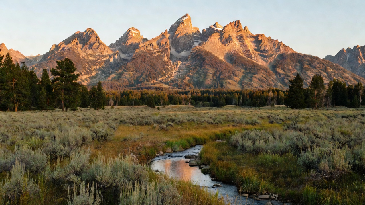
The 123,451-acre Jedediah Smith Wilderness covers the western slopes of the Teton Range against the Grand Teton National Park boundary -- the quiet side of the most photographed mountains in America, reached from Teton Canyon on a five-mile gravel road with trailheads and campgrounds. The Tetons are the youngest range in the Rockies, thrown up by fault movement only six to nine million years ago, and the west slope shows a different rock than the famous east face: Paleozoic and Cenozoic sedimentary layers instead of raw metamorphic and igneous core. Elsewhere: Minnetonka Cave above St. Charles at the north end of Bear Lake, a half-mile of limestone passages open for guided tours from June through Labor Day; the Birch Creek Charcoal Kilns, 1880s infrastructure built to feed the Viola Mine (found 1881, done by 1888); the Upper Palisades Lake trail, a 15-mile out-and-back in the Palisades district; and Mink Creek Recreation Area right outside Pocatello.
Camps are sourced from public U.S. Forest Service recreation data and have not been personally visited. Roads shown are Forest Service passenger-car routes (maintenance level 3–5) and may be seasonal or gated. Always confirm access, fees and fire rules with the ranger district before you go. Found a fee where we show free? Tell us on the contact page.