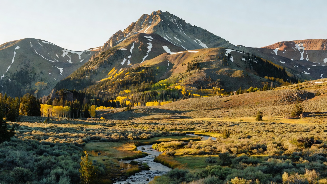
Carson National Forest
Where the camps cluster
The place
The Forest Service puts the elevation range here at 6,000 feet to 13,161 feet, and that spread is the whole story of the place. Come in from the west and you are in dry, open country -- the San Juan Basin and the southern San Juan Mountains, sage and pinyon-juniper, the Jicarilla Ranger District run out of an office in Bloomfield, closer to the oil-and-gas country of the Four Corners than to any alpine postcard. Come in from the east above Taos and you are climbing the Sangre de Cristos, the southernmost reach of the Rockies, through ponderosa and aspen into spruce-fir and finally out onto real alpine tundra, which New Mexico does not have much of. The forest is split into six ranger districts -- Camino Real, Canjilon, El Rito, Jicarilla, Questa and Tres Piedras -- with the supervisor's office in Taos, and most of the ground sits in Rio Arriba and Taos counties with smaller pieces reaching into Mora and Colfax. There are about 330 miles of trails and 86,193 acres of designated wilderness. For camping, the Carson runs close to 30 campgrounds spanning that same gradient, from pinyon-juniper flats up to high-elevation spruce, fir and aspen, and the stay limit on the forest is 14 days -- consecutive or not -- within any 45-day period.
History
The forest was established July 1, 1908, out of a merger of the old Taos National Forest and part of the Jemez National Forest, and it carries the name of Kit Carson, the frontiersman who spent his later years in Taos. The most important thing that ever happened on this forest, though, was giving land back. When the mountains above Taos Pueblo were pulled into the national forest system in the early 1900s, that took in Blue Lake -- water the Pueblo holds sacred, the place their ancestors live. The Pueblo fought for it for decades, framed the fight as a matter of religious freedom, and won: on December 15, 1970 President Richard Nixon signed Public Law 91-550 returning roughly 48,000 acres of that mountain land to Taos Pueblo, with another 764 acres transferred in 1996. It is generally counted the first major victory of the modern land-back movement. Don't go looking for the lake -- it is closed to outsiders, and the Pueblo themselves go up only for ceremony. A different kind of transfer built the forest's northeast corner: in 1982 the Pennzoil corporation donated the Valle Vidal, better than 100,000 acres of old Maxwell Land Grant elk country that had been a private hunting preserve, to the American public. When El Paso Corporation petitioned in 2002 to lease 40,000 acres of it for coalbed methane, the backlash was broad enough that Congress simply took the Valle Vidal off the table for oil and gas in 2006.
Wildlife & plants
The Carson holds the standard southern-Rockies big game -- mule deer, elk, black bear, cougar and bighorn sheep -- across something like four hundred miles of mountain streams. The elk are the headliner: the Valle Vidal alone carries a herd of roughly 2,500, along with black bear, wild turkey, bobcat, and bison that wander in off the neighboring Vermejo Park Ranch. Up in the Wheeler Peak Wilderness the country turns genuinely arctic -- marmots and pikas in the talus, golden eagles overhead, and Rocky Mountain bighorn sheep that were reintroduced to that range in 1993, with bristlecone pine, Engelmann spruce and subalpine fir hanging on below the tundra line. The fish worth knowing is the Rio Grande cutthroat trout, New Mexico's state fish and a native of Rio Grande tributaries in northern New Mexico and southern Colorado. It is in real trouble -- rated vulnerable, and a candidate for Endangered Species Act listing from 2008 to 2014 -- and Comanche Creek in the Valle Vidal is one of the streams that still has it. Two notes for anyone planning around wildlife: the Valle Vidal closes seasonally for the animals' sake, the east side January 1 through March 31 and the west side May 1 through June 30, and the alpine zone up on Wheeler is fragile enough that the Forest Service asks you to stay on the tread.
Notable features
Wheeler Peak is the obvious one. At 13,161 feet it is the state high point, and it was called Taos Peak until 1950, when it was renamed for Major George Montague Wheeler, who ran the great southwestern survey of the 1870s. Its neighbor Mount Walter, 13,141 feet, is the second-highest named summit in New Mexico. You can take the north ridge up from the Taos Ski Valley parking lot over Mount Walter, or the gentler switchbacked Williams Lake trail finished in 2011, or come in the long way from Red River on Trail 91, about seven miles past Lost Lake and Horseshoe Lake. The 19,154-acre Wheeler Peak Wilderness around it is the most heavily used wilderness on the forest, so it is not where you go for solitude. For that, look at the other five. Columbine-Hondo, 43,706 acres, is the forest's newest -- a wilderness study area since 1980 that finally got designated on December 19, 2014 -- and it holds the headwaters of the Rio Hondo and the Red River under Gold Hill, 12,710 feet, and Lobo Peak, 12,113 feet. Latir Peak, 20,405 acres north of Questa, is deep forest broken by meadows and streams with alpine tundra on top and Venado Peak at 12,734 feet; most people walk in from Cabresto Lake. Cruces Basin, 18,867 acres down near the Colorado line, is the smallest wilderness on the Carson and has no designated trails at all -- a 1979 fire took out the old timber and left aspen and grassy parks, and the creeks hold brook, brown and rainbow trout. The Carson also manages roughly 25,000 acres of the big 250,020-acre Pecos Wilderness with the Santa Fe National Forest to the south, and a 2,949-acre slice of the Chama River Canyon Wilderness in the west, where the Wild and Scenic Rio Chama runs under colorful sandstone bluffs and draws rafters and canoeists. On pavement, the Enchanted Circle Scenic Byway makes an 84-mile loop out of Taos on US 64, NM 522, NM 38 and NM 434 through Questa, Red River, Eagle Nest and Angel Fire -- it circles Wheeler Peak, and the Forest Service named it a National Forest Scenic Byway back on December 14, 1989. Off US 84 about 15 miles north of Abiquiu, Echo Amphitheater is a natural sandstone bowl with a short paved path and a picnic ground, and it throws your voice back at you, which never gets old. And three ski areas sit on or against this forest -- Taos Ski Valley, Red River and Sipapu -- so winter here is a season, not a shutdown.
Camps are sourced from public U.S. Forest Service recreation data and have not been personally visited. Roads shown are Forest Service passenger-car routes (maintenance level 3–5) and may be seasonal or gated. Always confirm access, fees and fire rules with the ranger district before you go. Found a fee where we show free? Tell us on the contact page.