Chequamegon-Nicolet National Forest
Where the camps cluster
The place
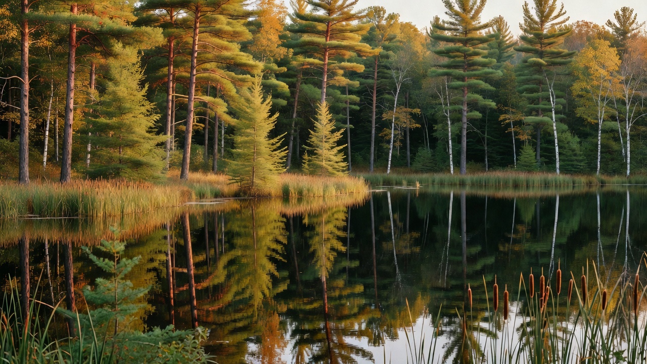
Chequamegon-Nicolet National Forest is the Northwoods of northern Wisconsin -- more than 1.5 million acres of National Forest System land scattered across eleven counties and 65 townships, inside an administrative boundary that takes in around two million. It comes in two halves that were separate forests for most of their lives: the Chequamegon side in the west, roughly 858,400 acres across Ashland, Bayfield, Sawyer, Price, Taylor and Vilas counties, and the Nicolet side in the east, nearly 661,400 acres across Florence, Forest, Langlade, Oconto, Oneida and Vilas. Today the Forest Service runs it as one forest in two zones and five ranger districts -- Lakewood-Laona and Eagle River-Florence in the east, Medford-Park Falls, Great Divide and Washburn in the west -- out of a supervisor's office in Rhinelander. The landscape is what the last glacier left behind: uplands and glacial lakes, bogs, wetlands, muskeg, rivers and streams, pine savanna and meadow. The woods are a northern mix -- sugar, red and mountain maple, white, red and black oak, aspen, beech, basswood and birch, with red, white and jack pine, white spruce and balsam fir; eastern hemlock reaches the westernmost limit of its range here. This is also working forest, and honestly so: the Forest Service calls it often one of the top timber-producing national forests in the country, selling on the order of 130 to 150 million board feet a year, 30 to 40 million of that through a Good Neighbor Authority agreement with the state. And it is treaty country -- the forest sits on land ceded by treaty, with eleven American Indian tribes retaining harvesting rights on it.
History
The short version of how this forest happened: the Northwoods were cut down, and nobody wanted the leftovers. The Forest Service tells it plainly on its own history page -- the nation had been drawing on its forests for more than a century, and by the late 1800s and early 1900s the Great North Woods were virtually non-existent. European immigrants moved onto the stumps to farm, the soil and the economy did not cooperate, and many farmers in northern Wisconsin could not afford the taxes on their lands during hard times, so they forfeited or abandoned them to the county governments. The counties sold that ground to the federal government, and, in the agency's own words, the Chequamegon and Nicolet National Forests were born in the 1930s from those over cut, burned over, and farmed out lands. Both were created in the same year by two different presidents: Nicolet on March 2, 1933, under Herbert Hoover, and Chequamegon on November 13, 1933, under Franklin Roosevelt. Then came the young men of the Civilian Conservation Corps, who replanted thousands of acres by hand and built the recreation sites people still use -- the Mondeaux Dam Recreation Area went up between 1933 and 1938 by CCC Camp Mondeaux River, and Anvil Lake Campground was built by CCC Camp Nine Mile. That history is still visible in the trees: the CCC pine plantations are 70 or more years old now and grow even-aged, all one cohort, because they all went in the ground at once. The two forests were joined under a single administration and have been managed as one unit since 1998. The names are older than any of it. Chequamegon comes to us secondhand -- chagaouamigoung, a French transliteration of the Ojibwe Zhaagawaamikong, meaning roughly 'sand bar place; at the sand bar; strip of land running into a body of water,' the name of the Lake Superior bay off to the northwest, where a village grew in the mid-1600s among Petun, Huron and Ottawa people fleeing the Beaver Wars after 1649; French fur traders reached it around 1658 and Jesuit missionaries in the 1660s. Nicolet honors Jean Nicolet, the French coureur des bois who came to Quebec in 1618 and headed west in July 1634, credited as the first European to explore Lake Michigan and the first to set foot in Wisconsin -- the man who, the story goes, stepped ashore at Green Bay in a silk robe firing a pistol in each hand. He drowned when his boat capsized near Quebec City on October 29, 1642. The popular version has him expecting to meet the Chinese; historians note there is no contemporary evidence he thought any such thing.
Wildlife & plants
This is black bear, gray wolf and white-tailed deer country, with bald eagles over the water and common loons calling on the glacial lakes -- and wolves are here because they came back on their own after protection in the 1970s. Moose turn up occasionally, never reliably. The animal worth knowing about is the elk. Wisconsin's native eastern elk were gone by the late 1800s, and in 1995 the state released 25 Rocky Mountain elk near Clam Lake, in what is now this forest's Great Divide District. They stuck. A second reintroduction started in 2015, and the Wisconsin DNR now puts the Northern Elk Herd at roughly 383 animals with the statewide population over 400 -- which means if you are camped in the Clam Lake country in September, you have a real chance of hearing a bull bugle. The plant list runs to the same northern mix as the woods themselves: maple, oak, aspen, beech, basswood, birch and sumac in the hardwoods, red, white and jack pine with white spruce and balsam fir in the conifers, and eastern hemlock at the far western edge of where it grows at all. The bogs and muskeg are their own world, and the lakes are the reason most people come -- this is serious northern-Wisconsin fishing water.
Notable features
Five wilderness areas totaling more than 44,000 acres are the quiet end of this forest. Headwaters is the biggest at more than 18,000 acres, sixteen miles southeast of Eagle River in Forest County, and holds some of the largest and oldest trees on the forest. Blackjack Springs, about 5,800 acres northeast of Eagle River, is built around four large crystal-clear springs that form the headwaters of Blackjack Creek. Whisker Lake, roughly 7,500 acres west of Florence on the Michigan line, took its name from the big pines along the lakeshore. Over on the Chequamegon side near Drummond, Porcupine Lake covers 4,446 acres of rolling hills in oak, maple, hemlock and white pine, and Rainbow Lake's 6,583 acres are laced with the narrow-gauge railroad grades that hauled logs out in the early 1900s. Two national scenic trails cross the forest. The North Country National Scenic Trail runs 61.4 miles here -- 27.5 on the Washburn district and 33.9 on Great Divide -- over flat to gently rolling ground, largely following those same old logging railroad beds past Wishbone, Reynard, Bufo, Rainbow and Tower lakes, with about two miles along the north shore of Lake Owen. The Ice Age National Scenic Trail, 1,200 miles tracing Wisconsin's terminal moraine and the kettles, eskers, kames and erratics the glacier left, crosses the national forest too. For history you can walk up to, the Round Lake Logging Dam sits on the South Fork of the Flambeau River about eighteen miles east of Fifield -- an earth-and-timber dam from around 1880 whose sluice gates flushed logs downriver toward the mills at Eau Claire and beyond on the Mississippi. It is the only known surviving logging dam in northern Wisconsin, a piece of 1880s backwoods engineering, listed on the National Register of Historic Places on September 17, 1981, and partially reconstructed since. Add the CCC-built Mondeaux Dam Recreation Area, and note that the public land does not stop at the forest boundary: the Forest Service counts more than 2.5 million acres of publicly owned property in this region once state and county forests are included.
Camps are sourced from public U.S. Forest Service recreation data and have not been personally visited. Roads shown are Forest Service passenger-car routes (maintenance level 3–5) and may be seasonal or gated. Always confirm access, fees and fire rules with the ranger district before you go. Found a fee where we show free? Tell us on the contact page.