Cibola National Forest
Where the camps cluster
The place
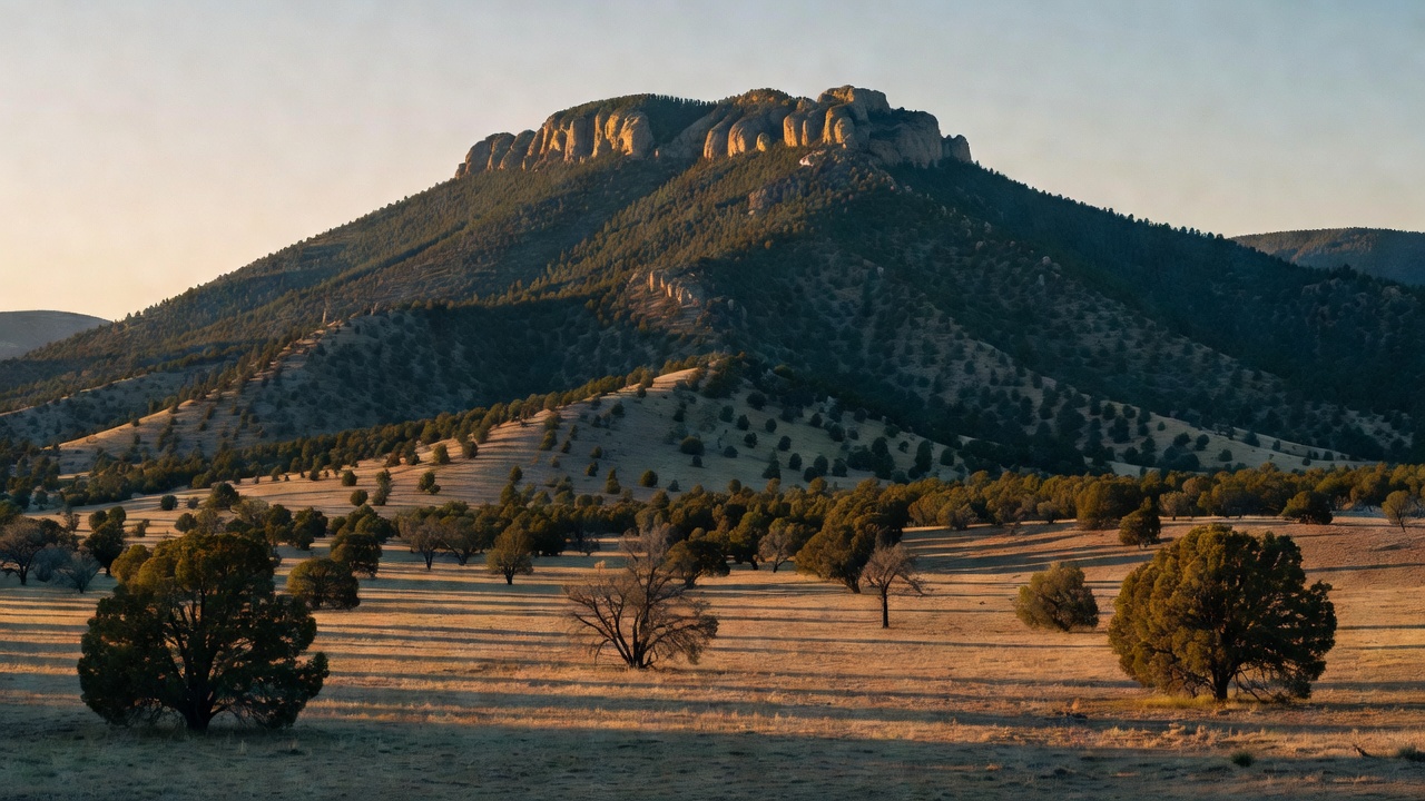
Cibola National Forest is a forest of islands. Instead of one continuous green block, it is a scatter of separate mountain ranges -- the Sandia, Manzano, Zuni, San Mateo, Magdalena, Datil, Bear and Gallina mountains, plus Mount Taylor -- standing up out of the surrounding desert and high plains of central and northwestern New Mexico. The Forest Service itself calls its four New Mexico districts (Sandia, Mountainair, Mt. Taylor and Magdalena) 'sky island' districts, and that is exactly what they are: each range is its own stacked world of climate, running from grassland and pinyon-juniper at the bottom through ponderosa pine and mixed conifer to spruce and fir on top. Elevations across the forest run from around 5,000 feet to just over 11,300 feet at the summit of Mount Taylor. The personality swings just as hard as the elevation: the Sandia district is a mountain wilderness with a tramway and a paved crest road hanging directly above New Mexico's biggest city, while the Magdalena district to the south is big, dry, empty country where you can drive dirt roads for a long time without meeting anyone. Add the four national grasslands the forest administers out on the plains of three states, and 'Cibola' can mean an alpine ridge over Albuquerque or open shortgrass prairie hundreds of miles away.
History
The name comes from the Zuni. 'Cibola' is generally understood as a Spanish rendering of a native name for the Zuni pueblos and their lands, and it is tangled up with one of the great wild-goose chases of North American history: the legendary Seven Cities of Cibola, the cities of gold that drew Francisco Vazquez de Coronado north in 1540. What Coronado actually found and attacked that year was the Zuni pueblo of Hawikuh -- no gold, just adobe. (Spanish interpreters later attached the same word to the buffalo, which adds a third layer to the confusion.) People have lived in this country far longer than any of that; archaeological evidence of human presence in the region goes back on the order of 14,000 years. The Spanish left their names on the ranges: the Sandias are the 'watermelon' mountains, and the Manzanos take their name from the apple orchards planted at the village of Manzano below them. The 1800s brought Apache resistance under leaders including Cochise, Geronimo and Victorio, then, after the Apache Wars, a mining rush into the Magdalenas chasing gold, silver and copper. Mount Taylor was renamed in 1849 for the sitting president, Zachary Taylor. Cattle came too: the Beefsteak Trail, a 125-mile driveway that ran herds toward the railhead at Magdalena, was in use from 1865 and was not officially closed until 1971. The national forest itself was established on December 3, 1931, assembled out of lands that had been set aside as forest reserves back in the late 1800s.
Wildlife & plants
The sky-island layout means the wildlife changes with elevation as much as with location. Black bear, mountain lion and mule deer range the wooded ranges, elk are a headline animal on the Mount Taylor country, pronghorn work the open grassland and plains, and wild turkey are common in the pinyon-juniper and ponderosa. Birds of prey do well here -- eagles, hawks and owls -- and the forest is habitat for the Mexican spotted owl, the threatened southwestern owl of shady canyons and old mixed-conifer stands. The vegetation stacks up the way it does on every range: the Sandias alone climb through four recognized life zones, from desert grassland at the base up through ponderosa pine, then mixed conifers, and finally Engelmann spruce and fir along the crest. In the wilderness areas to the south, pinyon and juniper on the lower slopes give way to spruce, fir and aspen up high. Water is the limiting factor across most of the forest, so springs and the few reliable creeks concentrate animals -- and, in season, an outsized share of the birdlife.
Notable features
The signature landmark is Sandia Crest, about 10,679 feet, standing over Albuquerque and reached either by the paved NM 536 crest road (a National Scenic Byway that ends at the Crest House) or by the Sandia Peak Tramway -- a 2.7-mile aerial cable ride that climbs more than 4,000 feet in roughly fifteen minutes and ranks among the longest tramways in the world. The Sandias are a fault block heaved up along the Rio Grande Rift within the last ten million years, with a core of pink Sandia granite dated to about 1,453 million years old and a cap of roughly 300 feet of Pennsylvanian limestone and sandstone full of marine fossils -- ancient seafloor now sitting two vertical miles above the desert. The forest holds four wilderness areas: Sandia Mountain (about 37,200 acres), Manzano Mountain (about 36,875 acres, with roughly 64 miles of trail including a 22-mile crest traverse), Withington (about 19,000 acres), and Apache Kid (44,626 acres in the San Mateo Mountains, with some 68 miles of trail). Mount Taylor, at just over 11,300 feet, is a dormant stratovolcano and the forest's roof, sacred to the Navajo as Tsoodzil and to the Acoma, Laguna, Zuni and Hopi peoples -- a living cultural landscape, not just a summit to bag. In the Magdalenas, South Baldy (about 10,783 feet, the highest point in Socorro County) carries the Langmuir Laboratory for Atmospheric Research and the Magdalena Ridge Observatory. Smaller pleasures are worth knowing too: Fourth of July Canyon in the Manzanos is famous for its bigtooth maples and a genuine red-and-orange fall color show, which is not what most people expect to drive to in central New Mexico. And well east of all of it, the Cibola administers the Kiowa, Rita Blanca, Black Kettle and McClellan Creek national grasslands out on the plains.
Camps are sourced from public U.S. Forest Service recreation data and have not been personally visited. Roads shown are Forest Service passenger-car routes (maintenance level 3–5) and may be seasonal or gated. Always confirm access, fees and fire rules with the ranger district before you go. Found a fee where we show free? Tell us on the contact page.