Cleveland National Forest
Where the camps cluster
The place
Cleveland spreads across San Diego, Riverside and Orange counties in three non-contiguous districts, and knowing which one you're in matters more here than on most forests. The Trabuco Ranger District is the northernmost, covering the Santa Ana Mountains along the Orange/Riverside county line. The Palomar Ranger District sits in northern San Diego County. The Descanso Ranger District lies entirely within San Diego County, east of Alpine. The supervisor's office is in San Diego, on Rancho Bernardo Road. Three districts, three different sets of dispersed-camping rules -- more on that below, because it is the thing that trips people up.
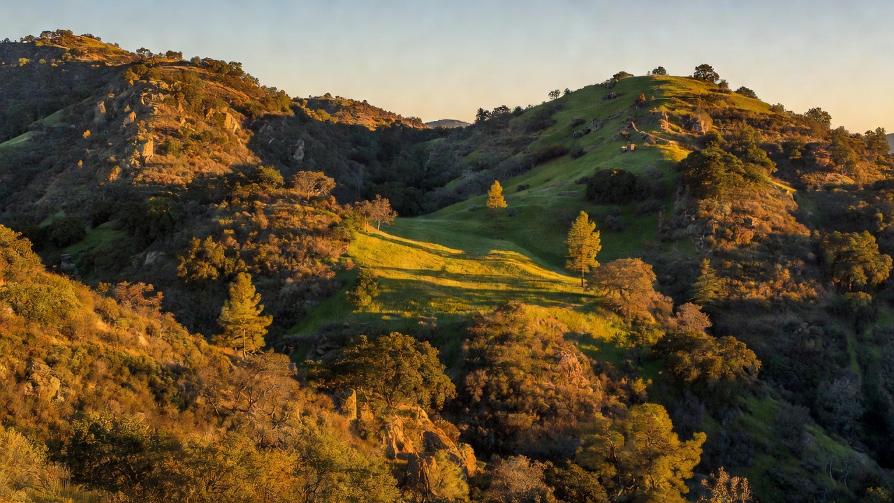
Reset what "forest" means before you come. The dominant cover here is chaparral, with coastal sage scrub, arroyos, high desert, meadows, oak woodland and riparian pockets near water; real conifer forest shows up mostly on the high ground at Palomar and in the Lagunas. The climate is what the record calls a "generally warm and dry, inland-Mediterranean climate," with frost and snowfall at the higher elevations in the cooler months. That last part surprises San Diegans every winter: the Laguna Mountains are one of the few places within easy reach of the coast that reliably gets snow, and sledding and snowshoeing are genuine local activities up there. Shade, though, is a local event out here, not a general condition. Plan water accordingly.
The developed side is modest. The forest's own recreation listing runs to about twenty campgrounds -- Blue Jay, Boulder Oaks, Burnt Rancheria, Cibbets Flat, Corral Canyon, Dripping Springs, El Cariso, Bobcat Meadow, Crestline Group and Atáxam Mámta'ash among them. Reservations run through Recreation.gov. Sites are generally sized for six to eight people and two vehicles. A National Forest Adventure Pass -- the regional pass shared by the Angeles, Cleveland, Los Padres and San Bernardino forests -- is required for parking at many locations; the region's own wording is that visitors "will be required to display the Pass in their vehicles when using the Forest for recreation purpose." You don't need one traveling through without stopping, or for what the region calls "activities incidental to through travel (stretch break, photo-opportunity, use a restroom)," or where a site-specific fee is already charged. America the Beautiful interagency passes are accepted everywhere the Adventure Pass is.
Now the two rules that make this forest different. First, campfires: the forest states that "wood or charcoal fires are never allowed outside of developed campgrounds or picnic sites." Not seasonally -- never. Portable stoves burning gas or other liquid fuels are permitted unless fire conditions prohibit them. If your camping plan involves a fire ring you build yourself, that plan does not work here.
Second, dispersed camping needs paperwork. All three districts offer remote camping, but the forest requires a permit for most of it: on Descanso, a "permit required for areas outside of the Laguna Recreation Area"; on Palomar, "permits required for all backcountry locations"; and on Trabuco, remote camping is "allowable only in the San Mateo Canyon Wilderness, permit required." The forest asks for two days of processing and says permits needed for the weekend should be submitted by close of business Thursday. The stay limit is stricter than the usual national-forest fourteen days, too, and worth reading twice: "You may camp a maximum of 14 consecutive days in a calendar year." Sort the permit out first, then pack. And check current restrictions before you go -- this is a forest that closes roads and burned areas regularly.
History
Cleveland National Forest was created on July 1, 1908, when President Theodore Roosevelt consolidated the Trabuco Canyon National Reserve and the San Jacinto National Reserve into a single unit. He named it after Grover Cleveland, the president who had done a great deal of forest-reserve setting-aside himself. It is one of the few national forests named for a president, and the only one carrying that particular name.
The people who were here first are still here. The Kumeyaay, Payomkawichum, Cahuilla and Cupeno peoples historically inhabited this country, and many of the forest's trails follow routes they established. Kumeyaay territory alone ran from what is now Oceanside south past Ensenada in Baja California and east to the Colorado River, organized as the 'Iipai in the north, the Tiipai in the south and the Kamia in the eastern desert, with the San Diego River loosely dividing the first two. Thirteen federally recognized Kumeyaay reservations exist in San Diego County today -- Barona, Viejas, Sycuan, Campo, Santa Ysabel, San Pasqual, Jamul, La Posta, Manzanita, Mesa Grande, Inaja and Cosmit, and Ewiiaapaayp among them. You are not camping in an emptied landscape. You are camping in the middle of thirteen sovereign nations' back yard.
One episode on this forest deserves telling. In 1964, Acjachemen leader Clarence H. Lobo, objecting to the federal government's proposed settlement terms for California Indian land claims, sent President Lyndon B. Johnson $12.50 -- twenty-five acres at the fifty cents an acre the government was offering -- and established a camp at Upper San Juan Campground to make the point. It is one of the sharpest pieces of political theater in the history of American public land, and it happened at a Forest Service campground.
Wilderness came late and came in a rush. The Agua Tibia Wilderness was added to the National Wilderness Preservation System on January 5, 1975 under Public Law 93-632. Then the California Wilderness Act of 1984 -- Public Law 98-425, signed September 28, 1984 -- created three more in a single stroke: San Mateo Canyon, Pine Creek and Hauser. Four wildernesses, and the newest of them is older than most of the people hiking in them.
And then there is fire, which on this forest is not a footnote but the main text. The Cedar Fire started October 25, 2003 in the Cuyamaca Mountains within this forest, burned until November 5, and covered 273,246 acres. It killed fifteen people -- fourteen civilians and one firefighter -- destroyed 2,820 buildings, wiped out the entire community of Cuyamaca and most of Cuyamaca Rancho State Park, and caused over $1.3 billion in damage. It was the largest wildland fire in California history at the time; by July 2023 it had slipped to tenth largest, which tells you more about the two decades since than it does about the Cedar Fire. It remains the state's sixth deadliest and fourth most destructive. The cause was a signal fire lit by a lost hunter that got away from him. The 2007 Santiago Fire took another 6,701 acres. The 2024 Airport Fire burned 23,526 acres and started accidentally during fire prevention activities -- and damaged the radio infrastructure on top of Santiago Peak on its way through. A fire year here is not an anomaly. It is the climate you are camping in.
Wildlife & plants
This is one of the most biologically crowded corners of the national forest system, and the reason is uncomfortable: it is also one of the most urbanized. Southern California's coastal scrub and chaparral have been built over almost everywhere else, so a great many rare species are pinned against this forest's boundary with nowhere further to go.
The arroyo toad is the one to know. Listed as endangered on December 16, 1994, it needs "narrow and shallow aquatic and riparian areas with slow moving water as well as nearby upland areas" -- sandy, fine-gravel streambeds with pliable soils and scattered vegetation, the kind of low-gradient creek bottom that is also exactly where people like to camp and drive. Its threats read like a list of everything humans do to a creek: "non-native predators and plants, disease, water withdrawals, agricultural and urban development, pollution, and natural disturbances (e.g., drought and climate change)." This is the practical reason some campgrounds and creek crossings close seasonally. Take the closures seriously -- a truck in the wrong wash in spring is a population-level event for an animal this scarce.
The Quino checkerspot butterfly was listed as endangered in 1997, by which point more than 75 percent of its historical range was already gone. It survives in western Riverside and San Diego counties and northern Baja California -- essentially this forest and its neighbors -- in "patchy shrub or small tree landscapes with openings of several meters between large plants," laying eggs on dwarf plantain, white snapdragon, woolly plantain and Chinese houses. It is a small orange-and-black checkerspot that most people would walk past. Offshore, the Southern California steelhead is listed as endangered across the stretch of coast this forest stands behind -- the distinct population segment runs from the Santa Maria River south to the U.S.-Mexico border -- a sea-run rainbow trout that still tries to climb creeks in one of the most dammed and diverted landscapes on earth.
The plant life is where this forest gets genuinely interesting, and it is mostly a chaparral story: chamise and scrub oak on the slopes, coastal sage scrub lower down, oak woodland threading the stream bottoms. The standout is in the Agua Tibia Wilderness, where a 480-acre Research Natural Area protects bigcone Douglas-fir and canyon live oak forest. Bigcone Douglas-fir is a relict species endemic to Southern California -- a leftover from a cooler, wetter past that hangs on in steep, fire-sheltered draws and nowhere else on the planet. Agua Tibia also shelters rare and endemic plants including Nevin's barberry, rainbow manzanita and Vail Lake ceanothus. Up on Palomar Mountain the cover turns to oak and conifer -- pine, cedar and fir, with California black oaks and closed-cone pines at the top and ferns underneath, which does not feel like San Diego County at all until you remember how high you have driven.
Notable features
Santiago Peak is the forest's landmark, at 5,689 feet the "highest and most prominent peak of both the Santa Ana Mountains and Orange County," with 4,387 feet of topographic prominence. Together with Modjeska Peak at 5,496 feet it forms Saddleback Ridge, visible from much of Southern California and the reason locals call the whole thing Old Saddleback. The Acjachemen call the peak Kalawpa, and the nearby village name Alume means "to raise the head in looking upward." Be warned that the summit is an antenna farm -- microwave towers providing radio coverage across five counties -- and you have to walk a quarter-mile around the perimeter to get the full view. Snow falls on it at least once in most winters. The Santa Anas run about 61 miles southeast of the Los Angeles Basin, and much of the range sits inside the Trabuco Ranger District. The way in for most people is State Route 74, the Ortega Highway, which also holds the less appealing distinction of being called one of the most dangerous highways in the state. Drive it like that is true.
The Pacific Crest Trail starts here. Its southern terminus sits next to the Mexico-United States border just south of Campo, and from that monument the trail runs 2,653 miles to Canada. The forest leads with this on its own homepage -- "Starting line of the PCT" -- and it is not overselling. The Laguna Mountains carry the trail north from there along what is described as "the southernmost crest along the Pacific Crest Trail," a range running roughly 35 miles northwest-southeast, topping out at Cuyapaipe Mountain at 6,381 feet, with perennial water in Noble, Cottonwood and Kitchen creeks. From vantage points like Inspiration Point the ground simply falls away east into the Anza-Borrego desert with the Vallecito and Santa Rosa mountains beyond. If you want one drive on this forest, that is the one.
San Mateo Canyon Wilderness is the big one at 39,419 acres, spanning Orange, San Diego and Riverside counties -- "mostly chaparral and Coastal sage scrub with oak woods at the lower elevations." It is also the only place on the Trabuco district where remote camping is allowed at all, permit in hand.
Agua Tibia Wilderness covers 17,961 acres in Riverside and San Diego counties, mostly in the Palomar district, topping out on Agua Tibia Mountain at 4,779 feet. It has no permanent streams -- but it does have warm springs, water historically recorded rising at 92 degrees Fahrenheit in a marshy area near the mountain's base. Agua Tibia means "lukewarm water," and for once a Spanish place name in California is a literal description rather than a saint.
Pine Creek Wilderness runs 13,261 acres in San Diego County, sloping from about 2,000 feet in the south to 4,000 feet in the north, chaparral of chamise and scrub oak with oak woodland down in the stream bottoms. Wilderness permits are required for both day and overnight use -- day hikes included, which catches people out. Immediately south of it, Hauser Wilderness takes in 8,000 acres of "rugged mountains with steep slopes, granite boulders, and rocky outcrops," running from 1,600 feet near Barrett Lake up to nearly 3,700 feet, with woodlands hidden in Salazar and Boneyard canyons. Hauser is California's southernmost wilderness area on National Forest System lands. There is no more southerly place in the state to be legally, federally alone.
Palomar Mountain rises to 6,142 feet in the Peninsular Ranges of northern San Diego County, with High Point at 6,140 feet about two miles east of the observatory and a Forest Service fire lookout on top. The name is Spanish for "pigeon roost" or "place of the pigeons" -- the mountain was known as home to band-tailed pigeons -- and the Luiseno called it Paauw. The Palomar Observatory's 200-inch Hale Telescope was the largest in the world from 1949 until 1975 and the most important until 1992, and it is up there because this mountain has dark, steady skies. Those same skies are why the high country here is worth a night with the tent flap open.
One campground is worth naming for its own sake. Atáxam Mámta'ash Campground -- 17 sites, no water, direct Pacific Crest Trail access -- carries a name the Forest Service changed deliberately: "The Campground name has been changed to Atáxam Mámta'ash 'ut-TAH-hoom MUM-tuh-ush' (People's Flat) Campground to honor the descendants of the land." Its season is tentative and posted year to year, so check before you drive out.
Camps are sourced from public U.S. Forest Service recreation data and have not been personally visited. Roads shown are Forest Service passenger-car routes (maintenance level 3–5) and may be seasonal or gated. Always confirm access, fees and fire rules with the ranger district before you go. Found a fee where we show free? Tell us on the contact page.