Coronado National Forest
Where the camps cluster
The place
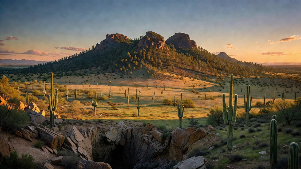
Coronado National Forest doesn't work like most national forests. Instead of one continuous block of trees, it is a constellation of sixteen separate mountain ranges scattered across southeastern Arizona, with a piece extending into Hidalgo County in New Mexico's bootheel -- managed as five non-contiguous ranger districts out of a supervisor's office in Tucson. These are the Madrean "sky islands": ranges that stand alone above the Sonoran and Chihuahuan deserts, close enough to see each other and far enough apart that their high forests are effectively marooned. The Santa Catalinas and Rincons sit over Tucson; the Pinalenos, Galiuros and Santa Teresas lie to the northeast; the Santa Ritas, Tumacacoris and Pajaritos run to the south; the Chiricahuas, Dragoons and Peloncillos hold the southeast corner; and the Huachucas, Patagonias and Whetstones cover the Sierra Vista country. The vertical range is the whole point -- campgrounds alone run from about 4,000 to 9,300 feet, and Mount Graham in the Pinalenos tops out at 10,720 feet. You start the day among giant saguaros and end it under Douglas-fir with snow on the ground.
History
The name comes from Francisco Vazquez de Coronado, whose entrada left Compostela in New Spain on February 23, 1540 hunting the fabled Cities of Cibola and, later, a place called Quivira. Over 300 armed Europeans, at least 1,200 Indigenous allies, Franciscan priests and scores of servants and enslaved people came north through this country -- the San Pedro River valley is widely regarded as the corridor they used -- and by the time the expedition straggled back to New Spain in April 1542 it had found no gold at all, only ruin for Coronado himself, who ended in bankruptcy and facing charges. The National Park Service, which interprets the expedition at Coronado National Memorial down near the Huachucas, is honest about the evidence: there is no physical trace of the expedition in the memorial itself. What the entrada did leave was a cultural and biological exchange that permanently changed the lives of the region's Indigenous peoples. This is also Chiricahua Apache homeland -- Cochise and Geronimo are the names history remembers, and the Chiricahua Apache were forcibly removed from the region in the late 19th century. Cochise Stronghold, in the granite of the Dragoon Mountains, still carries the name. The forest itself was assembled piece by piece: land here was part of the Santa Rita Forest Reserve in 1902, transferred to the new Forest Service in 1905, and the Coronado National Forest was formally established in 1908. A string of small separate forests -- Santa Catalina, Santa Rita, Tumacacori, Chiricahua, Dragoon, Peloncillo and Huachuca -- were folded in over the years, and Mount Graham National Forest, absorbed into the Crook in 1908, finally came to the Coronado in 1953.
Wildlife & plants
The sky islands are one of the great wildlife destinations in North America, and birders are the reason. Madera Canyon in the Santa Ritas is rated among the very best birding spots in the United States, with more than 256 species recorded -- including 15 kinds of hummingbird, 36 wood warblers, the sulphur-bellied flycatcher, and the elegant trogon, a green-and-crimson tropical bird that draws people across the country for a look. The Chiricahuas have logged 375 bird species on their own. The mammals are just as good: black bear, mountain lion, bobcat, white-tailed and mule deer, and 16 species of bats in Madera Canyon alone. This is also the last corner of the country where the big cats of the tropics still turn up -- ocelots are documented in the Chiricahuas, and a male jaguar was photographed by trail cameras at 23 different spots in the Santa Rita Mountains between 2012 and 2015, one of only about eight jaguars documented in the southwestern US between 1996 and 2024. In 2012 the US Fish and Wildlife Service designated roughly 838,000 acres in Arizona and New Mexico as jaguar critical habitat. Highest of all, on the cool spruce-fir crest of Mount Graham, lives the Mount Graham red squirrel -- a subspecies that exists on that one mountain and nowhere else on Earth, presumed extinct in the 1950s, rediscovered in the 1970s, and federally listed as endangered effective June 3, 1987.
Notable features
The Catalina Highway -- the Sky Island Parkway -- is the forest's signature drive, climbing from Tucson to the little village of Summerhaven below 9,171-foot Mount Lemmon, the high point of the Santa Catalinas, where the air runs 20 to 30 degrees cooler than the desert at the base and Mount Lemmon Ski Valley operates as the southernmost ski area in the continental United States. The peak is named for the botanist Sara Plummer Lemmon, who reached the summit on horse and foot in 1881 with her husband and a local rancher, E.O. Stratton; telescopes on the mountain still work today for projects like the Catalina Sky Survey. Sabino Canyon cuts into the same range closer to town. Northeast, Mount Graham (10,720 feet) is the forest's roof and Arizona's most topographically prominent peak, sacred to Western Apache people as Dzil Nchaa Si'an and crowned by the Mount Graham International Observatory, home of the Large Binocular Telescope and the Vatican Advanced Technology Telescope. In the southeast, the Chiricahuas rise to 9,759-foot Chiricahua Peak over a landscape of stone spires eroded from welded rhyolite tuff -- the ash left by the Turkey Creek Caldera some 27 million years ago. Eight designated wilderness areas are spread across the forest, at least one in every ranger district: Chiricahua, Galiuro, Miller Peak, Mount Wrightson, Pajarita, Pusch Ridge, Rincon and Santa Teresa.
Camps are sourced from public U.S. Forest Service recreation data and have not been personally visited. Roads shown are Forest Service passenger-car routes (maintenance level 3–5) and may be seasonal or gated. Always confirm access, fees and fire rules with the ranger district before you go. Found a fee where we show free? Tell us on the contact page.