Deschutes National Forest
Where the camps cluster
The place
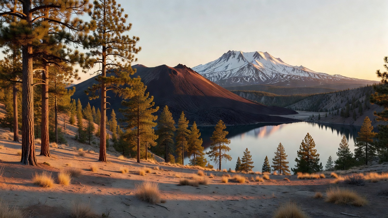
Deschutes National Forest is what happens on the rain-shadow side of a mountain range. The Cascade crest wrings the weather out of the Pacific air on its way over, so the west slope gets the moss and the fog and this side gets sunshine, open forest and volcanic dust. The result is one of the easiest landscapes in the West to move around in: big widely-spaced ponderosa pine you can see through for a hundred yards, a floor of pumice and bunchgrass instead of brush, and a skyline of snow peaks off to the west that never really leaves your mirror. Three ranger districts run it -- Bend, Sisters and Crescent -- out of a supervisor's office in Bend, and the forest reaches across Deschutes, Klamath, Lake and Jefferson counties.
Almost everything under your boots here was delivered by a volcano. When Mount Mazama blew its top about 7,700 years ago and left the hole that became Crater Lake, it dropped roughly three feet of ash and pumice across this country, and that layer is still the soil. Newer flows sit on top of it, some of them young enough that nothing much grows on them yet. There are more than 400 caves on the forest, most of them lava tubes -- drained plumbing from old eruptions. Six National Wild and Scenic Rivers overlay the forest, the Deschutes and the Metolius among them, and the Cascade Lakes string themselves along the base of the peaks like beads. It is a forest that reads as gentle and turns out, on inspection, to be almost entirely made of fire.
History
The forest was established on July 1, 1908. Its boundaries got shuffled early: in 1911 pieces were split off to create the Ochoco and Paulina national forests, and in 1915 the Paulina was folded back in. The Newberry National Volcanic Monument was carved out of the forest much later, on November 5, 1990, gathering 54,822 acres of the volcano's best features under one management umbrella while leaving them inside the national forest.
The human story out here is a timber story that quit. Bend built itself into a mill town on central Oregon pine, and for decades two big operations defined the place; when the Shevlin-Hixon Lumber Company was sold to Brooks-Scanlon and shut down in 1950, the loss is described as the largest economic drop the region had seen since the Great Depression, with the accessible timber running thin. What replaced it was the forest itself, in a different role -- Bend grew back through the late twentieth century as a recreation and retirement town, and the mountain, the lakes, the river and the lava are now the economy. The town's own name is a leftover from the wagon days: pioneers knew the spot as 'Farewell Bend' for a fordable double bend in the Deschutes, and the post office trimmed it to Bend.
There is one more chapter, and it is genuinely strange. Between 1964 and 1966, NASA brought Apollo astronauts to Newberry Volcano to train on the lava, because it was the closest thing to the Moon they could reach by bus. The men who practiced reading volcanic rock here included Neil Armstrong and Buzz Aldrin of Apollo 11, Alan Bean of Apollo 12, Edgar Mitchell of Apollo 14, James Irwin of Apollo 15, and Charlie Duke of Apollo 16. Every one of them later walked on the Moon.
Wildlife & plants
The everyday list is mule deer and Rocky Mountain elk, with the Forest Service also calling out bull trout and chinook salmon among the forest's headline species -- a reminder that the cold water here matters as much as the timber. The rivers deliver: the Metolius carries rainbow trout, bull trout, kokanee salmon and mountain whitefish, and the Deschutes is known for Columbia River redband trout, the native rainbows that local anglers call redsides.
The forest is unusually good bat country -- around 14 species have been documented, which makes sense in a place with 400-plus caves to roost in. Whitebark pine, the high-elevation five-needle pine that feeds Clark's nutcrackers and bears, is documented here and is federally listed as threatened rangewide. Wetter ground matters out of proportion to its size: the forest holds at least 460 acres of fen, a peat-forming wetland type that takes thousands of years to build and does not come back if you wreck it.
The plant community is classic east-slope dry forest. Ponderosa pine and lodgepole dominate the middle country, with sagebrush, manzanita and wild rose in the understory and Idaho fescue and bluebunch wheatgrass in the openings, plus yarrow, lupine and penstemon for color. A 1993 estimate put old growth on the forest at 348,100 acres. And then there are the mushrooms: this is serious matsutake ground, and the commercial harvest season is regulated with a set opening date of September 5 -- if you show up in early September and the pine woods are full of people walking slowly and staring at the duff, that is why.
Notable features
Newberry is the one to understand. Counting its lava flows it covers about 1,200 square miles, stretching 75 miles north to south and 27 miles east to west, which makes it the largest volcano in the Cascade Volcanic Arc by area -- and it is so broad and so low-slung that you can be standing on it and think you are on a plain. More than 400 vents pock it, the most of any volcano in the lower 48. The summit is not a peak but a hole: a caldera roughly 4 by 5 miles across, formed about 75,000 years ago, now holding two lakes side by side. Paulina Lake covers 1,530 acres and runs 250 feet deep; East Lake covers 1,050 acres and runs 180 feet deep. Paulina Peak stands on the rim just under 8,000 feet and has a road to the top. Newberry last erupted about 1,300 years ago, laying down the Big Obsidian Flow -- 700 acres of black volcanic glass inside the caldera, with a trail right up onto it. It is not extinct; a 1981 USGS well drilled 3,057 feet into the volcano hit 509 degrees Fahrenheit, and it is considered the best geothermal prospect in the Pacific Northwest.
The monument's other three units are strung along Highway 97 south of Bend. Lava Butte is a 500-foot cinder cone about 7,000 years old with a road spiraling to a lookout on the rim, and the Lava Lands Visitor Center sits at its foot. Lava River Cave is the longest lava tube in Oregon and one of the first ever found here -- roughly a mile of walkable tube, 2.2 miles round trip, 55 stairs down at the entrance, about an hour and a half, and a steady 42 degrees inside no matter what August is doing on the surface. Bring more light than you think you need. Lava Cast Forest, about 25 miles south of Bend, is a 6,000-year-old flow that surrounded living trees and hardened around them; the trees burned away and left their molds standing open in the rock.
West of all that, the Cascade Lakes Scenic Byway -- Forest Route 46, a National Scenic Byway -- runs 66 miles from Bend to Oregon 58, past Todd, Sparks, Devils, Elk, Hosmer, Lava, Little Lava and Cultus lakes and the Crane Prairie and Wickiup reservoirs, under Mount Bachelor, Broken Top and the Three Sisters. It closes December through March. Mount Bachelor itself is a dormant stratovolcano built on a shield between about 18,000 and 8,000 years ago, 9,068 feet high, carrying a ski area of 3,683 acres with 3,365 feet of vertical; it got its name for standing off by itself apart from the Sisters. Five wilderness areas touch the forest -- Mount Jefferson, Mount Washington, Three Sisters, Diamond Peak and Mount Thielsen -- and each is shared with a neighboring forest. The Three Sisters Wilderness is the giant at 286,708 acres, designated in 1964 and split with the Willamette: South Sister is 10,363 feet, North Sister 10,090, Middle Sister 10,052, Broken Top 9,175, with 14 glaciers including Collier, the largest in Oregon, and better than 260 miles of trail including 40 miles of the Pacific Crest Trail.
Camps are sourced from public U.S. Forest Service recreation data and have not been personally visited. Roads shown are Forest Service passenger-car routes (maintenance level 3–5) and may be seasonal or gated. Always confirm access, fees and fire rules with the ranger district before you go. Found a fee where we show free? Tell us on the contact page.