Dixie National Forest
Where the camps cluster
The place
Dixie National Forest is not one block of timber but four separate pieces of high ground scattered across southern Utah: the Markagunt, Paunsaugunt and Aquarius plateaus, plus the Pine Valley Mountains standing off by themselves north of St. George. The Forest Service describes the forest as straddling the divide between the Great Basin and the Colorado River, and that is not an abstraction out here -- water off one side of a ridge is headed for a desert sink with no outlet, water off the other is headed for the Colorado. Elevations run from about 2,800 feet near St. George to better than 11,300 feet on Boulder Mountain, so you can leave slickrock and creosote in the morning and be in spruce, aspen and lingering snowbanks by lunch. Four ranger districts run the place, working out of Cedar City, Escalante, Pine Valley and Panguitch.
The vegetation stacks up in bands you can read from the driver's seat: desert plants down low, pinyon pine and juniper through the middle elevations, then aspen and conifers -- pine, spruce and fir -- on top. The weather stacks up the same way. Precipitation runs about 10 inches a year in the low country and more than 40 inches near Brian Head; summers top 100 degrees near St. George while the plateau tops have gone below 30 below in winter. What makes this forest easy to overlook is its neighbors. Bryce Canyon, Zion, Capitol Reef, Cedar Breaks and Grand Staircase-Escalante all touch or nearly touch it, and most travelers cross Dixie on the way to one of them without registering that the forest is where the camping, the fishing and the elbow room actually are.
History
The Dixie Forest Reserve was set aside on September 25, 1905 by the General Land Office. The Forest Service took over the land in 1906, and on March 4, 1907 it became a national forest. It grew by absorbing its neighbors: the western part of Sevier National Forest was added on July 1, 1922, and all of Powell National Forest on October 1, 1944.
The name came from the country, not from the trees. In October 1856 Brigham Young called on Latter-day Saints to grow cotton in the warm southwestern corner of the territory. The first companies arrived in 1857, many of them from Mississippi, Alabama, Virginia, Texas and Tennessee; St. George was founded in 1861; and between the climate, the crop and where the settlers came from, the South's nickname stuck to this corner of Utah. The cotton mill stopped running consistently in 1897, but 'Utah's Dixie' outlived the cotton, and the forest inherited the name.
That settlement era is still standing in places. The Pine Valley Chapel, finished in 1868, is the oldest Latter-day Saint chapel in continuous use, and it was designed and built by Ebenezer Bryce, a Scottish ship's carpenter who framed the roof like an upturned hull -- the same Ebenezer Bryce who later homesteaded below the canyon that carries his name. About 30 miles north of St. George on Highway 18, a monument erected in 1999 honors those killed in the Mountain Meadows Massacre of 1857. Up on the Markagunt, a Forest Service lookout went up on the summit of Brian Head in 1934-35, and the road to it is still drivable in summer.
Wildlife & plants
The big game list is what you would expect of country this vertical -- mule deer, elk, black bear and mountain lion -- with one standout: Boulder Mountain is known for producing some of the biggest elk in Utah. The rare end of the list is more interesting. The Utah prairie dog, federally listed as threatened since 1984 and found nowhere else on earth, has much of its Paunsaugunt-area public-land habitat managed by this forest alongside the BLM's Kanab office and Bryce Canyon National Park. The Pine Valley Mountains hold Bonneville cutthroat trout, Townsend's big-eared bats and pygmy rabbits, and Box-Death Hollow carries three birds the state lists as sensitive: Lewis's woodpecker, western bluebird and mountain bluebird.
Botanically the Pine Valley Mountains are the prize. A floristic survey run from 1985 to 1987 turned up close to 1,000 plant species there, making it the most diverse mountain range in the state, and every conifer native to Utah grows on it except lodgepole pine -- including stands of virgin Engelmann spruce. Ashdown Gorge, next door to Cedar Breaks, has bristlecone pines on the plateau tops that are around a thousand years old.
The fishing deserves its own paragraph. Boulder Mountain is dotted with hundreds of small lakes sitting between 10,000 and 11,000 feet, and it became a serious fishery in the 1950s when crews hauled juvenile fish up on horseback to stock them. Brook trout, Colorado River cutthroat, splake and tiger trout are all in there, kokanee salmon were introduced to Blind Lake in 2022, and the state record brook trout -- 7 pounds, 8 ounces -- came off this mountain in 1971. Lower down, Pine Creek and Sand Creek in Box-Death Hollow hold brown and rainbow trout.
Notable features
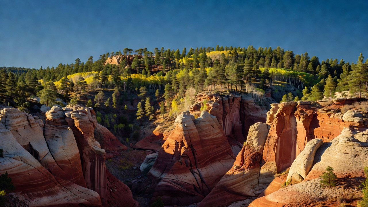
Most people meet this forest through Red Canyon, where Highway 12 runs between orange Claron Formation limestone eroded into the same spires and hoodoos Bryce Canyon is famous for, a few miles short of the park gate. The Forest Service calls it the most photographed place in Utah, there is a visitor center right on the highway, and the Pink Ledges, Hoodoo, Birdseye and Golden Wall trails go in from there -- Bryce scenery without the Bryce entrance line. The driving in general is the point: Highway 12 is 124 miles long and was designated an All-American Road in 2002, Highway 14 is a 40-mile state scenic byway across the Markagunt, and Utah's Patchwork Parkway runs 55 miles. On the Escalante district, Powell Point sits at 10,188 feet on the end of the Table Cliffs and looks out over Grand Staircase-Escalante, Bryce Canyon, the Blues, Johns Valley, Navajo Mountain and the Henry Mountains on a clear day.
The Aquarius Plateau -- Boulder Mountain to almost everyone who goes there -- is the forest's high roof, described as the highest timbered plateau in North America, with roughly 70 square miles of nearly flat summit and better than 50,000 acres of ground above 11,000 feet. Bluebell Knoll on top of it is the forest high point at better than 11,300 feet. Highway 12 climbs its eastern side between Torrey, Boulder and Escalante, and the backcountry Hell's Backbone road closes a 38-mile loop off it. The Markagunt end is volcanic country: more than 25 cinder cones, lava flows that blocked the drainage and made Navajo Lake, the Duck Creek lava tube (among the longest and highest in the United States), Mammoth Cave at 8,050 feet with over 2,200 feet of passages, and a small Ice Cave that keeps its icicles year-round.
Four wilderness areas are on the forest. Pine Valley Mountain is the largest at 50,232 acres, designated in 1984, a mountain island surrounded by desert that tops out at 10,365 feet on Signal Peak. Box-Death Hollow, 25,751 acres and also 1984, drops gray-orange Navajo sandstone walls into two tributaries of the Escalante -- Pine Creek's canyon is 'The Box,' enterable only from the lower end, and Death Hollow's narrows flood after rain. Ashdown Gorge, 7,043 acres and 1984, cuts steep multicolored canyons through the west rim of the Markagunt right beside Cedar Breaks. Cottonwood Forest, the small one at 2,620 acres, was added in 2009; it is narrow red-rock canyon country carrying Zion's landscape north, with no designated trails at all.
Camps are sourced from public U.S. Forest Service recreation data and have not been personally visited. Roads shown are Forest Service passenger-car routes (maintenance level 3–5) and may be seasonal or gated. Always confirm access, fees and fire rules with the ranger district before you go. Found a fee where we show free? Tell us on the contact page.