Inyo National Forest
Where the camps cluster
The place
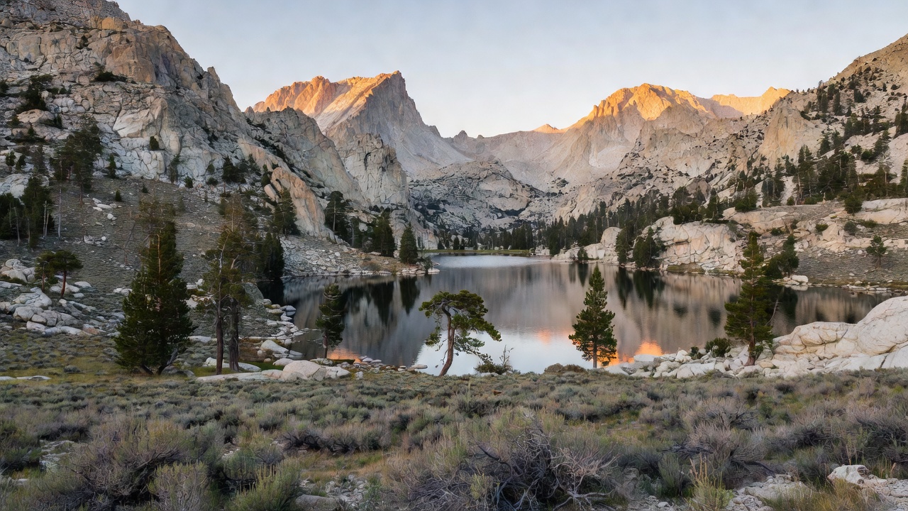
Inyo National Forest runs down the eastern side of the Sierra Nevada, stretching from the edge of Yosemite in the north to south of Sequoia National Park -- and it is geographically split in two, with one piece on each side of the Long Valley Caldera and the Owens Valley. Its elevation range is the headline: from about 4,000 feet on the Owens Valley floor to 14,505 feet on the summit of Mount Whitney, the highest point in the contiguous United States. A corner of the forest also crosses the state line into western Nevada. The supervisor's office is in Bishop, with district offices in Bishop, Lee Vining, Lone Pine and Mammoth Lakes -- and those four towns are, in practice, the four doors into the place.
Set your expectations for what "forest" means out here. The official line calls it "desert and glaciers in the dramatic Eastern Sierra," and that is not poetry -- when the forest was created it became one of the least wooded forests in the national forest system, because the Sierra crest wrings the storms dry before they ever reach this side. There are roughly 238,000 acres of old growth, mostly lodgepole and Jeffrey pine, and there is genuine timber in the canyons and around the lake basins. But a lot of Inyo is sagebrush flat, pinyon-juniper slope, glacial moraine, and bare granite, and the highest trees in it -- the bristlecones of the White Mountains -- grow in country so hostile it is arguably why they live so long.
For campers, the developed side is deep: the forest's own recreation listing runs to about 78 entries -- some 66 campgrounds, 11 group campgrounds and a horse camp -- names like Agnew Meadows, Big Pine Creek, Big Springs and Aspen. Standard sites can be reserved up to six months out on Recreation.gov (group sites up to twelve), and the rest are first-come, first-served with self-registration. Everything is seasonal, and a heavy snowpack routinely pushes opening dates later than the calendar says.
Dispersed camping is a yes-with-conditions here, and the conditions are real. The forest states plainly that camping is allowed outside designated campgrounds in some areas -- but in places designated "Developed Recreation Areas," camping is restricted to developed campgrounds only. Wherever you do camp outside a campground, you need a California Campfire Permit for any open flame at all, and that includes gas stoves, lanterns and smoking, not just wood fires. Nine wilderness areas covering over 800,000 acres sit on this forest, and overnight trips into the John Muir, Ansel Adams, Hoover and Golden Trout wildernesses need a wilderness permit, reserved online through Recreation.gov. The Mount Whitney Zone is stricter still -- a permit is required there for day use as well as overnight, and the popular Whitney permits go through an annual lottery. Check the current district rules and the motor vehicle use map before you commit to a pullout.
History
The forest was established on May 25, 1907, and the standard account of why is unusually blunt: it was set aside under Theodore Roosevelt in part to section off land for the Los Angeles Aqueduct project. Water, not timber, is the reason this forest has the shape it has -- and water is the thread running through everything that happened here since. On July 1, 1945, land from the former Mono National Forest was folded in, giving the forest its northern reach toward Yosemite and Mono Lake. The name "Inyo" is said to come from a Native American word meaning "dwelling place of the great spirit."
The mountain came with a story of its own. In July 1864 members of the California Geological Survey named the range's high point after Josiah Whitney, the state geologist. Nine years later, on August 18, 1873, Charles Begole, A. H. Johnson and John Lucas became the first to reach the summit. Down at the other end of the forest, Devils Postpile was protected as a national monument in 1911 by President William Howard Taft, after influential Californians -- John Muir among them -- helped stop a proposal that would have blasted the columns for a dam.
The water story turned ugly, then turned around. Los Angeles began diverting the streams feeding Mono Lake in 1941; by 1990 the lake had dropped 45 vertical feet and lost half its volume relative to the pre-diversion level, exposing the tufa towers that now draw photographers and, less charmingly, exposing alkali dust to the wind. The Mono Lake Committee and the Audubon Society litigated, and on September 28, 1994 the State Water Resources Control Board issued a protective order aimed at restoring the ecosystem. A decade before that, in 1984, the Mono Basin had become the first National Forest Scenic Area in the United States -- a designation the Inyo administers to this day. It is a rare case of a landscape being nearly drained and then argued back.
Wildlife & plants
The animal that defines this forest is the Sierra Nevada bighorn sheep (Ovis canadensis sierrae), a subspecies found only in the Sierra Nevada and listed as federally endangered on January 3, 2000. It ranges across five counties -- Tuolumne, Mono, Fresno, Inyo and Tulare -- from the eastern base of the range as low as 4,790 feet to peaks above 14,100 feet, which means the whole vertical span of this forest is bighorn country. The collapse began in the 1870s, when domestic sheep introduced virulent disease, particularly pneumonia; recovery has since been set back by heavy mountain lion predation combined with heavy snowfall. Roughly 600 animals remained in 2016, and more recent studies put the figure near 300 in 2023. If you see one, you are looking at a genuinely rare animal, and you should be looking at it from a long way off.
Black bears are the practical wildlife concern for campers, and the forest rents bear cans at its visitor center rather than assuming you brought one. On the plant side, the forest's roughly 238,000 acres of old growth is dominated by lodgepole pine and Jeffrey pine, but the celebrity conifer is the Great Basin bristlecone pine (Pinus longaeva), which grows in the White Mountains between about 9,800 and 11,000 feet, in dry alpine conditions where almost nothing else bothers to try.
And then there is Mono Lake, which runs an entire ecosystem on chemistry that should not support one. The water holds something like 280 million tons of dissolved salts at a pH around 10 -- far too harsh for fish -- and yet in summer it carries an estimated four to six trillion brine shrimp, plus alkali flies that walk underwater along the shallows encased in their own bubbles of air. That protein is the point: nearly two million waterbirds, including 35 species of shorebirds, use Mono Lake to rest and feed for at least part of the year. It is one of the great migratory refueling stops on the continent, and it is a lake with no fish in it.
Notable features
Mount Whitney is the obvious pilgrimage. The standard route is the Mount Whitney Trail from Whitney Portal at 8,360 feet, 13 miles west of Lone Pine -- about 22 miles round trip with over 6,100 feet of gain, which people routinely underestimate. Permits are required year round, a limited number are issued between May 1 and November 1, and the Forest Service runs an annual lottery. The peak itself sits on the boundary between Inyo National Forest and Sequoia National Park, and it stands 10,778 feet above the town of Lone Pine 15 miles east in the Owens Valley -- a wall you can take in from a gas station parking lot.
The Ancient Bristlecone Pine Forest, high in the White Mountains about 30 miles from Bishop, is the other unmissable stop. Schulman Grove has a visitor center with daily interpretive talks; Patriarch Grove, higher up, holds the world's largest bristlecone pine. The road is generally open from mid-May through the end of November, weather permitting. Somewhere in these groves stands Methuselah, well over 4,800 years old and one of the oldest known non-clonal living things on earth -- deliberately unmarked, so that vandals can't find it either.
The north end of the forest is a volcano that hasn't finished. The Long Valley Caldera, about 20 miles east-west by 11 miles north-south, was formed 760,000 years ago by an eruption whose ash cooled into the Bishop tuff you see layered all over the area. Running north from it, the Mono-Inyo Craters form a 25-mile volcanic chain along a narrow north-south fissure. The unrest is ongoing -- recurring earthquake swarms and continued dome-shaped uplift of the caldera floor. In May 1980 a swarm that included four magnitude-6 earthquakes hit the southern margin, and the caldera floor rose about 10 inches. Hot Creek, a famous geothermal stretch, was closed to swimming in 2006 after activity there increased.
Beyond that, the list is long: the tufa towers and craters of the Mono Basin National Forest Scenic Area, including Panum Crater; Devils Postpile National Monument, a wall of columnar basalt left by a lava flow less than 100,000 years old and polished on top by a glacier, reached in summer by a mandatory shuttle and paired with Rainbow Falls on the Middle Fork of the San Joaquin; and a string of lake basins that need no introduction locally -- Convict Lake, June Lake, Lake Sabrina, Tioga Lake and the Mammoth Lakes. The nine wilderness areas are Ansel Adams, Boundary Peak, Golden Trout, Hoover, Inyo Mountains, John Muir, Owens River Headwaters, South Sierra and White Mountains.
Camps are sourced from public U.S. Forest Service recreation data and have not been personally visited. Roads shown are Forest Service passenger-car routes (maintenance level 3–5) and may be seasonal or gated. Always confirm access, fees and fire rules with the ranger district before you go. Found a fee where we show free? Tell us on the contact page.