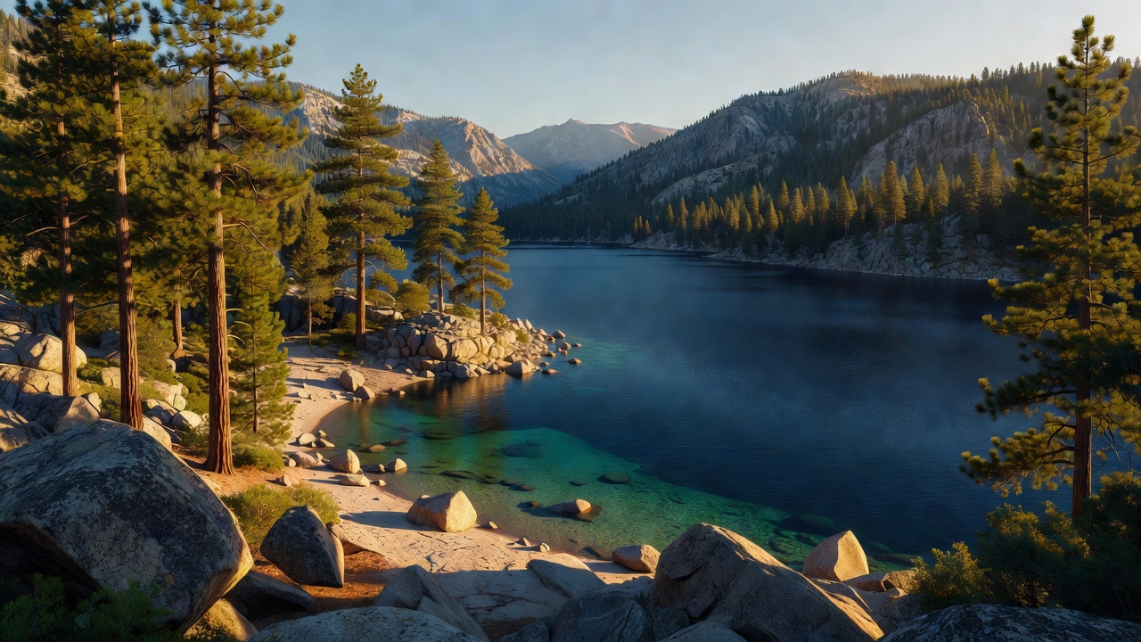
Lake Tahoe Basin Management Unit
Where the camps cluster
The place
This unit is shaped like a donut, and the hole is the point. Lake Tahoe sits at 6,225 feet on the California-Nevada line, 22 miles long and 12 miles wide with about 72 miles of shoreline, and the Forest Service land runs up the slopes around it in El Dorado and Placer counties in California and Douglas County in Nevada, climbing to 10,881 feet at Freel Peak. The supervisor's office is at 35 College Drive in South Lake Tahoe. The Forest Service manages roughly 78 percent of the land in the basin, which makes it far and away the basin's largest landowner -- officially "over 156,335 acres," a figure that covers beaches, trails, wilderness, historic estates, campgrounds and riding stables.
It also behaves unlike almost any other unit in the system. Mining, grazing and timber harvest are either absent here or play a very small role, and the agency describes the LTBMU's job as "the conservation, preservation and restoration of the Lake Tahoe watershed ecosystem." Its five core programs -- erosion control, watershed restoration, fire, forest and recreation management -- all point at the same target, because in this basin forest health and water clarity are the same problem wearing two hats. The other thing that makes it strange is the neighbors: this is a genuine inter-mix of national forest and urban community, with resort towns, highways and private shoreline threaded straight through the public land.
For campers, read the rules before you plan anything. Camping is confined to designated campgrounds plus a short list of backcountry areas -- Desolation Wilderness, Meiss Country, and the Pacific Crest and Tahoe Rim trails. There is no dispersed vehicle camping, full stop. National Forest land at Tahoe sits under year-round fire restrictions that prohibit campfires except in designated campgrounds with permanent fire pits, so plan on a stove and plan on it being legal only where the ring is already built. Food storage is not optional either: hard-sided bear canisters are required in Desolation Wilderness, and bear-resistant containers are required in all other areas. Most National Forest campgrounds here run a 14-day limit per calendar year and a limit of six people per campsite.
The season is short and the calendar is honest about it. Most campgrounds around the lake open from mid-May through mid-October, conditions and weather permitting; only a handful -- Sugar Pine Point, Tahoe Valley and Zephyr Cove -- stay open year round. Forest Service sites book through Recreation.gov, while the California and Nevada state park campgrounds around the same shoreline book through their own systems, which is a quirk worth knowing before you assume one reservation site covers the lake. Check the current alerts and restrictions before you go; fire status here changes fast.
History
People have been coming to this lake for a very long time. Archeologists believe the first people arrived at least 9,000 years ago, seasonally at first, and the Washoe -- Wa-siw -- are the basin's original inhabitants, with a homeland running from Honey Lake in the north to Sonora Pass in the south and Lake Tahoe at its center. Their language, Washo, is a linguistic isolate, unrelated to the Great Basin languages around it, and it is now endangered, with revival work aimed at young speakers. The name of the lake is theirs: "Tahoe" most likely comes from the Washoe term for, simply, "the lake." Their year moved with the food -- fishing at the lake in spring, hunting, and pinon pine nuts in the fall.
Then came the silver. The Gold Rush and the Comstock boom that followed wrecked the Washoe subsistence base: logging destroyed pinon groves, agriculture took the valley hunting grounds, and the 1857 "Potato War" -- a hunger-driven conflict over stolen crops -- was their last armed clash. The forest fared no better. Over roughly 25 years of the Comstock era, about two-thirds of the basin's forests were logged, cut and hauled to timber the mines and the towns that served them. Today the Washoe enroll through three federally recognized entities, and in 2002 the Senate Committee on Energy and Natural Resources acted to return custody of areas around the lake to them for cultural purposes.
The federal response to the clear-cutting arrived in 1899, when President William McKinley created the Lake Tahoe Forest Reserve -- 136,335 acres set aside specifically because of what the Comstock era had taken. Those lands moved to the newly created U.S. Forest Service in 1905, and for the next seven decades they were administered from three different directions: the Toiyabe to the east, the Eldorado to the south and west, and the Tahoe to the north. By the early 1970s that division was clearly getting in the way. In April 1973 the basin portions of all three were consolidated into a single management unit -- not a new national forest, the agency is careful to say, but a reorganization built to manage one watershed as one interdependent system. That is why it is a "Management Unit" and not a "National Forest," and the name has stuck for fifty years.
The most recent chapter is fire. The Caldor Fire started on August 14, 2021 near Pollock Pines in El Dorado County -- a Forest Service investigation concluded it was caused by a bullet -- and on August 30 it reached Echo Summit, less than five miles from South Lake Tahoe, becoming only the second fire known to have crossed the Sierra Nevada crest, days after the Dixie Fire did it first. At 10:59 that morning the entire city of roughly 22,000 people was ordered to evacuate. The fire burned 221,835 acres and destroyed 1,003 structures before it was contained on October 21, 2021. Restoration work in its footprint is still going on.
Wildlife & plants
The headline plant here is one you could step on without noticing. Tahoe yellow cress (Rorippa subumbellata) is a small, low-growing member of the mustard family with pinnate leaves and little yellow flowers, and it grows on the sandy shoreline of Lake Tahoe and in the mouths of the streams feeding it -- and nowhere else on earth. It is listed as endangered by the State of California and critically endangered in Nevada. Its life is tied to the lake's own level: when the lake is low the plant colonizes more sites, and when the lake is high its habitat is simply underwater. Trampling from beach use and marina and pier development are the main threats, which is a polite way of saying the plant's habitat is also everyone's favorite place to stand. There is a rare good-news ending in progress: after a 2003 conservation strategy signed by thirteen partners, the U.S. Fish and Wildlife Service removed the species as a candidate for federal Endangered Species Act listing in October 2015, citing the strategy's success. Annual shoreline surveys continue.
In the water, the native story is a work in progress. The unit's riverine restoration program is building habitat with the potential future reintroduction of native species such as Lahontan cutthroat trout in mind, and the LTBMU works with more than 80 organizations on projects including Lahontan cutthroat recovery. The strangest resident, though, is the western pearlshell mussel -- a freshwater mussel that is extremely rare, averages 60 to 70 years of life, and in some individuals passes a hundred, which puts it among the longest-lived animals on the planet. There is also a well-known non-native: kokanee salmon, landlocked relatives of the sockeye, which run up Taylor Creek to spawn from mid- to late October into November.
Birds are the easiest wildlife to actually see. Bald eagles are typically a winter sighting at Tahoe -- wingspans reaching seven feet -- and both wintering numbers and nesting are slowly increasing. Year-round and summer regulars include the Steller's jay (a pigeon-sized bird with deep blue wings, tail and breast, and no shyness at all around a picnic table), mountain chickadee, dark-eyed junco, western tanager, hairy woodpecker, American robin, red-tailed hawk, mallard, Canada goose, California gull and, in the marshes in early spring, the yellow-headed blackbird. On the forested slopes the conifers do the work: red fir and lodgepole pine dominate the higher country west of the lake, with Jeffrey pine, ponderosa pine and mountain hemlock mixed in, and the large conifer stands we see today became well established around seven thousand years ago. Those forests are now widely overstocked -- too many small trees competing for water, nutrients and light -- and restoration work is aimed at returning them toward a more natural open condition of fewer, larger trees.
Notable features
Desolation Wilderness is the big draw and the reason many people come at all: 63,960 acres of bare glaciated granite, lakes and creeks on the Sierra crest just west of the lake, in El Dorado County, administered jointly with the Eldorado National Forest. Pyramid Peak tops it at 9,985 feet, and Lake Aloha -- shallow, clear, sitting in a wide granite basin scoured by glaciers -- is its largest body of water. Its forests, red fir and lodgepole with Jeffrey pine, mountain hemlock and ponderosa mixed in, run between about 7,400 and 9,000 feet. It was set aside as the Desolation Valley Primitive Area in 1931 and formally designated wilderness in 1969, and it is one of the most heavily used protected areas in the United States -- which is why overnight camping is managed through 45 separate zones with their own quotas in summer, and why day-use permits are required at the trailheads. Bring the hard-sided canister.
The Tahoe Rim Trail is the other signature: a backcountry loop that circles the entire lake across both states, which the Forest Service describes as 165 miles and other accounts put nearer 170. It climbs from about 6,223 feet at the lake's outlet to 10,338 feet at Relay Peak on the Nevada side, roughly 24,400 feet of cumulative gain, and about 50 miles of it above the west shore doubles as the Pacific Crest Trail. The idea came from a Forest Service recreation officer, Glenn Hampton, in 1978; the trail was finished in September 2001, almost entirely by volunteers. Ninety-six miles along the east and south sides are designated a National Recreation Trail. Mountain bikes are allowed on about half of it, horses and skiers on all of it, motors on none of it.
On the south shore, two Forest Service sites sit within a few minutes of each other on Highway 89, about three miles northwest of South Lake Tahoe. The Taylor Creek Visitor Center, open from Memorial Day weekend through October 31, is the trailhead for four self-guided walks -- and a quarter mile down the Rainbow Trail is the Stream Profile Chamber, where you walk underground and look sideways into a diverted section of Taylor Creek through aquarium-style windows. Time it for late October and the glass fills with spawning kokanee. Next door, the Tallac Historic Site preserves the estates of what a century ago was billed as the "Grandest Resort in the World," the summer retreat of three of the San Francisco Bay Area's socially elite families.
And then the lake itself, which is the thing you will actually stare at. It is the largest alpine lake in North America and the second deepest lake in the United States, with a deepest recorded sounding of 1,645 feet and something on the order of 37 trillion gallons in it. It formed roughly two million years ago, after a period of mountain building around five million years ago and volcanic eruptions -- Mount Pluto among them -- blocked the basin's northern outlet and let snowmelt fill it; it has been roughly the size you see for the last million years. The clarity is a function of the plumbing: the steep geology and soils around the lake act as a natural filtering watershed system. That clarity is not what it was -- it has been declining at an average rate of about 0.82 feet per year -- and it is the single number that most of the restoration work in this basin is trying to bend back.
Camps are sourced from public U.S. Forest Service recreation data and have not been personally visited. Roads shown are Forest Service passenger-car routes (maintenance level 3–5) and may be seasonal or gated. Always confirm access, fees and fire rules with the ranger district before you go. Found a fee where we show free? Tell us on the contact page.