Land Between the Lakes National Recreation Area
Where the camps cluster
The place
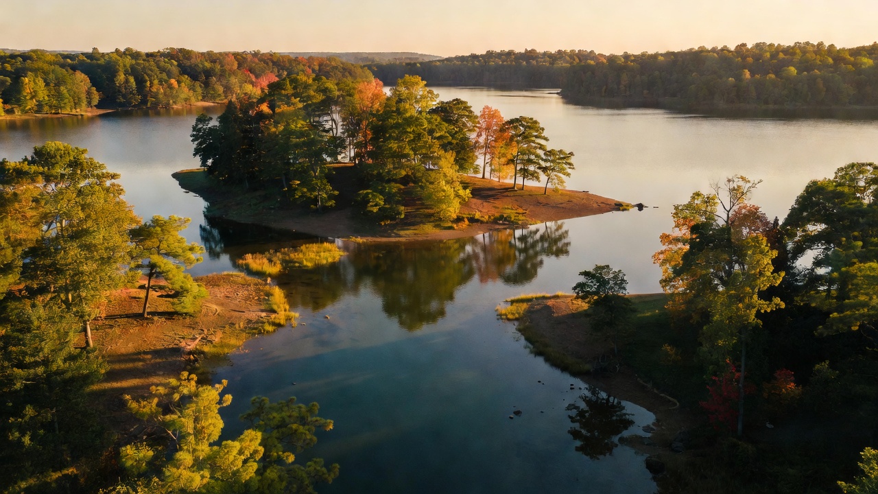
This is not a national forest, and it is worth getting that straight before you go. Land Between the Lakes is a National Recreation Area -- a unit of the National Forest System, run by the Forest Service, but created and shaped by a completely different agency for a completely different reason. The shape is the whole story: a long, skinny peninsula of oak-hickory ridges, wetlands and open ground, running north to south between two reservoirs that parallel each other for more than 50 miles. On the west is Kentucky Lake, the Tennessee River backed up behind Kentucky Dam, which the Forest Service's neighbors will tell you -- correctly -- is the largest artificial lake by surface area in the United States east of the Mississippi. On the east is Lake Barkley, the Cumberland River behind a Corps of Engineers dam finished in 1966 and named, like the lake, for Alben Barkley, the Kentucky man who was Truman's vice president. A canal a mile above Barkley Dam ties the two together at the north end, which is why boats can cross from one river system to the other without ever going downstream. Between them sits this place: more than 170,000 acres by the Forest Service's own count, about 300 miles of shoreline, and no towns. Administratively it straddles the state line -- Lyon and Trigg counties in Kentucky, Stewart County in Tennessee -- roughly 90 miles north of Nashville. One road, the Trace, runs the spine of it end to end, and nearly everything worth stopping for hangs off that road. The terrain is gentle: rolling hardwood ridges, coves and bays, beaver marshes, and a handful of restored grassland openings. There is no mountain here. What there is instead is water on both sides of you, all day, everywhere you go.
History
Before the lakes, this was "Land Between the Rivers," and it ran on iron. Investors put charcoal furnaces in here in the middle 1800s because the country handed them everything a furnace needs at once -- ore, limestone, and endless hardwood to burn. Center Furnace, sometimes called Hematite, was built by 1852 by Daniel Hillman: 35 feet high, 10 feet across inside at its widest, charcoal-fired with a steam-powered air blast. In 46 weeks of 1856 it turned out 2,139 and a half tons of pig iron, most of it shipped out by steamboat to fabricators. It ran, on and off, until 1912. The Kentucky Historical Society's marker for it puts the region in context: Kentucky was a major iron producer from 1791 and ranked third in the country in the 1830s, "Between Rivers" was one of the named furnace districts, and the charcoal-furnace era ended in the 1880s as the ore and the timber gave out. Center Furnace is its own counterexample -- it outlived that ending by thirty years. It should not be told as a tidy industrial story, either: the Great Western Iron Furnace here was worked in the 1850s by enslaved African Americans, and the furnaces generally were. War came through too. Fort Henry stood on the Tennessee River in Stewart County until February 6, 1862, when Union gunboats under Flag Officer Andrew Foote shelled it for 75 minutes while Grant's infantry was still slogging up; with the river in flood and most of the fort already underwater, Confederate Brigadier General Lloyd Tilghman surrendered with about 90 men before the ground attack arrived. It opened the Tennessee River to Union traffic and it was the first real crack in the Confederate line in the west. The fort itself is gone -- the site lies under Kentucky Lake now, marked by a navigation beacon. Then came the dams, and then came the eviction. TVA finished Kentucky Dam in 1944 and Barkley Dam in the 1960s, and in 1963 President John F. Kennedy designated the peninsula between them a National Recreation Area -- explicitly as a demonstration, to show that country with poor timber, farm and industrial prospects could be turned into a recreation economy. Making it empty took roughly 800 families. Golden Pond, the biggest settlement, had a post office back to 1848 and was known nationally during Prohibition for moonshine that moved to speakeasies in Chicago, Detroit and St. Louis; some residents who would not sell had their homes burned before condemnation was even finished, and the last of them were gone by 1969. Model and Tharpe, over in Stewart County, Tennessee, emptied out too -- most Model families were relocated by 1964, though one man, Cleo Griffin, negotiated to stay in his family's house and did not leave until 1989. A Little Golden Pond turned up in eastern Calloway County in 1989, founded by displaced residents. "Between the Rivers" is still a live grievance here, not a historical footnote. TVA ran the place for three decades. Congress ended that with the Land Between the Lakes Protection Act of 1998, which made it a unit of the National Forest System and moved administrative jurisdiction to the Department of Agriculture. It was a UNESCO Biosphere Reserve from 1991 until the United States withdrew it in 2017. On December 10, 2021, two tornadoes tore across it, and stretches of the North/South and Fort Henry trail systems were still closed years afterward.
Wildlife & plants
The headline animals here are ones you would not expect east of the Mississippi: elk and American bison, loose on a 700-acre grassland enclosure called the Elk & Bison Prairie, which was inaugurated in 1996 after the ground was burned and reseeded back toward the native prairie that covered a lot of Kentucky a century and a half ago. The elk came from Elk Island National Park in Alberta. The bison are a mongrel of good bloodlines and the Forest Service is unusually specific about it: animals from Theodore Roosevelt National Park in North Dakota in 1969, Fort Niobrara National Wildlife Refuge in Nebraska in 1988 and again in 2012, and Wind Cave National Park in South Dakota in 1996. The herds are trimmed by auction most years to keep them inside the prairie's carrying capacity. You drive it -- 3.5 miles of paved loop, windows-up, no walking, no bikes -- and you may also find wild turkeys, blue grosbeaks, indigo buntings, summer tanagers and prairie warblers in the grass. There is a second viewing herd of bison at the South Bison Range just below the Tennessee line. Birds are the real depth: more than 250 species have been documented. Bald eagles winter here in numbers from November into February, peaking in January, best around Honker Lake, the dam tailwaters and the northwestern bays, with ospreys, loons and grebes on the open water and herons and egrets in the shallows. The Woodlands Nature Watch Area -- which the Forest Service puts at 6,800 acres of beaver marsh and forested ridge between Honker and Hematite lakes -- is the concentrated version. On the ground it is white-tailed deer country, plus beavers, river otters, bobcats, and -- oddly -- fallow deer, a European species the Forest Service lists among the animals you may see here. At Woodlands Nature Station the Forest Service keeps native animals that were orphaned, injured or born captive and cannot go back out, including endangered red wolves bred as part of the U.S. Fish and Wildlife Service's Red Wolf Recovery Program -- a species the Forest Service's page describes as down to fewer than 300 animals worldwide. In the water it is largemouth bass, crappie, sauger, catfish, bluegill and sunfish. For plants, walk the Hematite Lake trail in April or May: Virginia bluebells, trout lily, larkspur, trilliums, spider lily, fire pink, cardinal flower and crimson-eyed rosemallow all show along a 2.25-mile loop with about a quarter mile of boardwalk over the beaver marsh.
Notable features
The Elk & Bison Prairie is the one everybody comes for -- a 700-acre enclosure a mile north of the Highway 68/80 junction on the Trace, entered by a 3.5-mile paved loop for a per-vehicle fee, open sunrise to sunset, and strictly windows-up: no pedestrians, no motorcycles, no bicycles, because the animals are genuinely wild and genuinely large. Golden Pond Visitor Center, on the site of the drowned town's name, is the hub and holds a planetarium and observatory. The Homeplace, down near Dover on the Tennessee end, is a working 1850s two-generation farm with interpreters in period clothing, heirloom crops grown from pre-Civil War seed, and rare and endangered livestock breeds -- it is a real farm that gets real work done, not a diorama. Woodlands Nature Station on the north end is the wildlife side of the same idea, with a "Backyard" of non-releasable native animals and the red wolf enclosure; it runs April through October daily, shoulder-season days in March and November, and closes for the winter. Turkey Bay is the motorized outlet: roughly 100 miles of primary, secondary and tertiary OHV trail, one of the few sanctioned riding areas of its size in the region. For foot travel the backbone is the North/South Trail, which runs about 59 miles the length of the peninsula, with the 11-mile Canal Loop at the north end near the Barkley Canal and the 11-mile Central Hardwoods Scenic Trail crossing east to west. Developed camping is at Hillman Ferry and Piney -- the two big lakefront campgrounds -- plus Energy Lake and Wranglers, which is the one for horse and OHV people; Brandon Spring is a group center rather than a drive-up campground. Note that the December 2021 tornadoes did real damage to the trail systems, so check current closures before you commit to a long walk.
Camps are sourced from public U.S. Forest Service recreation data and have not been personally visited. Roads shown are Forest Service passenger-car routes (maintenance level 3–5) and may be seasonal or gated. Always confirm access, fees and fire rules with the ranger district before you go. Found a fee where we show free? Tell us on the contact page.