National Forests in Alabama
Where the camps cluster
The place
The Forest Service treats Alabama as a single administrative unit, but on the ground you are visiting one of four separate forests -- Bankhead in the northwest, Talladega in the east and center, Tuskegee just outside its namesake town, and Conecuh down on the Florida line. The official line is that they span more than 673,000 acres across seventeen counties, and that they show off "the state's remarkably diverse geography, from the Southern Appalachian Mountains, Cumberland Plateau and Piedmont, to the Coastal Plain." That is not marketing. Drive from the sandstone gorges of the Sipsey to the wiregrass and gopher-tortoise burrows of the Conecuh and you have crossed most of the eastern United States in ecological terms without leaving one state.
Set your expectations for the scale, though. Alabama's highest point, Cheaha Mountain, tops out at 2,413 feet -- respectable for the Deep South, but this is ridge-and-hollow country, not alpine country. The reward is different: old hardwood coves, blackwater creeks, limestone bluffs, and a long green shoulder season when the mountain West is buried in snow.
Camping here skews developed. The Forest Service's own recreation listing for Alabama runs to about a dozen sites -- ten campgrounds and two horse camps -- names like Clear Creek, Coleman Lake, Corinth, Payne Lake, Lake Chinnabee, Houston and Open Pond. Most operate first-come, first-served; only the Corinth and Clear Creek pair at Bankhead take reservations through Recreation.gov. Dispersed camping is listed as an option here, but as anywhere on national forest land it's allowed unless a spot is posted or ordered closed, and the districts differ -- so check the current district rules and the motor vehicle use map before you pick a pullout.
History
Alabama's public forest starts in 1918, when the Alabama National Forest was established on January 15 with 66,008 acres. It was renamed the Black Warrior National Forest on June 19, 1936, and renamed again on June 6, 1942 for William B. Bankhead, a longtime Alabama congressman. Two more forests arrived on the same day -- July 17, 1936 -- when Talladega was proclaimed under Proclamation 2190 and Conecuh was created by presidential proclamation down on the Florida line. The youngest and smallest came much later: Tuskegee, established November 27, 1959 by President Eisenhower under Proclamation 3326.
That 1930s timing tells you what these forests were. The Conecuh was clear-cut in the 1930s and then reforested with slash pine -- a well-meant fix that cut down the number of nesting trees the endangered red-cockaded woodpecker depends on, and the work of putting longleaf back is still going on. The Civilian Conservation Corps left its own marks: the stone Bunker Tower still stands on the summit of Cheaha, and the mountain opened to the public as part of Cheaha State Park on June 7, 1939.
Alabama also got there first on wilderness. The Sipsey Wilderness inside Bankhead was designated in 1975 under the Eastern Wilderness Areas Act -- legislation introduced by Alabama's Senator John Sparkman -- making it the first designated wilderness area east of the Mississippi River. It was expanded in 1988 and now covers 24,922 acres.
Wildlife & plants
Talladega carries the standard southern-Appalachian cast: white-tailed deer, coyotes, foxes, wild turkeys, and black bears, plus threatened and sensitive species including the seepage salamander, the eastern spotted skunk, and the red-cockaded woodpecker. Store your food and keep a clean camp -- bears in the Southeast are shy but perfectly capable of learning what a cooler is.
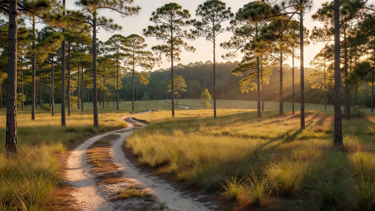
The southern end is a different world. Conecuh's thriving longleaf pine ecosystem is the reason the Forest Service talks about gopher tortoises and red-cockaded woodpeckers in the same breath down there -- longleaf savanna is one of the most species-rich habitats in North America, and the tortoise's burrow is the apartment block that half the other residents borrow.
Tree cover shifts just as hard across the state. The Oakmulgee district runs to mixed pine and oak; the northeastern districts hold Appalachian mixed mesophytic forest. In Bankhead, about 260 acres of genuine old growth survive along Bee Branch Gorge and Buck Rough Canyon -- old eastern hemlock, American beech, sweet birch, white oak, and tulip poplar, the kind of trees that make you recalculate how long they've been standing there.
Notable features
Bankhead, 181,230 acres in Lawrence, Winston and Franklin counties, is the scenic headliner. It holds the Sipsey Fork, Alabama's only National Wild and Scenic River, and enough cascades pouring off its sandstone and limestone layers to earn the nickname "land of a thousand waterfalls." It is also one of the Southern United States' premier sites for petroglyphs and prehistoric rock carvings, including the Kinlock Shelter, and it wraps around the western arm of Lewis Smith Lake.
Talladega is the big one -- 392,567 acres at the southern edge of the Appalachian Mountains, split into two separate blocks and three ranger districts (Oakmulgee in the center of the state, Shoal Creek and Talladega in the northeast). Cheaha Mountain, the state high point at 2,413 feet, sits in its Cleburne County section; the name is thought to come from the Choctaw word chaha, meaning "high." Two wilderness areas are here: the small 7,400-acre Cheaha Wilderness, and Dugger Mountain Wilderness, protecting Alabama's second-highest peak. Running through it all is the Pinhoti National Recreation Trail -- about 171 miles of it in Alabama -- whose southern terminus is Flagg Mountain near Weogufka, the southernmost peak in the state that rises over 1,000 feet. Construction started in Talladega National Forest in 1970 and the trail was finished in February 2008; at its northern end it joins the Benton MacKaye Trail, roughly 26 miles from Springer Mountain and the start of the Appalachian Trail.
Conecuh, 83,000 acres in Covington and Escambia counties, is the flat, sandy, pine-savanna one -- the name is believed to be Muskogee for "land of cane." The 20-mile Conecuh Trail winds through the coastal plain there; the Youth Conservation Corps began building it in 1976. Open Pond Recreation Area covers 450 acres with camping, and Blue Lake Recreation Area sits nearby, both off State Road 137 north of Wing.
Tuskegee, at 11,252 acres in Macon County, is the smallest national forest in the United States -- level to moderately sloping country of broad ridges, stream terraces and floodplains. Part of the Bartram Trail runs through it, and it packs in four main hiking trails, horse trails, two fish ponds, the Tsinia Wildlife Viewing Area, the Uchee Shooting Range, primitive camping and the Taska Recreation Area.
Camps are sourced from public U.S. Forest Service recreation data and have not been personally visited. Roads shown are Forest Service passenger-car routes (maintenance level 3–5) and may be seasonal or gated. Always confirm access, fees and fire rules with the ranger district before you go. Found a fee where we show free? Tell us on the contact page.