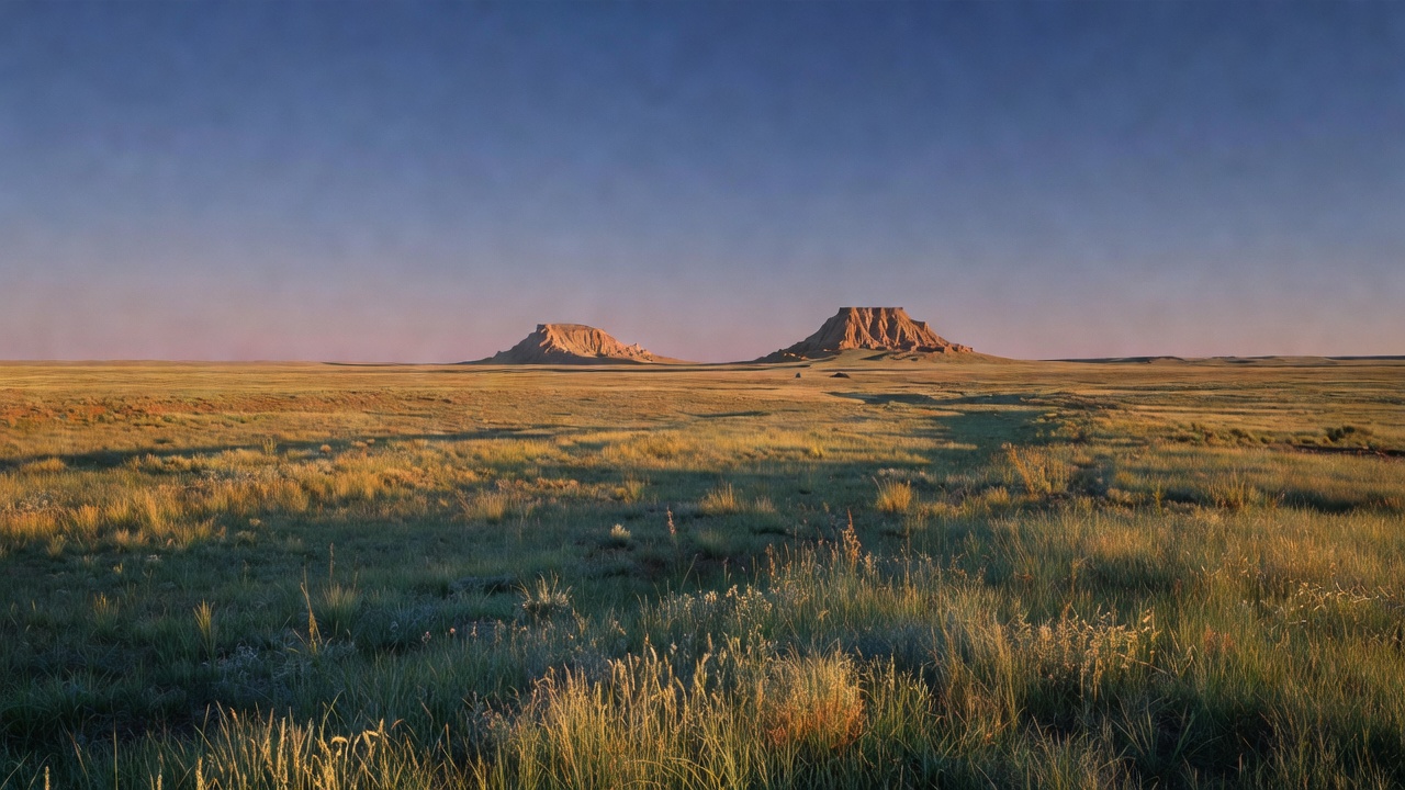
Pawnee National Grassland
Where the camps cluster
The place
Pawnee National Grassland is shortgrass prairie in Weld County, northeastern Colorado -- about 35 miles east of Fort Collins and 25 miles northeast of Greeley, with the northern edge running up toward the Wyoming line. The number that matters more than the acreage is the footprint: the Forest Service scatters those acres across a roughly 30-by-60-mile block, interleaved with private ranches, State of Colorado parcels and the USDA's Central Plains Experimental Range. It is a checkerboard, not a park. There is no entrance station and often no sign, and the agency's own instruction is to carry the Motor Vehicle Use Map and use it, because plenty of the two-tracks running off the county roads are closed to the public or lead straight onto somebody's deeded ground. On the Pawnee Pioneer Scenic and Historic Byway the Forest Service marks legal routes with numbered posts for exactly that reason -- to stop erosion and to stop accidental trespass.
The grassland comes in two main pieces. The western one is centered on Crow Valley Recreation Area outside Briggsdale, the only developed site on the unit and the only place here with shade -- cottonwoods and elms at about 4,800 feet, ringed by eroding creek drainages. The eastern piece holds the Pawnee Buttes, the landmark of the whole grassland, rising 300 feet off the prairie roughly 13 miles south of the Wyoming border. Between them is county road: gravel, mostly unpaved, and the Forest Service is blunt that wet weather can make some of it impassable and that four-wheel drive is the right call after rain or snow.
Plan around water and fuel, because the prairie supplies neither. There is no potable water at the Pawnee Buttes trailhead and none at Crow Valley either; the nearest gas station may not be close. The agency warns that temperatures can top one hundred degrees in July and August out here, with no shade to duck into and weather that changes fast. Carry water, a hat and sunscreen, top off the tank in Ault or Briggsdale, and treat the forecast as a hard constraint. Do that and this is superb, low-effort country -- day hiking, birding, wildlife watching, horseback riding, photography, and some of the darkest star-viewing within easy reach of the Front Range.
History
This was Ute and Arapaho country before American settlement, and the Forest Service notes that many other tribes moved through it -- Cheyenne, Kiowa, Apache, Comanche, Pawnee, Lakota and Shoshone. The high plains of northeastern Colorado carried enormous herds of deer, antelope, elk and bison, and the first Euro-American economy laid over that was cattle, not crops. In 1861 John Wesley Iliff started his first cow camp on Crow Creek; in 1868 he bought $40,000 worth of cattle from Charles Goodnight, who trailed them up from Texas and established the Goodnight-Loving trail through here. By 1877 Iliff's range ran from the South Platte north to the Chalk Bluffs at the Wyoming line and from the mountains east to the present Kansas border, and he was the biggest cattleman in Colorado. He got there partly by gaming the Homestead Act -- having his cowhands file and fence 160-acre claims on the water, then buying the 'homesteads' back from them. Barbed wire arrived in 1874 and cattlemen used it to fence public land for their exclusive use until President Cleveland ordered those fences off the public domain in 1885. That order was the beginning of the end for the open-range outfits.
Then came the farmers, and the fundamental problem was arithmetic. The Homestead Act of 1862 handed out 160 acres and required a quarter of it tilled; later acts pushed the total to 320. Major John Wesley Powell -- explorer of the West and later director of the U.S. Geological Survey -- said plainly in his report on the lands of the arid region that plots of less than 2,560 acres would not succeed in country this dry, and that without a dependable water supply it was futile to plow the grassland at all. He was ignored. The railroads advertised the opposite -- that 'the rain-belt has moved westward,' that 'rain follows the plow' -- because settlers meant freight. Sod-breaking began in the mid-1880s, and the pattern that followed was boom, bust, boom, catastrophe. The brutal winter of 1886-87 froze and starved thousands of cattle and broke the big ranchers; their range was carved into quarter sections. The dry years of 1889 and 1890 emptied many of the new towns. Rain returned around 1905 and settlers poured back in -- Keota, Grover and Briggsdale all boomed -- and homesteading peaked between 1914 and 1918, with over 35 percent of the land plowed. Tractors and combines let dryland farmers break still more. By 1930 roughly 60 percent of the high plains grassland in Weld County had been turned over.
In the 1930s the drought and the wind came back, and the exposed soil went with them. Winds of 50 to 60 miles an hour became routine along the Front Range from Texas to the Canadian border, and the Forest Service's own history of this ground says the farms were 'literally blown away' and the Dust Bowl country 'became a virtual desert.' Bankruptcy and tax sales followed. The population of northeastern Weld County fell from more than 600 families to around 64. What happened next is why this place is public: through the federal land utilization program, the government bought the ruined and submarginal land back, restored it, and converted it to grazing and wildlife use rather than crops. Franklin Roosevelt's Resettlement Administration put a headquarters north of Briggsdale, and the meadow along Crow Creek there became the first reclamation and demonstration plot in the area -- seventy acres, two dams and three diversion ditches built to spread floodwater over the ground. Elsewhere crews tore out and rebuilt fences into workable pastures, developed springs, dug wells, raised windmills, dug catch basins for runoff, and plowed contour furrows to stop the blowing dirt. The bared land was seeded largely to crested wheatgrass, an introduced Russian species that took the climate; within two years the planted grass had covered the old fields and limited grazing resumed. Trees went in as windbreaks and wildlife cover. The Bankhead-Jones Farm Tenant Act of 1937 gave the whole program a permanent home in the Department of Agriculture, and the local ranchers organized to run the range: the Crow Valley Grazing Association formed in 1937, and after the Pawnee area was acquired in 1938 the ranchers there formed their own association in 1941, patterned on Crow Valley's success.
The Soil Conservation Service held the land from 1938 until 1954, when it was transferred to the Forest Service to be run under multiple-use, sustained-yield. On June 20, 1960 the Secretary of Agriculture formally designated roughly 3.8 million acres of former land utilization project ground as the National Grasslands, and the Pawnee became one of them. The Forest Service's history of this grassland records grazing climbing from practically none at the start of the reclamation to around 9,000 head of cattle, with the native grasses slowly pushing the crested wheat back out and the soil blowing very little now. That history closes on a warning rather than a victory lap: constant watch must be kept to prevent another dust bowl.
Wildlife & plants
The plant community is shortgrass steppe, and it is built for exactly this -- warm-season, grazing-resistant shortgrasses, blue grama and buffalograss above all, holding ground on very little water. The USDA's long-term record next door at the Central Plains Experimental Range puts average annual precipitation at 13 inches over 1940-2019 -- and averages mislead here, because the same record swings from 4 inches in 1964 to 23 inches in 1967. April, May and June rain is what drives the growing season, and the growing season itself runs about 133 days. It does not look like much from a car window at 60 miles an hour. Get out and walk it in season and the wildflowers run from April through September. Pronghorn are the animal you are most likely to see, often at speed and at distance; mule and white-tailed deer, black-tailed prairie dogs and coyotes are all part of the same system.
Birds are the real headline. Over 200 species have been found around Crow Valley alone, and birders come here from a long way off for prairie specialists that are hard to find anywhere else -- this is one of the larger surviving blocks of shortgrass in Colorado. The Forest Service built a 21-mile self-guided bird tour through the habitat types for exactly this audience. What the science says about a prairie bird community, though, is worth knowing before you go: it is simple in species and enormous in numbers. One survey on the Pawnee recorded 1,047 individual birds from just 14 native species, and three of them -- horned lark, McCown's longspur and lark bunting, Colorado's state bird -- made up 87 percent of every bird counted. This is not a place where you rack up a long list. It is a place where you watch a handful of species that belong to this ground and almost nowhere else.
The cliffs are the exception to the flatness and the reason for the only hard closure on the grassland. Hawks, eagles and falcons nest in the rock at the Pawnee Buttes -- golden eagle and prairie falcon among them -- so the Overlook, the Lips Bluff trail and everything within 200 yards of the bottom of Lips Bluff are closed to the public March 1 through June 30 every year. The Forest Service asks that you not disturb nesting birds and not climb the bluffs at any time of year, which is both a wildlife rule and a safety one: the rock is crumbling sandstone. One more thing sits next door and shapes what is known about this landscape. The USDA's Central Plains Experimental Range, 15,500 acres established in 1937 and adjacent to the grassland, has been running livestock and vegetation research on this same shortgrass steppe for the better part of a century, with the Forest Service as a research partner. Very little prairie anywhere has been watched this closely for this long.
Notable features
The Pawnee Buttes are the destination, and they earn it. Two flat-topped remnants stand about 300 feet above the prairie -- soft, buff-colored Oligocene clay and siltstone of the Brule beds protected by a harder sandstone and conglomerate cap, which is the entire reason they are still standing while the plain around them wore away. The trail from the Pawnee Buttes trailhead runs 2 miles to the first butte, an easy walk with no shade and no water; the second butte is on private land, so the first one is where the public route ends. Vault toilets, picnic tables and trailer parking are at the trailhead, horses are welcome on the marked routes, mountain bikes are not, and the March-through-June raptor closure applies. Getting there is a string of Weld County gravel roads east and north off Colorado 14 from Ault; write down the turns before you lose signal.
Crow Valley Recreation Area near Briggsdale is the other anchor and the base camp for the western half. It is the only developed camping on the grassland, 14 miles east of Ault and about 32 miles northeast of Greeley, a quarter mile north of Highway 14 on Weld County Road 77. Cottonwoods and elms give real shade in the family campground -- the group sites have very little -- and there are vault toilets, picnic tables, short nature walks, a group picnic area that holds up to 200 people, and a volleyball court, horseshoe pit and ball field left over from its long history as the community's park. Day use runs $10 per vehicle. There is no potable water here, and dogs need a hand-held leash. The site's history is the grassland's history in miniature: it was part of one of the first reclamation projects here, the campground opened in 1938, the picnic shelter, roads and restrooms were built largely with Works Progress Administration labor, Briggsdale ran it as the town park under contract for years, and the education center was dedicated in 1981 to Steward J. Adams, the district ranger who died in office in 1979. The Lee and Dorothy Rhoads Farm Implement Museum sits inside the recreation area with the homesteaders' tools in it -- fitting, since the Rhoadses are the volunteers who researched and wrote the Forest Service's history of this grassland.
Between the two, drive the Pawnee Pioneer Scenic and Historic Byway or the 21-mile bird tour. The bird tour starts at Crow Valley, runs county roads through the habitat types and ends at Highway 14 and County Road 61, and the Forest Service figures 3 to 4 hours at a leisurely pace by vehicle -- early morning and late afternoon are the productive hours. The byway climbs to around 5,400 feet at the buttes and is the best single introduction to the human story out here: cattle empire, homestead boom, Dust Bowl, and the towns that did not make it. Keota is the one to look for. Founded in 1880, boosted by the railroad, it had a post office off and on from 1890 until 1974 and a school from 1888 to about 1951; it lost its incorporated status in 1990 and is now mostly ruins and foundations with a few modern houses nearby.
Camps are sourced from public U.S. Forest Service recreation data and have not been personally visited. Roads shown are Forest Service passenger-car routes (maintenance level 3–5) and may be seasonal or gated. Always confirm access, fees and fire rules with the ranger district before you go. Found a fee where we show free? Tell us on the contact page.