Shoshone National Forest
Where the camps cluster
The place
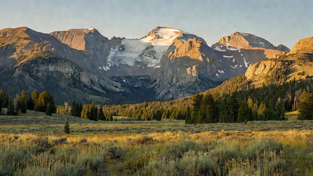
Shoshone National Forest is the eastern wall of the Greater Yellowstone country -- nearly 2.5 million acres of northwest Wyoming stacked up against the park's back door and named for the Shoshoni people, who have lived in this country for thousands of years. It is one forest with three distinct mountain personalities. In the north the Beartooths are ancient granite and windswept plateau, crossed by the Beartooth Highway at nearly 11,000 feet. Through the middle run the Absarokas, a range built out of volcanic rock that weathers into dark crumbling towers, ribs, and pinnacles above the two forks of the Shoshone River. In the south the Wind River Range rises into hard Precambrian granite, big walls, and glacier basins -- the highest country in Wyoming. The forest climbs from about 4,600 feet near Cody to just over 13,800 feet on Gannett Peak, roughly nine thousand feet of vertical, which is why a single forest can hold sagebrush flats, deep spruce timber, and permanent ice.
What you should know before you plan: this is not mostly a drive-up forest. More than 1.4 million acres -- over half of it -- is designated wilderness, where there are no roads, no motors, and no mechanized travel of any kind, so the good stuff is reached on foot or on horseback. The Forest Service counts over 1,300 miles of trails, 32 campgrounds, and 11 picnic sites, plus four scenic byways that thread the roaded country between the wilderness units. And this is genuine grizzly country, part of the same ecosystem as Yellowstone -- food storage and bear-aware camping are not optional habits here.
History
The whole national forest system starts here. On March 3, 1891, under the Forest Reserve Act, President Benjamin Harrison set aside the Yellowstone Timberland Reserve on the lands east and south of Yellowstone National Park -- the first federal forest reserve in the country. The Shoshone division of that reserve became Shoshone National Forest, and the forest has carried the 'America's First National Forest' banner ever since. In 1903, well before most of the agency's infrastructure existed, the Wapiti Ranger Station went up about 30 miles west of Cody: the first ranger station in the United States built at federal expense. It still stands, and it was added to the National Register of Historic Places on May 21, 1963, as a National Historic Landmark.
People were here far longer than that. Archaeological evidence points to habitation of this country for at least 10,000 years, and beyond the Shoshone the forest was used by the Arapahoe, Blackfeet, Comanche, Crow, Nez Perce, Northern Cheyenne, and Sioux. Mummy Cave, on the North Fork of the Shoshone River east of Yellowstone, was excavated in the 1960s and produced a record of occupation spanning more than 9,000 years, with the oldest layers radiocarbon dated to around 7,300 BC -- one of the finest paleoindian assemblages found in the Rocky Mountain region. Later came the mountain men, John Colter and Jim Bridger among them; then miners, who worked gold on the slopes of Francs Peak and left the ghost town of Kirwin behind; then the tie hacks on the south end of the forest, who cut millions of railroad ties and left the remains of their flumes and cabins in the timber.
The forest also gave American firefighting one of its hardest lessons. On August 18, 1937, lightning started the Blackwater fire in the timber west of Cody. It burned only about 1,700 acres, but on the afternoon of August 21 a dry front swung the wind and blew up the fire on top of the crews. Fifteen firefighters died. It remained the deadliest wildland-fire incident in the country between the Great Fire of 1910 and Yarnell Hill in 2013, and the reckoning that followed helped produce the smokejumper program in 1939 and, eventually, the Ten Standard Firefighting Orders.
Wildlife & plants
Shoshone is an intact piece of the Greater Yellowstone Ecosystem, and it still holds the full native cast -- all of the mammal species known here before white settlement are still present, the gray wolf having closed the last gap after the 1990s Yellowstone reintroduction. Grizzly bears range across the forest; estimates have put roughly 125 of them inside the forest boundary out of some 700 in the wider Yellowstone ecosystem, and about a dozen wolf packs totaling around 70 animals were documented here in 2012. Black bears, mountain lions, bobcats, coyotes, wolverines, martens, weasels, and badgers fill out the rest of the list.
The hooved animals are what most people come to see. Elk number over 20,000 and mule deer around 40,000. Bighorn sheep run about 5,000, and one of the largest bighorn herds in the lower 48 winters in the country near Dubois -- though the herds have been knocked back by disease since 1990. Mountain goats hold the northern high country, and moose are here but have been declining. Roughly 300 bird species have been recorded, including bald eagles, peregrine and prairie falcons; Canada lynx is federally listed as threatened, with designated recovery habitat on the forest. In the water are Yellowstone cutthroat trout, rainbow, brook and brown trout, mountain whitefish, and burbot, spread across more than 500 lakes and a thousand miles of stream.
The vegetation changes as fast as the elevation does. Sagebrush and grassland hold the low ground; lodgepole pine, Rocky Mountain juniper, and quaking aspen take the middle elevations to about 9,000 feet; above that it is subalpine fir, Engelmann spruce, and whitebark and limber pine to timberline. About a quarter of the forest is above the trees entirely, and roughly 13 percent is bare rock and ice. Bark beetles -- mountain pine, spruce, and Douglas-fir -- have worked through more than a million acres of this timber, so expect a lot of standing dead in places, and expect it to matter when you pick a tent site on a windy day.
Notable features
Gannett Peak, at just over 13,800 feet the highest point in Wyoming, stands on the Continental Divide at the forest's southern end, shared with the neighboring Bridger-Teton. Below it lies the reason Shoshone is unusual: the Wind River Range holds the greatest concentration of glaciers of any national forest in the Rocky Mountains -- the forest's own recreation guide counts 16 named and about 140 unnamed -- including Gannett Glacier, likely the largest single glacier in the American Rockies. They are shrinking; Gannett Glacier has lost more than half its volume since 1920, and Wind River glaciers overall lost about a quarter of their mass between 1985 and 2009.
Four scenic byways carry the roaded half of the forest. The Beartooth Highway (U.S. 212) climbs over 10,947-foot Beartooth Pass to Yellowstone's northeast entrance and is designated an All-American Road. The Buffalo Bill Cody Scenic Byway (U.S. 14/16/20) runs west from Cody up the North Fork past the Wapiti Ranger Station toward Sylvan Pass. The Chief Joseph Scenic Byway (Wyoming 296) connects Cody to the Beartooth along the route of the Nez Perce flight of 1877. The Wyoming Centennial Scenic Byway (U.S. 26/287) crosses Togwotee Pass toward Jackson Hole.
The Clarks Fork of the Yellowstone is Wyoming's only federally designated Wild and Scenic River, running 22 miles through the forest in a canyon with walls up to 2,000 feet. Five wilderness areas cover the bulk of the backcountry -- North Absaroka, Washakie, Fitzpatrick, Popo Agie, and the Wyoming end of the Absaroka-Beartooth. In the Popo Agie, the Cirque of the Towers is one of the most famous rock-climbing amphitheaters in America, with something like 200 routes on the peaks that ring it. And the Continental Divide Trail crosses the forest at Sheridan Pass.
Camps are sourced from public U.S. Forest Service recreation data and have not been personally visited. Roads shown are Forest Service passenger-car routes (maintenance level 3–5) and may be seasonal or gated. Always confirm access, fees and fire rules with the ranger district before you go. Found a fee where we show free? Tell us on the contact page.