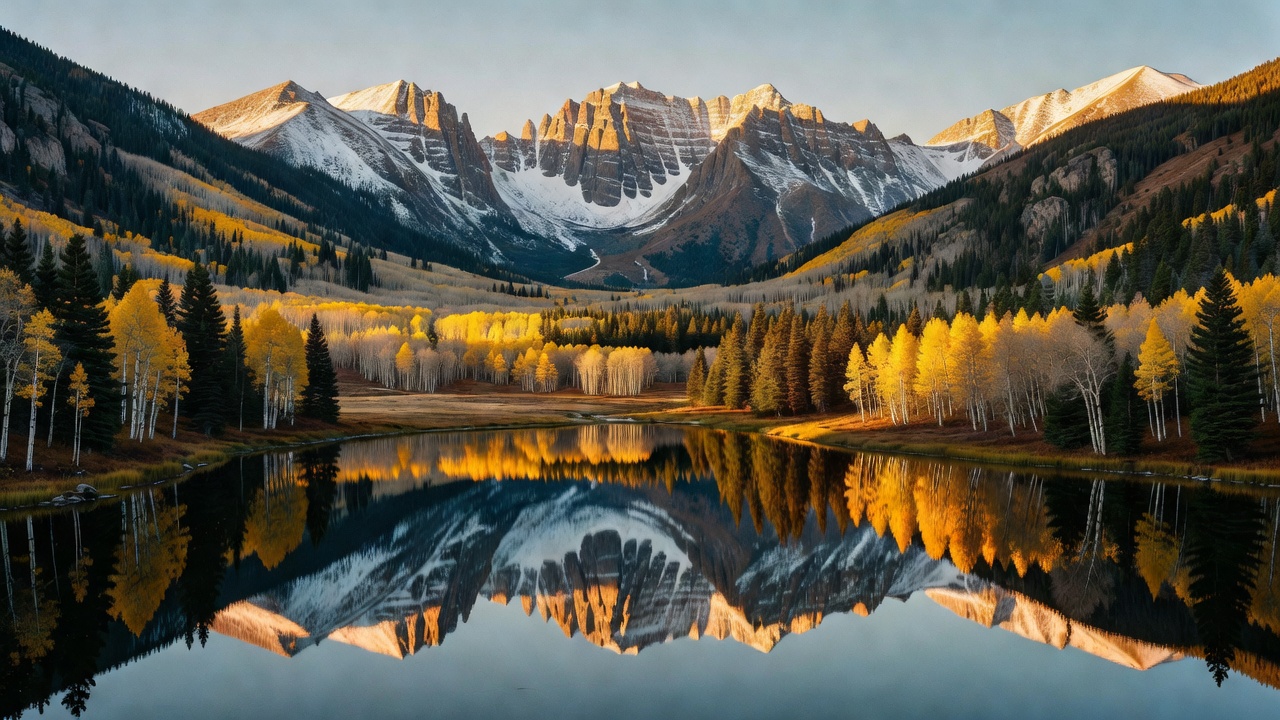
White River National Forest
Where the camps cluster
The place
White River is the forest most people mean when they picture Colorado. Roughly two and a half million acres of high country in the northwest quarter of the state, it sprawls across Eagle, Pitkin, Garfield, Summit, Rio Blanco, Mesa, Gunnison, Routt and Moffat counties, with Glenwood Springs as the nearest city and Aspen, Vail, Breckenridge and Dillon all sitting in or against it. The Forest Service runs it out of five ranger districts -- Aspen-Sopris, Blanco, Dillon, Eagle-Holy Cross and Rifle -- and describes it plainly as a world-renowned recreation destination, which for once is not marketing.
Geologically it is five landscapes stapled together. The Gore, Tenmile, Sawatch and Elk ranges give it the classic jagged skyline, including ten peaks above 14,000 feet; Castle Peak in the Elk Mountains, at 14,279 feet, is the forest's high point. Then there are the Flat Tops, which are exactly what they sound like and nothing like the rest -- a broad volcanic plateau capped by horizontal basalt flows, its summits sitting between 11,000 and 12,000 feet, its edges chewed into cliffs by glaciers. Standing on the Flat Tops feels like standing on a table in the sky, and it is the single most distinctive piece of country in the forest.
What that means for you: this is a big, well-roaded forest -- Wikipedia's figures put it at about 2,500 miles of trail and 1,900 miles of forest road, with four major reservoirs (Dillon, Green Mountain, Ruedi and Homestake) -- but it is also one of the most heavily used pieces of public land in America, widely cited as the most-visited national forest in the country. Popularity has consequences. The marquee spots here run on permits and shuttles rather than first-come luck, high roads open late because the snow says so, and solitude is something you drive toward rather than something you're handed at the forest boundary. Come with a second and third plan.
History
The forest was established on June 28, 1902, but its place in American history was earned seventeen years later, at a lake on the Flat Tops. In the summer of 1919 the Forest Service sent Arthur H. Carhart -- its first landscape architect, then 27 years old -- to Trappers Lake to survey around a hundred summer home sites and lay out a road around the shoreline. Carhart did the survey and then closed his report by recommending, in the strongest terms, that none of it be built. 'There are a number of places with scenic values of such great worth that they are rightfully the property of all people,' he wrote. 'They should be preserved for all time for the people of the Nation and the world. Trappers Lake is unquestionably a candidate for that classification.'
In what the agency itself calls an unprecedented move, the Forest Service set the plans aside for further study. The road was never built. Carhart went on to work with Aldo Leopold, and the memorandum laying out their shared thinking became the foundation of the wilderness concept that eventually produced the 1964 Wilderness Act. That is why Trappers Lake and the Flat Tops are known as the Cradle of Wilderness -- the place where the idea was first applied to public land. The Flat Tops Wilderness itself was designated in 1975 and covers 235,214 acres, the third largest wilderness in Colorado.
The forest's other great historical chapter is a military one. In 1942 the Army built Camp Hale at 9,238 feet in the Eagle River valley between Red Cliff and Leadville, and trained the 10th Mountain Division there in mountaineering, alpine and Nordic skiing, cold-weather survival and weapons -- some 15,000 soldiers at its peak. The camp was decommissioned in November 1945, and the men who had learned to ski under load in that valley came home and built the American ski industry; Pete Seibert, who trained at Camp Hale, founded Vail nearby in 1962. On October 12, 2022, the site was designated Camp Hale-Continental Divide National Monument -- 53,804 acres, managed by this forest.
A third piece of history came and went. In 1929 President Herbert Hoover set aside Holy Cross National Monument around Mount of the Holy Cross, and it passed to the National Park Service in 1933. The mountain was simply too remote for the tourism anyone imagined, and President Truman abolished the monument in 1950, returning the ground to White River National Forest. It is the Holy Cross Wilderness today.
Wildlife & plants
This is prime Rocky Mountain big-game country. The forest holds deer, elk, bighorn sheep, mountain goats, black bears, moose, mountain lions and lynx, along with a long list of birds. Colorado has the largest elk population in North America -- Colorado Parks and Wildlife puts the statewide herd at more than 290,000 animals, up from fewer than 1,000 in 1910 -- and CPW describes the White River drainage as holding some of the largest elk and mule deer herds in the state. The White River herd has been big enough for long enough that a dedicated Habitat Partnership Program committee has worked since 1993 to bring it down toward its population objective and reduce conflicts with ranching. If you camp here in September you will hear bugling.
The vegetation stacks the way it does everywhere in the southern Rockies, just with more vertical to work with. Aspen groves take the lower and middle slopes -- and in this forest they are spectacular in late September. Above them come lodgepole pine, then Engelmann spruce and subalpine fir to timberline, then alpine tundra on the plateau tops and the ridgelines. The Flat Tops carry roughly 110 lakes and ponds across that high tableland, and Trappers Lake -- 302 acres at 9,627 feet -- holds a native strain of cutthroat trout, which is why motors are banned on it and boats have to be hand-carried the last quarter mile.
Fire and beetles are part of the picture here, as they are across Colorado. Lightning fires in August 2002 burned more than 22,500 acres of the Flat Tops Wilderness, about a tenth of it. Expect standing dead timber in places, and expect the forest to be in fire restrictions during a dry summer -- as of this writing all five ranger districts were posting Very High fire danger and Stage 2 restrictions. Check before you strike a match.
Notable features
The Maroon Bells are the forest's signature and probably Colorado's most photographed view: Maroon Peak at 14,163 feet and North Maroon Peak at 14,019, rising above Maroon Lake in bands of dark red rock. That color is Maroon Formation mudstone, and it is the reason the peaks are beautiful from the lake and lethal from the ridge -- the rock fractures readily, and the Forest Service's own warning sign describes it as 'downsloping, loose, rotten and unstable.' They earned the nickname 'the Deadly Bells' in 1965, when eight people died in five separate accidents. Roughly 300,000 people a year visit; from mid-June into early October a shuttle runs every 20 minutes from Aspen Highlands and private vehicles are largely kept out.
Mount of the Holy Cross, just over 14,000 feet in the Sawatch and the high point of Eagle County, carries a cross-shaped snowfield on its northeast face. William Henry Jackson made the first widely seen photograph of it in 1873, Thomas Moran painted it, Longfellow wrote 'The Cross of Snow' about it, and for a while it drew genuine pilgrimages. The Cross Couloir is now a classic snow climb.
On the forest's western edge, the Colorado River cuts Glenwood Canyon -- about 12.5 miles long with walls up to 1,300 feet, and one of the most scenic stretches of the entire Interstate Highway System. Hidden in its north wall is Hanging Lake: a shallow, turquoise, travertine-rimmed pool that formed when roughly an acre and a half of valley floor sheared off along a fault and dropped. It became a National Natural Landmark in 2011, draws well over 130,000 visitors a year, and since 2019 has required a paid permit to reach the trailhead -- a mile and a bit of trail for about a thousand feet of climbing.
Up on the Flat Tops, the Devil's Causeway is the walk people talk about: a neck of the plateau where glaciers cutting from both sides nearly met, leaving a rock catwalk that narrows to three or four feet with a long drop on either hand. And spread across the forest are eight wilderness areas -- Collegiate Peaks, Eagles Nest, Flat Tops, Holy Cross, Hunter-Fryingpan, Maroon Bells-Snowmass, Ptarmigan Peak and Raggeds, several of them shared with neighboring forests -- covering more than a third of the whole place.
Camps are sourced from public U.S. Forest Service recreation data and have not been personally visited. Roads shown are Forest Service passenger-car routes (maintenance level 3–5) and may be seasonal or gated. Always confirm access, fees and fire rules with the ranger district before you go. Found a fee where we show free? Tell us on the contact page.