Morapos Trailhead
Everything you need — measured from Morapos Trailhead · White River National Forest · CO
- OOutfitter13 mi
- GGrocery21 mi
- WWater22 mi
- ShShower22 mi
- RxPharmacy22 mi
- FFuel22 mi
- MMechanic22 mi
- HHardware22 mi
- @Mail22 mi
- +Urgent care23 mi
- DDump38 mi
- LLaundry43 mi
- PPropane57 mi
The read: water is a real 22-mi drive, fuel & food sit about 21 mi out.
One dot per need — the nearest of each kind, straight-line from camp. Places from OpenStreetMap (© OpenStreetMap contributors); the EV fast charger from the US DOE station locator. Open in Google Maps ↗
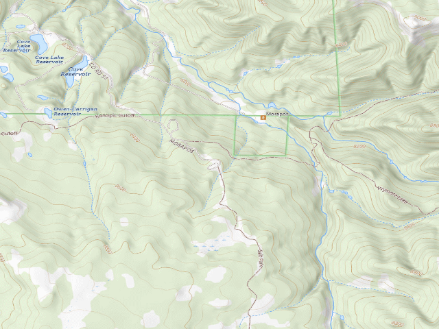
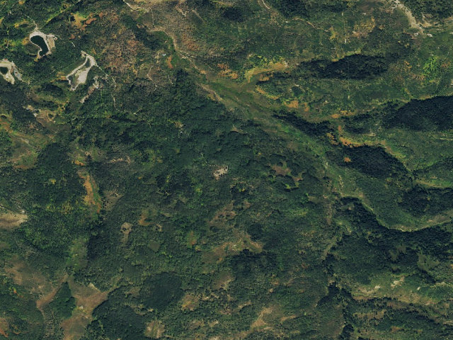
The site — Morapos Trailhead
Nearby & resupply — around Morapos Trailhead · White River National Forest · CO (OpenStreetMap)
- Water featureOwen-Carrigan Reservoir (water) · mapped within 1.6 mi
- Nearest townThornburgh · ~7.2 mi
- Drinking waternone within 10 mi
- FuelMaverik · ~22.4 mi
- Propane / LPGnone within 31 mi
- GroceriesWatt's Ranch Market · ~20.9 mi
- PharmacyWalmart Pharmacy · ~22.2 mi
- Hospital / clinicPioneers Medical Center · ~19.6 mi
- HardwareHarbor Freight Tools · ~22.5 mi
Nearby restrooms — around Morapos Trailhead · White River National Forest · CO — pit toilets, restrooms & rest areas (government data)
- Vault / pit toiletMorapos · ~0.4 mi NE · USFS
- RestroomNorth Fork Cg · ~11.3 mi SE · USFS
- RestroomEast Marvine · ~14.2 mi SE · USFS
- Vault / pit toiletMarvine Cg · ~14.5 mi SE · USFS
Coming out here — Morapos Trailhead · White River National Forest · CO
- Surface water mapped nearby: Owen-Carrigan Reservoir (water). That is wash water at best, and nobody has checked it for you — a creek can be dry and a tank can be mud. Filter or boil anything you drink.
- Assume no services at all. Most dispersed camping in a national forest has none: no tap, no power, no dump, often no toilet. Everything you need, you bring.
- Power: Dave carries his own — batteries or solar. A generator will run your rig and it is also the thing everybody camped near you can hear.
- Getting online: Dave recommends Starlink. He has had it since SpaceX introduced it, used it for four years living on the road, and it delivers as promised — several hundred nights out, and he can count on one hand the places he could not connect. The cable on his unit runs 150 feet, which is usually all it takes to find enough sky. Starlink → Referral link — Starlink pays Dave $100 in cash if you sign up through it, and that money funds this site and the next trip. It costs you nothing and does not change the recommendation.
Open Morapos Trailhead elsewhere
Other camps near Morapos Trailhead
If this one is full, gated or washed out.
- North Fork Cg~11.3 mi · fee
- East Marvine~14.2 mi · fee
- Marvine Cg~14.5 mi · fee
- Ripple Creek Pass~14.9 mi
The unit that manages Morapos Trailhead
Stay limits, road closures and fire restrictions at Morapos Trailhead are set by White River National Forest, not by the campsite — check there before you go.
Snow, and when this opens
The nearest automatic snow station is Ripple Creek at 10,340 ft, about 15 miles away. It sits about 1,918 ft higher than this camp, so treat it as a guide rather than a reading for this spot. We do not repeat a depth here, because any number we stored would be stale by the time you read it — the station publishes today's.
How we know this — Morapos Trailhead
What we don’t know about Morapos Trailhead
A land record can put you within a few meters of a spot. It cannot tell you any of this — so check it yourself, and treat anything below as the open question it is.
- Road surface & last-mile access
- How many rigs actually fit
- Cell coverage by carrier
- Seasonal & winter access
- Current fire restrictions
- Whether any water here is drinkable
- Shade & wind exposure
- Noise and who else shows up
- Whether a listed EV charger works today, or the road miles to it