Agency-listedUSFS · dispersedFree
Bienville WMA camp site 2
Drive-up · U.S. Forest Service · MS · 32.43220, -89.55626
Ask an AI about this campsiteOpens Grok already loaded with this site. It reads the same records this page is built from, and links whatever it tells you.
Ask about this camp →U.S. Forest Service lists this site. On most of their ground you can camp away from developed sites pretty much anywhere — so treat this as a known-good spot, not the only one allowed. The unit sets stay limits and how far off road and water you must be. What changes is conditions — roads, gates, closures, fire rules. Check those with the unit before you commit to the drive.
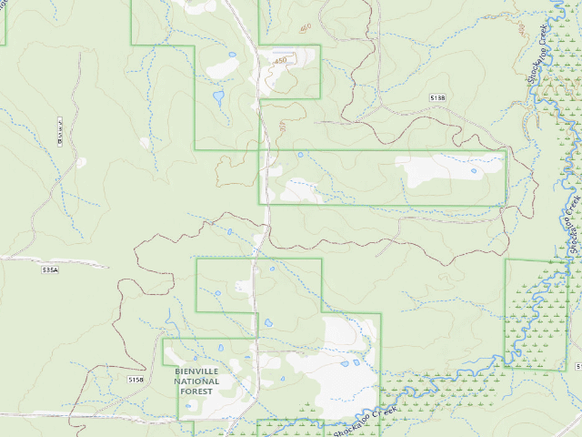
USGS topo — contours & terrain
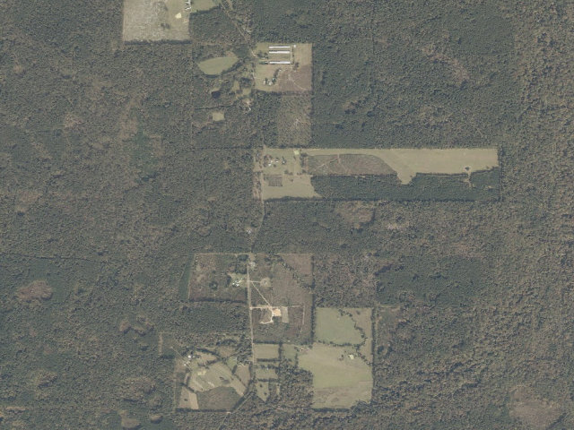
Aerial — USGS / NAIP
Weather outlook — at Bienville WMA camp site 2
Loading the latest forecast…
Live NWS area forecast (~2.5 km grid, not elevation-corrected). Camp sits at 446 ft.
Fire & smoke — around Bienville WMA camp site 2NIFC · AirNow
Checking active fires & air quality…
Active wildfires from NIFC (within ~50 mi); air quality from AirNow. Always confirm current fire restrictions with the managing office before you go.
Everything you need — measured from Bienville WMA camp site 2 · U.S. Forest Service · MS
Straight-line miles · bearings approx · roads run longer
Nearest of each
- @Mail3 mi
- FFuel6 mi
- RxPharmacy6 mi
- HHardware6 mi
- GGrocery7 mi
- +Urgent care25 mi
- EVEV fast charger28 mi
- MMechanic28 mi
- WWater35 mi
- OOutfitter36 mi
- AAir-up38 mi
- LLaundry38 mi
- DDump44 mi
≤30 mi30–4545+water
The read: water is a real 35-mi drive, fuel & food sit about 6 mi out.
Not within 60 mi: Propane. Plan those before you head up.
One dot per need — the nearest of each kind, straight-line from camp. Places from OpenStreetMap (© OpenStreetMap contributors); the EV fast charger from the US DOE station locator. Open in Google Maps ↗
The site — Bienville WMA camp site 2
Access
Drive-up
Land
U.S. Forest Service · dispersed
Elevation
446 ft
State
MS
Coordinates
32.43220, -89.55626
Cost
Free
Nearby & resupply — around Bienville WMA camp site 2 · U.S. Forest Service · MS (OpenStreetMap)
- Nearest townClifton · ~2.4 mi
- Drinking waternone within 10 mi
- FuelShell · ~6.3 mi
- Propane / LPGnone within 31 mi
- GroceriesStore · ~6.7 mi
- PharmacyOlde Towne Drugs · ~29.5 mi
- Hospital / clinicLackey Memorial Hospital · ~6.8 mi
EV charging — from Bienville WMA camp site 2 · U.S. Forest Service · MS — nearest public DC fast & Level 2 (US DOE station data)
- Nearest public DC fast charger27.5 mi straight-line SW — Entergy Services Inc. - Poindexter EV Hub, Brandon, MS · EV Connect · CCS · 4 fast ports listed · listed open, last confirmed by AFDC 2026-09-16 · hours: 24 hours daily · directions
- Public DC fast stations within reachnone within 25 mi · 22 within 50 · 49 within 100 · 133 within 150
- Nearest listing NACS (Tesla)36.4 mi — Pearl, MS - Tesla Supercharger, Pearl
- Nearest listing CHAdeMO34.2 mi — L830 SVC 1, Ridgeland
- Nearest public Level 2 (J1772)25.9 mi — East Central Community College, Decatur, MS (at a parking lot) · Non-Networked · J1772 · 2 Level 2 ports listed · listed open, last confirmed by AFDC 2025-07-03 · hours: 24 hours daily
- Pricing at the fast chargernot listed
- Power (kW)not listed by AFDC — “DC fast” spans roughly 24 to 350 kW, so ask the network.
- Read this honestlyStraight-line miles, like every distance on this site. Roads run longer than this, and you have to get back. We know where a charger is listed. We don’t know if it works today, how fast it is, or the road miles. Check the network before you commit.
Snapshot 2026-09-16 · AFDC record 386893 · US DOE Alternative Fuels Data Center
Nearby restrooms — around Bienville WMA camp site 2 · U.S. Forest Service · MS — pit toilets, restrooms & rest areas (government data)
- Vault / pit toiletShockaloe Trail Bc 2 · ~2.5 mi S · USFS
- Vault / pit toiletShockaloe Trail Bc 1 · ~4.5 mi S · USFS
- Highway rest areaNHS Rest Area Scott County I-20 EB · ~10.0 mi SE
- Highway rest areaNHS Rest Area Scott County I-20 WB · ~12.1 mi SW
Open Bienville WMA camp site 2 elsewhere
Other camps near Bienville WMA camp site 2
If this one is full, gated or washed out.
- Shockaloe Trail Bc 2~2.5 mi · fee
- Shockaloe Trail Bc 1~4.5 mi · fee
- Bienville WMA camp site 1~5.2 mi
- Caney Creek WMA camp site 5~10.1 mi
How we know this — Bienville WMA camp site 2
Stay limit
30 nights (camp in a dispersed area for up to 30 days)
Source
public land records
Confidence
Likely — The record is good enough to put a pin on, but thin in places. Treat the details as a starting point, not gospel.
How it was placed
Camp site mapped by MDWFP inside Bienville WMA, which lies on U.S. Forest Service land. Camping here is governed by the U.S. Forest Service, not MDWFP: 40 Miss Admin Code Pt 2 Ch 1 Rule 1.2 M ('Camping is allowed subject to U.S. Forest Service regulations') and Rule 1.5 A, which records the 10 Apr 2002 MOU giving the Forest Service authority over WMAs inside National Forest land. Forest Service dispersed-camping rules for the National Forests in Mississippi (fs.usda.gov/r08/mississippi/recreation/camping-cabins, read 2026-08-13): 'You may camp in a dispersed area for up to 30 days. After 30 days, you must move at least 5 road miles for camping in another dispersed area.' Camp 'at least 100 feet from any stream or other water source'; use existing fire rings; no wood permit needed; bury human waste in a cathole 200 ft from water or pack it out. Dispersed camping means 'no services (such as trash removal) and little or no facilities'. No fee. Coordinate is MDWFP's own GIS: public ArcGIS service https://arcgis.mdwfp.com/arcgis/rest/services/Website/WMA_New/MapServer layer 0 ('WMA POINT FEATURES'), queried 2026-08-13 for TYPE IN ('CAMPING','CAMP SITE','CAMP SITES'). It is the agency's mapped camp-site point, NOT a field visit and NOT a geocode. MDWFP does not publish per-site facilities, so table/fire-ring/toilet presence is UNKNOWN. No water source is claimed. A WMA User Permit (Rule 1.6 B, $15 resident / $30 non-resident annual) is required on USFS-owned WMAs only of people hunting, fishing or trapping -- not of campers. MDWFP Rule 1.1 bans alcoholic beverages on WMAs. Hunting seasons run here -- check mdwfp.com/wma and the Forest Service Motor Vehicle Use Map before you go, and wear hunter orange in season. Nearest town: Forest ~6.7 mi -- STRAIGHT-LINE distance to the nearest OpenStreetMap place=city/town/village, NOT a driving distance; in the Delta and the Pascagoula bottoms the road in can be far longer. MDWFP does not name its individual camp points, so the number in this row's name is ours, assigned in MDWFP OBJECTID order, not a sign on the ground. Ingest 2026-08-13.
--- NIGHT SHIFT REVIEW 2026-08-18 (reviewer=nightshift-verified) --- Coordinate re-checked against the live agency source this fire: MDWFP ArcGIS https://arcgis.mdwfp.com/arcgis/rest/services/Website/WMA_New/MapServer layer 0 ('WMA POINT FEATURES'), re-queried 2026-08-18 for TYPE IN ('CAMPING','CAMP SITE','CAMP SITES'). 182 camp points came back and this row's lat/lon still matches its agency point EXACTLY (0 m): OBJECTID 518, TYPE 'CAMP SITE', WMA label 'BIENVILLE WMA'. All 92 pending MDWFP rows in this state matched exactly, so the coordinate provenance recorded above holds. CONTAINMENT re-checked this fire against layer 2 ('WMA PROPERTY BOUNDARY') with a point-in-polygon query: the point falls inside 'BIENVILLE WMA'. Rule 1.2 re-read 2026-08-18 (40 Miss. Code R. 2-1.2 [Effective 6/30/2025], 'NON-STATE OWNED, NON-COE WMA REGULATIONS'): paragraph A still lists Bienville among the covered areas, and paragraph M still reads verbatim "CAMPING: Camping is allowed subject to U.S. Forest Service regulations or the regulations below:" -- the 'below' exceptions are only Wolf River, John Starr and Little Biloxi, so Bienville remains under Forest Service camping rules exactly as recorded above. Rule 1.5 A re-read the same day and still reads verbatim "The current Memorandum of Understanding dated April 10, 2002, between the U.S. Forest Service and the MDWFP establishes the Forest Service as having authority to regulate access on wildlife management areas within National Forest Lands." Forest Service dispersed-camping rules re-read 2026-08-18 at https://www.fs.usda.gov/r08/mississippi/recreation/camping-cabins -- "The National Forests in Mississippi welcomes dispersed camping in all forests", "You may camp in a dispersed area for up to 30 days. After 30 days, you must move at least 5 road miles for camping in another dispersed area", "Please place your campsite at least 100 feet from any stream or other water source" and "No amenities are provided, such as water, restrooms or trash cans" are all still present, unchanged. TWO CORRECTIONS to the older text above, both from that Forest Service page as read this fire: (1) the page ALSO says "Campers may not return to the same campsite within the calendar year" -- a real limit the note above omits; (2) the note above says to bury human waste in a cathole '200 ft from water'. The agency page actually says "dig a hole six (6) inches deep at least 100 feet away from any water source" and "take your toilet paper with you". 100 feet / 6 inches is the agency figure; the 200 ft was our error, not theirs. The page also asks campers to "keep your campsite within 150 feet from a roadway". No potable water is available here and none is claimed; the agency tells campers to "Carry water or a water filtration device with you". WMA User Permit re-verified 2026-08-18 at 40 Miss. Code R. 2-1.6 [Effective 6/30/2025]: Resident Annual $15.00, Non-Resident Annual $30.00; required of ALL users on WMA property not owned by the U.S. Forest Service, and on USFS-owned WMA property only of those hunting, fishing or trapping; persons exempt from a licence under Miss. Code Ann. 49-7-5 / 49-7-9 are exempt. Unchanged from what is recorded above. DUPLICATE CHECK: every pending Mississippi row was compared BY COORDINATE (haversine, never by name) against all published and 'later' Mississippi camps. This row has no published camp within 1500 m and no other pending row within 120 m. Checked specifically for the trap that caught Upper Sardis in this same batch: this point is not within 1500 m of any National Forests in Mississippi developed FEE campground we already hold (Marathon Lake, Shockaloe Trail BC1/BC2, Chewalla Lake, Puskus Lake, Big Biloxi, Cypress Creek Landing, Clear Springs, Choctaw Lake, Davis Lake, Turkey Fork, Long Leaf Horse Camp, Delta Hunt Camps), so this is dispersed ground and free rather than a fee site. VERDICT: HOLDS UP. Free dispersed camping on National Forest land inside Bienville WMA. Campers need no permit (the WMA User Permit binds only hunters, anglers and trappers on USFS-owned WMAs). Facilities UNKNOWN, no water available and none claimed.
EV chargers
US DOE Alternative Fuels Data Center station locator, snapshot 2026-09-16. Straight-line miles to the nearest public, open, unrestricted station; restricted and planned units are shown but never counted.
Field check
On the agency's books. The land manager inventoried this site, so its existence is not in question — current conditions are. Nobody from here has camped it recently.
What we don’t know about Bienville WMA camp site 2
A land record can put you within a few meters of a spot. It cannot tell you any of this — so check it yourself, and treat anything below as the open question it is.
- Road surface & last-mile access
- How many rigs actually fit
- Cell coverage by carrier
- Seasonal & winter access
- Current fire restrictions
- Whether any water here is drinkable
- Shade & wind exposure
- Noise and who else shows up
- Whether a listed EV charger works today, or the road miles to it
Before you go — Bienville WMA camp site 2
Water on public land →What “dispersed” means here →Forest road numbers →Power off-grid →All field notes →
Been here? Tell us what changed. This page is built from public records, so the fastest way it gets better is somebody who has actually pulled in. Road washed out, site gone, gate locked, or it is exactly as described — all of it useful. Send a report →