Dalton-Rd 329-008
Everything you need — measured from Dalton-Rd 329-008 · Helena-Lewis and Clark National Forest · MT
- @Mail9 mi
- FFuel9 mi
- GGrocery9 mi
- HHardware9 mi
- PPropane24 mi
- EVEV fast charger29 mi
- +Urgent care32 mi
- MMechanic33 mi
- DDump34 mi
- LLaundry34 mi
- WWater35 mi
- OOutfitter35 mi
- RxPharmacy35 mi
- ShShower37 mi
- AAir-up59 mi
The read: water is a real 35-mi drive, fuel & food sit about 9 mi out.
One dot per need — the nearest of each kind, straight-line from camp. Places from OpenStreetMap (© OpenStreetMap contributors); the EV fast charger from the US DOE station locator. Open in Google Maps ↗
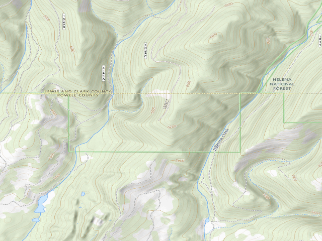
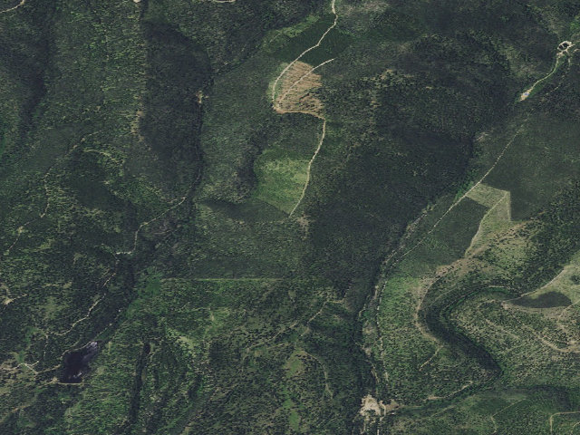
The site — Dalton-Rd 329-008
Nearby & resupply — around Dalton-Rd 329-008 · Helena-Lewis and Clark National Forest · MT (OpenStreetMap)
- Water featureWater · nearby
- Nearest townFinn · ~4.3 mi
- Drinking waternone within 10 mi
- FuelExxon · ~8.8 mi
- Propane / LPGnone within 31 mi
- GroceriesStore · ~8.8 mi
- Hospital / clinicDeer Lodge Medical Center · ~28.7 mi
- HardwareGrizzly Home Center · ~8.8 mi
EV charging — from Dalton-Rd 329-008 · Helena-Lewis and Clark National Forest · MT — nearest public DC fast & Level 2 (US DOE station data)
- Nearest public DC fast charger28.7 mi straight-line S — Sinclair - Tesla Supercharger, Deer Lodge, MT (at a gas station) · Tesla · NACS (Tesla) · 8 fast ports listed · listed open, last confirmed by AFDC 2026-09-14 · hours: 24 hours daily · directions
- Public DC fast stations within reachnone within 25 mi · 5 within 50 · 17 within 100 · 39 within 150
- Nearest listing CCS34.9 mi — Target T1282 (Helena, MT), Helena
- Nearest listing CHAdeMO35.6 mi — L146 DC1, Helena
- Nearest public Level 2 (J1772)29.7 mi — JD Self Service Storage, Deer Lodge, MT (at an office building) · AMPUP · J1772 · 2 Level 2 ports listed · listed open, last confirmed by AFDC 2023-12-13 · hours: Contact site for information
- Also listed, not counted aboveNACS-only Level 2 — Trixi's Saloon - Tesla Destination, Ovando, 24.2 mi · NACS (Tesla) · hours: 24 hours daily. Open to Teslas only. · AFDC lists it “Free”
- Pricing at the fast charger$0.56 per kWh (as listed by AFDC)
- Power (kW)not listed by AFDC — “DC fast” spans roughly 24 to 350 kW, so ask the network.
- Read this honestlyStraight-line miles, like every distance on this site. Roads run longer than this, and you have to get back. We know where a charger is listed. We don’t know if it works today, how fast it is, or the road miles. Check the network before you commit.
Snapshot 2026-09-16 · AFDC record 466520 · US DOE Alternative Fuels Data Center
Nearby restrooms — around Dalton-Rd 329-008 · Helena-Lewis and Clark National Forest · MT — pit toilets, restrooms & rest areas (government data)
- Vault / pit toiletStemple Pass Trailhead · ~10.4 mi NE · USFS
- Vault / pit toiletAspen Grove Picnic Area · ~12.9 mi NE · USFS
- Vault / pit toiletAspen Grove Campground · ~12.9 mi NE · USFS
- Vault / pit toiletLost Horse Cabin · ~12.9 mi E · USFS
Open Dalton-Rd 329-008 elsewhere
Other camps near Dalton-Rd 329-008
If this one is full, gated or washed out.
- Madison Gulch Rd-011~0.4 mi
- Madison Gulch Rd-009~0.6 mi
- Madison Gulch Rd-010~0.8 mi
- Jefferson Crk-Rd 329-001~1.1 mi
The unit that manages Dalton-Rd 329-008
Stay limits, road closures and fire restrictions at Dalton-Rd 329-008 are set by Helena-Lewis and Clark National Forest, not by the campsite — check there before you go.
Snow, and when this opens
The nearest automatic snow station is Nevada Ridge at 7,030 ft, about 9 miles away. It sits about 818 ft higher than this camp, so treat it as a guide rather than a reading for this spot. We do not repeat a depth here, because any number we stored would be stale by the time you read it — the station publishes today's.
How we know this — Dalton-Rd 329-008
What we don’t know about Dalton-Rd 329-008
A land record can put you within a few meters of a spot. It cannot tell you any of this — so check it yourself, and treat anything below as the open question it is.
- Road surface & last-mile access
- How many rigs actually fit
- Cell coverage by carrier
- Seasonal & winter access
- Current fire restrictions
- Whether any water here is drinkable
- Shade & wind exposure
- Noise and who else shows up
- Whether a listed EV charger works today, or the road miles to it