Ecrow09A
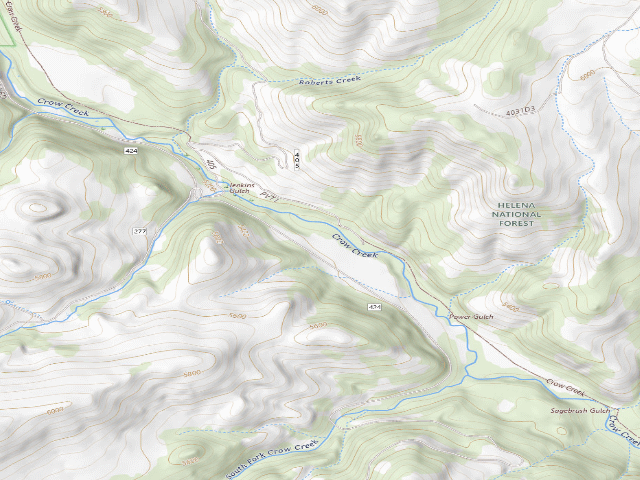
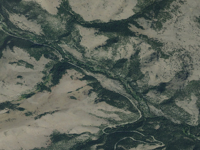
Everything you need — measured from Ecrow09A · Helena-Lewis and Clark National Forest · MT
- FFuel10 mi
- GGrocery10 mi
- HHardware10 mi
- @Mail10 mi
- DDump18 mi
- ShShower18 mi
- MMechanic22 mi
- +Urgent care22 mi
- RxPharmacy23 mi
- LLaundry24 mi
- WWater25 mi
- OOutfitter25 mi
- EVEV fast charger25 mi
- AAir-up43 mi
The read: water is a real 25-mi drive, fuel & food sit about 10 mi out.
Not within 60 mi: Propane. Plan those before you head up.
One dot per need — the nearest of each kind, straight-line from camp. Places from OpenStreetMap (© OpenStreetMap contributors); the EV fast charger from the US DOE station locator. Open in Google Maps ↗
The site — Ecrow09A
Nearby & resupply — around Ecrow09A · Helena-Lewis and Clark National Forest · MT (OpenStreetMap)
- Water featureWeston Creek (stream) · nearby
- Nearest townHassel (site) · ~3.2 mi
- Drinking waternone within 10 mi
- FuelFuel · ~10.0 mi
- Propane / LPGnone within 31 mi
- Dump station~18.5 mi
- GroceriesTown Pump · ~10.0 mi
- PharmacyBergum Drug · ~23.3 mi
- Hospital / clinicBillings Clinic Broadwater · ~10.3 mi
- HardwareHardware Hanke · ~10.1 mi
EV charging — from Ecrow09A · Helena-Lewis and Clark National Forest · MT — nearest public DC fast & Level 2 (US DOE station data)
- Nearest public DC fast charger25.2 mi straight-line NW — L146 DC 2, Helena, MT · ChargePoint Network · CHAdeMO, CCS · 1 fast port listed · listed open, last confirmed by AFDC 2026-09-16 · hours: 24 hours daily · directions
- Public DC fast stations within reachnone within 25 mi · 9 within 50 · 21 within 100 · 34 within 150
- Nearest listing NACS (Tesla)25.8 mi — Helena, MT - Tesla Supercharger, Helena
- Nearest public Level 2 (J1772)10.2 mi — Silos's Junction - Tesla Destination, Townsend, MT · Tesla Destination · J1772, NACS (Tesla) · 2 Level 2 ports listed · listed open, last confirmed by AFDC 2026-08-27 · hours: 24 hours daily. Open to all vehicles.
- Pricing at the fast chargernot listed
- Power (kW)not listed by AFDC — “DC fast” spans roughly 24 to 350 kW, so ask the network.
- Read this honestlyStraight-line miles, like every distance on this site. Roads run longer than this, and you have to get back. We know where a charger is listed. We don’t know if it works today, how fast it is, or the road miles. Check the network before you commit.
Snapshot 2026-09-16 · AFDC record 354437 · US DOE Alternative Fuels Data Center
Nearby restrooms — around Ecrow09A · Helena-Lewis and Clark National Forest · MT — pit toilets, restrooms & rest areas (government data)
- Vault / pit toiletEagle Guard Station Cabin · ~1.4 mi N · USFS
- RestroomCrow Creek Toilet · ~4.2 mi SE · BLM
- RestroomRadersburg Ohv Recreation Site - Toilet · ~8.4 mi SE · BLM
- Vault / pit toiletIndian Road Campground - Precast Single Vault Toilet Building · ~9.9 mi E · BoR
Open Ecrow09A elsewhere
Other camps near Ecrow09A
If this one is full, gated or washed out.
The unit that manages Ecrow09A
Stay limits, road closures and fire restrictions at Ecrow09A are set by Helena-Lewis and Clark National Forest, not by the campsite — check there before you go.
Snow, and when this opens
The nearest automatic snow station is Tizer Basin at 6,880 ft, about 7 miles away. It sits about 1,702 ft higher than this camp, so treat it as a guide rather than a reading for this spot. We do not repeat a depth here, because any number we stored would be stale by the time you read it — the station publishes today's.
How we know this — Ecrow09A
What we don’t know about Ecrow09A
A land record can put you within a few meters of a spot. It cannot tell you any of this — so check it yourself, and treat anything below as the open question it is.
- Road surface & last-mile access
- How many rigs actually fit
- Cell coverage by carrier
- Seasonal & winter access
- Current fire restrictions
- Whether any water here is drinkable
- Shade & wind exposure
- Noise and who else shows up
- Whether a listed EV charger works today, or the road miles to it