Agency-listedUSFS · dispersedFree
Oriole Roadside Dispersed Campsite 4 (Hoosier NF)
Drive-up · U.S. Forest Service · IN · 38.17164, -86.45222
Ask an AI about this campsiteOpens Grok already loaded with this site. It reads the same records this page is built from, and links whatever it tells you.
Ask about this camp →U.S. Forest Service lists this site. On most of their ground you can camp away from developed sites pretty much anywhere — so treat this as a known-good spot, not the only one allowed. The unit sets stay limits and how far off road and water you must be. What changes is conditions — roads, gates, closures, fire rules. Check those with the unit before you commit to the drive.
Nearest town not verified this fire. Tell City Ranger District.
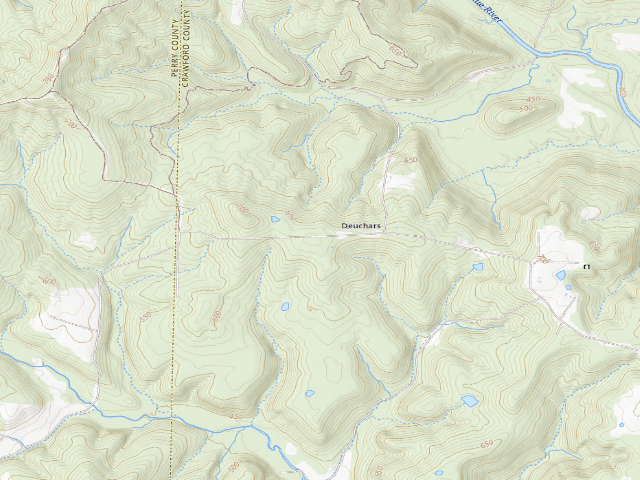
USGS topo — contours & terrain
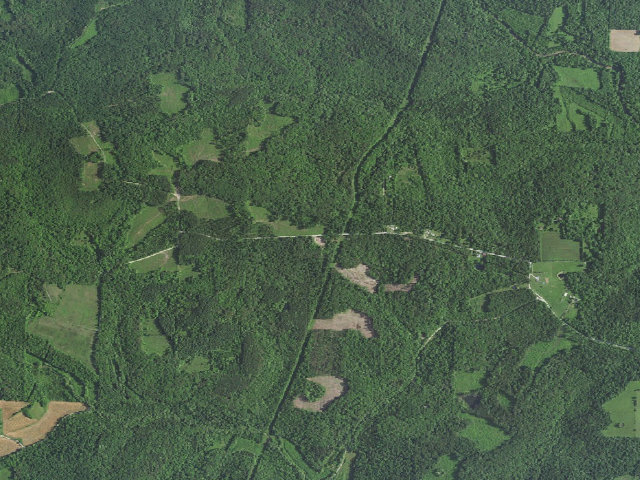
Aerial — USGS / NAIP
Weather outlook — at Oriole Roadside Dispersed Campsite 4 (Hoosier NF)
Loading the latest forecast…
Live NWS area forecast (~2.5 km grid, not elevation-corrected). Camp sits at 680 ft.
Fire & smoke — around Oriole Roadside Dispersed Campsite 4 (Hoosier NF)NIFC · AirNow
Checking active fires & air quality…
Active wildfires from NIFC (within ~50 mi); air quality from AirNow. Always confirm current fire restrictions with the managing office before you go.
Everything you need — measured from Oriole Roadside Dispersed Campsite 4 (Hoosier NF) · U.S. Forest Service · IN
Straight-line miles · bearings approx · roads run longer
Nearest of each
- FFuel4 mi
- GGrocery7 mi
- MMechanic9 mi
- @Mail15 mi
- EVEV fast charger17 mi
- RxPharmacy18 mi
- LLaundry18 mi
- WWater19 mi
- ShShower19 mi
- DDump19 mi
- HHardware22 mi
- +Urgent care25 mi
- AAir-up29 mi
- OOutfitter29 mi
- PPropane53 mi
≤30 mi30–4545+water
The read: water's a short hop out, fuel & food sit about 4 mi out.
One dot per need — the nearest of each kind, straight-line from camp. Places from OpenStreetMap (© OpenStreetMap contributors); the EV fast charger from the US DOE station locator. Open in Google Maps ↗
The site — Oriole Roadside Dispersed Campsite 4 (Hoosier NF)
Access
Drive-up
Land
U.S. Forest Service · dispersed
Elevation
680 ft
State
IN
Coordinates
38.17164, -86.45222
Cost
Free
Nearby & resupply — around Oriole Roadside Dispersed Campsite 4 (Hoosier NF) · U.S. Forest Service · IN (OpenStreetMap)
- Nearest townAlton · ~4.0 mi
- Drinking waternone within 10 mi
- FuelMarathon · ~4.1 mi
- Propane / LPGnone within 31 mi
- Dump station~19.4 mi
- GroceriesMarathon · ~6.7 mi
- PharmacyWalgreens · ~17.7 mi
- Hospital / clinicFirst Aid · ~25.3 mi
- HardwareHardware · ~21.7 mi
EV charging — from Oriole Roadside Dispersed Campsite 4 (Hoosier NF) · U.S. Forest Service · IN — nearest public DC fast & Level 2 (US DOE station data)
- Nearest public DC fast charger17.3 mi straight-line E — John Jones Chev Buick of Corydon · EV Connect · CCS · 1 fast port listed · listed open, last confirmed by AFDC 2026-09-16 · hours: 24 hours daily · directions
- Public DC fast stations within reach2 within 25 mi · 35 within 50 · 101 within 100 · 351 within 150
- Nearest listing NACS (Tesla)37.8 mi — Meijer - Tesla Supercharger, New Albany
- Nearest listing CHAdeMO17.8 mi — Corydon, Corydon
- Nearest public Level 2 (J1772)17.8 mi — Holiday Inn Express Cordyon, Corydon, IN · VIALYNK · J1772 · 2 Level 2 ports listed · listed open, last confirmed by AFDC 2026-09-16 · hours: 24 hours daily
- Pricing at the fast chargernot listed
- Power (kW)not listed by AFDC — “DC fast” spans roughly 24 to 350 kW, so ask the network.
- Read this honestlyStraight-line miles, like every distance on this site. Roads run longer than this, and you have to get back. We know where a charger is listed. We don’t know if it works today, how fast it is, or the road miles. Check the network before you commit.
Snapshot 2026-09-16 · AFDC record 313070 · US DOE Alternative Fuels Data Center
Nearby restrooms — around Oriole Roadside Dispersed Campsite 4 (Hoosier NF) · U.S. Forest Service · IN — pit toilets, restrooms & rest areas (government data)
- Vault / pit toiletBuzzard Roost Campground · ~3.6 mi S · USFS
- Vault / pit toiletIndian Celina Recreation Area · ~8.2 mi W · USFS
- Vault / pit toiletTipsaw Recreation Area · ~8.4 mi W · USFS
- Vault / pit toiletCelina Northface Loop · ~8.4 mi W · USFS
Open Oriole Roadside Dispersed Campsite 4 (Hoosier NF) elsewhere
Other camps near Oriole Roadside Dispersed Campsite 4 (Hoosier NF)
If this one is full, gated or washed out.
- Oriole Roadside Dispersed Campsite 3 (Hoosier NF)~0.7 mi
- Oriole Roadside Dispersed Campsite 5 (Hoosier NF)~1.6 mi
- Oriole Roadside Dispersed Campsite 2 (Hoosier NF)~2.7 mi
- Buzzard Roost Campground~3.6 mi
How we know this — Oriole Roadside Dispersed Campsite 4 (Hoosier NF)
Stay limit
14 nights (14 days in a 28-day period)
Area rules
All dispersed camp sites must be at least 200 feet away from trails, trailheads, roads, water sources, rock shelters, caves, and historic structures, unless in a designated campsite. Personal property must not be left unattended overnight.
Source
public land records
Confidence
Thin — A single weak source put this here. Treat the location itself as unconfirmed, not just the details.
How it was placed
Designated roadside campsite in the Hoosier NF "Oriole Area", Tell City Ranger District. Official map sheet: https://www.fs.usda.gov/media/241272 (read 2026-08-14). Hoosier NF dispersed-camping rules (read 2026-08-14 at https://www.fs.usda.gov/r09/hoosier/recreation/dispersed-camping): "There is no charge for dispersed camping." Stays limited to 14 days in a 28-day period and 28 days total per calendar year. Personal property must not be left unattended overnight. Camp at least 200 ft from trails, trailheads, roads, water, rock shelters, caves and historic structures unless in a designated site. "Firewood restrictions apply throughout the Forest" - check for fire bans before you go. Map sheet adds: campsite may be occupied up to 14 days in a 30-day period but no more than 30 days in a calendar year; use the existing campfire pit and dead-and-down wood only; bury human waste at least 200 ft from campsite and water; pack everything out. COORDINATE IS DERIVED AND ONLY APPROXIMATE. The USFS publishes these campsites only as symbols on a raster map sheet, and this sheet carries no USFS point feature that could be used to anchor it. It was georeferenced by matching the trail drawn on the sheet to the same trail in the Indiana DNR "Dispersed Camping" GIS layer (https://gisdata.in.gov/server/rest/services/Hosted/Dispersed_Camping_RO/FeatureServer/0), with the print scale taken from the Hickory Ridge sheet. On the two sheets where that method could be checked against USFS point data it was off by 230-250 m, so treat this coordinate as +/- ~250 m: correct road, correct stretch of road, not a pinpoint. The campsite is marked on the ground with a small post and tent symbol visible from the roadway. VERIFY BEFORE PUBLISHING.
--- REVIEW 2026-08-20 (nightshift, leftover-backlog fire, GA/IN/AL pass 5) ---
[THIS IS THE CURRENT VERDICT. It was written after, and supersedes, the same-day review block above: that block is dated 2026-08-20 as well, so the dates alone do not tell you which came last. The single blocker it names -- the USFS map sheet being unreachable -- has since cleared.]
THE BLOCKER FROM THE PREVIOUS FIRE IS CLEARED. That fire kept this row unapproved for one reason only: fs.usda.gov's media endpoint returned HTTP 502 on every attempt, so the one document that actually places this campsite could not be read. Tonight it answered HTTP 200. The sheet was re-fetched from https://www.fs.usda.gov/media/241272 and is BYTE-IDENTICAL to the copy taken on 2026-08-14 (MD5 654859a7cf6a1dcfb75454a0e805d02d). So this is not a re-reading of our own old file: the live sheet still says exactly what this row records, down to its 9/5/2024 revision date and its rules text ("first-come-first served and free of charge"; "Campsite may be occupied up to 14 days in a 30 day period but no more than 30 days in a calendar year"; "Campsites are marked on the ground with a small post and tent symbol viewable from the roadway"; "Use existing impacted campfire pit and dead and downed wood only; do not cut live trees"; "Bury human waste at least 200 feet from campsite and water").
RULES PAGE RE-READ TOO. https://www.fs.usda.gov/r09/hoosier/recreation/dispersed-camping was read 2026-08-20 and carries "Last updated July 6, 2026". It still says "There is no charge for dispersed camping", "Stays are limited to 14-days in a 28 day period, and 28 days total per calendar year", "Personal property must not be left unattended overnight", "All dispersed camp sites must be at least 200 feet away from trails, trailheads, roads, water sources, rock shelters, caves, and historic structures, unless in a designated campsite", and "Firewood restrictions apply throughout the Forest." It still lists the Oriole Area among its "Roadside Designated Dispersed Camping Area Maps", and still describes these as "drive-in designated dispersed campsites along roads". Its water sentence is unchanged: "Bring enough water for the duration of your stay." No water is provided at these sites and no natural water near them should be treated as potable.
THE +/- ~250 m COORDINATE CAVEAT THIS ROW CARRIED HAS NOW BEEN MEASURED, NOT ASSUMED. The campsite symbols on these sheets are live PDF text in ESRI's ESRIUSForestry1 symbol font, not just raster ink, so their page positions can be read exactly instead of being detected off a rendered image. Extracting them and fitting an affine page-to-WGS84 transform against the coordinates already stored here gives, for this sheet: 5 symbols on the sheet vs 5 rows here; least-squares residuals 32, 35, 1, 2 and 1 m (the two large ones are the merged-blob pair, see the Oriole-01 note); implied map scale 94.0 pt/mile in x and 93.0 in y. For comparison, all three sheets that could be fitted agree on scale to within 0.5% and are near-conformal (shear terms ~1e-7, anisotropy under 1.1%), which is not something a wrong symbol-to-row pairing would produce. The 2026-08-14 raster georeference was therefore far better than the +/-250 m it claimed for itself.
BE CLEAR ABOUT WHAT THAT DOES AND DOES NOT PROVE. A tight fit only shows our stored coordinates are a faithful affine image of the symbols on the sheet. It cannot by itself rule out a common-mode error in the original registration - if the whole sheet had been pinned 300 m off, the residuals would still be ~1 m. So absolute position was tested separately and independently, against the U.S. Census TIGERweb road network (https://tigerweb.geo.census.gov/arcgis/rest/services/TIGERweb/Transportation/MapServer, layers 6 and 8, queried 2026-08-20), by asking whether each pin lands on the road whose NAME is printed beside its symbol on the USFS sheet. Across the seven pins carried into this fire as pending, it did so seven times out of seven, at 9-59 m. Land status was checked against USFS EDW Basic Ownership (https://apps.fs.usda.gov/arcx/rest/services/EDW/EDW_BasicOwnership_01/MapServer/0) and Forest Service roads against EDW Road Basic (https://apps.fs.usda.gov/arcx/rest/services/EDW/EDW_RoadBasic_01/MapServer, layer 0 = open to motorized use, layer 1 = CLOSED to motorized use), both queried 2026-08-20. Note that EDW carries only Forest Service roads, so a large "nearest FS road" distance means only that the adjoining road is county-maintained; that is why TIGER was used alongside it.
DEDUPE: checked against all 19,136 published and approved camps in the database. The nearest one to any Hoosier roadside pin reviewed tonight is 1,695 m away (German Ridge Campground). None of these is a re-listing of something already on the map.
HOLDS UP. Land under the pin is USDA FOREST SERVICE, Hoosier National Forest. Nearest road is E Deuchers Rd / Co Rd 4 at 32.8 m (TIGER, S1400 local road) - "Deuchers Rd" is the label the USFS sheet prints beside this symbol. Fit residual 2 m. The nearest FS-inventoried road, 1263.060 SW DEUCHARS at 26.1 m, is maintenance level 1 - BASIC CUSTODIAL CARE (CLOSED) and must NOT be driven; the public access here is the county road, not the FS spur. Free. No water provided.
DISCOVERY GAP FOUND WHILE DOING THIS (recorded here, NOT acted on - adding leads is not this fire's job): reading the campsite symbols as vector text shows the Oriole sheet carries 6 symbols against our 5 rows, and the German Ridge/Highwater sheet carries 5 against our 2. The Hoosier's own page confirms that last sheet covers "German Ridge/Highwater Areas" - two areas - which is why three of its symbols have no row here. Roughly four Hoosier NF designated roadside campsites are therefore missing from the database. See research/REVIEW_LEFTOVERS.md.
EV chargers
US DOE Alternative Fuels Data Center station locator, snapshot 2026-09-16. Straight-line miles to the nearest public, open, unrestricted station; restricted and planned units are shown but never counted.
Field check
On the agency's books. The land manager inventoried this site, so its existence is not in question — current conditions are. Nobody from here has camped it recently.
What we don’t know about Oriole Roadside Dispersed Campsite 4 (Hoosier NF)
A land record can put you within a few meters of a spot. It cannot tell you any of this — so check it yourself, and treat anything below as the open question it is.
- Road surface & last-mile access
- How many rigs actually fit
- Cell coverage by carrier
- Seasonal & winter access
- Current fire restrictions
- Whether any water here is drinkable
- Shade & wind exposure
- Noise and who else shows up
- Whether a listed EV charger works today, or the road miles to it
Before you go — Oriole Roadside Dispersed Campsite 4 (Hoosier NF)
Water on public land →What “dispersed” means here →Stay limits →Dispersed camping tips →All field notes →
Been here? Tell us what changed. This page is built from public records, so the fastest way it gets better is somebody who has actually pulled in. Road washed out, site gone, gate locked, or it is exactly as described — all of it useful. Send a report →