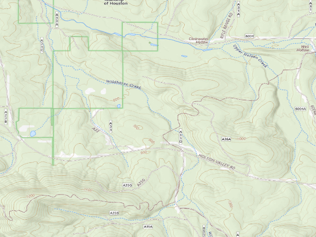
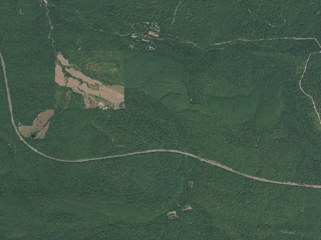
How it was placed
AREA RULE (https://www.wildlifedepartment.com/hunting/regs/public-hunting-areas-special-regulations, read 2026-08-16): ODWC Special Regulations heading "Ouachita WMA – Le Flore Unit" (county: Le Flore) -- Additional Restrictions, verbatim: "Cedar Lake, Billy Creek and Winding Stair recreation area campgrounds in the Ouachita WMA are closed to hunting. Special U.S. Forest Service regulations apply to this area, including rules on baiting, OHV (Off-Highway Vehicle)/ATV use and treestands. Go to www.fs.fed.us/r8/ouachita/ or a Forest Service visitor center for more information. Camping is allowed in accordance with U.S. Forest Service regulations, except on the Homer L. Johnston portion, where camping is allowed only in designated areas during deer and turkey seasons." LEGAL BASIS -- ODWC Department-Managed Area Rules, https://www.wildlifedepartment.com/hunting/regs/department-managed-area-rules, read 2026-08-16, verbatim: "Camping is limited to a maximum of 16 consecutive days, and for no more than 21 days total in any 30-day period on the same WMA. Camping on these areas is limited to two days longer than the period the camper (hunter) is authorized to hunt. Leaving a campsite unattended for a period longer than 48 hours is prohibited. Unattended camp items will be removed. Quiet hours are enforced from 11 p.m. to 7 a.m. All dogs or other pets must be kept on a leash or otherwise confined while in camping areas." FEDERAL LAND: ODWC's own special regulations for this area say camping here is governed by U.S. Forest Service rules, not ODWC's -- ODWC manages the wildlife, the Forest Service manages the ground. The 16-day ODWC limit quoted above may not be the operative one here; check the forest's own order before publishing a stay limit. FIRE -- same page, verbatim: "Fires shall be confined to those areas designated for camping and shall be contained in fireplaces, fire rings, grills, or other facilities designed for this purpose. Fires shall not be left unattended and must be completely extinguished prior to departure." ODWC does not publish a statewide seasonal fire ban on this page; Oklahoma county burn bans are issued separately and are not reflected here. Also verbatim from that page: "Public lands not specifically listed as open are closed." Read the area's own regulation before you go. THIS IS NOT A FEE-FREE PLACE TO ENTER -- fee=0 on this row means ODWC publishes NO per-night camping charge, not that access is free. ODWC's license fee table (https://www.wildlifedepartment.com/licensing/regs/license-fees, read 2026-08-16) states verbatim that an "Annual Wildlife Conservation Passport" is "Required of all persons 18 or older who enter Department owned lands, regardless of residency, unless exempt" at $46 for residents and $239 for nonresidents, and a "3-Day Wildlife Conservation Passport" at $26 / $51. A separate $100 / $200 "Land Access Permit" is "Required for residents ages 18 to 63, and nonresidents of any age, including lifetime license holders to access certain ODWC managed properties." ODWC's fee table says "unless exempt" but does not list the exemptions on that page, so we do not state who is exempt. Treat this as: budget for a permit, and check odwc before you drive. ODWC camp type: "Primitive". Restroom per ODWC: No. Showers per ODWC: No. Picnic area per ODWC: No. Grills per ODWC: No. ODWC publishes NO site name for this point -- the '#' number in our name is ours, assigned north-to-south within the area for stable identification. It is not an ODWC site number and it is not signed on the ground. WATER: ODWC's layer carries no drinking-water field for camping areas and this row claims none. Do not treat any lake, creek or pond near these sites as potable. COORDINATE PROVENANCE: latitude and longitude are ODWC's own, from its public ArcGIS service https://www.wildlifedepartment.com/server/rest/services/PublicWILMA/WILMAFeatures/MapServer/4 (layer 4, 'Camping Areas'), queried 2026-08-16 with where=1=1 outSR=4326. Every ingested point carries OPENTOPUBL='Yes' in that layer. No geocoding was used. Nearest town: Heavener ~13.0 mi. 'Nearest town' is STRAIGHT-LINE distance to the nearest OpenStreetMap place=city/town/village and is NOT a driving distance -- on a Corps lake shoreline or in the Ouachitas the road in is routinely two or three times longer. Ingest 2026-08-16. STATUS=pending: this is a lead for review, not published.
--- NIGHT-SHIFT REVIEW 2026-08-20 (pass 5), reviewer nightshift-verified ---
RE-CHECKED THE SOURCE THIS ROW WAS BUILT FROM.
(1) The ODWC camping-areas layer cited above was re-queried live on 2026-08-20:
https://www.wildlifedepartment.com/server/rest/services/PublicWILMA/WILMAFeatures/MapServer/4/query?where=1=1&outFields=*&outSR=4326&f=json returned 299 features. OBJECTID 80 is
still there, still carries OPENTOPUBL="Yes", and its geometry still matches this row's
latitude/longitude to better than 1e-5 degrees, about a metre. That held for every Oklahoma
row we hold from this layer: 278 checked, 278 OBJECTIDs still present, 277 matching to under
1e-5 degrees and one ("A Frame", Beaver River WMA) shifted by roughly 10 m.
(2) A CHECK THE ORIGINAL INGEST DID NOT DO: the coordinate was tested point-in-polygon against
ODWC's separate boundary service, https://services1.arcgis.com/jRf8jjFwxedITdFe/arcgis/rest/services/Public_WMA_Boundaries/FeatureServer/1 (layer "Public_WMA_Boundaries_08172026", read 2026-08-20).
It falls inside "Ouachita Wildlife Management Area - Leflore" (223,822 acres, OWNERSHIP field "USFS"). Two independent ODWC
services agree on where this point is, so the "low" confidence on this row was never about
the position.
(3) Both rules pages quoted higher up were re-read on 2026-08-20 and every passage quoted above is
still present word for word: the 16-consecutive-day / 21-days-in-30 camping limit, the
48-hour unattended-camp rule and the quiet-hours line at
https://www.wildlifedepartment.com/hunting/regs/department-managed-area-rules; the "Fires shall be confined to those areas
designated for camping..." paragraph and "Public lands not specifically listed as open are
closed." on that same page; and the Annual ($46 / $239) and 3-Day ($26 / $51) Wildlife
Conservation Passport rows at https://www.wildlifedepartment.com/licensing/regs/license-fees.
(4) THE AREA'S OWN ODWC PAGE, which the original ingest never read: https://www.wildlifedepartment.com/hunting/wma/southeast/ouachita-wma-le-flore-unit, read 2026-08-20 --
it repeats the special-regulations sentence verbatim: "Camping is allowed in accordance with U.S. Forest Service regulations, except on the Homer L. Johnston portion, where camping is allowed only in designated areas during deer and turkey seasons.".
(5) TWO CORRECTIONS TO THE PERMIT PARAGRAPH WRITTEN ABOVE. Both come from https://www.wildlifedepartment.com/licensing/regs/specialty-licenses, read 2026-08-20,
which the original ingest also never read.
(a) The "unless exempt" gap is now closed. Verbatim: "Wildlife Conservation Passport People
who use Department owned areas for non-hunting or non-fishing activities, such as
birdwatching or photography, are required to have either a Wildlife Conservation Passport
or any current hunting or fishing license issued by the Wildlife Department. Persons 17
years of age or younger at the start of the calendar year, and students and instructors
participating in bona fide educational tours or activities sponsored or organized by an
education institution or any other organized event sanctioned by and approved in advance
by the Wildlife Department are exempt." Note the first clause: a current Oklahoma hunting
or fishing licence satisfies the requirement on its own, so do not tell a reader they must
buy a $46 passport.
(b) The $100 / $200 Land Access Permit paragraph above is TOO BROAD for this row and should
not be repeated to a reader. Verbatim from the same page: "Land Access Permit Required for
residents to hunt, fish or otherwise use Honobia Creek, Three Rivers and Herron Family
WMAs, and OLAP properties. Nonresidents are required to purchase an annual permit, no
exemptions." This area is not Honobia Creek, Three Rivers or Herron Family, so the Land
Access Permit does not apply here.
AREA RULE RE-READ 2026-08-20 at https://www.wildlifedepartment.com/hunting/regs/public-hunting-areas-special-regulations?page=8 -- heading "Ouachita WMA - Le Flore Unit", "Additional
Restrictions" still reads, verbatim: "Cedar Lake, Billy Creek and Winding Stair recreation area campgrounds in the Ouachita WMA are closed to hunting. Special U.S. Forest Service regulations apply to this area, including rules on baiting, OHV (Off-Highway Vehicle)/ATV use and treestands. Go to www.fs.fed.us/r8/ouachita/ or a Forest Service visitor center for more information. Camping is allowed in accordance with U.S. Forest Service regulations, except on the Homer L. Johnston portion, where camping is allowed only in designated areas during deer and turkey seasons."
That heading does NOT carry the binoculars icon the page uses to mark a "Conservation Passport Area".
THIS ROW IS ON NATIONAL FOREST, NOT ON ODWC LAND, AND THAT CHANGES THREE THINGS THE NOTE ABOVE SAYS.
ODWC's own boundary layer gives OWNERSHIP = "USFS" for this 223,822-acre unit (read 2026-08-20), and
ODWC's own rule for the unit hands the camping question to the Forest Service.
- The stay limit here is the Forest Service's, not ODWC's 16 days. Ouachita National Forest,
https://www.fs.usda.gov/r08/ouachita/recreation/camping-cabins, read 2026-08-20, verbatim: "You may camp in a dispersed area for up to 30 days. After 30
days, you must move at least 5 road miles for camping in another dispersed area. Campers may not
return to the same campsite within the calendar year."
- The Wildlife Conservation Passport applies to "Department owned areas". This is not one, and the
special-regulations page does not flag this unit as a Conservation Passport Area. Hunting is a
separate question and still needs the usual licence.
- Camping here is affirmatively allowed, not merely unprohibited. Same Forest Service page,
verbatim: "Dispersed camping is the term used for camping anywhere in the National Forest OUTSIDE
of a designated campground." Also verbatim: "Typically, dispersed camping is NOT allowed in the
vicinity of developed recreation areas such as campgrounds, picnic areas, or trailheads."; "To
prevent resource damage please keep your campsite within 150 feet from a roadway."; "Do NOT camp
within 100 feet of any water source, plants near water are especially fragile."; and on fire,
"Campfires are allowed when you are dispersed camping unless there are fire restrictions in
effect due to high fire danger conditions. Please use existing sites and fire rings. Wood permits
are not needed for usage on the forest."
- On water, the same page: "You need to be self-contained. No amenities are provided; such as
water, restrooms or trash cans." and "Carry water or a water filtration device with you." Nothing
at or near this point is potable.
- NOT CHECKED, AND IT MATTERS: the Homer L. Johnston exception in the rule above restricts camping
to designated areas during deer and turkey seasons. I could not find a boundary for the Homer L.
Johnston portion in any queryable layer, so I cannot say whether this point is inside it. Anyone
camping here in autumn should ring the Poteau or Cold Springs district first.
COVERAGE NOTE: ODWC's layer maps EIGHT camping points on the Le Flore unit. We hold five of them --
these four and "Crooked Branch Lake", which an earlier pass left at 'later'. Three have never been
ingested. A gap in our coverage, not a reason to doubt this row.
DUPLICATE CHECK, ON COORDINATES RATHER THAN NAMES: the nearest published Oklahoma camp is "Dispersed camp #8 — Le Flore County, OK"
(source osm) at 6,799 m. The nearest developed Forest Service recreation site of any kind is
kilometres away, so this point is clear of the "vicinity of developed recreation areas" restriction
quoted above.
VERDICT: APPROVED, with this row's own field note rewritten. The camping holds up on two agencies'
evidence. But the field note the row shipped with came off the generic ODWC template and told the
reader three things that are wrong on Forest Service ground: a 16-day limit, a Conservation Passport
requirement and a Land Access Permit. Rather than let that publish as-is, the field note has been
replaced with the sourced Forest Service text above, and the tags corrected the same way --
state-land -> national-forest + usfs, 16-day-limit -> 30-day-limit, permit-required dropped,
land_manager ODWC -> USFS. The dispersed flag was deliberately LEFT AT 0: ODWC maps this as a
specific designated point, so calling it dispersed would tell a reader to camp anywhere, which is
not what the agency mapped. The Forest Service's dispersed-camping rules quoted above still govern
how you behave once you are there.
CONFIDENCE RAISED low -> verified-agency, on the same provenance grounds as the rest of this batch.