Agency-listedUSFSFree
Ragtown
Drive-up · U.S. Forest Service · TX · 31.68220, -93.82490
Ask an AI about this campsiteOpens Grok already loaded with this site. It reads the same records this page is built from, and links whatever it tells you.
Ask about this camp →U.S. Forest Service lists this site. On most of their ground you can camp away from developed sites pretty much anywhere — so treat this as a known-good spot, not the only one allowed. The unit sets stay limits and how far off road and water you must be. What changes is conditions — roads, gates, closures, fire rules. Check those with the unit before you commit to the drive.
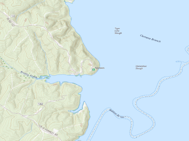
USGS topo — contours & terrain
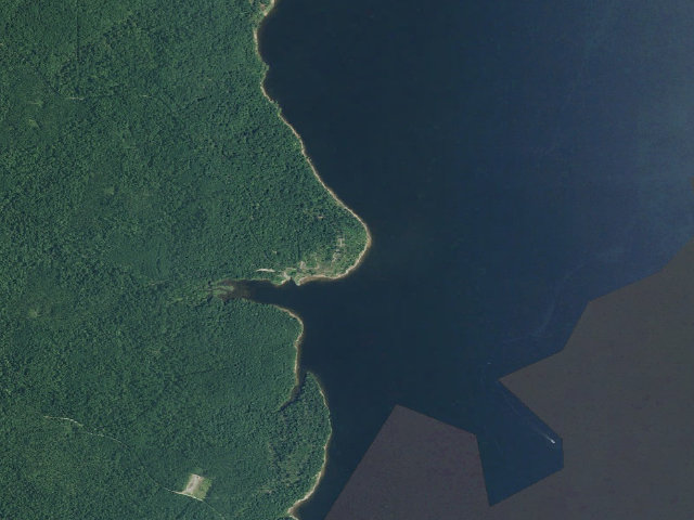
Aerial — USGS / NAIP
Weather outlook — at Ragtown
Loading the latest forecast…
Live NWS area forecast (~2.5 km grid, not elevation-corrected). Camp sits at 208 ft.
Fire & smoke — around RagtownNIFC · AirNow
Checking active fires & air quality…
Active wildfires from NIFC (within ~50 mi); air quality from AirNow. Always confirm current fire restrictions with the managing office before you go.
Everything you need — measured from Ragtown · National Forests in Texas · TX
Straight-line miles · bearings approx · roads run longer
Nearest of each
- @Mail8 mi
- DDump10 mi
- FFuel11 mi
- GGrocery11 mi
- RxPharmacy20 mi
- MMechanic21 mi
- HHardware22 mi
- +Urgent care22 mi
- EVEV fast charger23 mi
- LLaundry43 mi
- OOutfitter55 mi
≤30 mi30–4545+water
The read: fuel & food sit about 11 mi out.
Not within 60 mi: Water, Propane. Plan those before you head up.
One dot per need — the nearest of each kind, straight-line from camp. Places from OpenStreetMap (© OpenStreetMap contributors); the EV fast charger from the US DOE station locator. Open in Google Maps ↗
The site — Ragtown
Access
Drive-up
Land
U.S. Forest Service
Elevation
208 ft
State
TX
Coordinates
31.68220, -93.82490
Cost
Free · dispersed public land, no fee in any source
Nearby & resupply — around Ragtown · National Forests in Texas · TX (OpenStreetMap)
- Water featureSabine River (river) · nearby
- Nearest townRagtown · ~3.9 mi
- Drinking waternone within 10 mi
- FuelSpring Market Fuel Center · ~11.1 mi
- Propane / LPGnone within 31 mi
- Dump station~10.5 mi
- GroceriesSpring Market · ~11.1 mi
- PharmacyBrookshire Brothers Pharmacy · ~20.3 mi
- Hospital / clinicCHI St. Luke’s Health Memorial San Augustine · ~19.4 mi
- HardwareNichols Retail Department Store · ~21.5 mi
EV charging — from Ragtown · National Forests in Texas · TX — nearest public DC fast & Level 2 (US DOE station data)
- Nearest public DC fast charger23.2 mi straight-line W — Center Motor Company (at a public site) · FORD_CHARGE · CCS · 4 fast ports listed · listed open, last confirmed by AFDC 2026-09-16 · hours: 24 hours daily · directions
- Public DC fast stations within reach1 within 25 mi · 4 within 50 · 37 within 100 · 144 within 150
- Nearest listing NACS (Tesla)39.1 mi — Natchitoches, LA - Tesla Supercharger, Natchitoches
- Nearest listing CHAdeMO58.1 mi — FAMILY VW MOFFITT VOLKSWA, Bossier City
- Nearest public Level 2 (J1772)23.3 mi — Holliday Inn Express & Suites Center, an IHG Hotel · NOODOE · J1772 · 2 Level 2 ports listed · listed open, last confirmed by AFDC 2026-09-16 · hours: not listed
- Pricing at the fast chargernot listed
- Power (kW)not listed by AFDC — “DC fast” spans roughly 24 to 350 kW, so ask the network.
- Read this honestlyStraight-line miles, like every distance on this site. Roads run longer than this, and you have to get back. We know where a charger is listed. We don’t know if it works today, how fast it is, or the road miles. Check the network before you commit.
Snapshot 2026-09-16 · AFDC record 416853 · US DOE Alternative Fuels Data Center
Nearby restrooms — around Ragtown · National Forests in Texas · TX — pit toilets, restrooms & rest areas (government data)
- Flush restroomBoles Field · ~10.1 mi NW · USFS
- Vault / pit toiletRed Hills Lake · ~14.4 mi S · USFS
Open Ragtown elsewhere
Other camps near Ragtown
If this one is full, gated or washed out.
- Haley's Ferry Boat Ramp~8.8 mi
- Boles Field~10.1 mi · fee
- Boles Field Campground~10.5 mi
- Red Hills Lake~14.5 mi
The unit that manages Ragtown
Stay limits, road closures and fire restrictions at Ragtown are set by National Forests in Texas, not by the campsite — check there before you go.
How we know this — Ragtown
Source
OpenStreetMap contributors
Confidence
Likely — The record is good enough to put a pin on, but thin in places. Treat the details as a starting point, not gospel.
How it was placed
auto: drive (road/trail right there)
EV chargers
US DOE Alternative Fuels Data Center station locator, snapshot 2026-09-16. Straight-line miles to the nearest public, open, unrestricted station; restricted and planned units are shown but never counted.
Field check
On the agency's books. The land manager inventoried this site, so its existence is not in question — current conditions are. Nobody from here has camped it recently.
What we don’t know about Ragtown
A land record can put you within a few meters of a spot. It cannot tell you any of this — so check it yourself, and treat anything below as the open question it is.
- Road surface & last-mile access
- How many rigs actually fit
- Cell coverage by carrier
- Seasonal & winter access
- Current fire restrictions
- Whether any water here is drinkable
- Shade & wind exposure
- Noise and who else shows up
- Whether a listed EV charger works today, or the road miles to it
Before you go — Ragtown
Finding water out here →What “dispersed” means here →Reading a forest MVUM →Reading your camp page →All field notes →
Been here? Tell us what changed. This page is built from public records, so the fastest way it gets better is somebody who has actually pulled in. Road washed out, site gone, gate locked, or it is exactly as described — all of it useful. Send a report →